Ferrum meta-data

Southern San Andreas Fault

33.4572 N 115.8539 W

Length 10 m

Obliquity 30°

Invar/steel composite installed 6 March 04.

Graphite rod installed 25 March 2004.

DC-SE#2225 Transducer -8.282 dextral_mm/V Range 32 mm, Resolution 10 µm.

Telemetry AT&T unit 000922828

The distance between Ferrum and Salt Creek is 1.37 km, and between Salt Creek and Durmid is 5.58 km, a total span of 6.95 km.

End mounts consist of 2 m steel rods in stiff shales driven to refusal at 5 m depth on the edges of a railrod in Durmid Hill.

Heavy rain causes expansion of the flanks of the fault and apparent left-lateral signals in the data that are believed to be fault-normal contraction of the fault gouge. Occasional right-lateral creep events with amplitudes of approximately 1 mm occur spontaneously, or in response to regional moderate earthquakes.

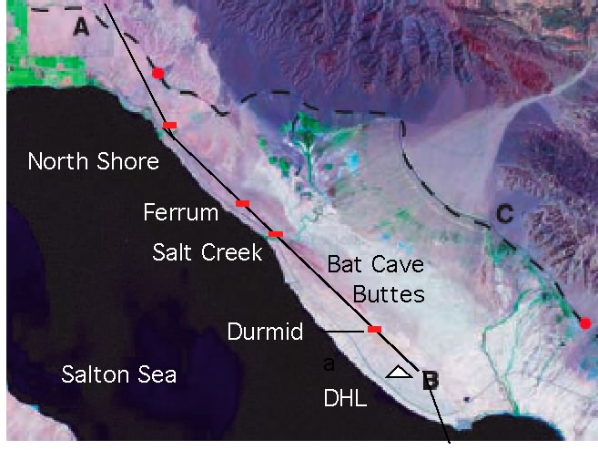
Ferrum, creep-meter, Durmid Hill (coFE).

Data available from March 2004 to October 2009. jpg or pdf

Numerical data

A three column zipped .csv Excel file of all the data from Ferrum may be downloaded here,(with a one line header) . date format is MM/DD/YY hh:mm:s, in the first column, dextral slip in mm in the second column and subsurface temperature in degreesC in the third column. Time in this files is local time (GMT-8hours).

A unix downloadable zipped .csv file for data 2004-October 09 with times in GMT may be downloaded here.