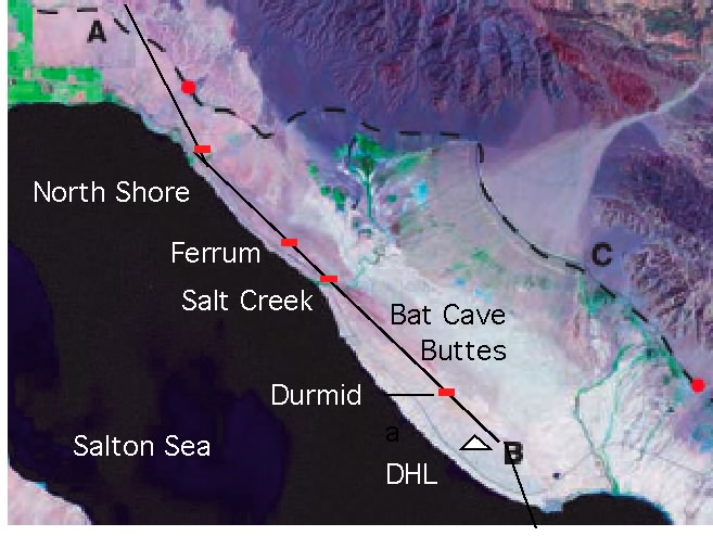

Salt Creek, creepmeter, Durmid Hill, coSC
 In the period 2005-2009 the creep rate has been less than 1 mm/yr interrupted by creep-events and triggered slip with amplitudes less than 1 mm. The uncertain obliquity of this site requires the displacements measured to be multiplied by 1.15-1.3. The early data depicted below have been corrected for temperature by subtracting 6.7*degC from the raw displacements: a mechanical shift in the placement of the temperature sensor required this correction factor to be adjusted in correcting the later data.
Data

The large offset in April 2010 was caused by triggered slip in the El Major earthquake. Data from 2004 to Feb 2001 may be downloaded here.
Pre2010 data 
A four column zipped Excel file of raw data from Salt Creek may be downloaded, and a zipped .csv file may be downloaded here. The date format is local time MM/DD/YY hh:mm:ss, in the first column, dextral slip in mm in the second column, subsurface temperature in degreesC in the third column. Time in this file is GMT. The data corrected for temperature as shown in the above jpg or pdf may be downloaded as a zipped .csv file here. Times in GMT at variable data intervals.