Duzce Earthquake 12 November 1999 Summary
Photographs in this largely text only version are accessed by clicking on highlighted words and numbers.
The Duzce earthquake (M=7.2 ) occurred in Turkey at the eastern end of the Izmit 17 August 1999 rupture (M=7.4) on 12 November. (GMT 99/11/11 16:57:20 40.768N 31.148E 14.0 7.3Ms 7.1Mw)
650 Dead, 3300 injured, 750 buildings destroyed.
Most of the damaged area is near Duzce (350 buildings destroyed)
and Kaynasli (301 buildings destroyed) with some damage as far
as Bolu.
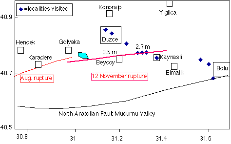
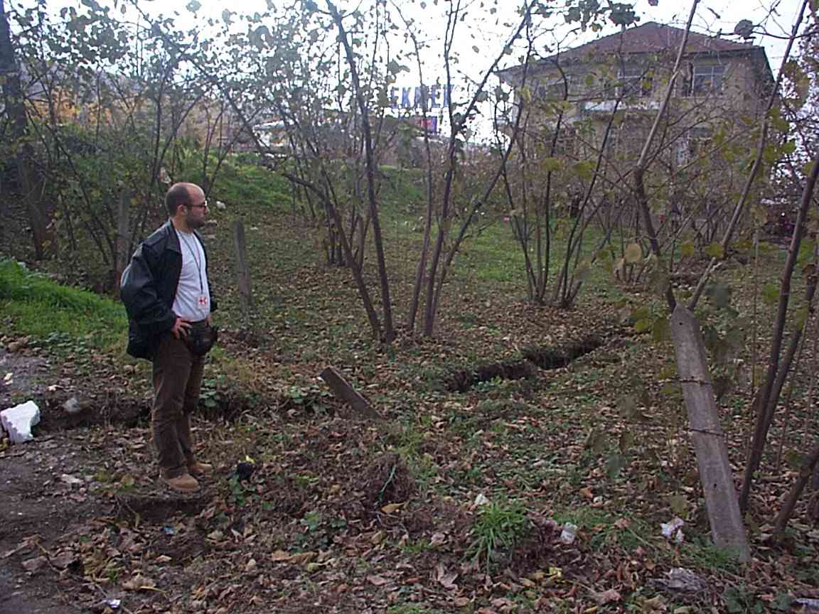
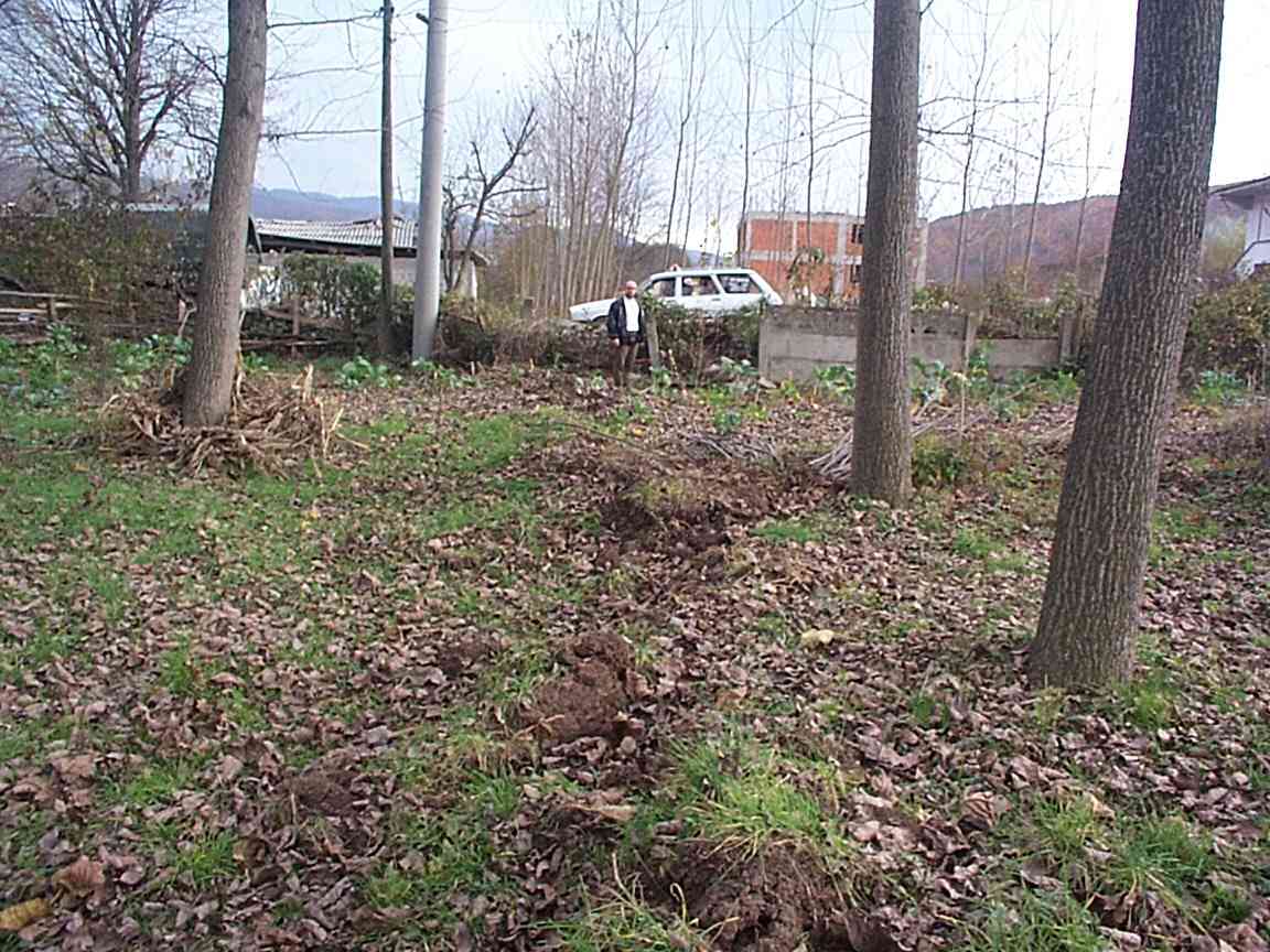
A right-lateral rupture with an offset of 2.7 m was measured (756,758) at 3 locations spaced 3 km apart near 40.7765°N, 31.3015°E (Figure 1)near the western end of the rupture. It is reported to have ruptured at least 40 km east-west with slip locally exceeding 5 m.
The above figure indicates the approximate location of the Duzce rupture and the following table lists official statistics available on 18 November:
| City | dead | injured | buildings destroyed |
| Bolu | 42 | 354 | 10 |
| Akcakoca | 2 | 95 | - |
| Beykoy | 9 | 120 | - |
| Cumayeri | - | 31 | 4 |
| Duzce | 218 | 1752 | 350 |
| Golyaka | 1 | 50 | 50 |
| Gumusova | - | 34 | - |
| Kaynasli | 235 | 155 | 301 |
| Konoralp | 34 | 302 | - |
| Yigilca | 38 | 35 | - |
| Zonguldak | 3 | 181 | - |
| Eskisehir | 1 | - | - |
| Adapazari | 4 | 168 | - |
| Yalova | 1 | - | - |
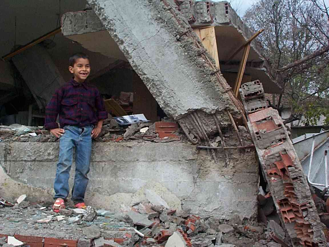
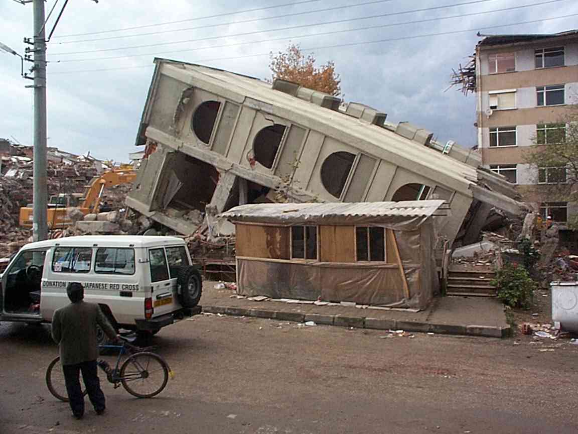
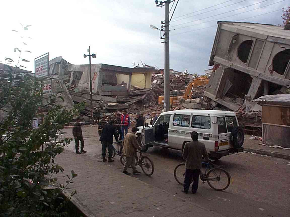
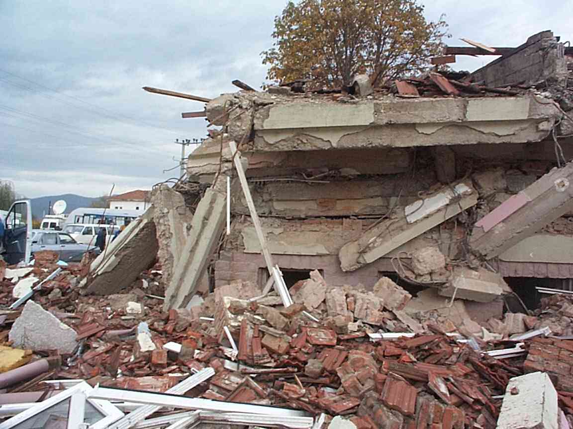
On the 17 and 18 of November (5 days after the mainshock) I visited the epicentral area of the Duzce event with a team from the International Federation of Red Cross/Red Crescent hosted by Andrei Neacsu. Parts of Duzce are heavily damaged and resemble central Adipazari after the Izmit 17 August earthquake. Small aftershocks were occurring and the weather which in the previous few days had been wet and cold had warmed slightly. Two survivors had been rescued on the 17 th and although search and rescue teams continued to operate on the 18 th hope was fast dwindling. The region in which the search and rescue operations occurred was eerily silent, despite the presence of several dogs & handlers, some 20 soldiers in gas masks, 2 cranes and other heavy machinery, and more than 30 rescue workers and press. The faint sounds of a survivor had been heard beneath the rouble and everyone was listening intensely. Heavy rain started when I left the epicentral region, causing much hardship in the tent villages where most of the local population had once again taken refuge.
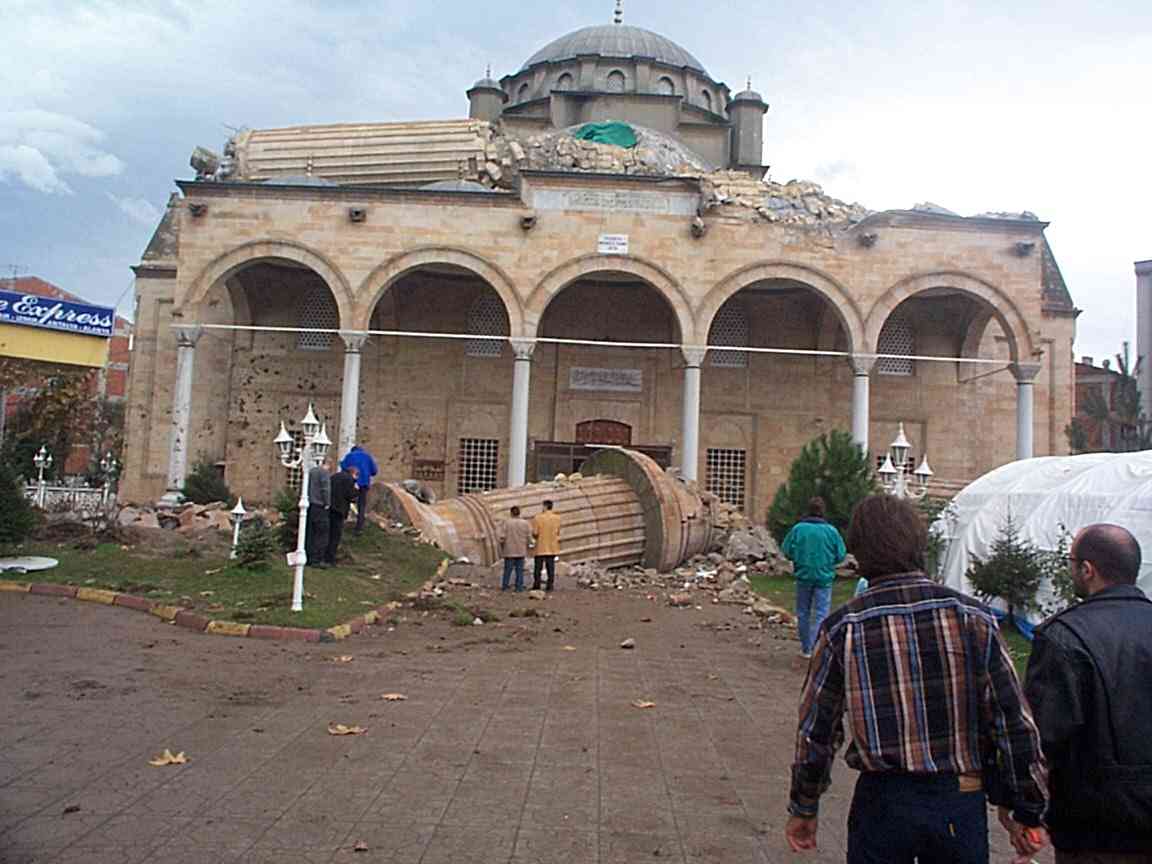
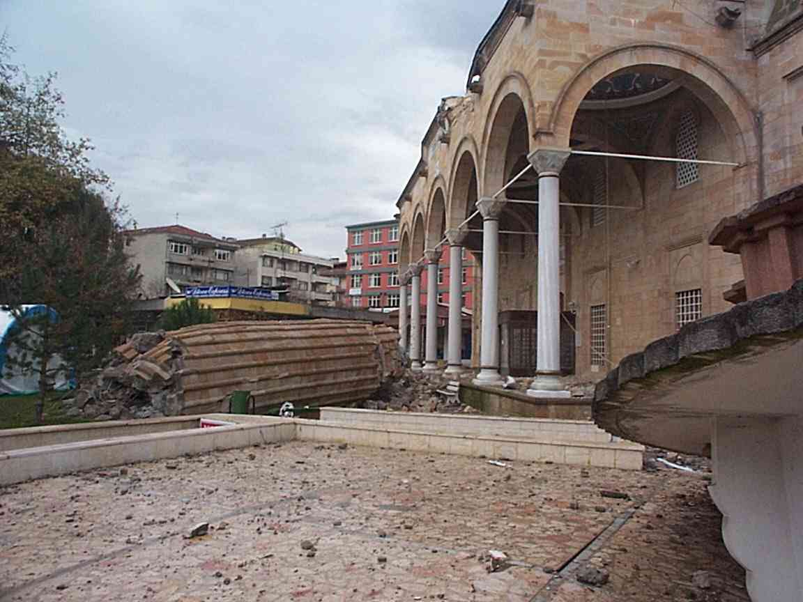
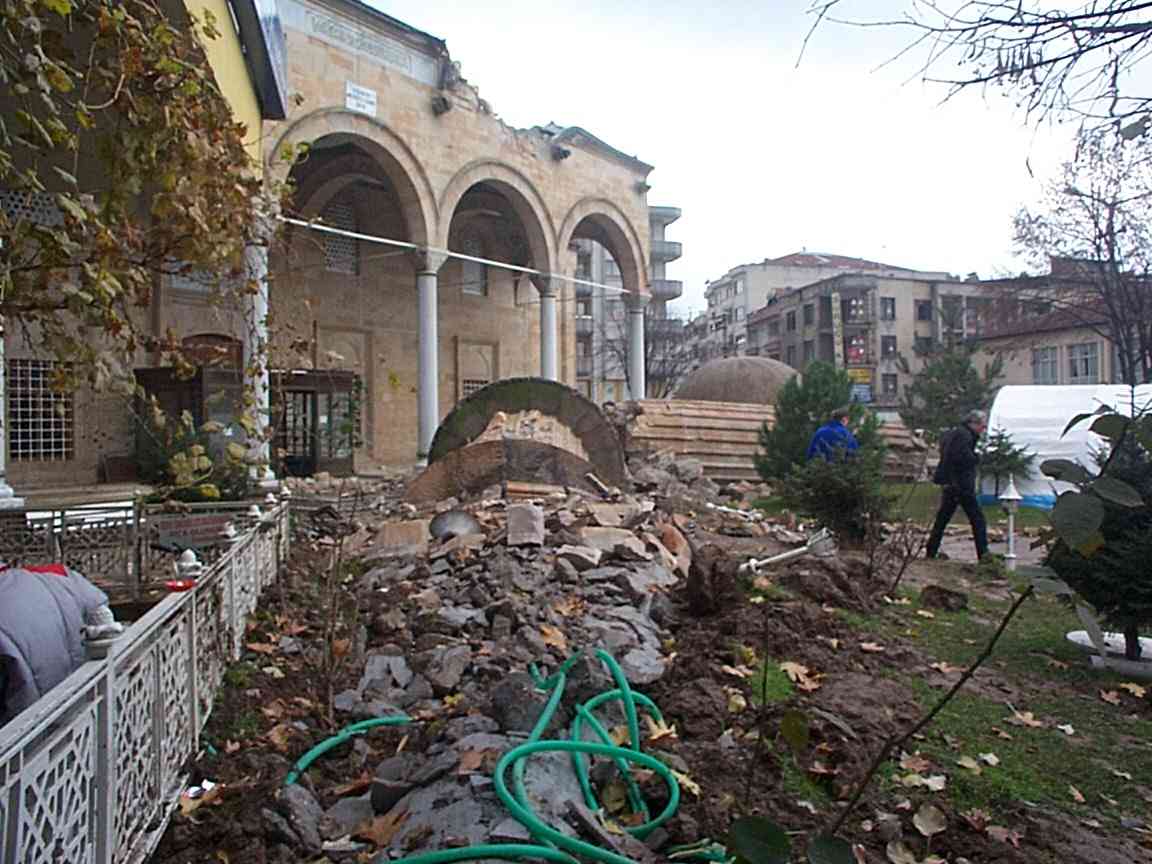
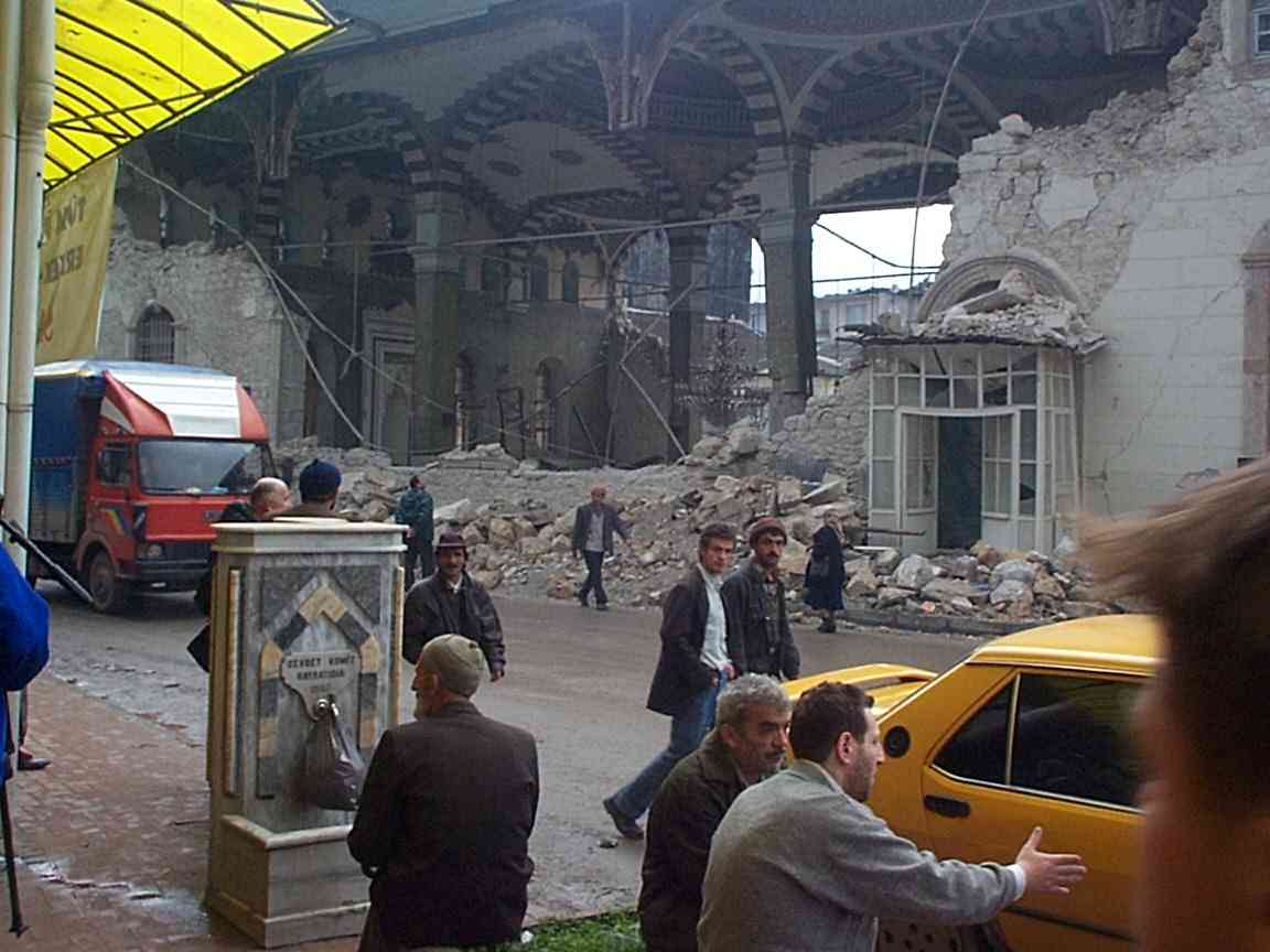
The minarettes of two mosques have collapsed near the center of Duzce. One of the mosques was constructed in 1976 from reinforced-concrete faced with cut stone blocks (671). Its minarettes collapsed without significantly damaging the central mosque structure, the arches of which were braced by steel tie beams. Small surrounding structures were destroyed by the fall of one of the minarettes (670, 672).
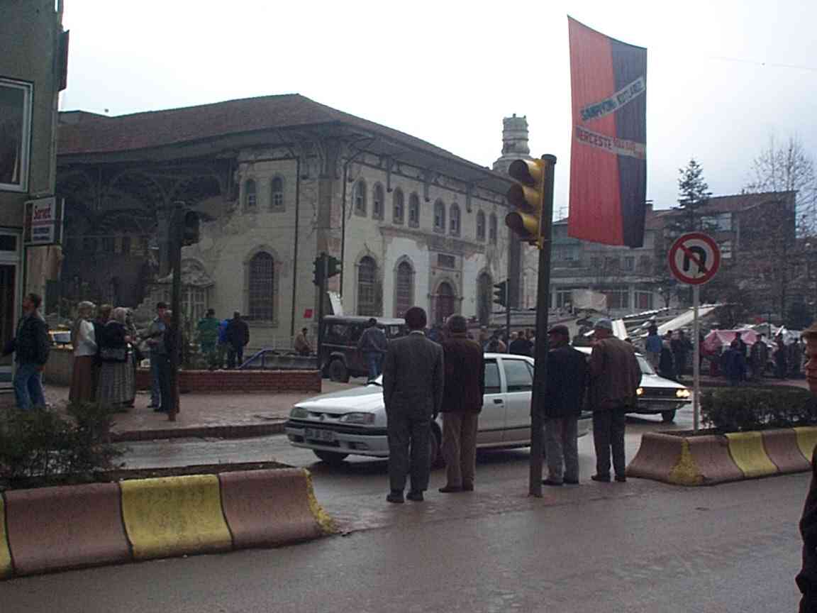
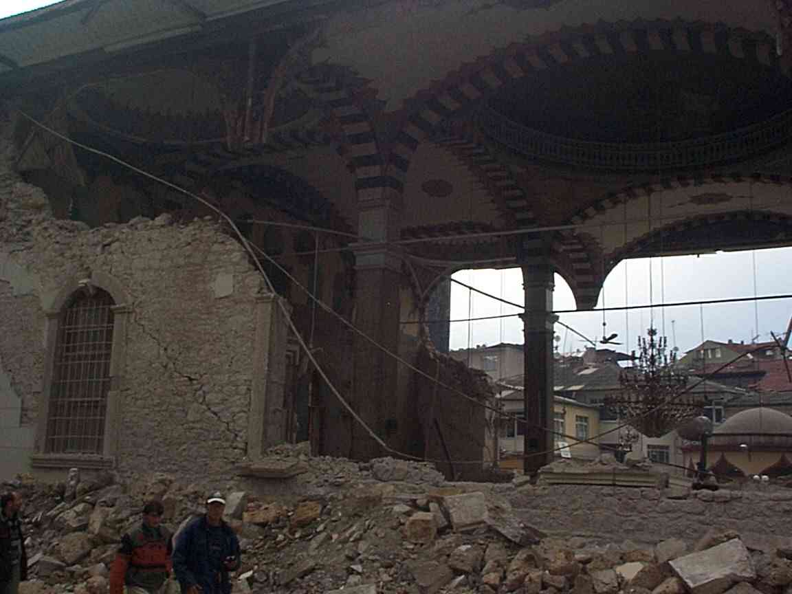
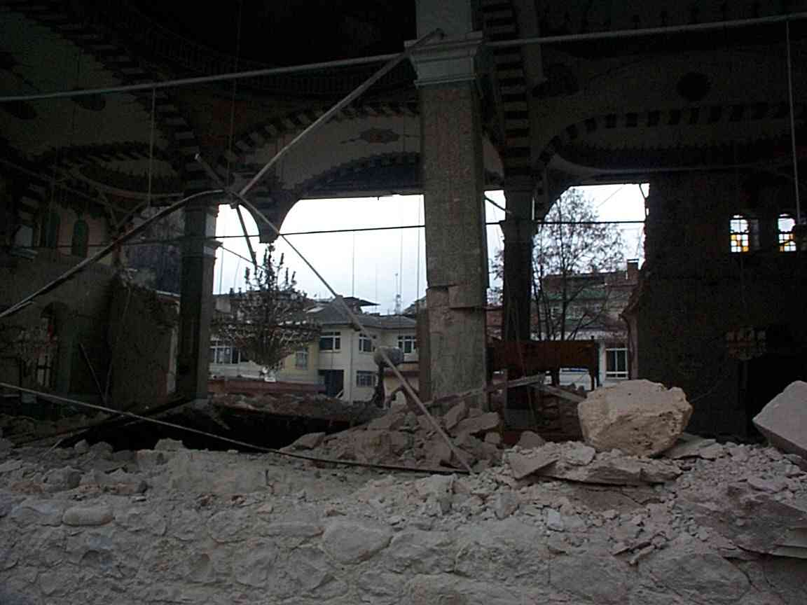
The two opposing side walls of a second, much older, mosque had collapsed outwards. The mosque is rectangular in plan and taller in form (677), built from massive limestone blocks . The wooden/plaster roof system remains in place and consist of six cupulas supported by four masonry pillars. The edges of the roof were moderately damaged but still in place (680, 678,). Masonry blocks of one of the pillars (682) and one outer-corner-pillar (683) had shifted by several cm but remained supporting the roof. A steel tie-band around the base of the roof had snapped (682) but had held the roof together throughout the shaking. Remarkably, three huge chandeliers hung, unbroken from the central cupula and side cupulas (683, 684).
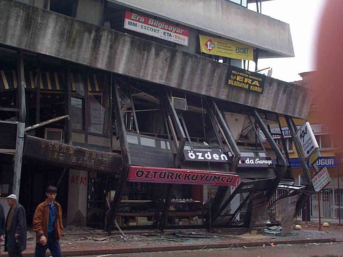
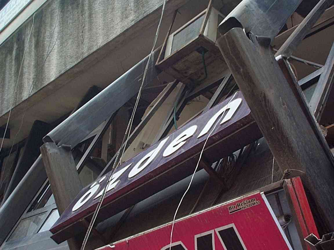
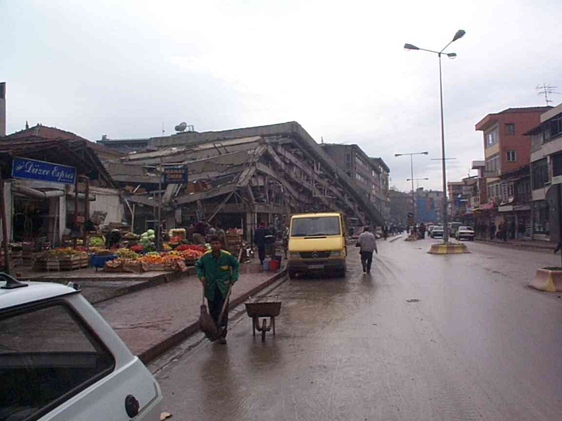
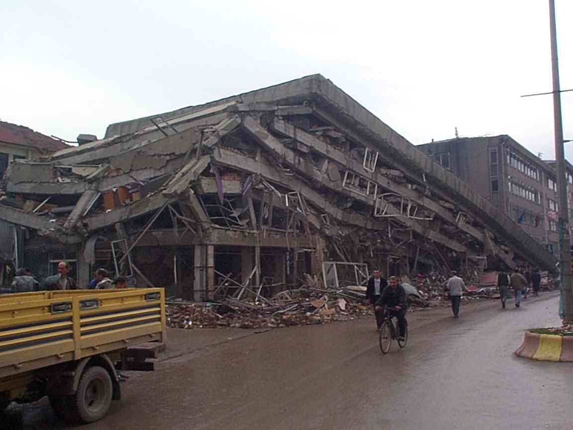
Between these two mosques a five-storey concrete-beam office building in the main street of Duzce, faced by hollow steel columns had failed on one side (685) causing the outer steel tube system to crumple (686) . The outer walls had hitherto supported a glass outer sheath which now lay on the road and sidewalk. No horizontal stirrups were visible on an exploded internal concrete-pillar although they appear to have unraveled and fallen to the ground nearby (687) . In this part of the town 1 in 10 structures collapsed.
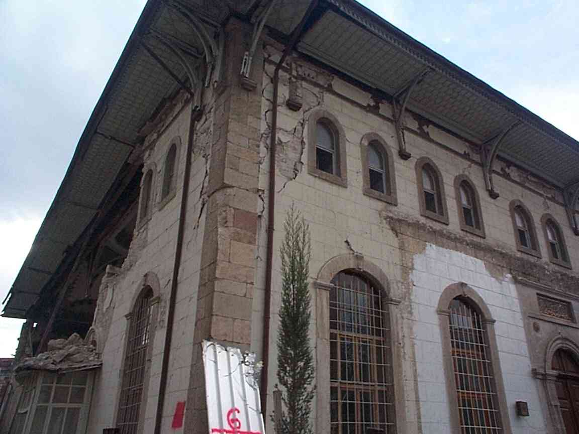
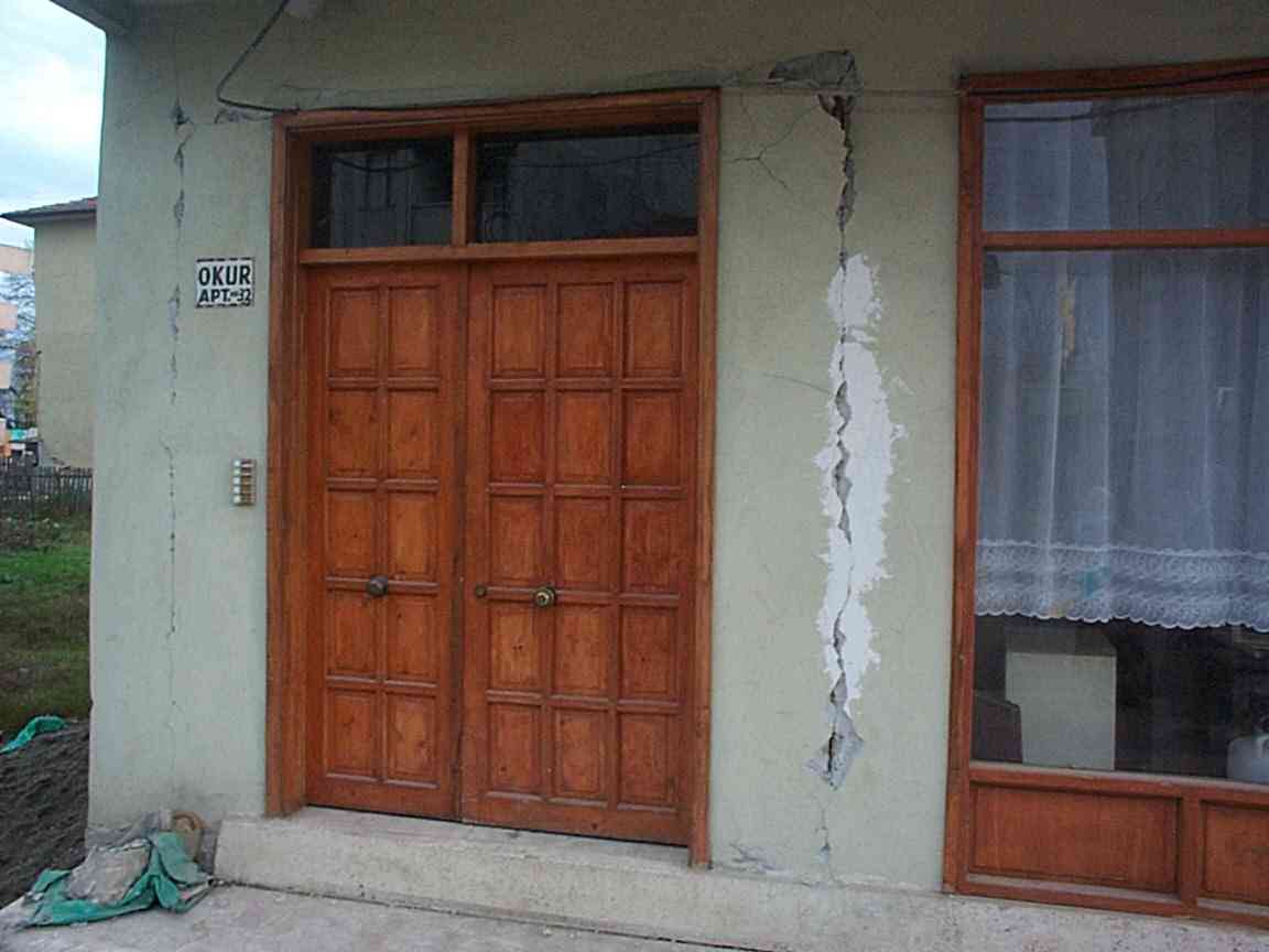
Large tracts of the city are relatively lightly damaged with diagonal cracks on lower floors (674) but in limited areas collapse was total.
In some locations cosmetic repairs (cement rendering of 17August damage) were dislodged by the Duzce earthquake (749).
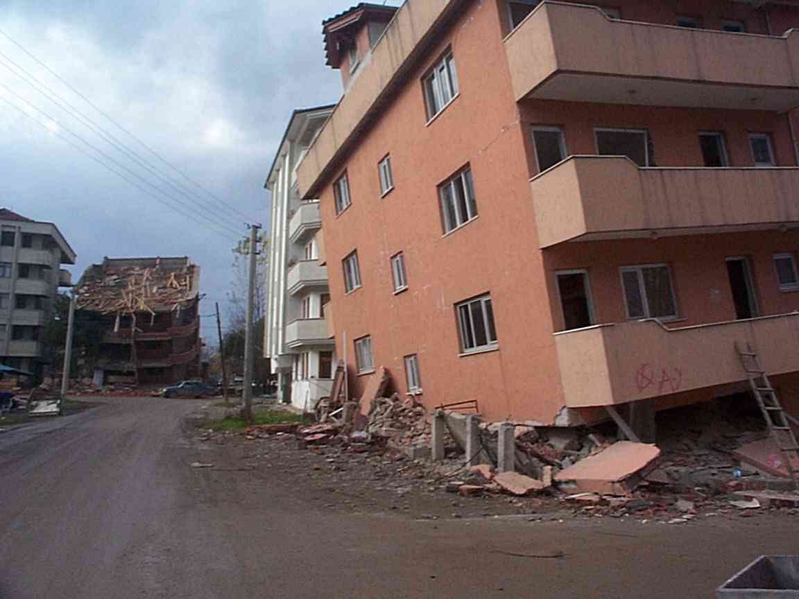
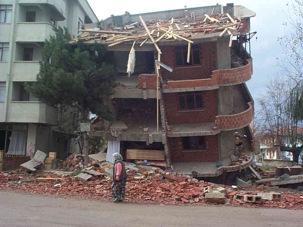
Many partial collapses of structures occurred due to soft lower story collapse on one side only (675,676, 751,755)
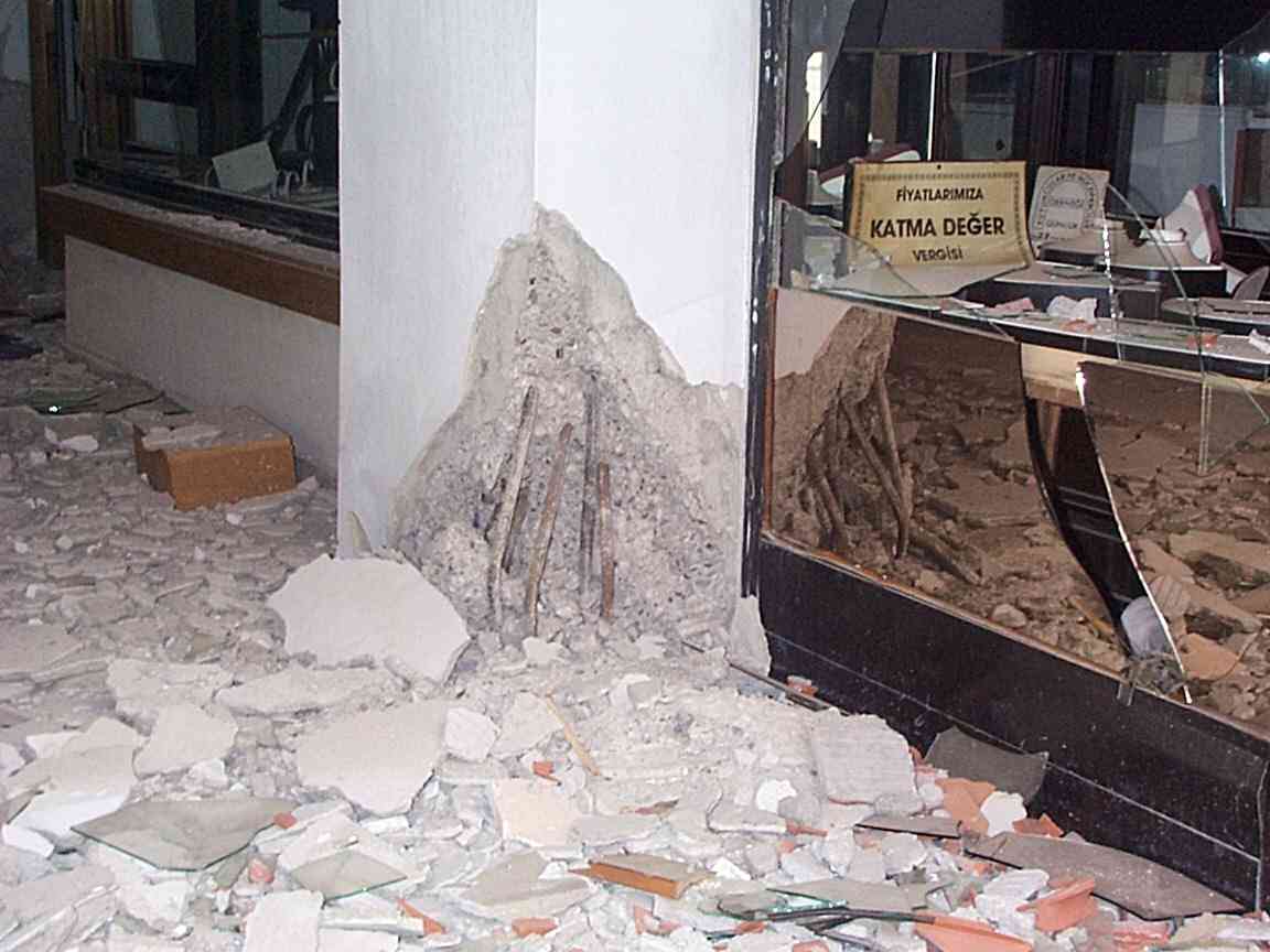
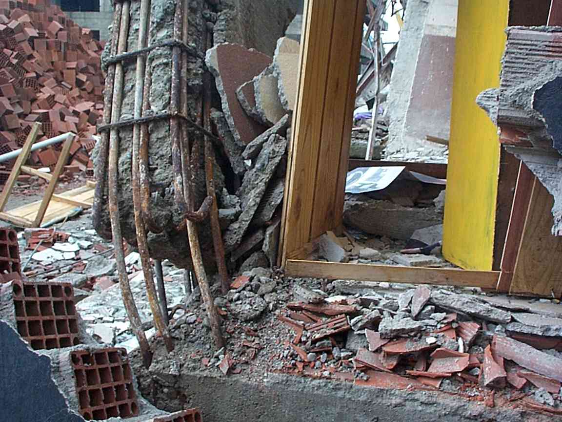
In the support columns of one 5 storey dwelling that I inspected (689,690,691,692 ) the steel reinforcing was smooth but appeared adequate in thickness, spacing and number. The horizontal stirrups were spaced about 15 cm apart and were substantially thinner (4 mm) than the vertical members (12 mm), and had evidently unwrapped during stressing, permitting the columns to fail in compression. As the building toppled the trailing pillars were pulled from the foundation because fewer than half of the reinforcing rods penetrated to the foundation concrete box. The smooth steel rods embedded in the foundation box had no cohesion within the concrete, nor any hook structure on their free ends to prevent their being pulled out.
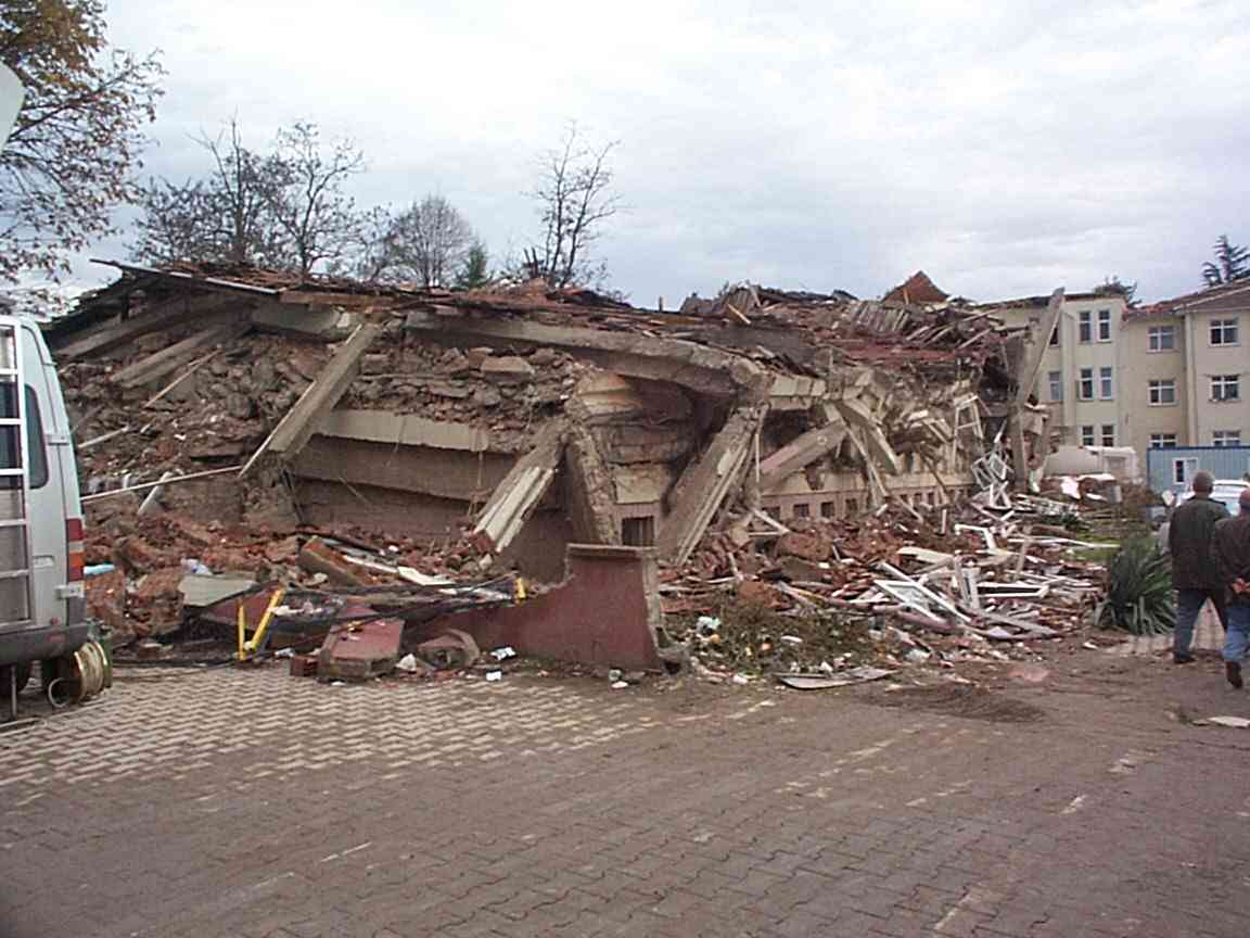
Total destruction of one complete block occurred near the hospital with one survivor still apparently alive after 6 days. Perhaps as many as seven 3-5 storey buildings were involved in a collapse of a 100-m-long block, suggesting local very high accelerations must have prevailed. One building on a facing block had collapsed south (722) One building was folded into the second storeys of two adjacent buildings, perhaps indicating that they had helped destroy each other (723).
The damaged northern wing of Duzce hospital is now completely collapsed (on corner of street), but another hospital structure, whose brickwall fill of hollow bricks I had photographed in September remains relatively unscathed. This suggests that the concrete frame structure continues to function, and that the wall-infill masonry does not act in a supportive capacity. It has been suggested that the masonry fill acts as a sacreficial dissipative component. Buildings opposite the hospital have been similarly left only slightly more damaged, including one with a working grocery on the ground floor that I visited in Spetember. The grocer is happily still well.
I saw no liquefaction features during my relatively brief visit to the town. Heading east out of Duzce I passed several heavily damaged structures, with severe damage at Kaynasli near the fault trace. The fault crosses the road very obliquely requiring a 50-m-long repair. Offset fences (2.7 m) here showed a clean break perhaps 4 m wide with mole tracks in wet soil. The fault reduces in slip amplitude westward according to Turkish investigators.
I visited a few cites up to 20 km east of Duzce which had experienced progressively less damage. Kaynasli was very severly damaged but damage in Boludagi was mostly confined to the valley floor and was not severe. A hospital here is reported to be damaged but I was unable to visit it because of time constraints.
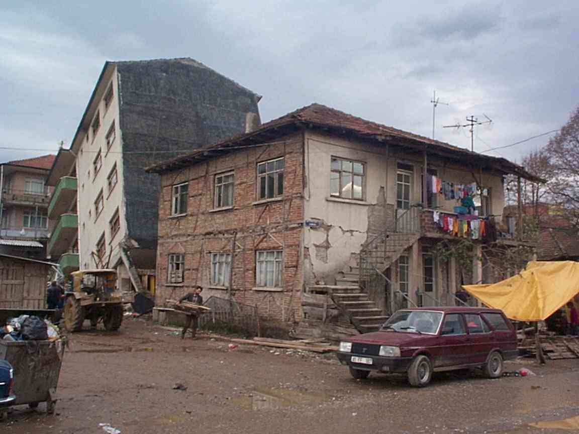
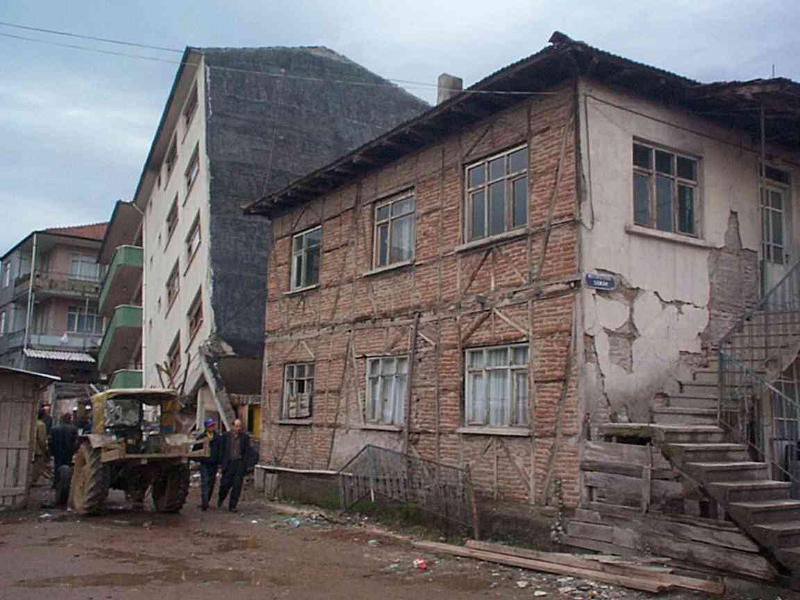
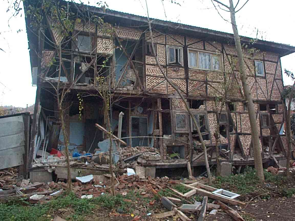
Traditional buildings consisting of timber frame with masonry infill were found standing next to partially collapsed concrete frame structures (689, 759).