Velocity field Kashmir

The arrows indicate the velocity of points in the Kashmir region holding India fixed. Uncertainties are of the order of 1-3 mm/yr and velocities range from 3-10 mm/yr.
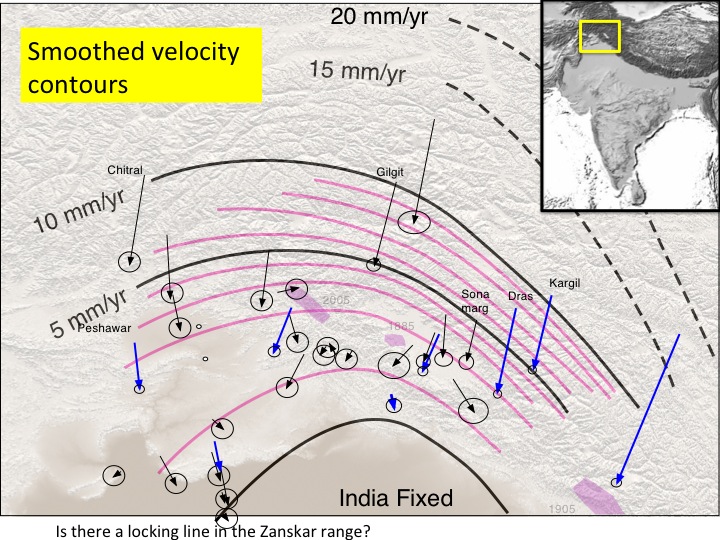
The sparcity of GPS velocity data in the NW Himalaya nevertheless permits a first glimpse of the surprisingly broad zone of deformation that exists here compared with the compact velocity field in the central Himalaya. There is no evidence for a rapid deceleration of surface velocities anticipated from locking at ~20 km depth, as is typical of the central Himalaya.

The dashed lines above indicate (from south to north) the Main Frontal Fault, the Main Central Thrust (Riasi thrust), the Balpora Fault and an inferred locking line beneath the Zanskar range. In 1885 a Mw=6.3 earthquake occurred near Baramulla, possibly on a branch of the Balpora fault, or on theMCT. Scenario rupture widths invoking rupture between the locking line and these thrust systems are shown in the next figure.
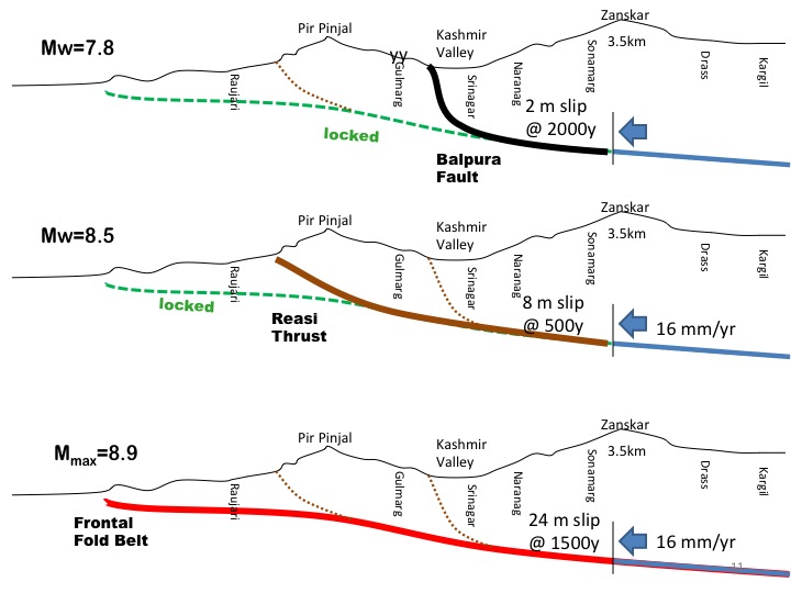
Senario ruptures on the known rupture systems in the Pir Pinjal and Kashmir are shown schematically above for a convergence rate of 16 mm/yr. Mmax magnitudes assigned to each assume the release of cumulative slip as indicated near the locking line, and an along-strike length of 300 km.

The above four images show in map view possible rupture areas for earthquakes shown in section in the previous figure. The grey areas are the rupture zones of known historical earthquakes. (A) worst case-scenario of 300x200km rupture. (B)Two smaller ruptures propagate only to the base of the Balapora fault. (C) Intermediate rupture only to the Riasi fault (D) the inferred earthquake rupture of the 1555 earthquake is no longer viable since GPS data show that locking does not occur beneath the Kashmir valley