Mapping Kalhana's RajaTarangini
During his translation in 1892 of the Sanskrit text of Kalahana's Raja Tarangini - the River of Kings of Kashmir -Stein realized (Notes on maps) that earlier translations (eg Dutt, 1887) were imprecise due to their uninformed knowledge of its geography. In the years 1895-8 Stein traveled throughout the valley with Montgomerie's maps associating many villages with their original Sanskrit names. His Rajatarangini is liberally annotated with references to these maps, but both Montgomerie's map and Stein's three annotated maps attached to his "Ancient geography of Kashmir" are difficult to find in libraries, and are omitted or unreadable in present-day reprints.
His annotated map of Kashmir is here digitized in segments that may be viewed at various magnifications. The 18 segments can be accessed by clicking on the appropriate segment on the index map, and if higher resolution is desireable, a 20Mb scan of each map segment can be accessed by clicking on each large map thereby viewed.
A convenient and more compact single sheet version of the above map of ancient Kashmir is available here.
A small jpg or a hi resolution jpg of his map of Ancient Srinagar are also available, and his detailed 1898 map showing the Sindh/Jhelum confluence near Trigrami is available here. These last two maps were also the subject of his "notes".
Montgomerie's 1860 Map
Montgomerie's map was prepared at a scale of 2 inches to the mile over a period of three years 1855-1865 (spanning the time of the mutiny). The 1/4"=1 mile map was published in 1861 (the 1886 folding version is available below). Reginald Phillimore describes the survey and planetabling of the maps, and the difficulties encountered in Zanskar and Ladakh. link
Montgomerie, T. G. Map of Kashmir, with part of adjacent Mountains, surveyed on the basis of the Great Trigonometrical Survey of India, under the instruction of Lieut.-Colonel A. S. Waugh, Engineers, F.R.S., F.R.G.S., Surveyor-General of India; by Capt. T. G. Montgomerie, Engineers, F.R.G.S., 1st Assistant G. T. Survey of India, and the Assistants under his orders, during 1855, '56, and '57. Scale, 2 miles to 1 inch. With an insertion entitled, Kashmir Route Map; scale, 32 miles to I inch; on 4 sheets; size, 50 inches by 50. MS. Click on the quadrant you want NW_10Mb, NE_14Mb, SW_13Mb, SE_15Mb, Entire map (42Mb)
Montgomerie, T. G., 1886 1/4" Map of Kashmir, Scale 4 miles to the inch. (14.6Mb)
Stein, A, Kalhana's Rajatarangini: A chronicle of the Kings of Kasmir, 2 volumes. Constable and Co. Calcutta. 1898. incomplete pdf
Stein, A., Notes on maps of ancient Kasmir and Srinagar. - [Paris] : Impr. Nat., [1897] 75-85. ; 27 cm
Stein, A., Ancient Geography of Kashmir, J. As. Soc. Bengal, 68, Part 1 1-231, and Extra No. 2 (3 maps), 1899.
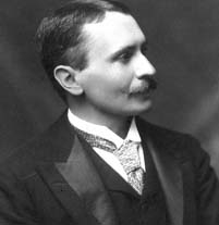
 Born Hungary 1862- died Afghanistan 1943. While on leave from an administrative position at the University of Lahore Stein searched for and found the earliest available codex of Rajatarangini whose existence had been hinted at by his former advisor, Buhler. He set about translating it in a tent overlooking the Kashmir Valley in 1895/8. His copious notes on the geography of Kashmir are of importance in quantifying the Medieval seismic history of the valley.