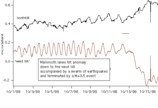
A rapid 0.4 microradian tilt down-to-the-west started on October 13th, 1998. A smaller 0.2 microradian tilt occurs on the north-south tiltmeter. The sinusoidal signal is the earth's tilt tide, and the abrupt vertical lines are local earthquakes (the north south tilt signal is noisy, see below). The largest of these (M=3.5 ) occurs on 15 October close to the time of maximum tilt.
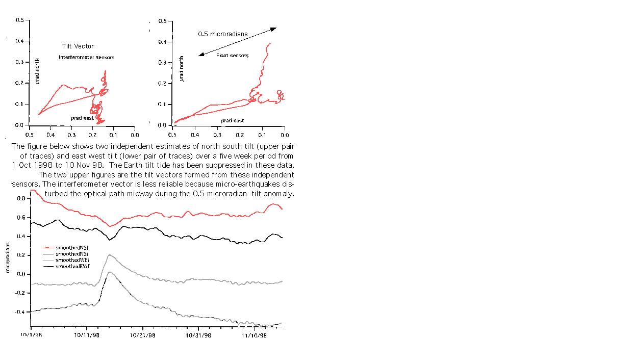
This anomalous tilt signal was recorded by 8 sensors, two at each end of the two orthogonal water pipes. Four of the sensors are optical interferometers with a precision of 0.25 micron (the south one has a bit-count malfunction). The remaining four sensors are floats whose positions are recorded by LVDT displacement transducers with a precision of 0.5 micron. The perfect antisymmetry of the signal, and the coherence between independent sensors, indicates that it is a real rotation of the Earth's surface relative to an equipotential surface, and not an artifact of the instrument.
The tilt vector observed during the anomaly is plotted below. The amplitude is approximately 0.5 microradians and the signal consists of a tilt toward the graben bounding fault for three days followed by a slow recovery over the next ten days. Aseismic dip-slip movement is believd to have occurred on a normal fault mapped near the tiltmeter.