Site Horrible Stream (HOR)
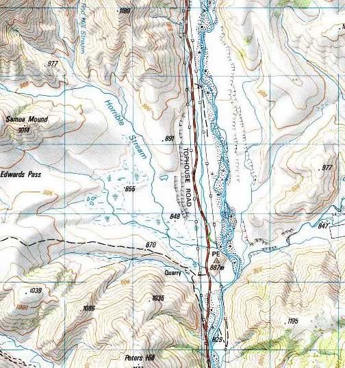
Map of Horrible Stream area (probably on Clarence Fault--most
likely through the "U" in TOPHOUSE). Most likely on track south
of fault and along the river. Gates to track to west locked.
Site owners: St. James Station. Considerable DOC involvement
here, probably Hanmer Springs office.
Please send mail to cjones@terra.colorado.edu
if you encounter any problems or have suggestions.
Marlborough
Main Page | C.
H. Jones | CIRES | Dept.
of Geological Sciences | Univ.
of Colorado at Boulder
0 visits from
Last updated
Saturday, April 21, 2001 12:11 PM