Overview of Caribou region
External maps/figures:
|
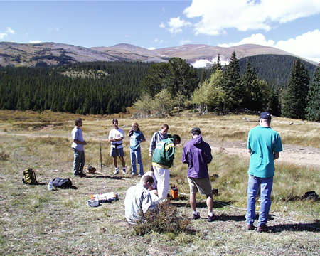
Resistivity sounding in Caribou Park, 1998. Other photos
are on a separate page.
|
Caribou is a ghost town site that hosts one of the few active hardrock
mines in Boulder County today. Caribou is about 10,000 feet in elevation,
somewhat below timberline, to the west-northwest of Nederland. Subalpine
fir and spruce forest mixes with boggy meadows; higher areas are tundra
covered and quite exposed. The area is a mix of private and public lands
accessed by dirt roads varying from good to terrible. The area is on the
edge of the Indian Peaks Wilderness and is used by recreationalists including
mountain bikers, wildlife viewers, fishermen, off-road enthusiasts, and
hunters.
During the term the weather varies from summer thunderstorms to winter
snows. Temperatures can be brisk or comfortable and rain will not of itself
postpone a trip; dress accordingly. Appropriate footwear is also advised,
as is sunscreen for the sunnier days.
|
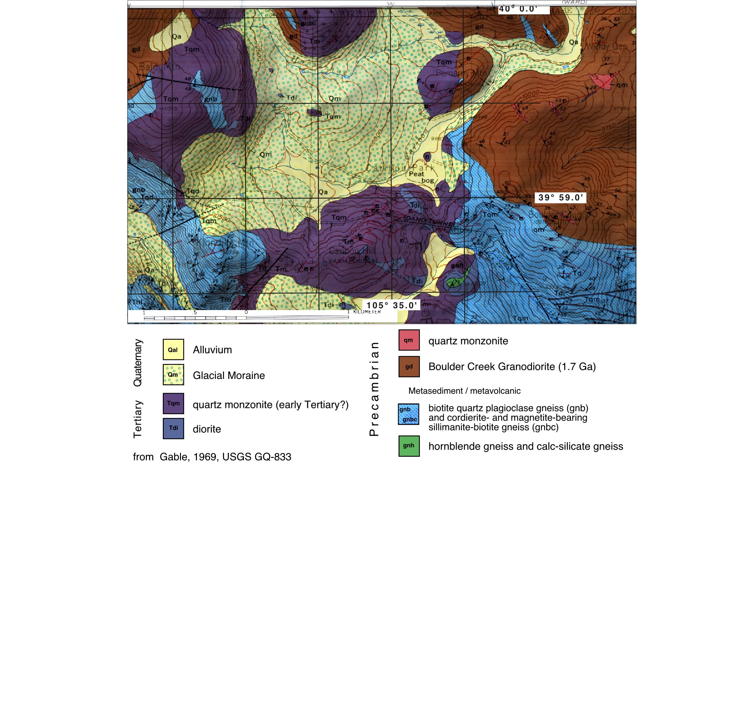
Geologically, Caribou juxtaposes old and young (see below). Bedrock
consists of metamorphic rocks probably mixed together as Colorado was assembled
some 1.8-1.7 billion years ago; these rocks were intruded at considerable depth
by the Boulder Creek granodiorite (1.7 Ga) and associated quartz monzonite.
The metamorphic rocks include some magnetite-rich rocks. The remainder of the
Proterozoic, Paleozoic, and Mesozoic are not in the rock record in this area.
Early Tertiary quartz monzonite to monzonite intrusions associated with the
Laramide orogeny intruded at shallow depth. Interaction with the Precambrian
rocks produced the ore bodies mined both in the past and present in the region.
One characteristic of the ores in Caribou is a very high level of magnetite.
Later Tertiary sedimentation or magmatism is absent until glaciers scoured the
area in the Late Pleistocene, deepening some drainages and damming others, depositing
moraines and other periglacial deposits. Postglacial sedimentation has filled
some of the glacial depressions, possibly including the bog mined in the 1950s
for peat to the northwest of the old townsite of Caribou.
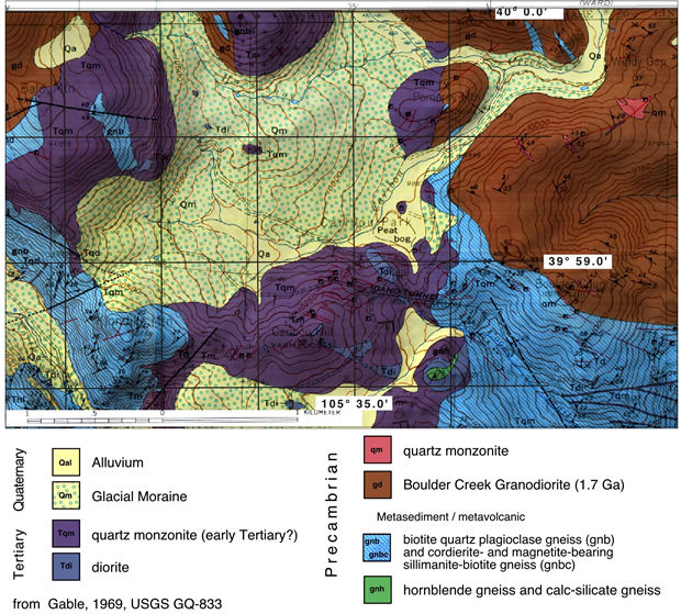
(click on the map above for a larger version)
Geophysical targets in the area are numerous; we will focus on three:
- Dense, magnetic ore bodies in the igneous rocks can be located and their
geometry constrained, as can some of the bedrock contacts (gravity, magnetics)
- The thickness, geometry and possible lithologies of the Pleistocene and
Holocene sediments in the drainages can be examined (refraction, resistivity)
- Archeological sites such as buildings and gravesites in the townsite of
Caribou can be located (ground-penetrating radar, shallow resistivity, magnetics).
Alternatively, we might assist the town of Nederland in locating the graves
in their historic cemetary.
Because of the altitude, afternoon thunderstorms are common in late summer.
This can be a serious problem for some of our geophysical experiments, so bad
weather can postpone a field day. On the other end, snow can make the area difficult
and unpleasant to work in. As a result, we try and do all our field work as
early in the term as possible with the goal of being done in the field before
the halfway point in the term.
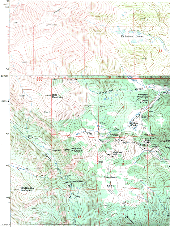
(Click on topo map for large version)
Please send mail if
you encounter any problems or have suggestions.
GEOL4714/5714 home | C.
H. Jones | CIRES
| Dept. of Geological
Sciences | Univ. of Colorado
at Boulder
Last modified at Thursday, October 10, 2024 5:13 PM
0 visits from