 Figure
1. (Cowen et al. 1997)
Figure
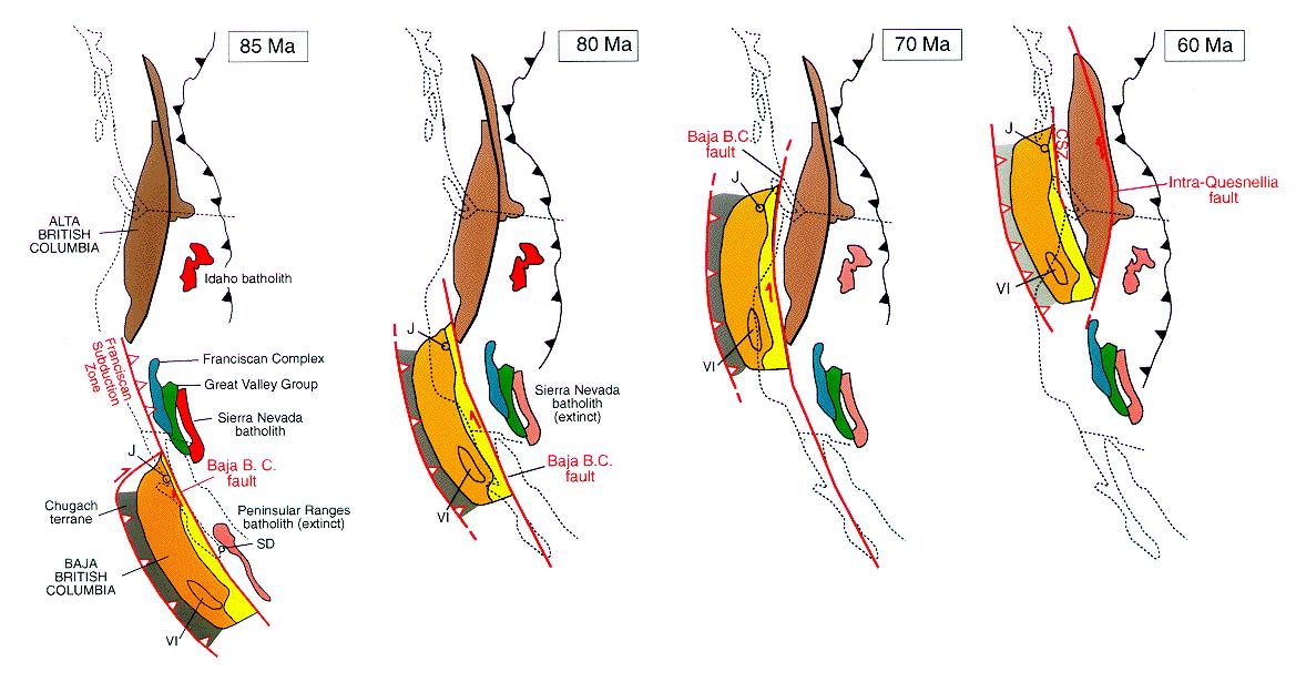
1. (Cowen et al. 1997)The paleomagnetic data suggest
that the Insular super-terrain and related coastal mountains’ origin was
3000 km to the south during the middle to late Cretaceous. About 85 to 55 MA
the super-terrain was transported northward along the North American coast to
its current location on the British Columbia coast, see Figure 1. This is the
main idea behind the Baja BC hypothesis (Cowan et al. 1997).
Figure
1. (Cowen et al. 1997)
Because
this is a case of latitude transport, the paleolatitudes must be defined, there
are two ways of doing this. The first is by paleomagnetism. The second way is
to identify the ancient climate (tropical or polar) recorded in the rocks. Faunal
data from Baja BC do not provide paleolatitude information beyond Jurassic ammonites
having Tethyan and South American affinities, which is not useful in the Baja
BC debate (Keppie and Dostal 2001).
To
disprove the Baja BC hypothesis the paleomagnetic data must not include poleward
transport. Tilting of Cretaceous plutonic rocks, compaction of sedimentary rocks,
or synfolding remagnetization of volcanic rocks would all cause errors in the
paloemagnetic interpretations. (Housen and Beck 1999). However, since the original
data was published in 1972, several more paleomagnetic studies by different
authors have been conducted, all showing similar results. No evidence of the
above causes of error have been identified.