
Jim Mize
Conventional models of Western North America identify it as an east dipping subduction zone since at least the Mesozoic and continuing to modern day (Engebretson et al., 1985). The magmatic bodies found in Western North America should be the product of continental arc magmatism or island arc magmatism and subsequent accretion onto North America. Based on the nature of the magmatism, the 87Sr/86Sr ratios should predictable (Faure and Mensing, 2004). Island arc magmatism produces 87Sr/86Sr ratios around and below 0.706. Continental arc magmatism typically produces 87Sr/86Sr values above 0.706. Thus, the subduction of oceanic plates eastward under Western North American should produce 87Sr/86Sr values in a large cloud around 0.706.
Hildebrand (2009) argues that the model of east dipping oceanic plate subduction is incorrect. Instead, he suggests that Western North America was a passive margin in the Mesozoic, and the oceanic plate off the west coast of North America was subducted under a ribbon continent, Rubia. This west dipping subduction continued until the late Mesozoic, when Rubia collided and accreted onto North America. This model allows only for island arc type magmatism in Rubia. As discussed above, island arc magmatism should produce 87Sr/86Sr values of less than 0.706. With these predictions in mind, the nature of magmatism in Western North America can be examined to determine the validity of these models.
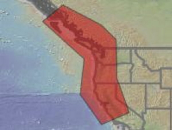
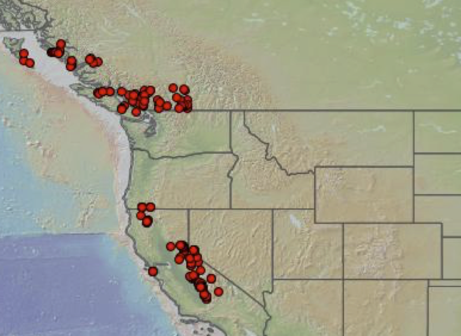
The Western North American Volcanic and Intrusive Rock Database (NAVDAT) was used to gather hundreds of isotopic measurements of plutonic bodies in Western North America. The database was queried for plutonic rocks 100 to 250 million years old along the west coast of North America (fig. 1) with 87Sr/86Sr measurements. A total of 407 measurements were found for these input parameters. Of those measurements, 210 samples had 87Sr/86Sr values greater than 0.706. The remaining 197 samples had 87Sr/86Sr values less than 0.706. The samples were distributed more or less randomly in space (fig. 2 and 3) and in time (fig. 4).
The conventional models are favored by these measurements. Samples that contradict the hypothesis put forward by Hildebrand are scattered spatially throughout the zone he thought should only show signs of island arc subduction. There are no temporal patterns in the samples to indicate that the type of subduction changed through time.
|
Figure 1 (left). The geographic bounding box from which measurements were taken. The box is much more narrow than Hildebrand’s Rubia, to ensure that none of Hildebrand’s North America was included in the sampling. | |
|
|
|
| Figures 2 and 3. The locations of measurements of 87Sr/86Sr ratios. Figure 2 (left) shows all points with 87Sr/86Sr > 0.706. Figure 3 (right) shows all points with 87Sr/86Sr < 0.706. Both maps show high and low 87Sr/86Sr values scattered across Western North America | ||
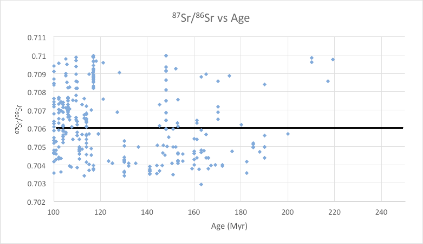
Figure 4. A graph of 87Sr/86Sr vs rock age. There is no discernable pattern between rock age and 87Sr/86Sr value in Western North America.
Works Cited