 |
Network of 20 automatic weather stations (AWS) distributed over the Greenland ice sheet . Data are transmitted via satellite link on an hourly interval and updated.
|
 |
This project focuses on Larsen C, the largest remaining ice shelf on the Antarctic Peninsula. Three automatic weather stations (AWS) installed in 2008 along a north-south transect. During the 2009 field season, extensive ice penetrating radar and kinematic GPS surveys were conducted along and across flow lines near each AWS station. |
|
Field schedule and information for media visits |
 |
PARCA is a NASA project initiated to assess whether airborne laser altimetry could be applied to measure ice-sheet thickness changes. |
 |
The total area of surface melt on the Greenland Ice Sheet broke all known records again in 2005 for the island as analysis of melt extent on the Greenland ice sheet using passive microwave satellite data show a very dramatic increasing melt trend since 1979 which appeared to be interrupted only in 1992 by the eruption of Mt. Pinatubo. The previous maximum melt extent and total melt area of 2002 has already been equalized on September 25 this year (2005) with melting still going on at lower and southern parts of the ice sheet. |
 |
Greenland QuickSCAT Melt Climatology
For more information about this project, contact us. |
 |
Animations of arctic area ice and polynyas in Baffin Bay, made using satellite imagery |
 |
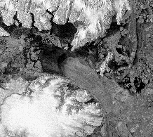
Petermann Gletscher
Surface and bottom ablation, CTD profiles under floating ice tongue, GPS measurements of tidal interaction. For more information about this project, contact us. |


