|
|
| Wessman Home | People | Projects | Contact |
| RESEARCH GROUPS @ CIRES > |
|
Rozita Abdul-WilliamsContact Information
Associate Scientist I Research Activities Other Affliations PhD Student at Michigan State University (2002-Present) 1. An Analysis of Land Use Cover Change in the Baram Watershed Using an Integration of GIS/Remote Sensing and Human Environment InteractionMy research topic is firmly rooted in Land Use/Land Cover Change analysis with remote sensing and GIS applications. Potentially it offers an explanation of these land use changes through geospatial analysis and political ecology. It will be interesting to make a contribution that helps move political ecology forward as it continues to embrace geospatial technology in its various methodologies. My study area will be in the Baram watershed of Sarawak, Borneo Island. Much of my concentration will focus on issues related to land degradation. Land degradation is a serious problem that has affected the historical pattern use of resources by the indigenous community in Sarawak. In view of the rapid logging and land development in Sarawak, the concern really is how to strike a balance. Water supply will become an increasingly difficult and expensive problem to tackle. A good theme for this study may include how the various impacts have been and will be affecting society and biodiversity when insufficient attention is given to the protection of catchments. Monitoring impact of activities such as logging and oil palm plantation usage on water quality (affected by silting and chemical discharge) will be important to enable appropriate mitigating measures to be developed. Tackling this problem requires political will and awareness. Studies show that the Baram delta and river system indicates high suspended sediment loads caused by logging activities upstream. This contributes to rather serious problems in terms of soil erosion, loss of soil fertility, clogging of rivers and drainage systems and extensive flooding. Some of land use changes such as deforestation and land losses that have taken place have a big impact on human society. The adverse form of land degradation occurring in the Baram watershed includes deforestation, soil erosion, pollution and the destruction caused by logging activities. These occurrences are crucial to understanding why the rainforest is degraded and destroyed in sight, which has affected the Penans ecosystem. When the forestland is disturbed or degraded, the ecology is damaged and the natural course of indigenous culture is at risk. The environmental impact in the Baram Watershed of Sarawak, by soil erosion and other forms of land degradation, is overly familiar. This can be witnessed through the advancement of remote sensing and Geographical Information System (GIS) technologies. Land degradation is a serious problem that has affected the historical pattern use of resource by the indigenous group in Sarawak. This study will focus on the political ecology (state of affairs) of the Penan settlements in the Baram watershed, Borneo Island. 2. Ecological Vulnerability Model - Methods: Ecological Niche Model[July, 01 September, 01, 2005]
Hawaii Project Outline:
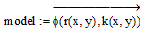
Steps taken in the procedures: Step 1: Parameterized the responds functions. Step 4: Mapping the distribution
x Ξ READRGB ("baram_bathy_modeltest+10000.tif" ) – 1000 y Ξ READRGB ("baram_elevation_modeltest_rcl+10000.tif" ) – 10000
3. Delta Project - WDN Work ProcedureMy work involves in producing the Deltas general Area of Influence (AOI), and the Delta Area (DA) boundary files for each study areas. The boundary files were derived from masking and buffering the 1km DEM and 4km Bathy, which were used to define the initial thresholds. I am also responsible to produce a shape file and Arcinfo format of the boundary files. These are vector GIS boundary files for deltas in the World Deltas Database, which define the "Area of Interest" (AOI) for the purposes of the WDN. These boundaries are intended to be the standard area used to subset spatial data to add to the WDN and WDD. They are in easy-to-use formats (Idrisi/Vector and ESRI/Shapefile). There is also a .jpg image showing the boundary on a relied image for reference. The delineation criteria were generated to the closest data-driven boundary meant to outline the area of influence, the other the active physical delta itself. The work procedure involved includes:
This work will incorporate processing the Landsat imagery for 1990 and 2000 and applying a standard atmospheric correction. This includes identifying and mosacking necessary scenes that cover AOI and DA boundaries. The Delta project will contribute to the development of a worldwide Delta database, part of the climate and global change research initiative. This database will provide access to wide arrays of information and data from field studies and satellite imagery, with GIS overlays on the deltas in question. It is significant to study the land loss of the Delta as it exists to sustain often large human populations. River Deltas of the world are renowned as fertile regions for agriculture. Deltas are key components of the hydrological system linking white and blue water. They are highly dynamic indicators and integrators of larger system processes, and hence they can provide valuable information that may be used for assessment and prediction of watershed and coastal change. This will be a useful study to initiate the potential scale of the problem, and to study the impacts of both climate and atmospheric compositional change on ecosystem functionality and the implications for the earth system. |