Below are some photos around the 2017 total eclipse as viewed from a ridgeline on the north side of Cream Puff Peak in the northern end of the Hobart Range and within the Gros Ventre Wilderness, Wyoming. Clicking on most images will get a larger version of the photo. These are copyright Craig Jones, 2017.
|
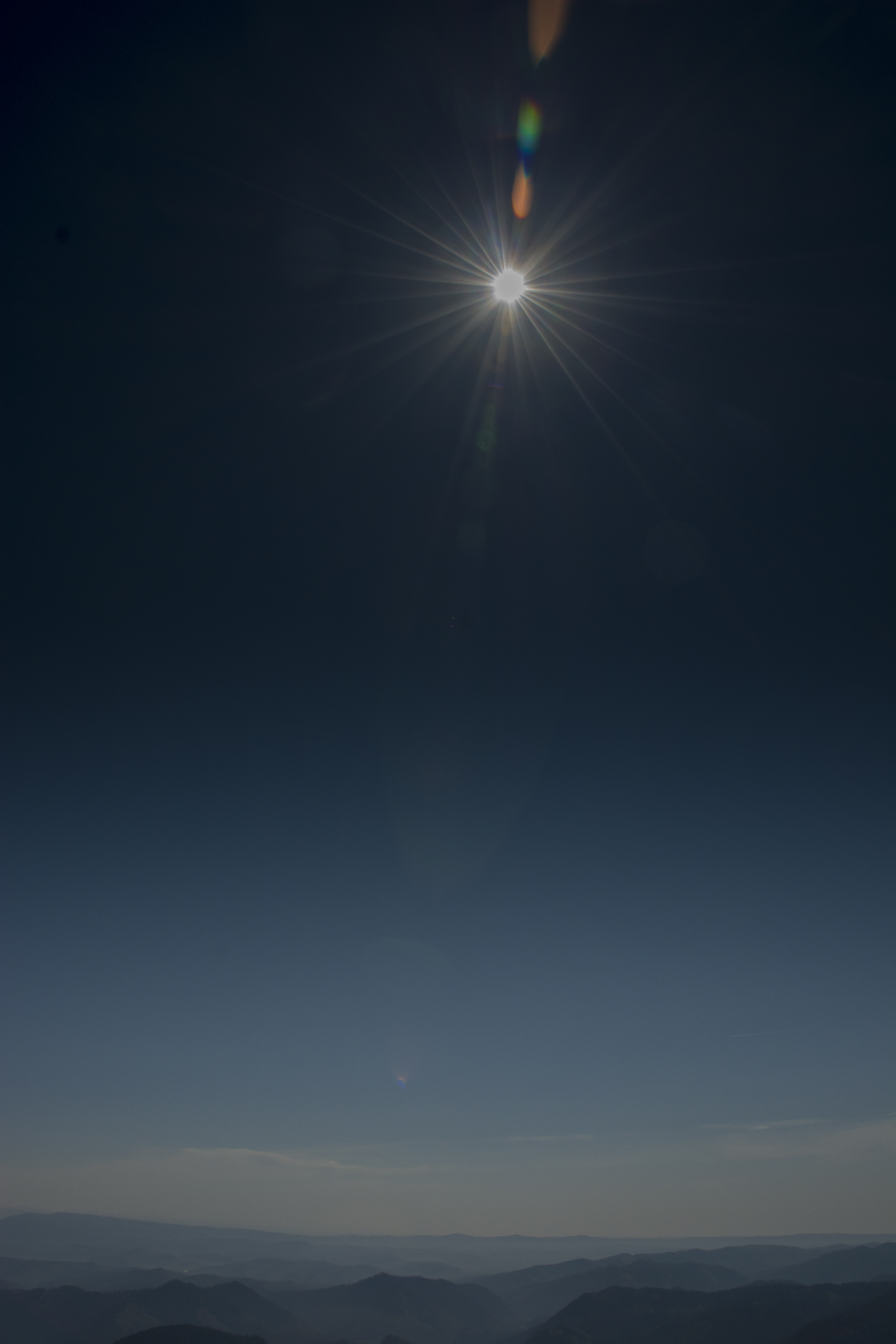
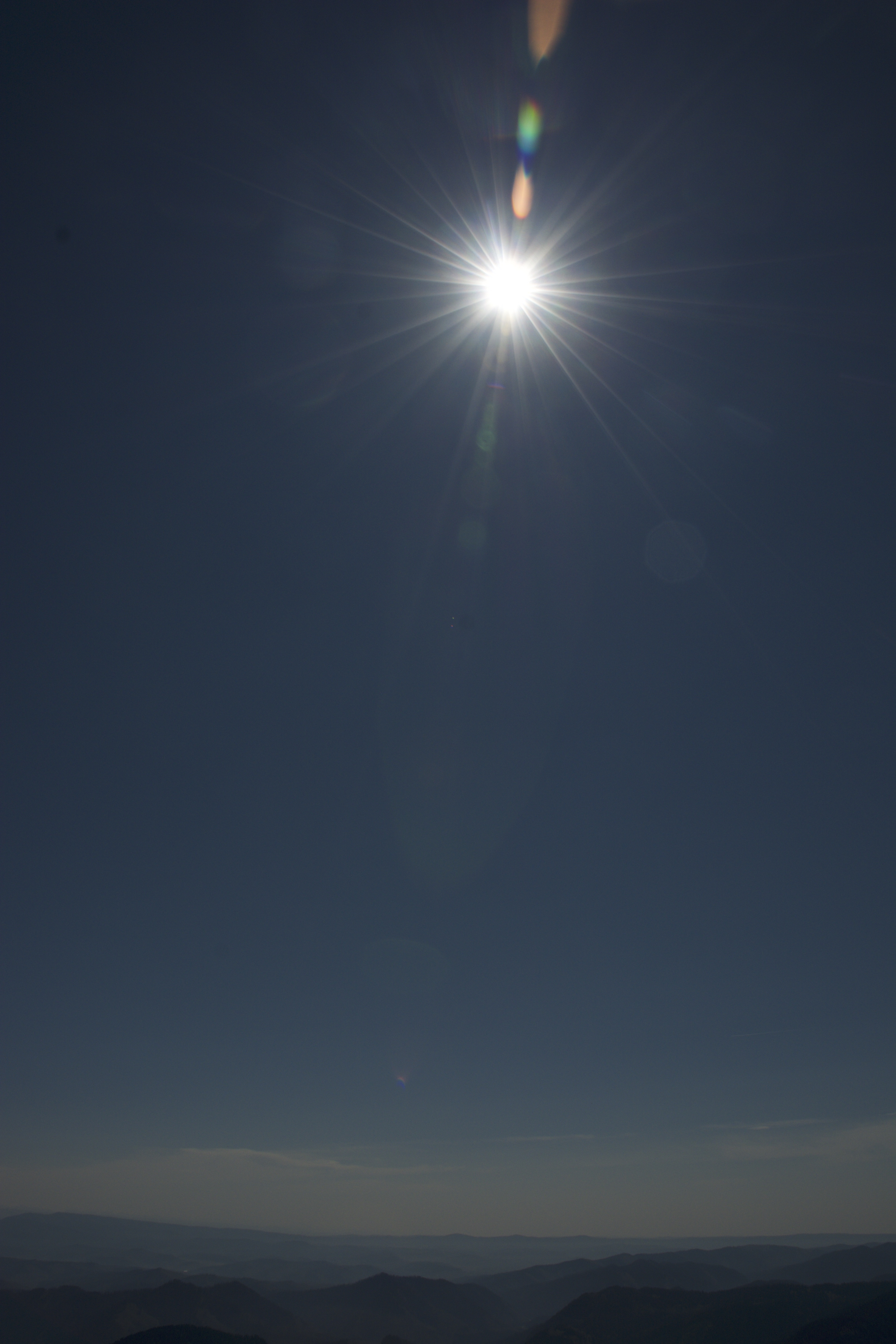
A few minutes before totality starts, looking to the SE. A gradational filter darkens the top half of the image to get a sense how little sun is still in view. The unaltered JPEG version of the photo is here. |
| Taken just as totality started. You can see a reflection in the distance to the left from outside the umbra while nearby ridges are totally dark. (No gradational filter here. The sky above is dark). | 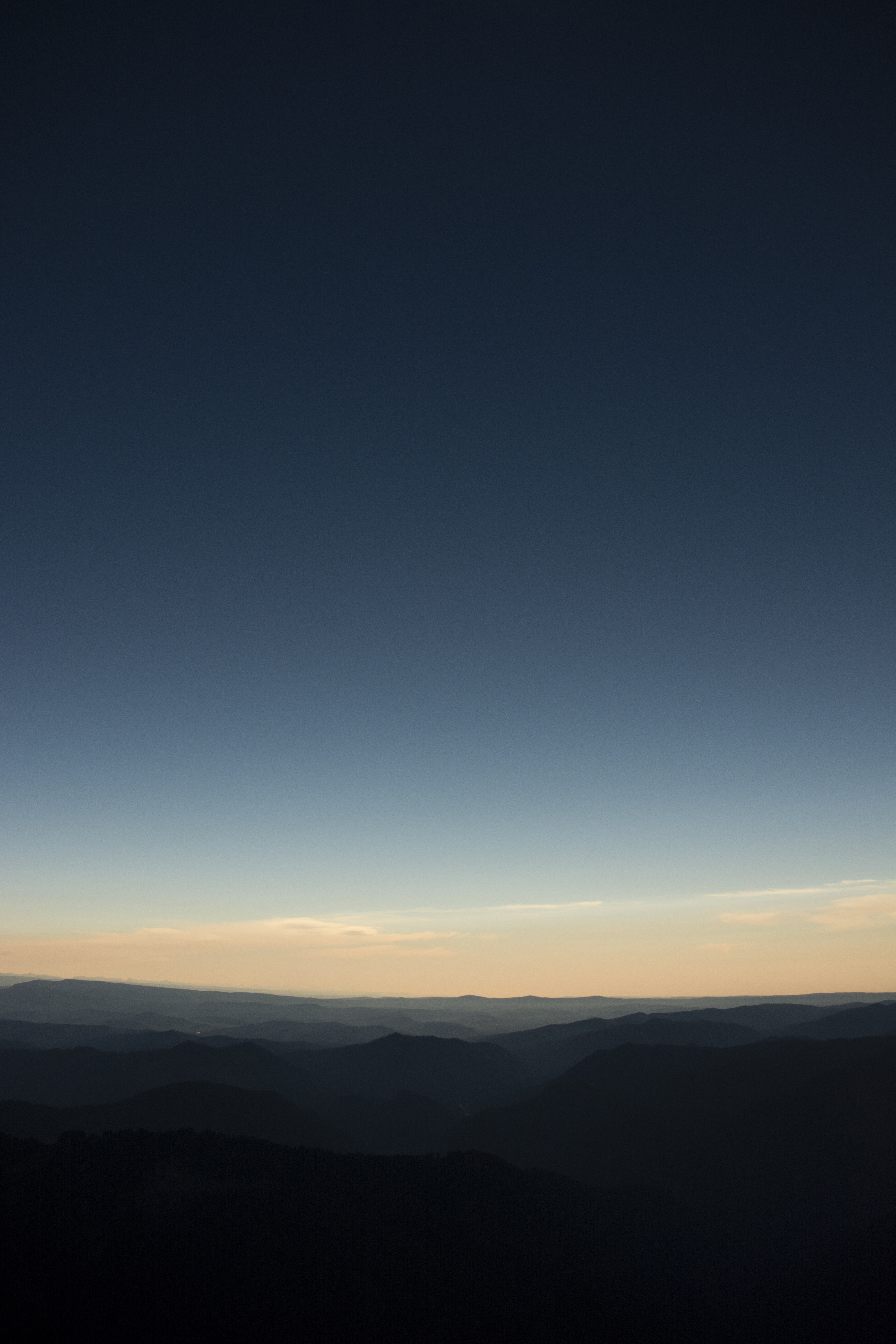 |
How dark does it get in an eclipse? The stop motion movie below was set to use a constant exposure and is about 93x actual speed (runs from 11:20:03 to 12:08:35; eclipse is 11:35:16 to 11:37:16 MDT at this spot). Pretty dark in the eclipse, but you can also get a sense of how sunlight is returning as distant ranges wash out towards the end of the clip. A bigger version of this is here (56 Mb)
A view to the south through the eclipse sees outside of the umbra (which was traveling about 5 miles a second, if you were wondering). Here the exposure varies but drops low enough that things go pretty dark during totality. Check out the sky near totality--you can see the shadow move across from right to left. A larger version is here. Both time lapses were made with LapseIt on an iPad (top) and iPhone (below).
During the eclipse the distant horizon was lit like at sunset while Venus and Mercury came into view around the sun.
 |
A motion-blurred photo of the eclipse over the western Wyoming landscape gives a sense of context. |
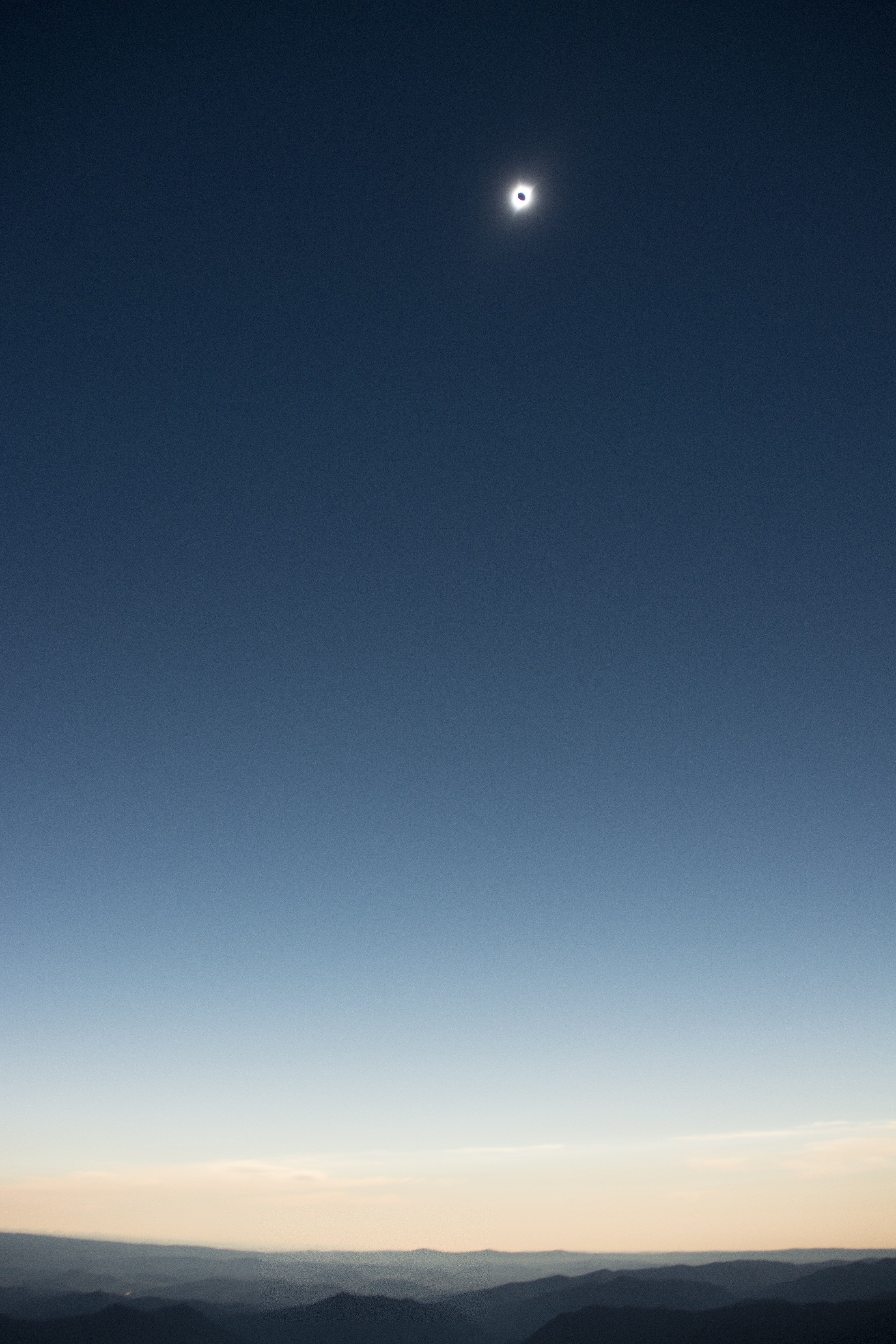
| Telephoto view of the eclipse | 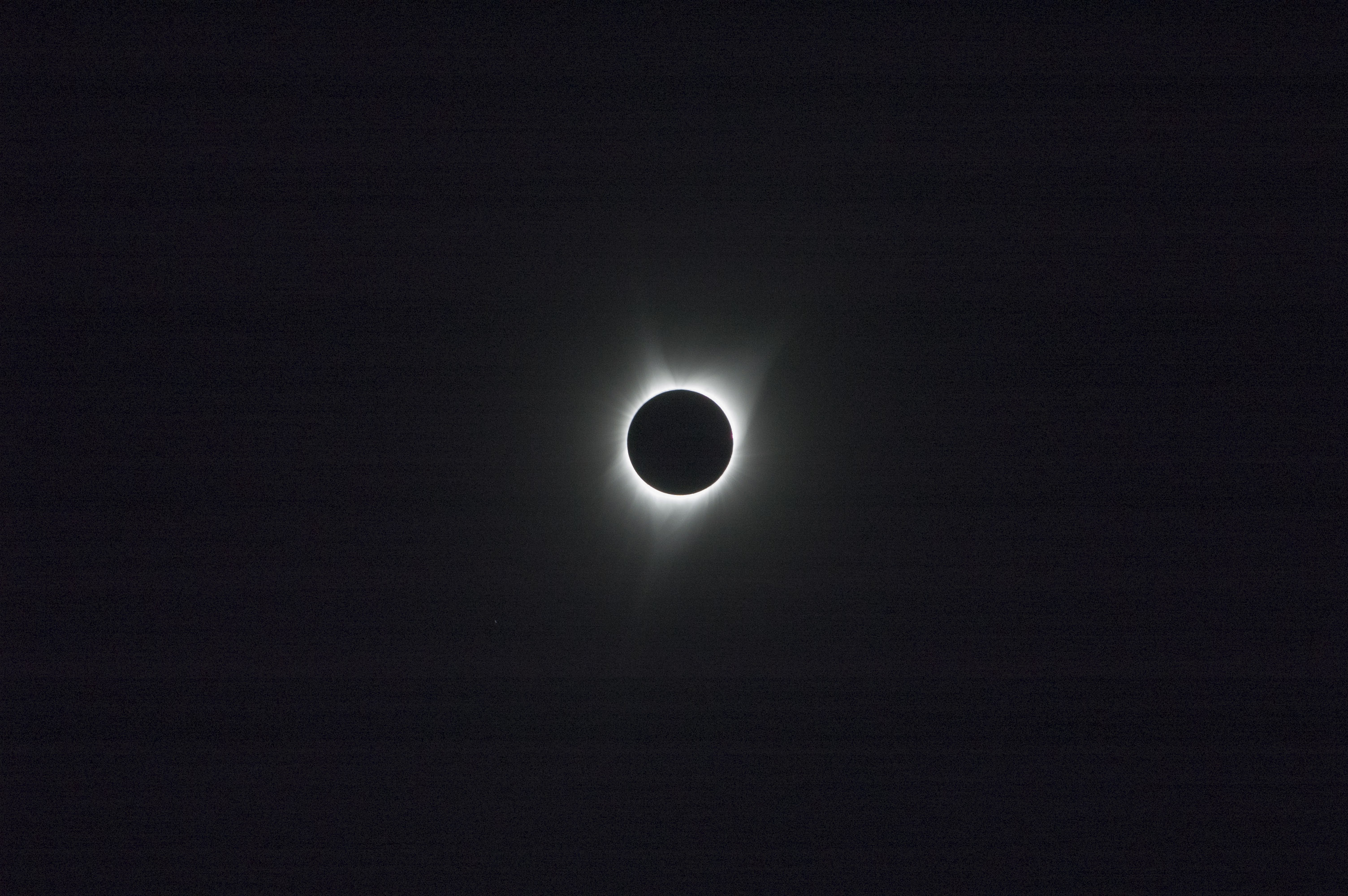 |
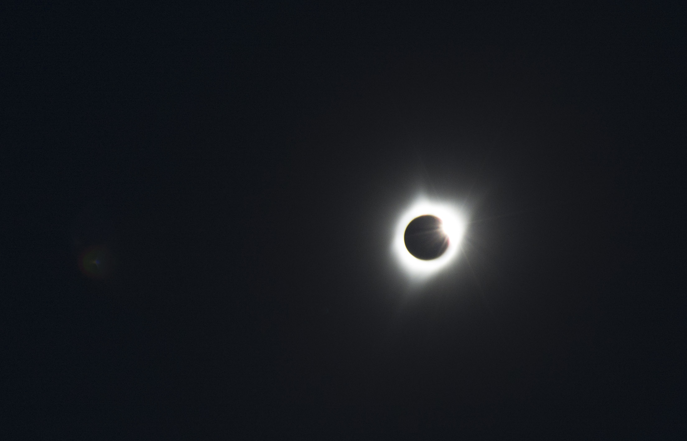
| A closer view and longer exposure. Mercury is visible down and left of the eclipse (Mars, oddly enough, is not visible in any of my photos, despite being about as bright and about the same distance from the sun but on the opposite side). | 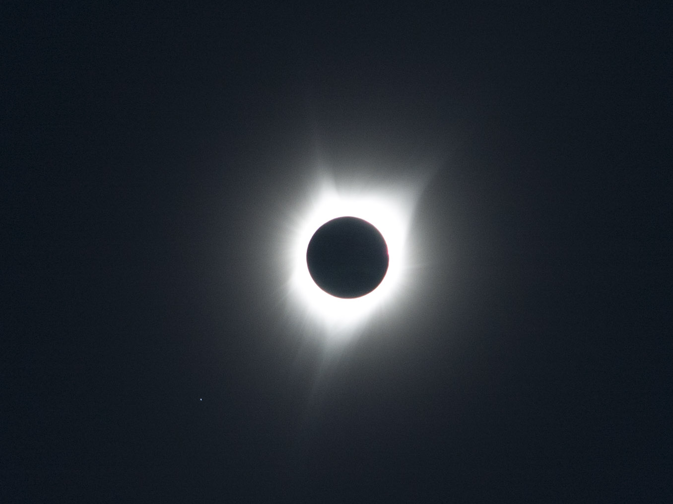 |
After just about exactly two minutes the sun returned on our ridge--but you could see the distant peaks of the Gros Ventres and Wind Rivers were still in shadow...
 |
Totality's end. |
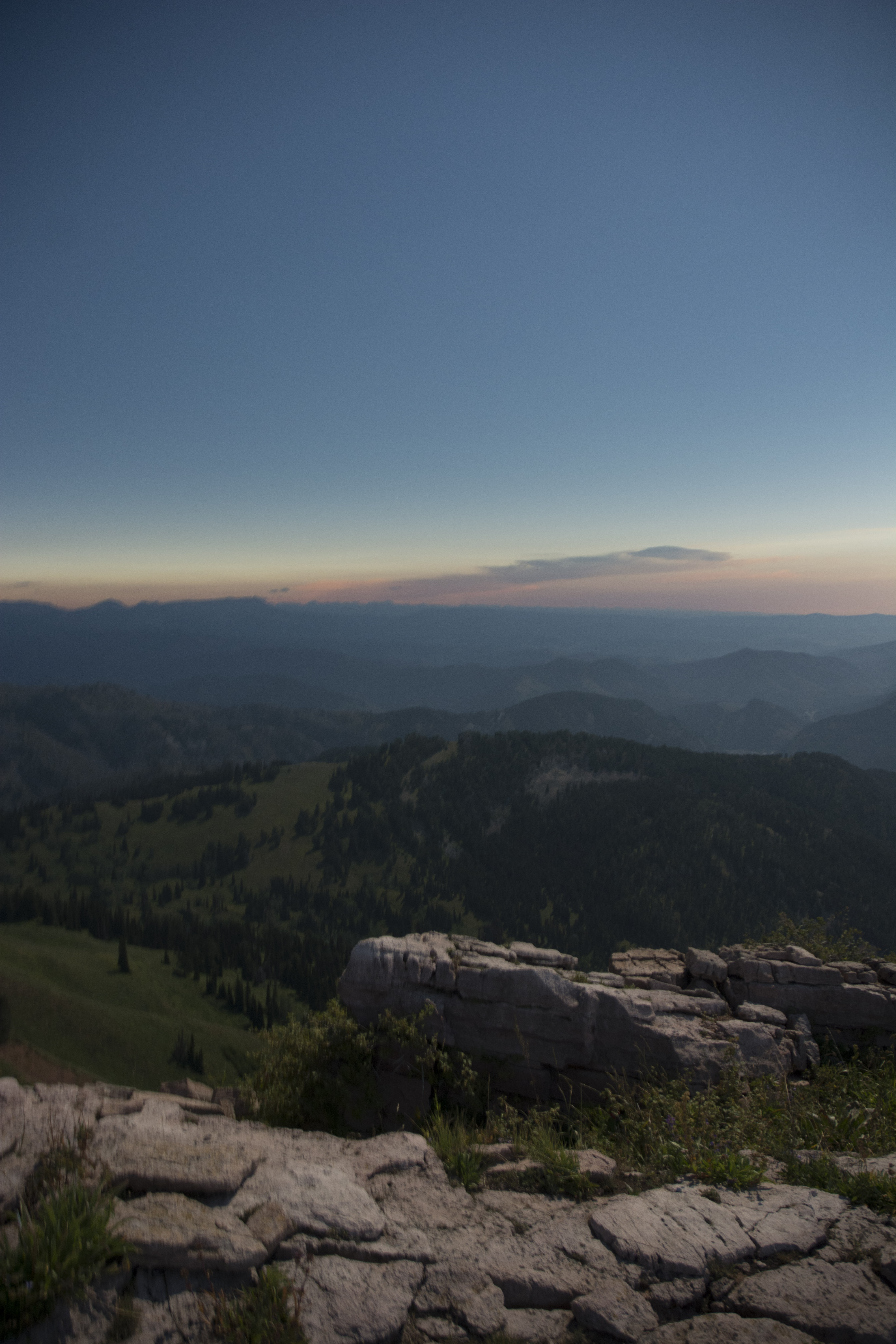 |
Light has returned to our knob (foreground) but the distant ridges of the Gros Ventre Range (left) and Wind Rivers (skyline in distance slightly left of center) are still shadowed. Note that the distant clouds, which were well lit in the pre-totality photos, are now mostly in shade. |
| Megan Jones models eclipse glasses while the retreating shadow still covers distant peaks (but note the reflection in distant right center absent in photo above). | 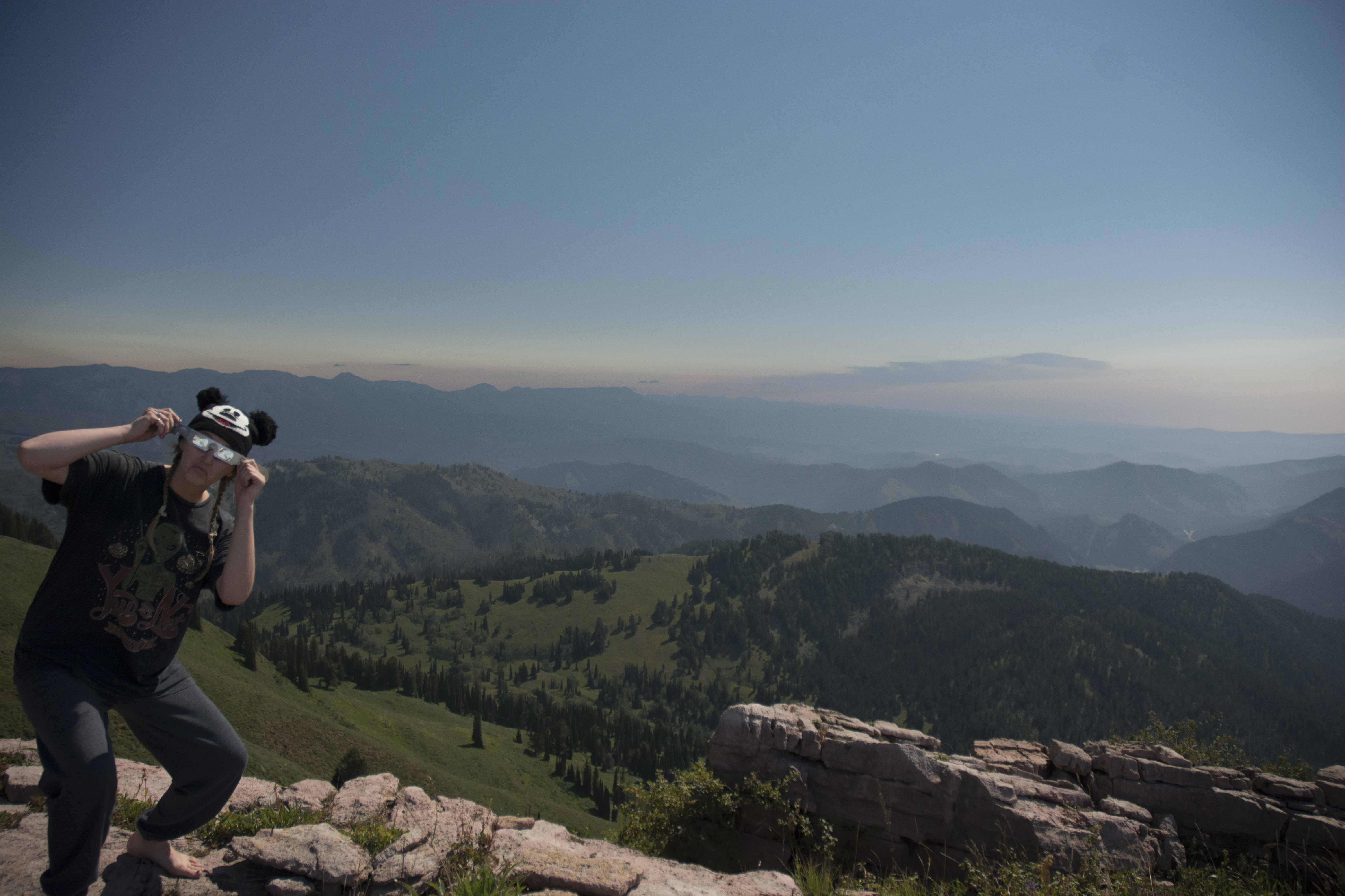 |
Finally, a slightly later 360 panorama from our site can be viewed here.
How we got here is a small story of itself. The goal was Cream Puff Peak (which is in view to the south in the panorama), but I didn't want to climb the brutal straight-uphill that University of Michigan campers from Camp Davis have used over the years. The Forest Service shows a pretty nicely graded trail going up the backside of Cream Puff, their trail 4120 (Cow Creek Trail). This is an OK trail all the way to the hunting camp area just east of the Cream Puff Peak ridgeline. From there, you encounter a couple of splits--one is marked, the next is not (a prominent trail heading down to the north), the third is also not marked. This third junction is on the ridgeline that runs east out of the peak north of Cream Puff (Pk 9739' on USFS online map). The more pounded trail heads almost due west and up towards that peak; the less obvious trail but the one plotted on the USFS maps (and the Bull Creek map you can get through Avenza Maps) continues south on a gentle incline. You then come out of the trees and see Cream Puff just over a mile away across what appears to be a nice grassy field. Sadly, it is anything but: in late summer, the field is a mass of waist-high plants that not only obscure the trail but are very hard to plunge through on a side hill. Although from the GPS-enabled map I knew where the trail was, we simply could not make progress and sidehilling crosscountry through these plants was going to take too long--so in assuming that various reviewers simply were incapable of navigating very well, I ignored their quite prescient warnings. So we turned uphill and fought our way up to the ridgeline (well, most of us). From a little ways up you could make out a couple of the spots on the trail that had been graded into the sidehill, but by then there was little point. So we missed out on the view to the WNW to the Tetons that those on Cream Puff had, but at least we did make the ridgeline to see things off to the south and southwest. Our return down the ridgeline revealed that the steep uphill trail was in decent shape and is one used by horseriders. So for any others looking to climb Cream Puff from the official Forest Service trail--head for that other peak. It is easier...
Please send mail to cjones@colorado.edu if you encounter any problems or have suggestions.
C. H. Jones | CIRES | Dept. of Geological Sciences | Univ. of Colorado at Boulder
Last modified at September 1, 2017 2:31 PM