|

|
| Molnar Home | Research Projects | Publications |
| RESEARCH GROUPS @ CIRES > |
|
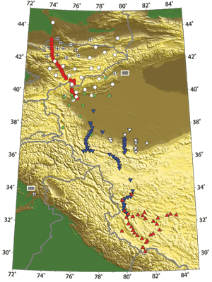
Figure 1: Map of western Tibet and the Tien Shan showing deployments of broad-band seismographs in this region during the past 20 years. |
Western Tibet seismologyImaging the mantle beneath the western Tibetan Plateau
Collaborators (recent past and present)
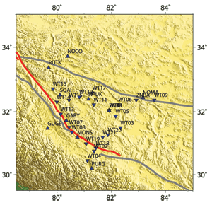
Figure 2: Blow-up of our network. We installed an array of seismographs across western Tibet to study deep structure, and we recently retrieved data from them. We anticipate constraining the deep structure sufficiently well that we will be able to discriminate between subduction of Indian lithosphere beneath the Himalaya, subduction of Tarim lithosphere beneath northern Tibet, and convective instability of thickened mantle lithosphere beneath Tibet. Preliminary results [Duret et al., 2010] using aftershocks from the 2008 Wenquan earthquake in Sichuan corroborate those of Shapiro et al. [2004] and show that Love and Rayleigh wave group speeds cannot be matched with the same structure. ReferencesDuret, F., N. M. Shapiro, Z. Cao, V. Levin, P. Molnar, and S. Roecker (2010), Surface wave dispersion across Tibet: Direct evidence for radial anisotropy in the crust, Geophys. Res. Lett., 37, L16306, doi:10.1029/2010GL043811. |
 Supported by NSFs Seismology program