Several GTS points were destroyed by the earthquake. Photographs of two of these are shown below.
I . Bhachau Hill Station, lat. 23 18', long. 70 23' observed
at in 1857 is situated at the center of the highest, round bastion
or tower at the northern corner of a fort on the summit of the
hill at the western foot of which lies the large village after
which the station has been named. It is in the lands of the village
of Bhachau, pargana Vagad, Cutch State. The station consists of
a mud platform, enclosing a solid, circular and isolated pillar
of masonry about 5 feet in height, which has a mark-stone in its
upper surface. When visited by the Levelling Party in 1874-75,
the station was found in good preservation. The directions and
distances of the circumjacent villages are;- Sikra N.W., miles
4; Kunjhisar N., miles 5; Karmaria N.E. by N., miles 3 ; Vondh
E., miles 3 ; and Chopadau W.S.W., miles 4.
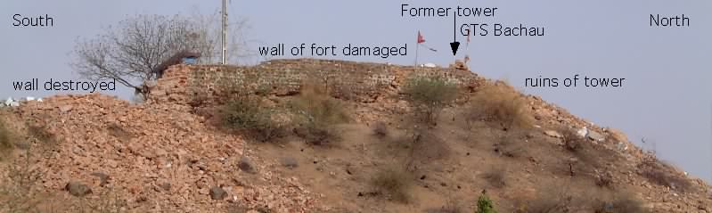
This Cutch Coast Series site was destroyed during the 26 January earthquake. Roughly 70% of the walls of the fort were destroyed including the tower on which the mark was constructed. The remains of the tower, consisting of stone blocks and clusters of cemented blocks, are scatterred 20 m over the edge of the bluff on which the fort stands. The foundations are shattered. The point was less than 20 km from the epicenter.
II Nara Hill Station, lat. 23 26', long. 70 36' observed at in 1856 is situated on one of the hills about 4 miles N.E. by N. of the town of Adhoi and 1 miles E.N.E. of the small village after which the station has been named. It is in the lands of the village of Nara, pargana Vagad, Cutch State. The station consists of a platform of rubble enclosing a circular, isolated pillar of masonry 5 feet in height. The directions and distances of the circumjacent villages are; Sarasla N.W. by N., miles 2 1/3; Badargad E.N.E., miles 4 ; Vashtava S.E., miles 2 ; and Gamdau S.W. by W., miles 3.
The figure shows cartoon sections of the central pillar and surrounding masonry before and after the January earthquake.
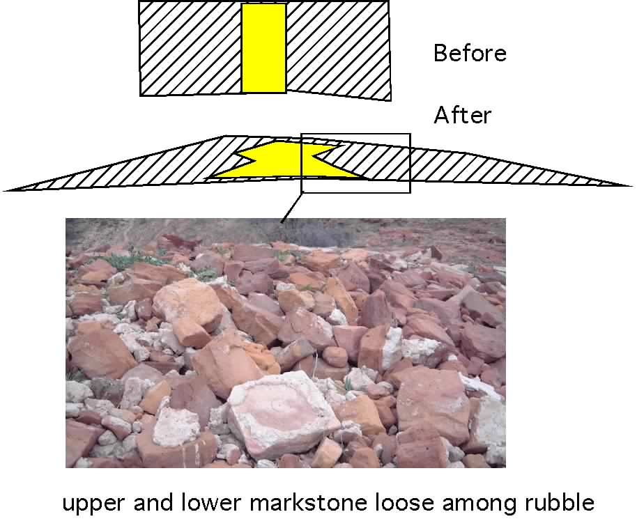
This site was destroyed during the 26 January earthquake. The platform, which in June 2001 was found to be a gaussian-shaped heap of rubble less than 1 m high and 6 m across, acted as a battering ram during the earthquake destroying the central pillar, and both the lower and upper marks were found displaced and loose on the surface.