This page illustrates the geometry of the Hayward Fault creep-meters and their location relative to alignment arrays along the fault (for details of alignment array creep rates see Galehouse web site), and to other cultural features in the East Bay. The basemap for all the creep-meter map views is to be found on Jim Lienkaemper's USGS web page. The latter is a scrollable map that can be viewed at a variety of scales. Click here for a summary of data or here for access to detailed numeric data.
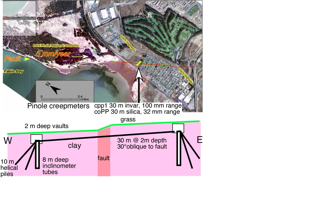
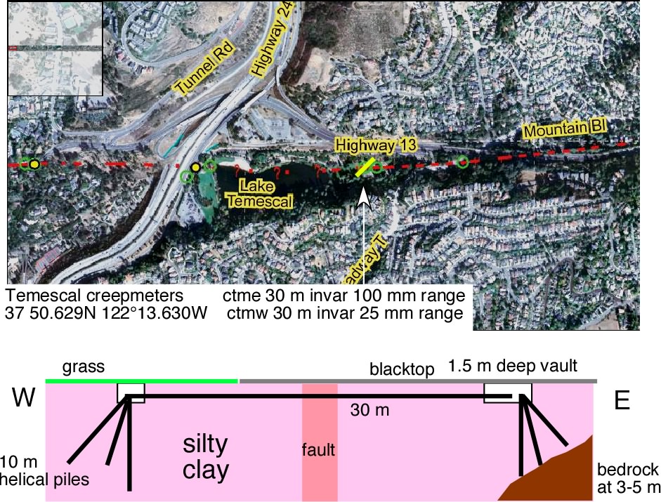
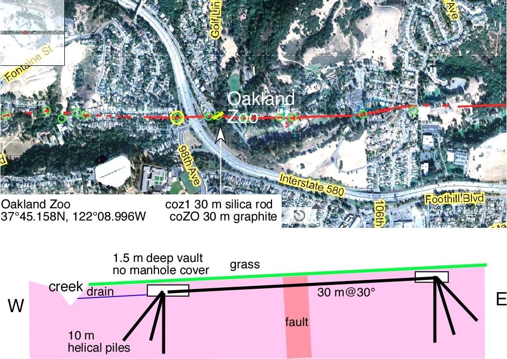
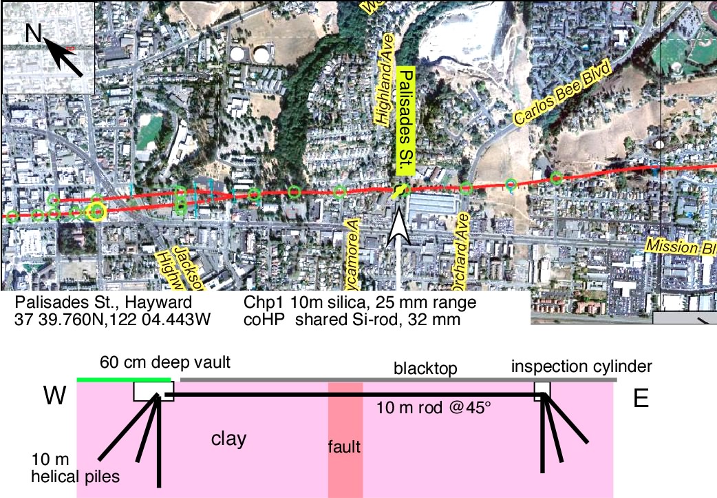
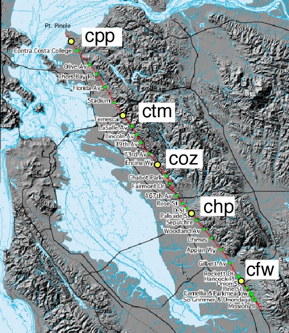
Click on the map below (or the named creep-meter in the following list) to examine the geometry and cross section of each creep-meter site. A description of creep-meter monumentation is found below the map. The site descriptions indicate soil type and surface cover (grass/blacktop etc).
cpp= Point Pinole telemetry , coPP = Backup microstation data logger
ctm= Temescal Park telemetry, coTM =Backup microstation data logger
coz=Oakland Zoo , coZO =Backup microstation data logger
chp=Palisades St, Hawyward, coHP =Backup microstation data logger
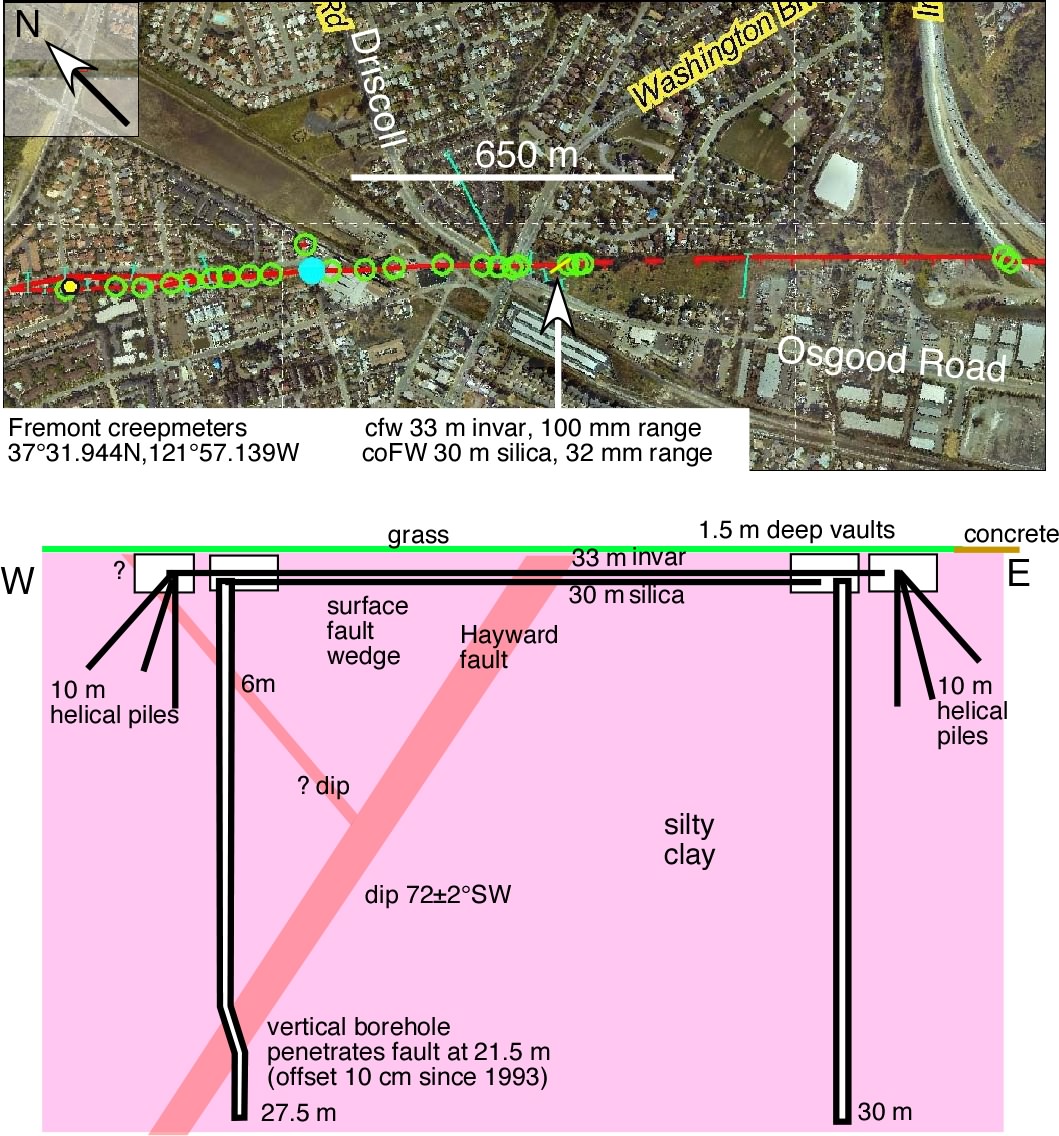
cfw=Fremont Gallegos Winery, Osgood Road, coFW =Backup microstation data logger
General details about the creepmeter monuments
Each creep-meter site includes two creep-meters attached to soil materials of the East Bay using engineered monuments. In all sites helical piers extend to 10 m depth in the form of a buried tripod with one vertical leg and two 45° inclined legs. One inclined leg leads away from the fault to the east or west, and the other extends parallel to the fault to the NW on the west side of the fault, and to the SE on the east side of the fault. The legs consist of welded 3 m sections of 5 cm x 5 cm square galvanized steel bar and welded at their intersection point at the top(1-2 m below the surface) to a 2 inch diameter towing ball to which the length-standards are fixed. The base of each leg consists of a steel helix that is screwed into the caly adjoing the fault zone. The Fremont creepmeters use both a helical pile system and an experimental vertical inclinometer borehole system to determine monument stability. The borehole was measured at infrequent intervals until 1999 when our inclinometer failed. The western monument penetrated the (unexpectedly) SW-dipping Hayward fault at 21.5 m depth, and as a result of creep, its base (from 23 m to 27.5 m) has been shifted 10 cm to the SE.