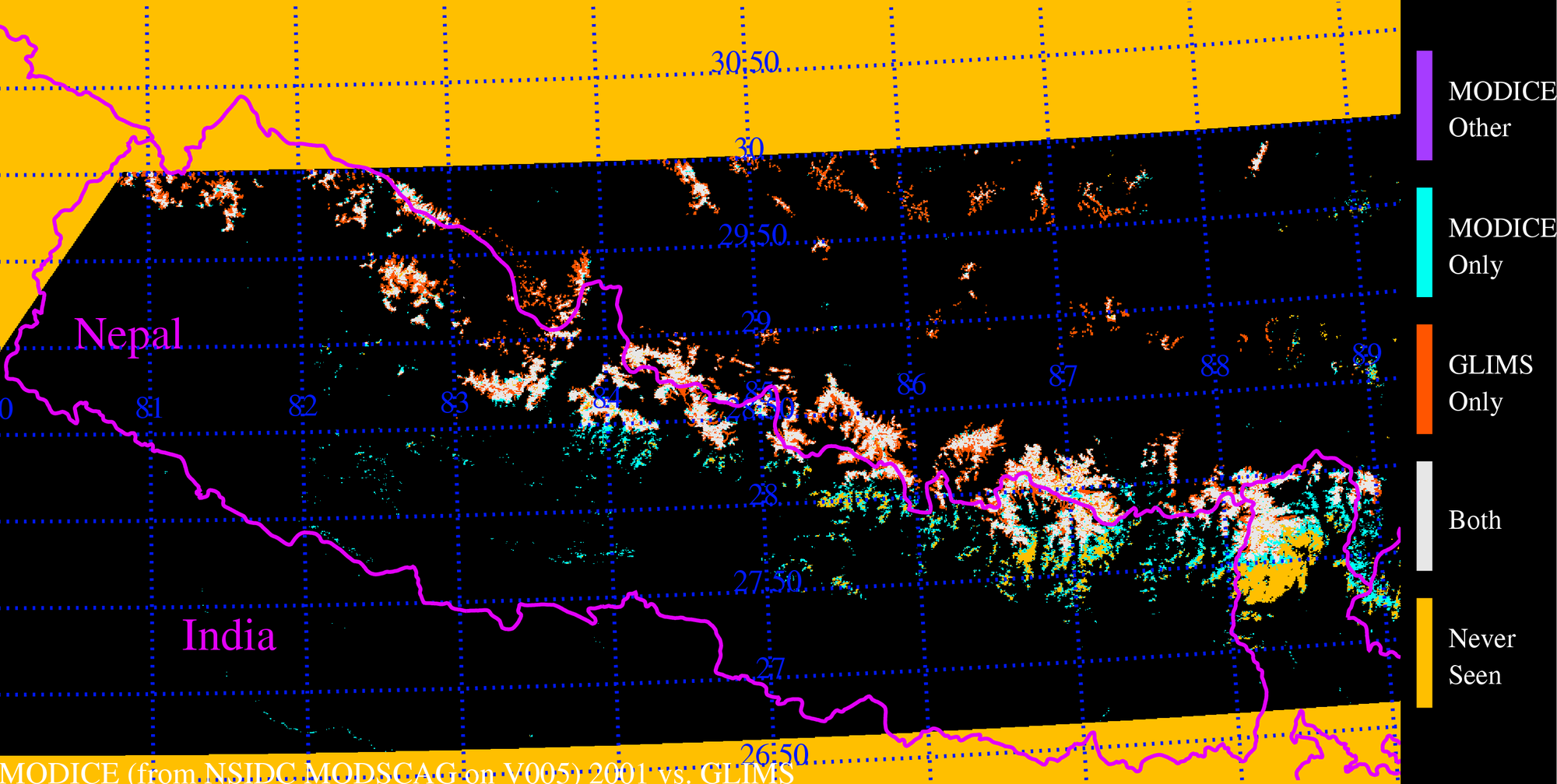
| 2001: MODICE vs. GLIMS outlines for this region, Nepal (only uses snow.dat) |
 |
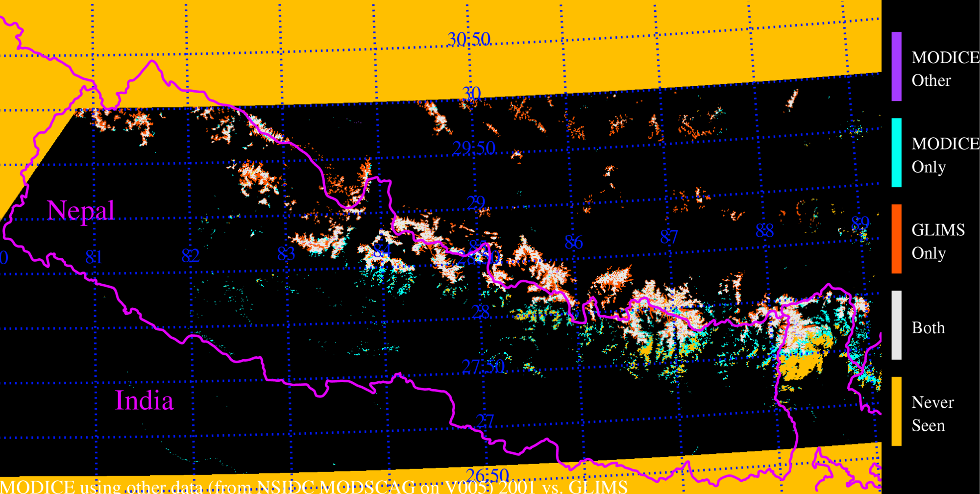
| 2001: MODICE vs. GLIMS outlines for this region, Nepal (uses snow.dat + other.dat; signal data is generated as THRESHOLD=70,SCALAR=1) |
 |
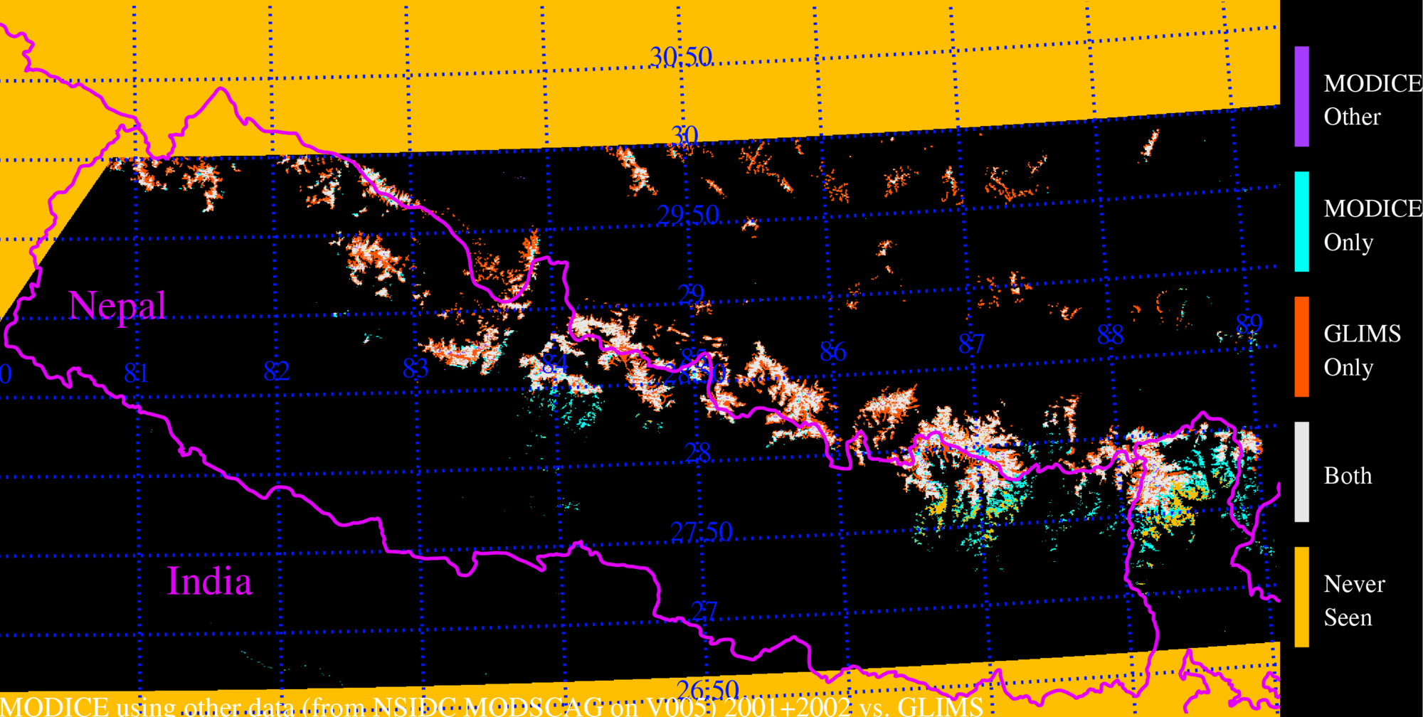
| 2001+2002: Cumulative MODICE vs. GLIMS outlines for this region, Nepal (uses snow.dat + other.dat; signal data is generated as THRESHOLD=70,SCALAR=1) Note fewer places in Sikkim with "never seen"--but some of the MODICE-only detail is lost, the longer we accumulate information. |
 |
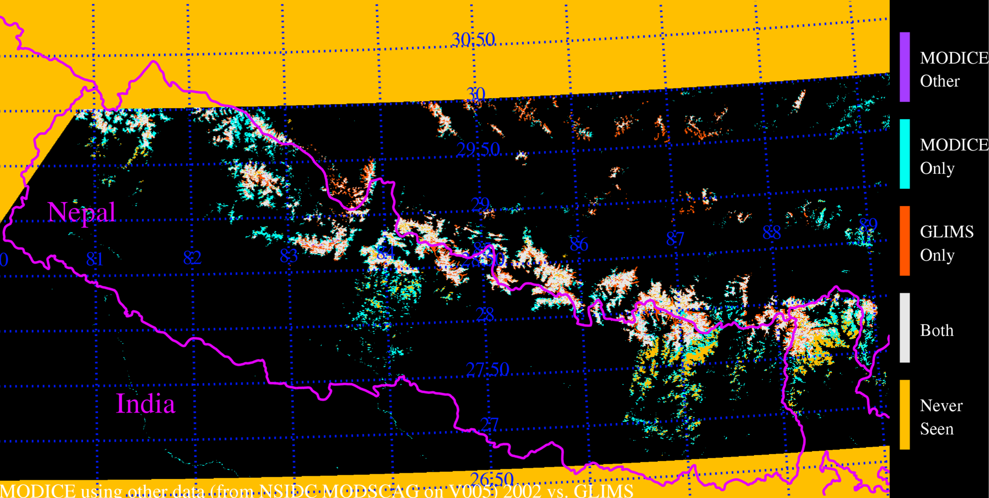
| 2002: MODICE vs. GLIMS outlines for this region, Nepal (uses snow.dat + other.dat; signal data is generated as THRESHOLD=70,SCALAR=1) |
 |
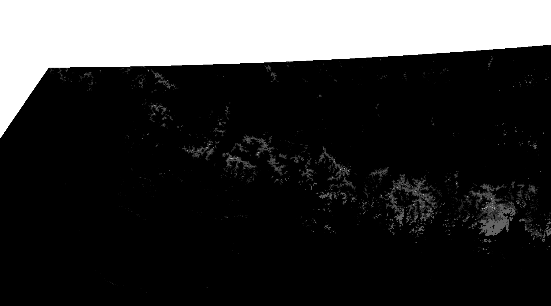
| This is just the modice data for the 2001 run that uses snow+other. Very bright pixels are the "other" pixels with "adequate" signal. There were so few purple pixels in the comparison image, (above), I generated this to see what was really "MODSCAG ICE". |
 |