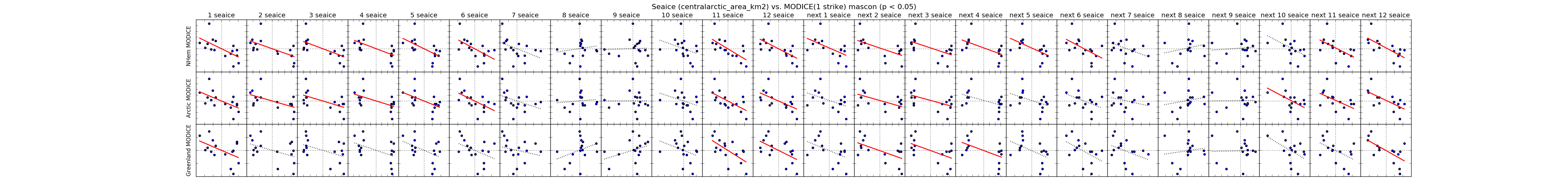
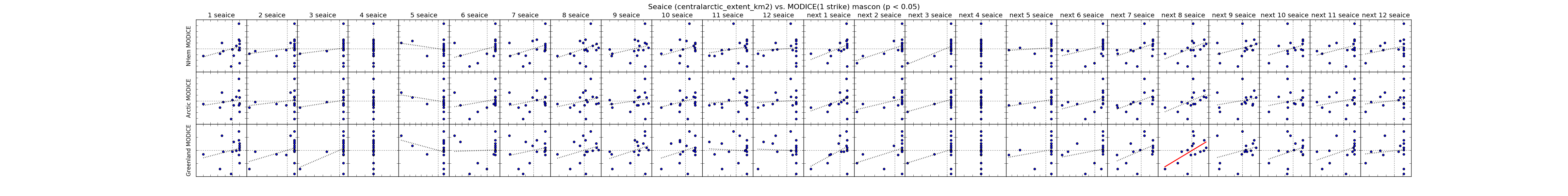
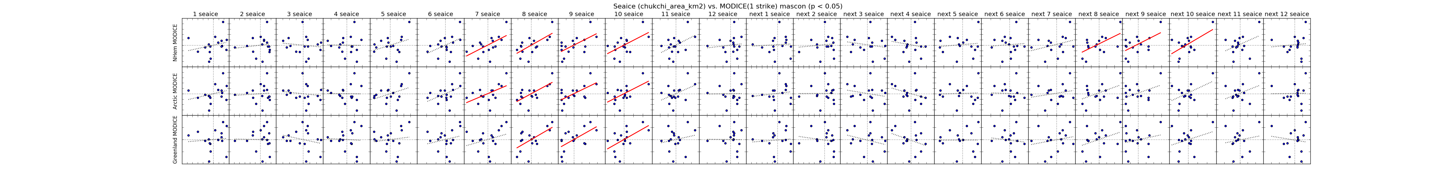
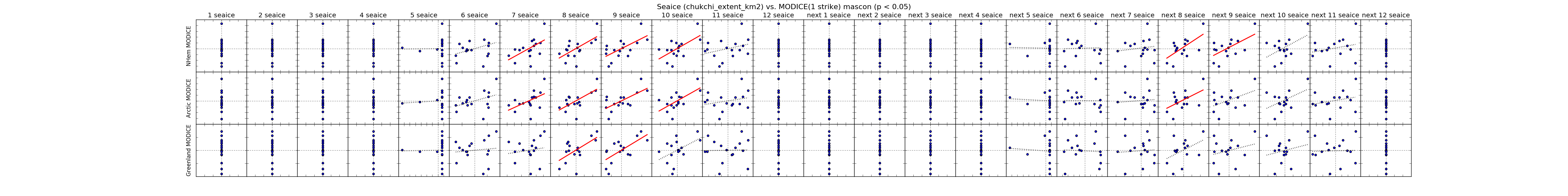
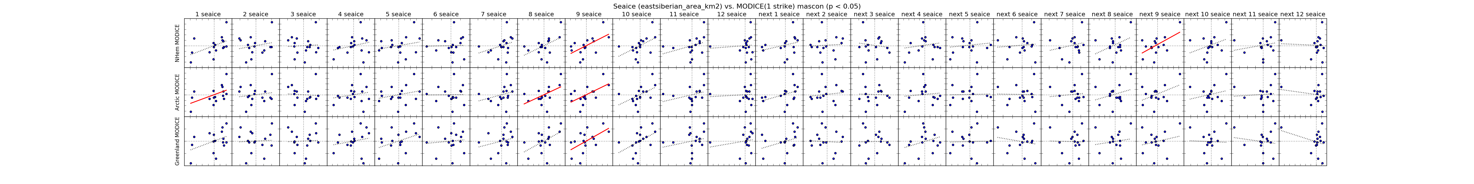
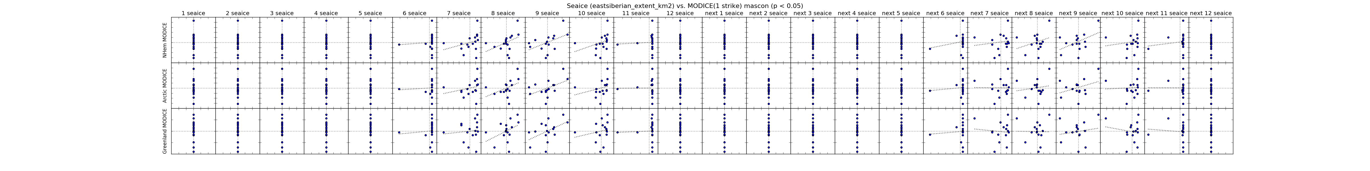
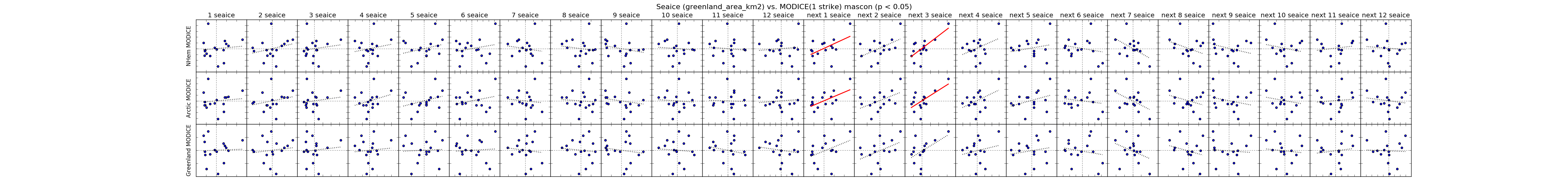
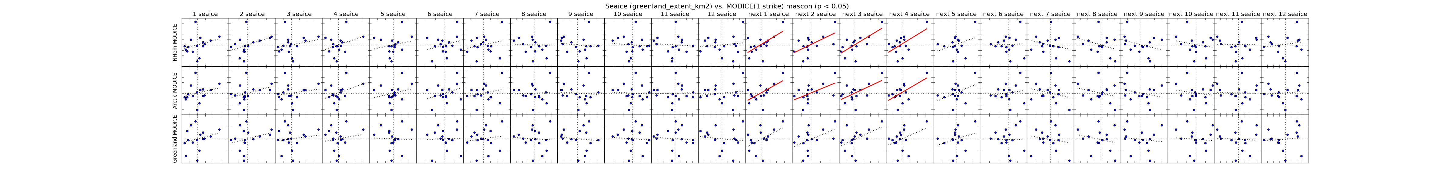
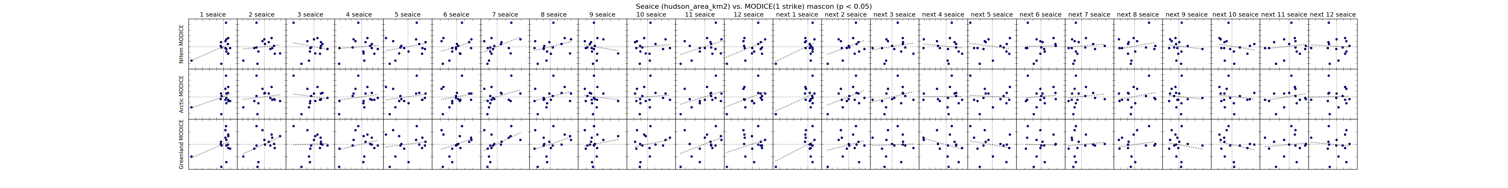
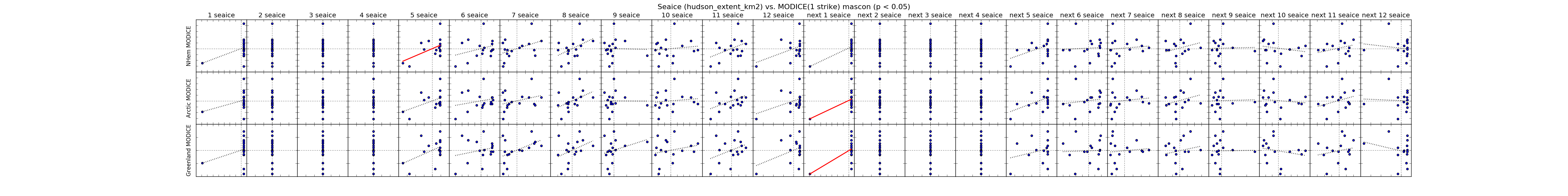

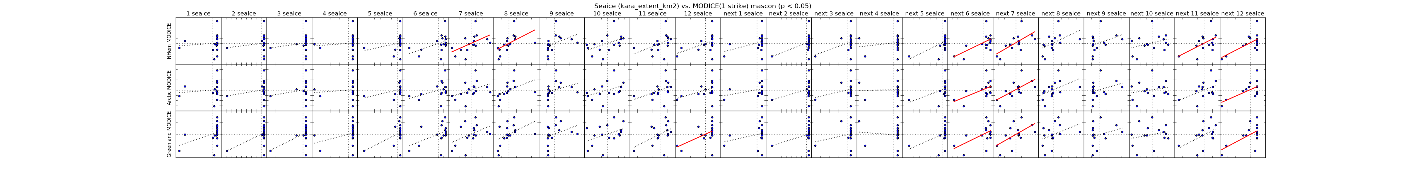
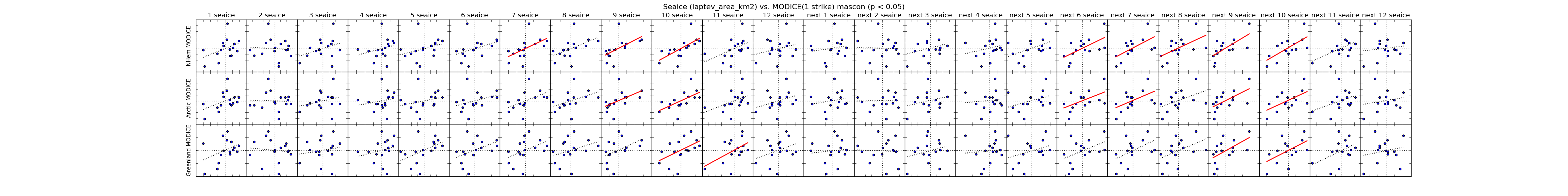
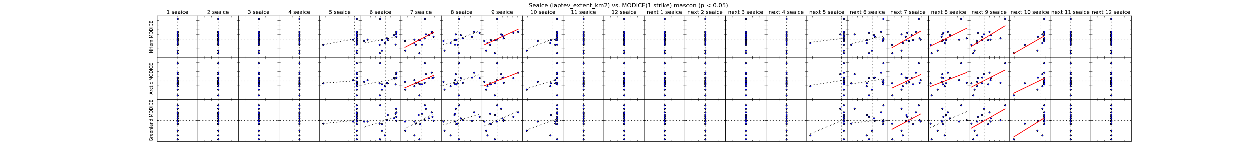

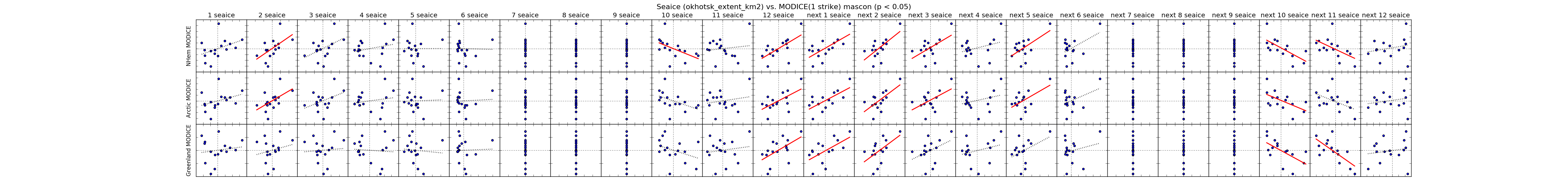
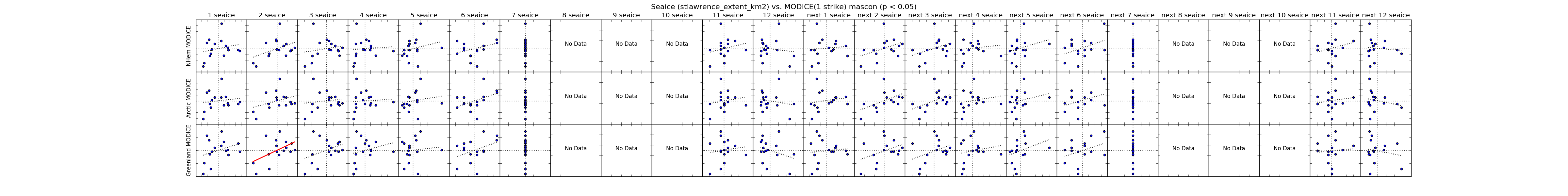
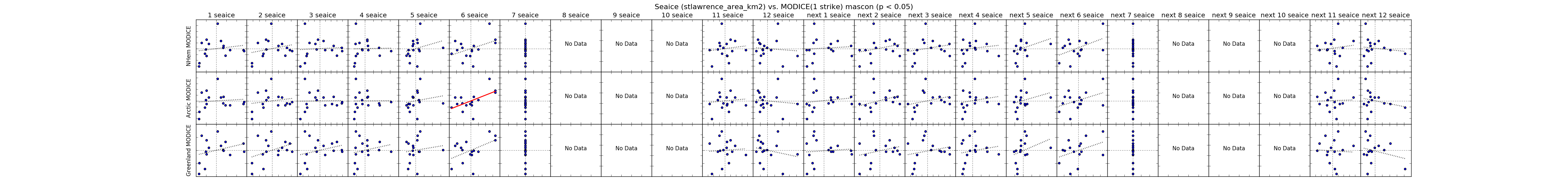
The following data compare MODICE (1strike) areas to passive microwave sea ice area and extent by month and region. Each small plot is of residuals (take actual value of parameter for given time period and subtract mean for that time period). Data are grouped in general categories:
Seaice values are arranged by month in columns. 24 columns are included, the first 12 columns compare the MODICE to the given month in the same year as MODICE, the second 12 columns compare MODICE to the seaice month for the subsequent year.
Seaice regions include "total" and various Arctic subregions, and include both area (area-weighed by sea ice concentration for a given pixel) and extent (all areas with concentration >=15% counted for the area of the pixel) values.
Each comparison plot includes an OLS regression line. Regression lines with slopes different from zero at 95% confidence (p<0.05) are drawn in red.
Click anywhere in the figure to open a new window with just the figure, and use your Cmd+ and Cmd- (or Control+ and Control-) to zoom in and out).
| Sea Ice Region | Comparisons by Month |
|---|---|
| Total Sea Ice Area | |
| Total Sea Ice Extent | |
| ------------- | |
| Baffin Area | |
| Baffin Extent | |
| ------------- | |
| Barents Area | |
| Barents Extent | |
| ------------- | |
| Beaufort Area | |
| Beaufort Extent (Extent residuals in winter are zero because the whole region is completely covered by seaice) | |
| ------------- | |
| Bering Area | |
| Bering Extent | |
| ------------- | |
| Canadian Archipelago Area | |
| Canadian Archipelago Extent | |
| ------------- | |
| Central Arctic Area | |
| Central Arctic Extent | |
| ------------- | |
| Chukchi Area | |
| Chukchi Extent | |
| ------------- | |
| East Siberian Area | |
| East Siberian Extent | |
| ------------- | |
| Greenland Area | |
| Greenland Extent | |
| ------------- | |
| Hudson Area | |
| Hudson Extent | |
| ------------- | |
| Kara Area | |
| Kara Extent | |
| ------------- | |
| Laptev Area | |
| Laptev Extent | |
| ------------- | |
| Okhotsk Area | |
| Okhotsk Extent | |
| ------------- | |
| St Lawrence Area | |
| St Lawrence Extent | |
| Sea Ice Region | Comparisons by Month |
|---|---|
| Total Sea Ice Area | 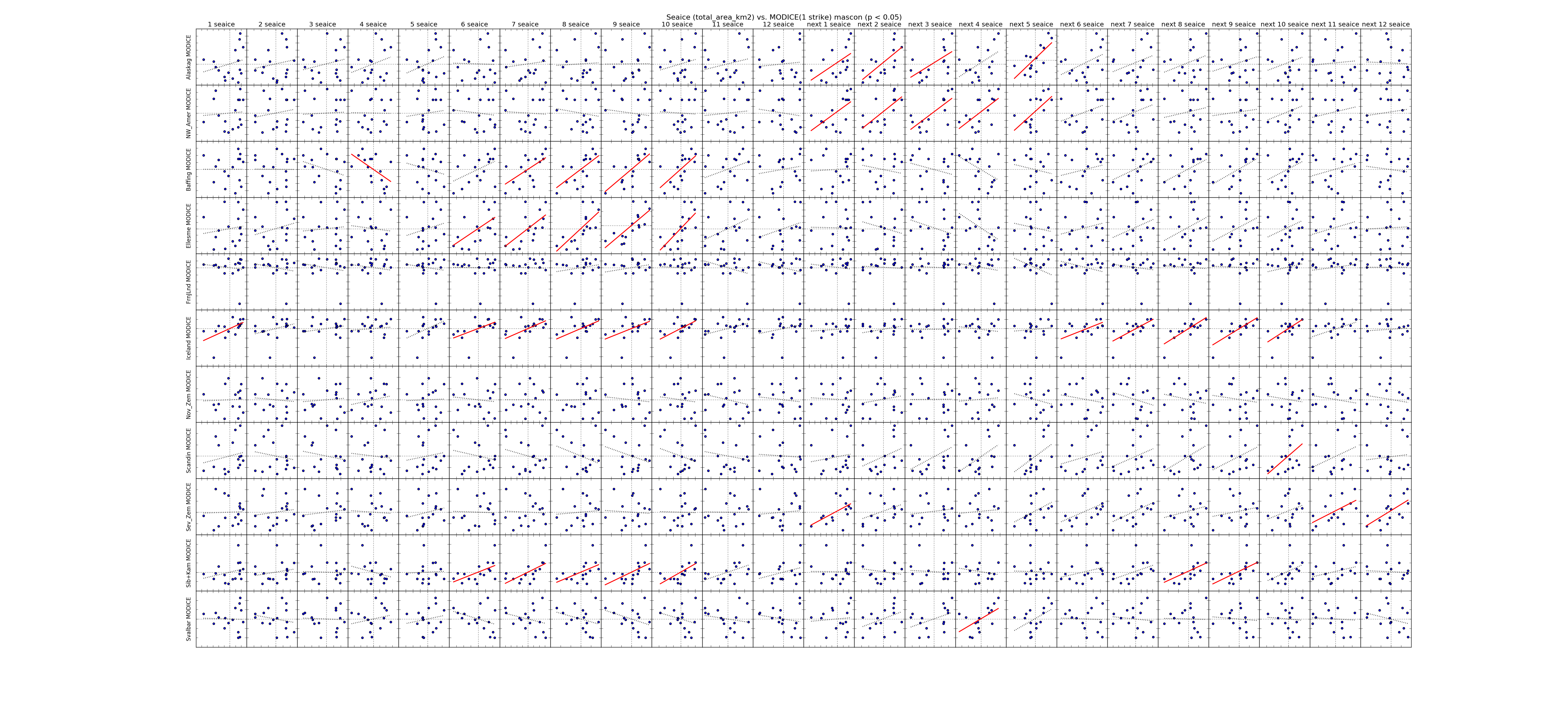 |
| Total Sea Ice Extent | 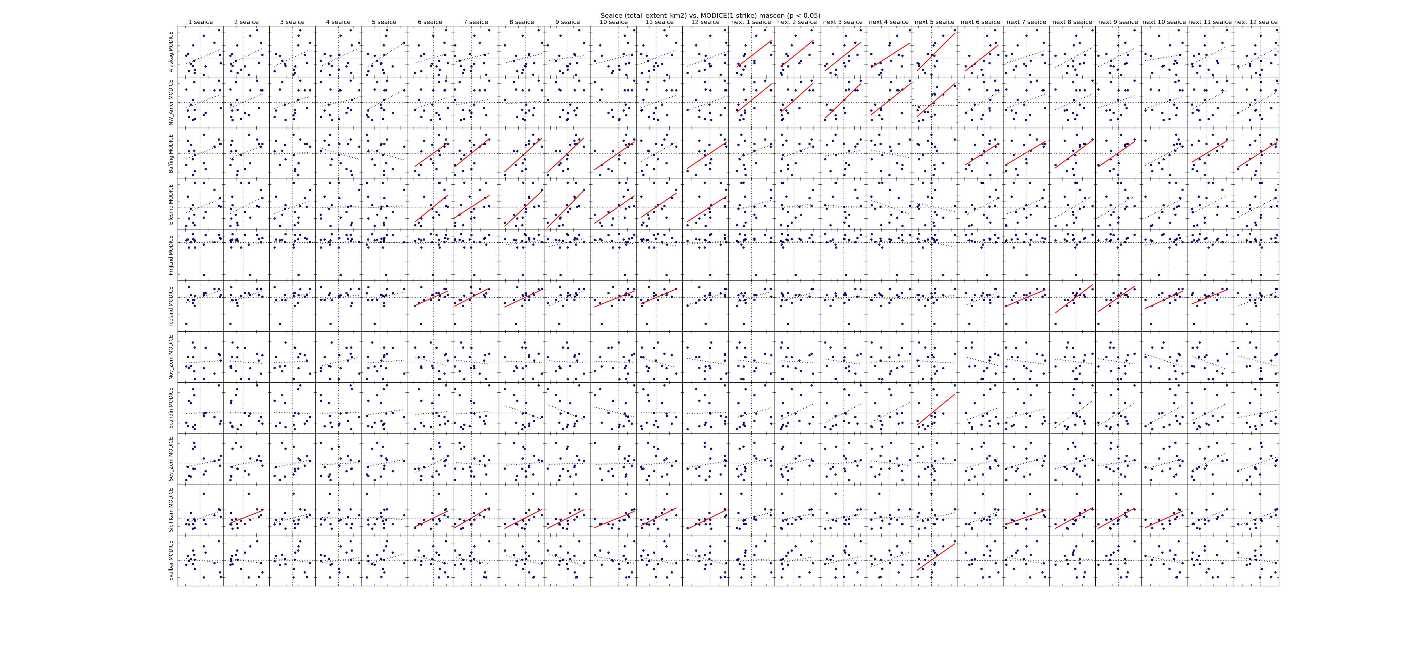 |
| ------------- | |
| Baffin Area | 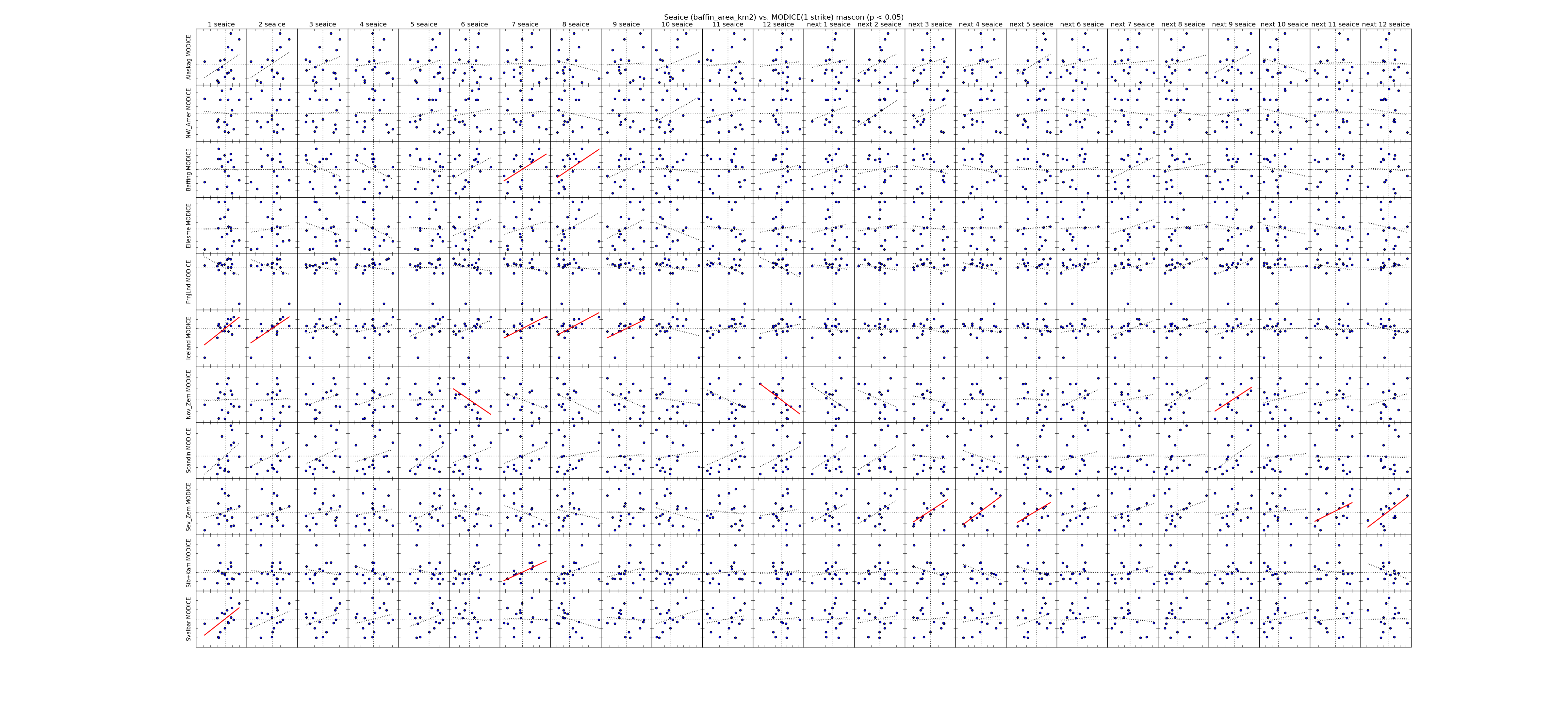 |
| Baffin Extent | 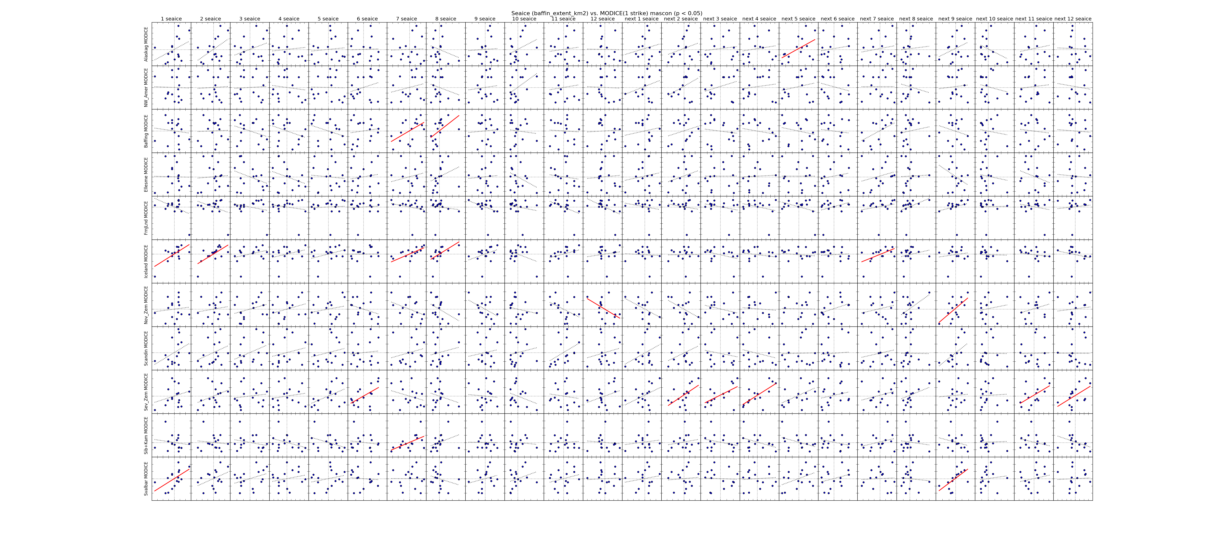 |
| ------------- | |
| Barents Area |  |
| Barents Extent |  |
| ------------- | |
| Beaufort Area |  |
| Beaufort Extent |  |
| ------------- | |
| Bering Area | 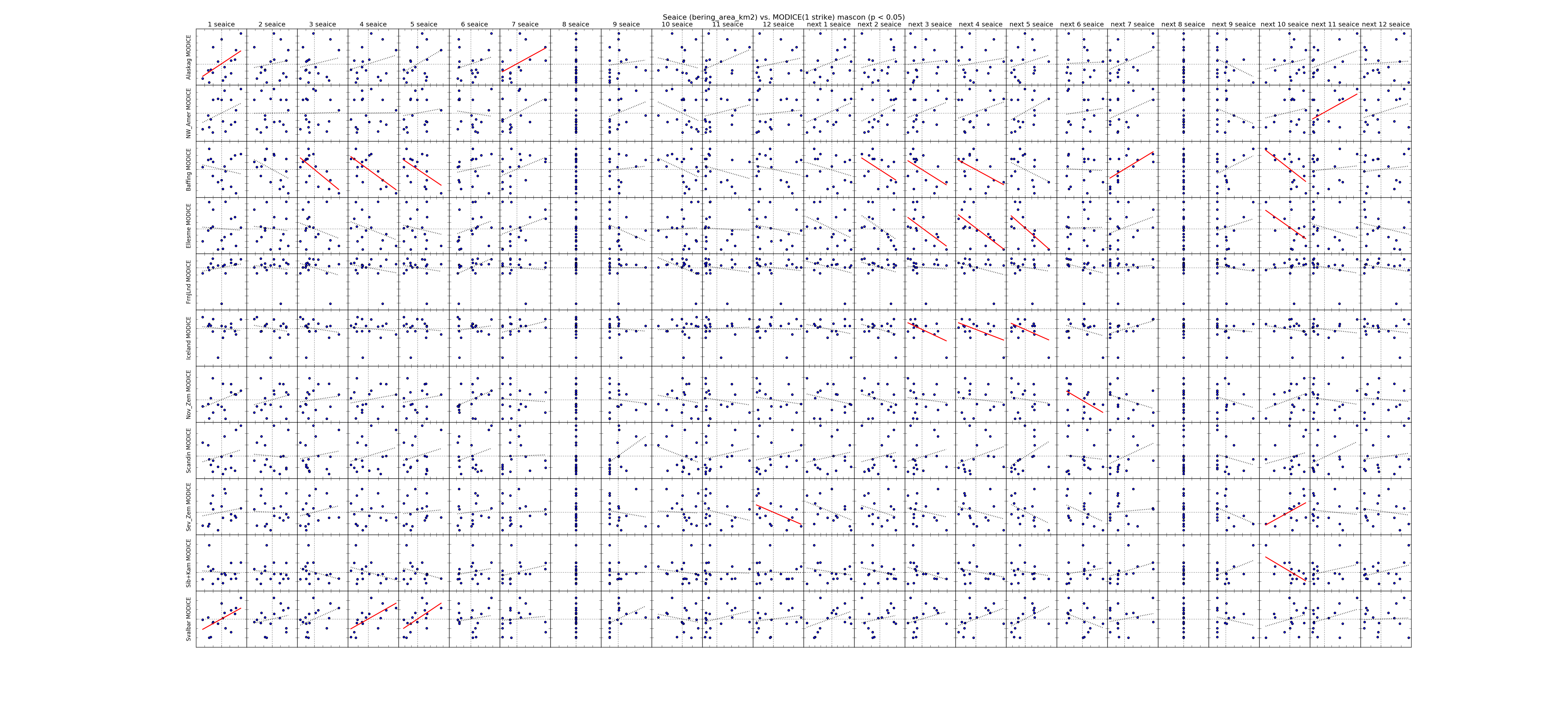 |
| Bering Extent | 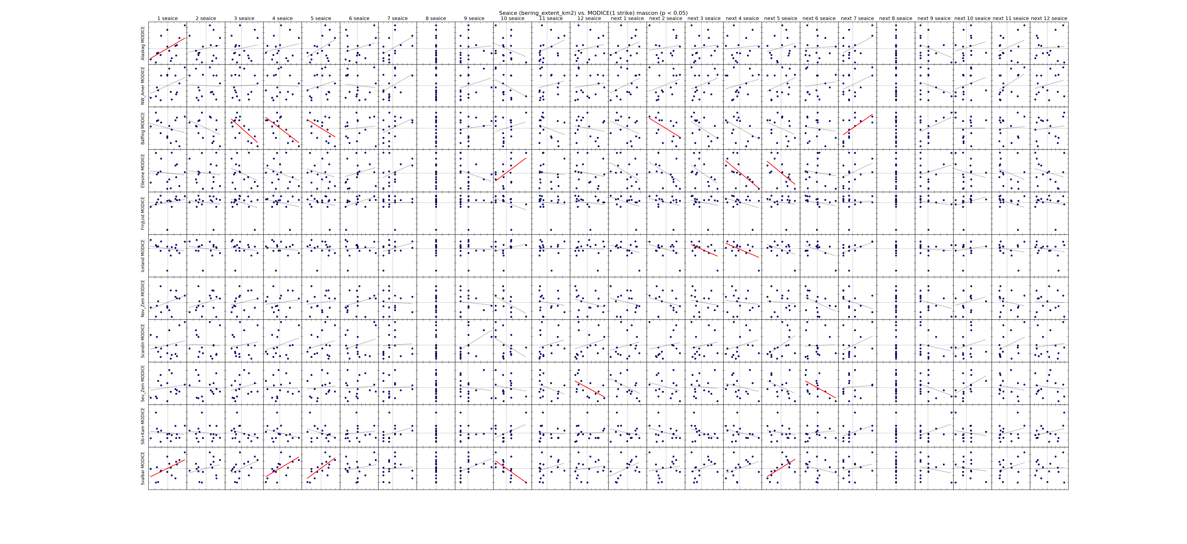 |
| ------------- | |
| Canadian Archipelago Area | 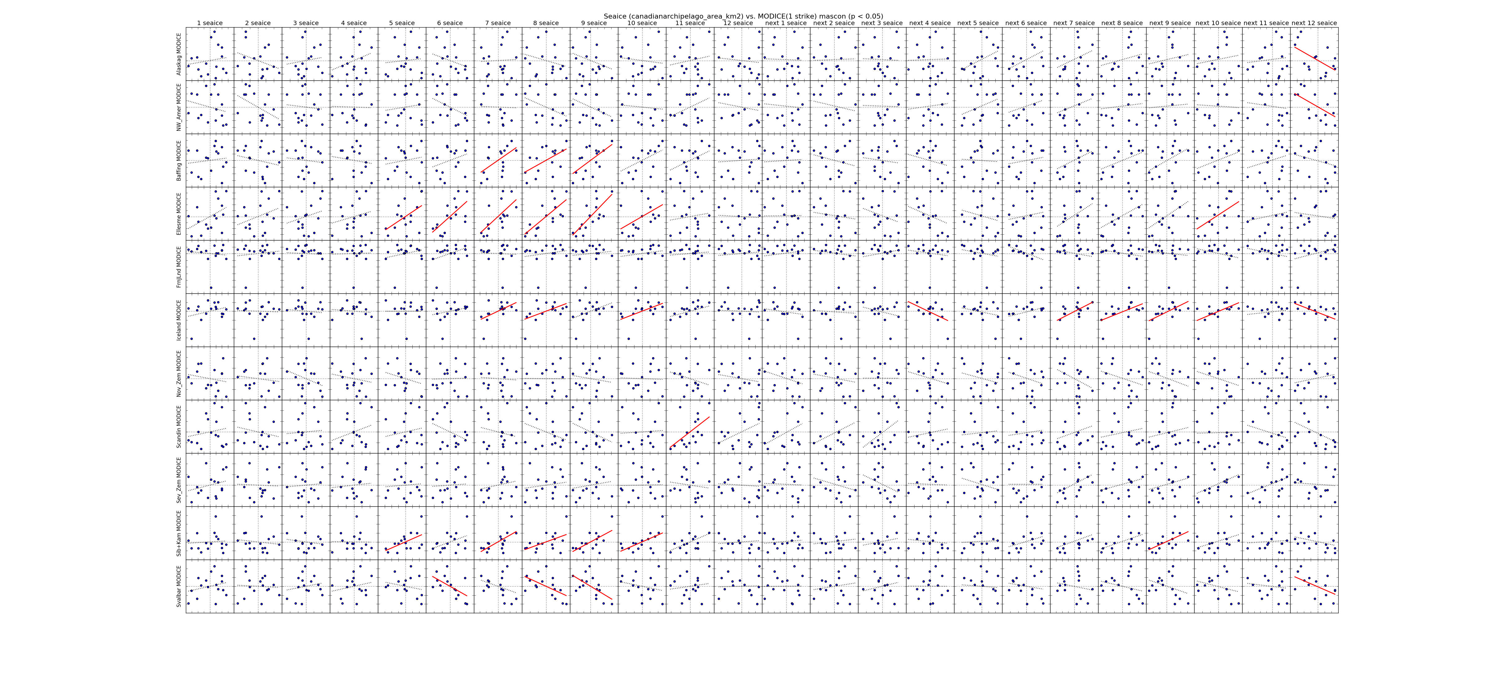 |
| Canadian Archipelago Extent | 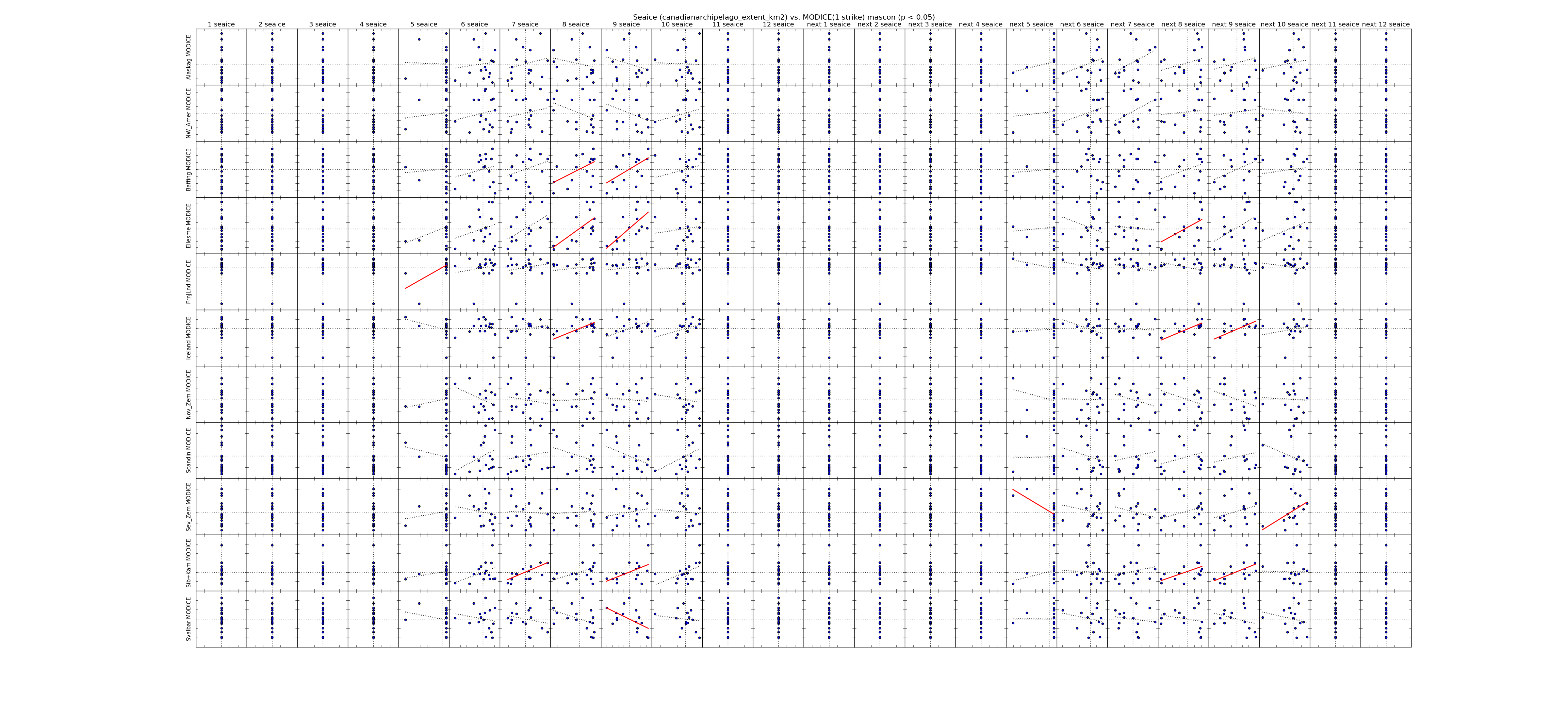 |
| ------------- | |
| Central Arctic Area | 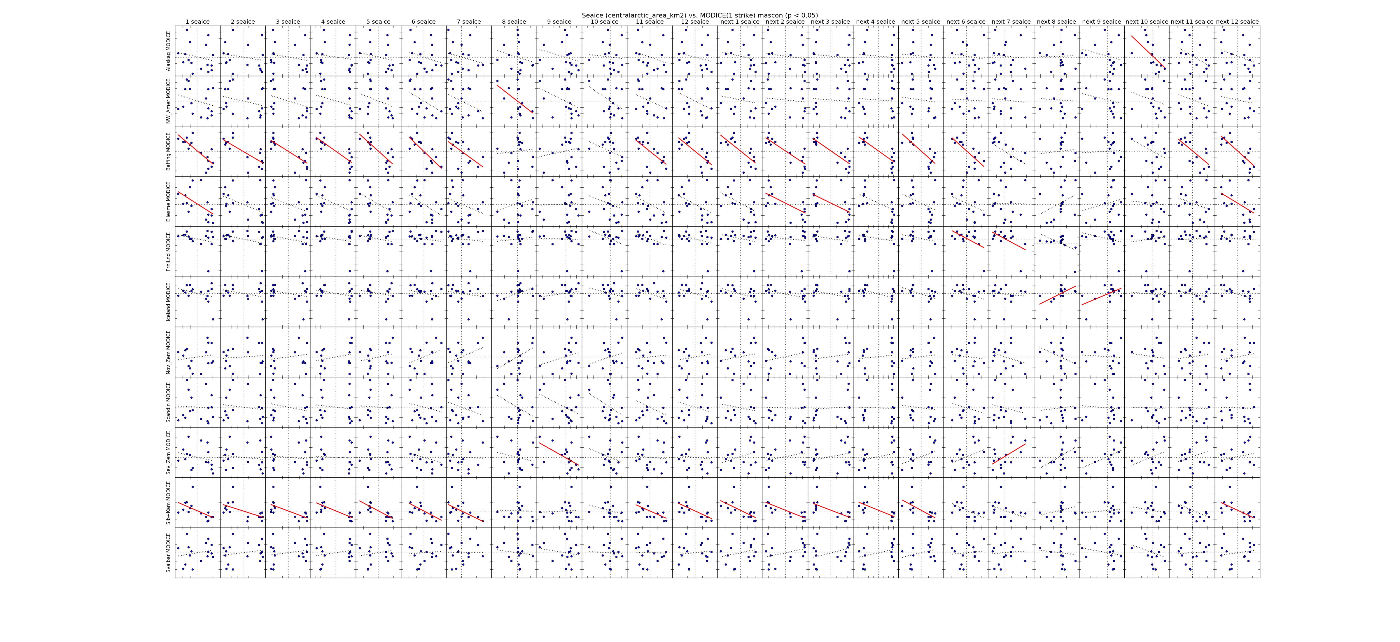 |
| Central Arctic Extent | 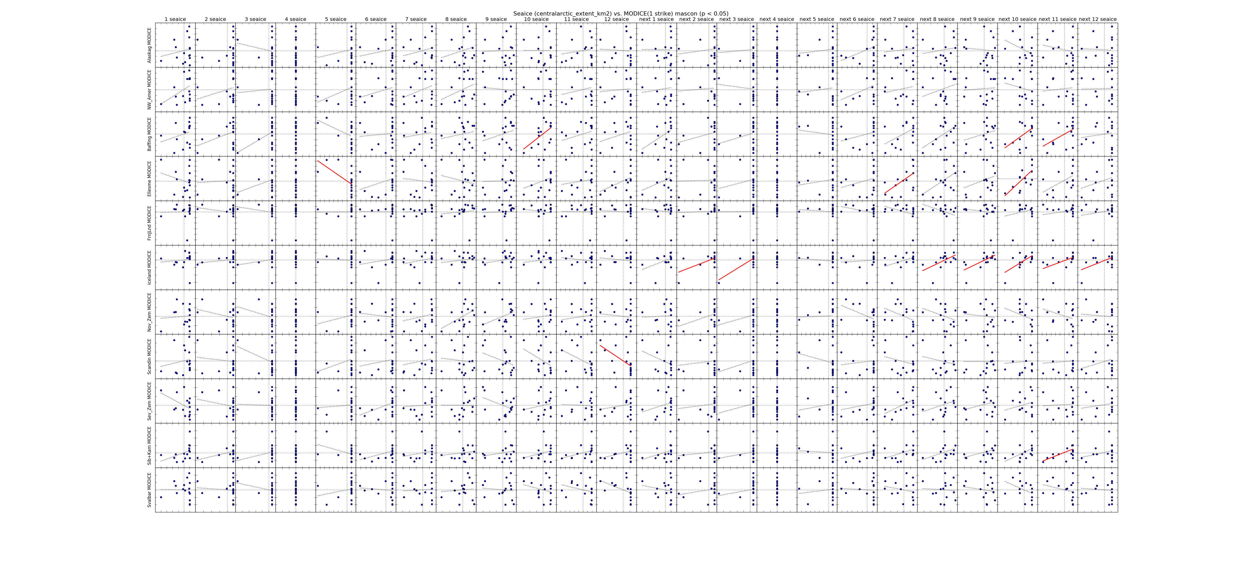 |
| ------------- | |
| Chukchi Area | 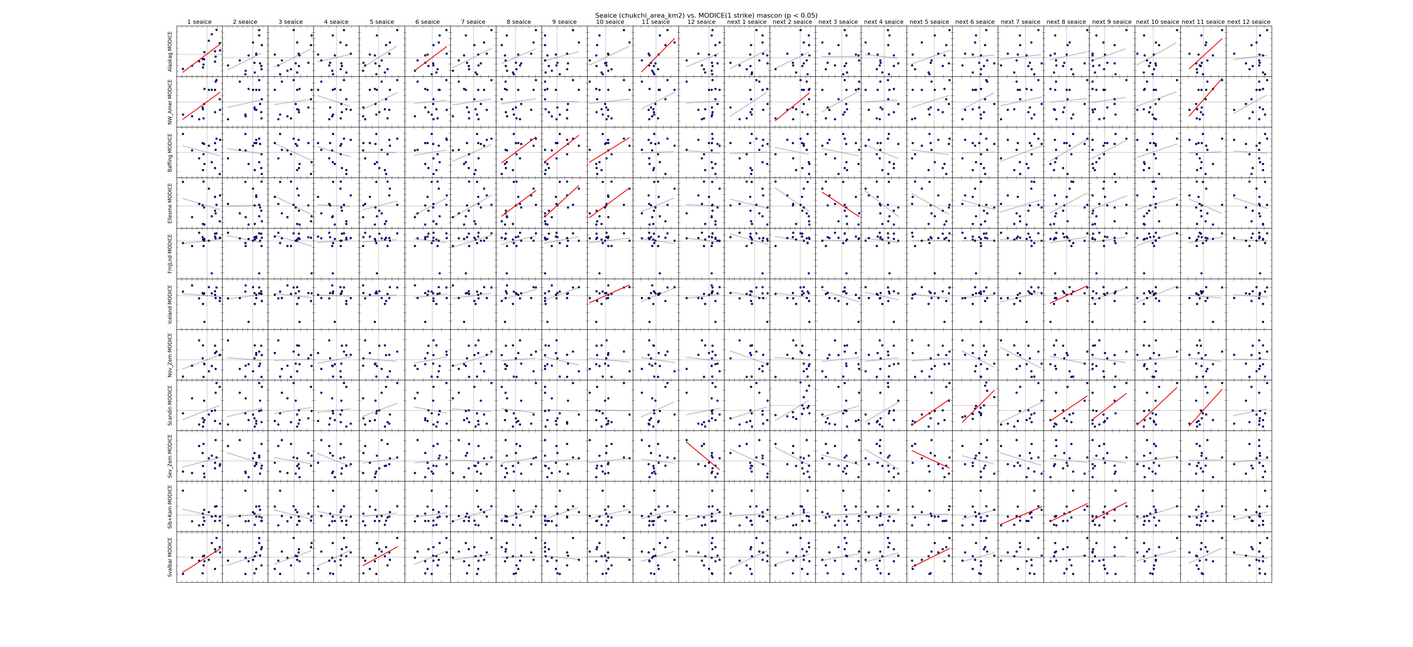 |
| Chukchi Extent | 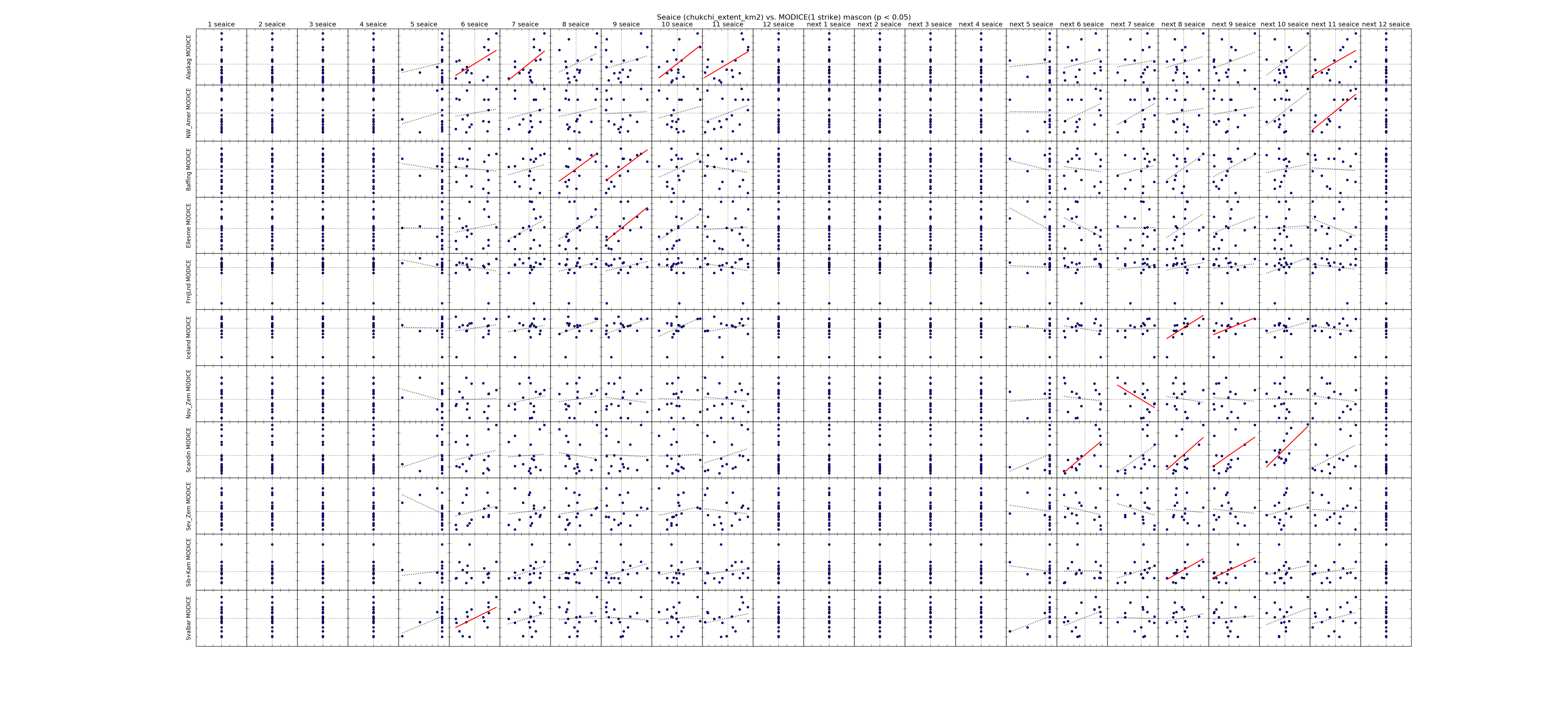 |
| ------------- | |
| East Siberian Area | 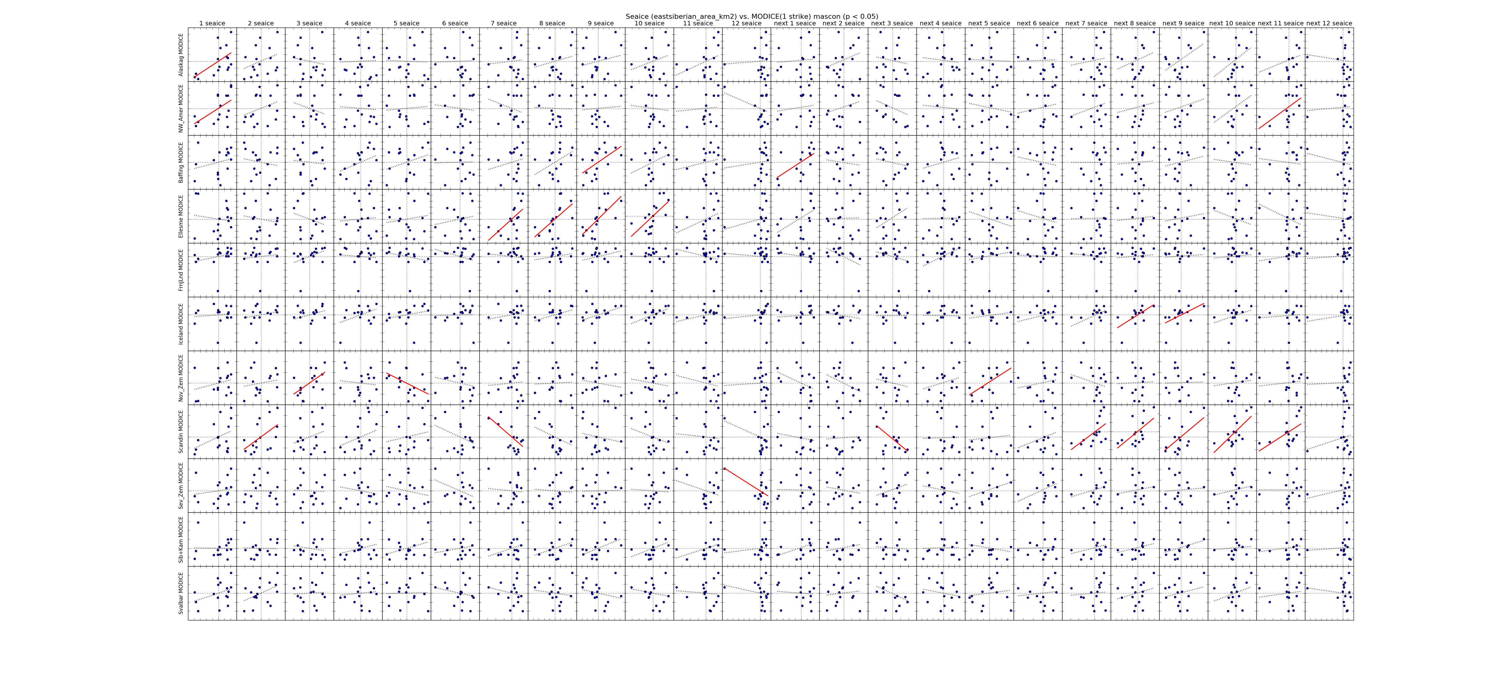 |
| East Siberian Extent | 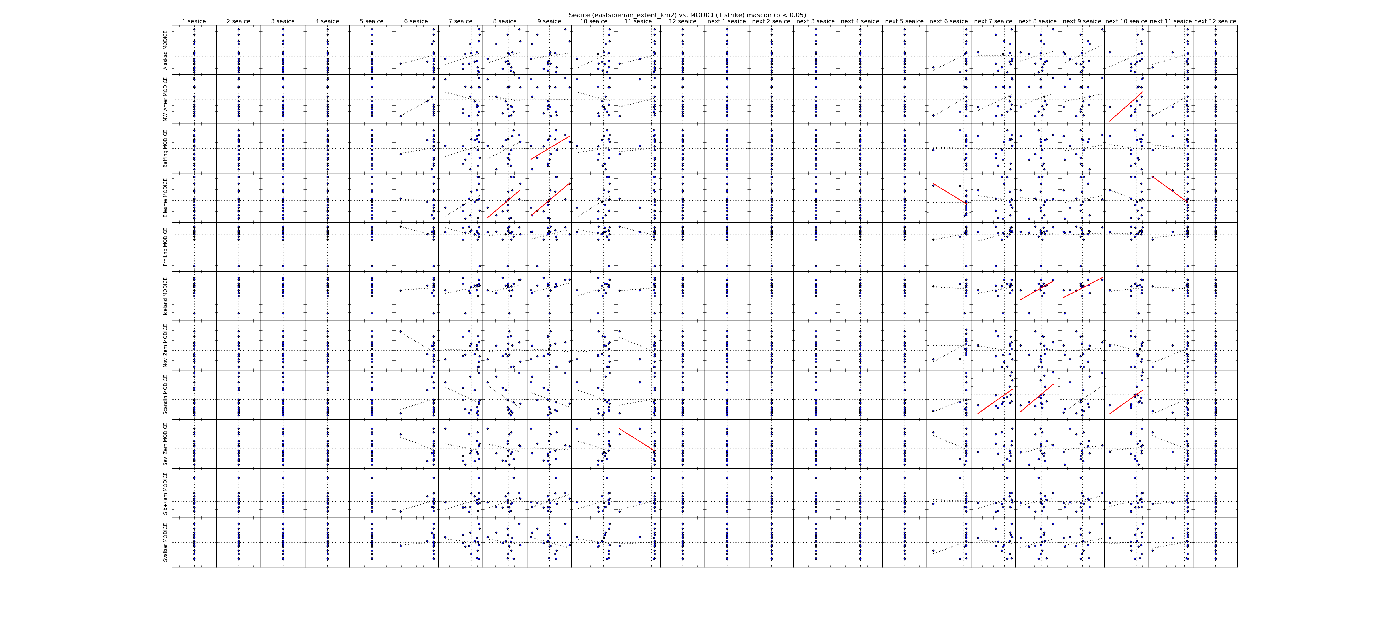 |
| ------------- | |
| Greenland Area | 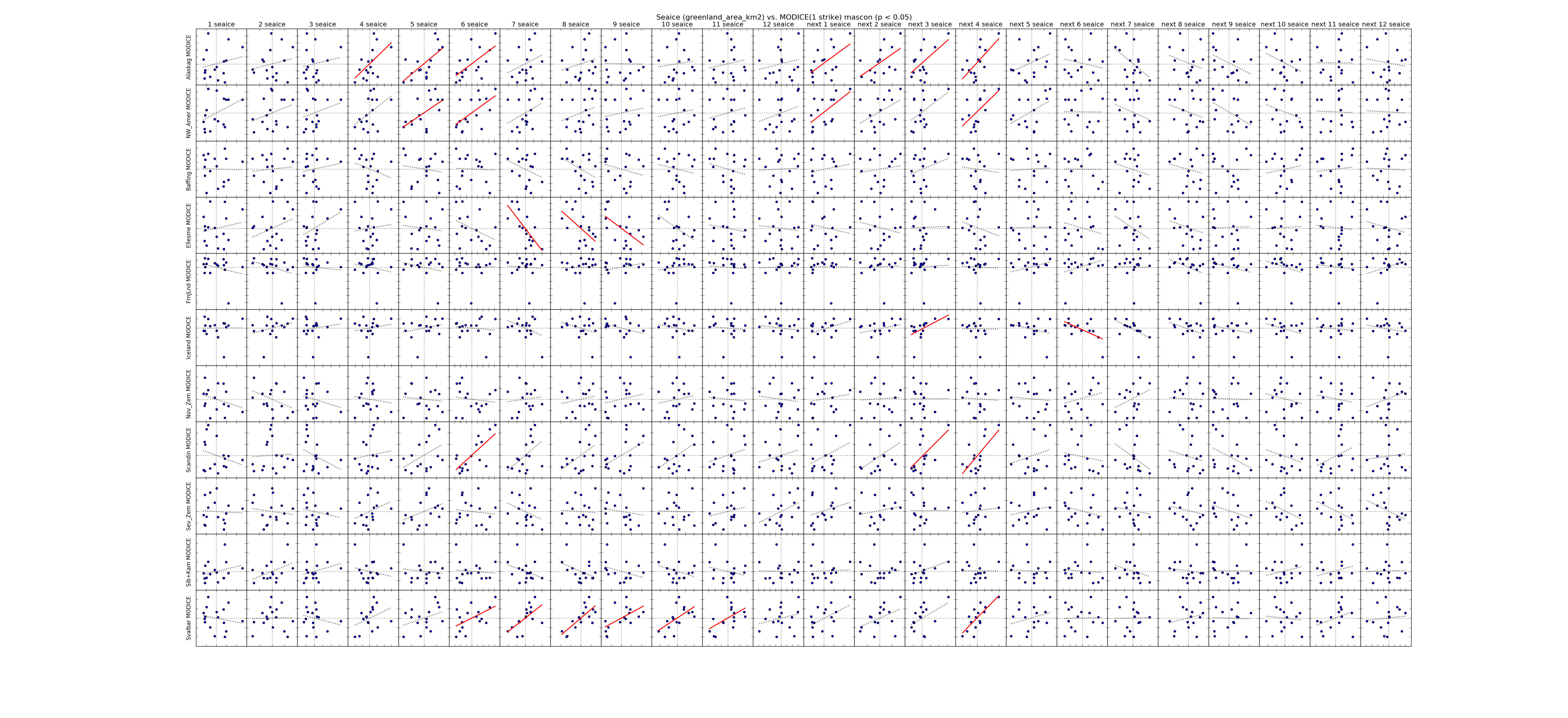 |
| Greenland Extent | 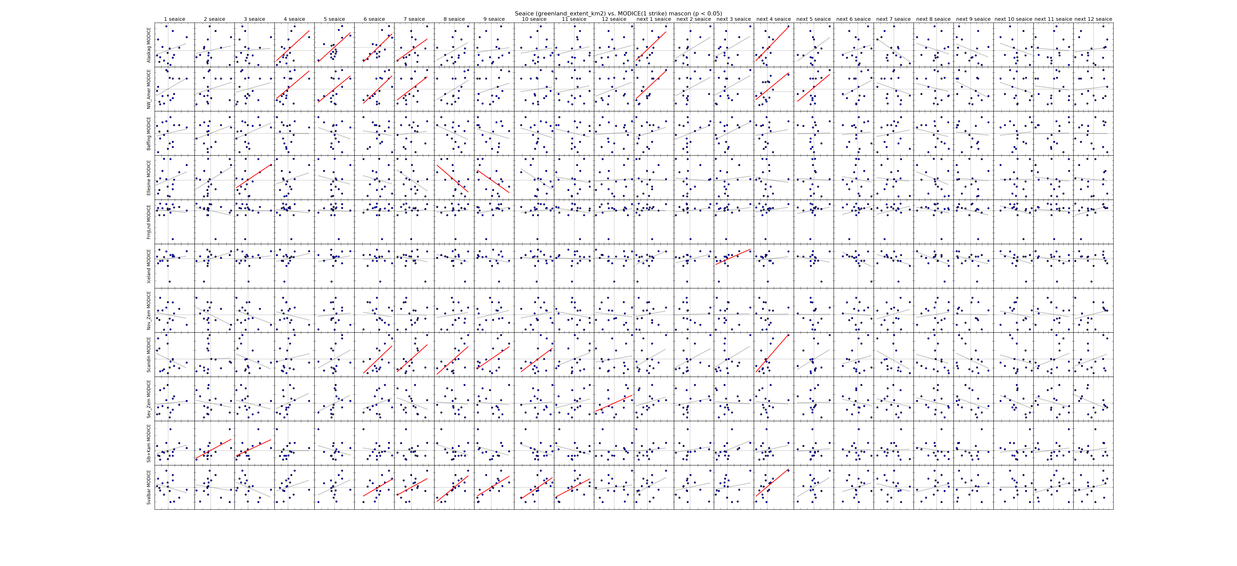 |
| ------------- | |
| Hudson Area | 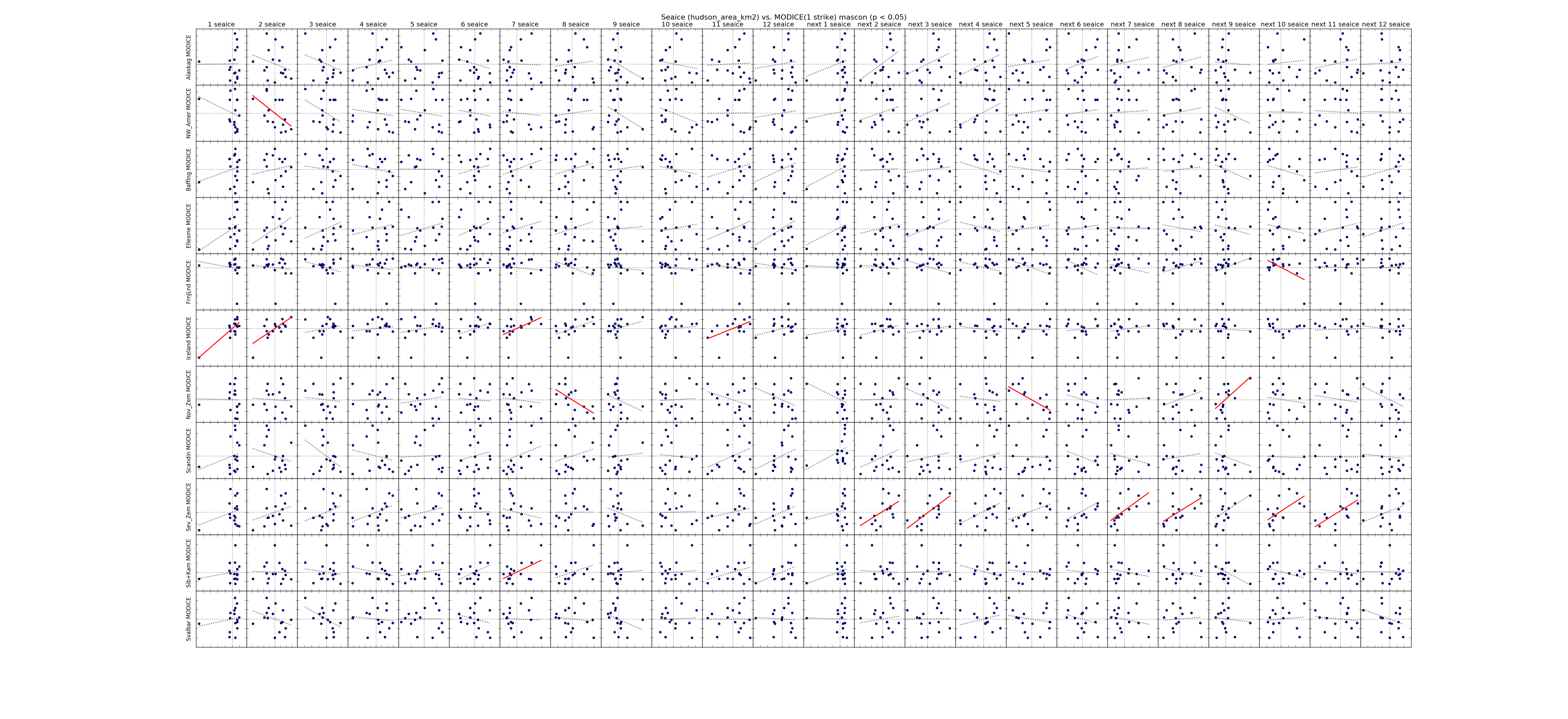 |
| Hudson Extent | 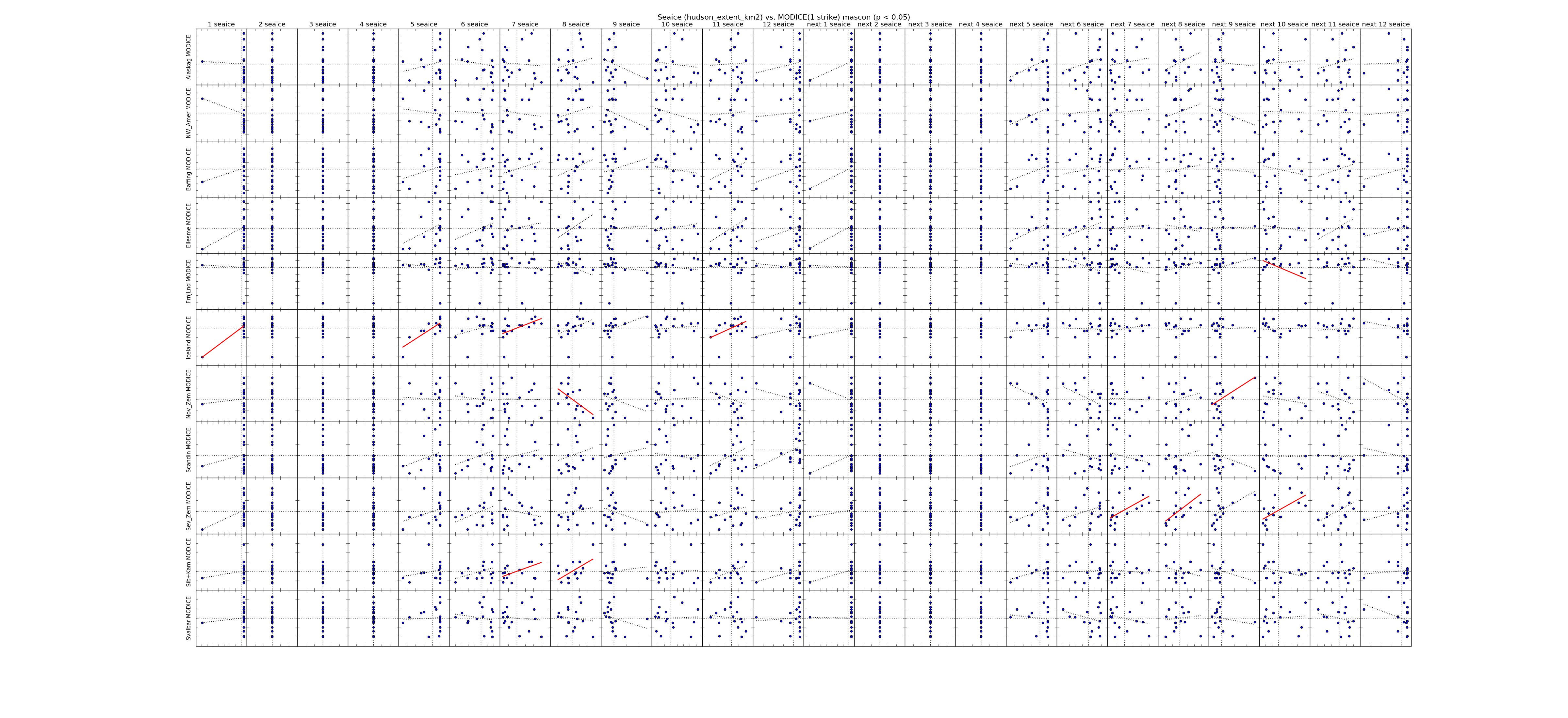 |
| ------------- | |
| Kara Area | 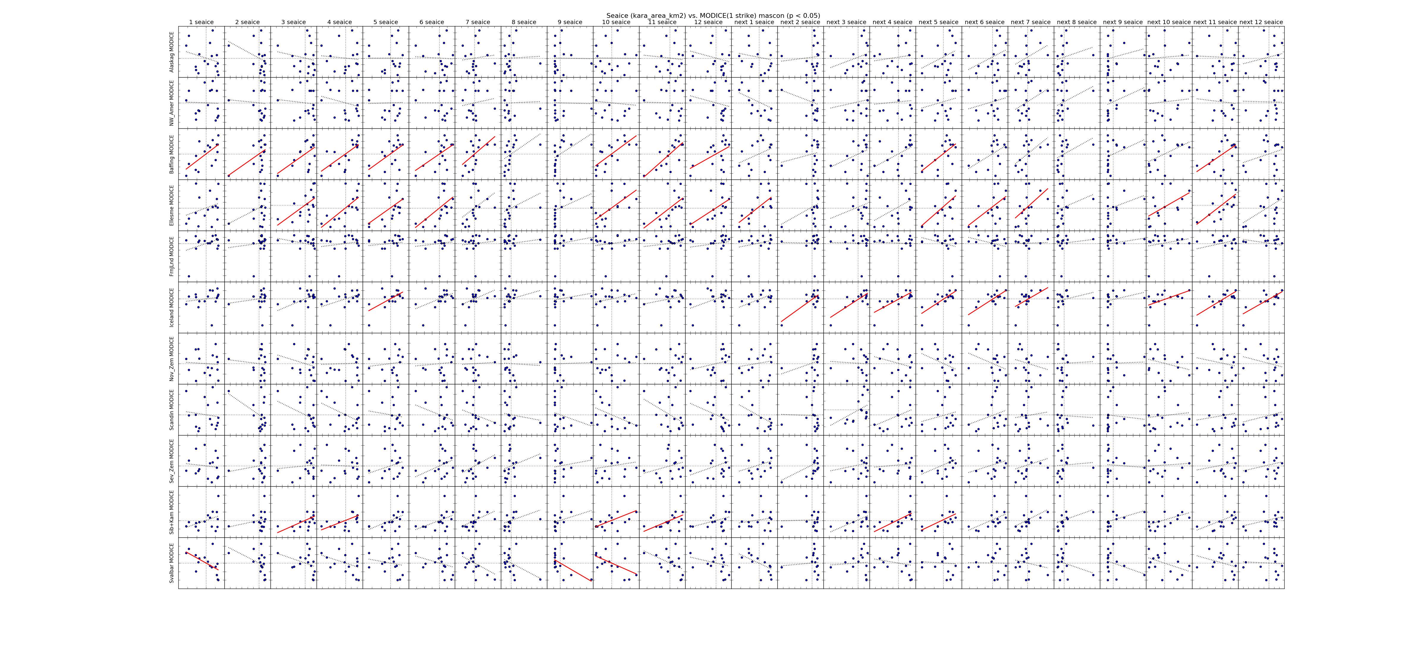 |
| Kara Extent | 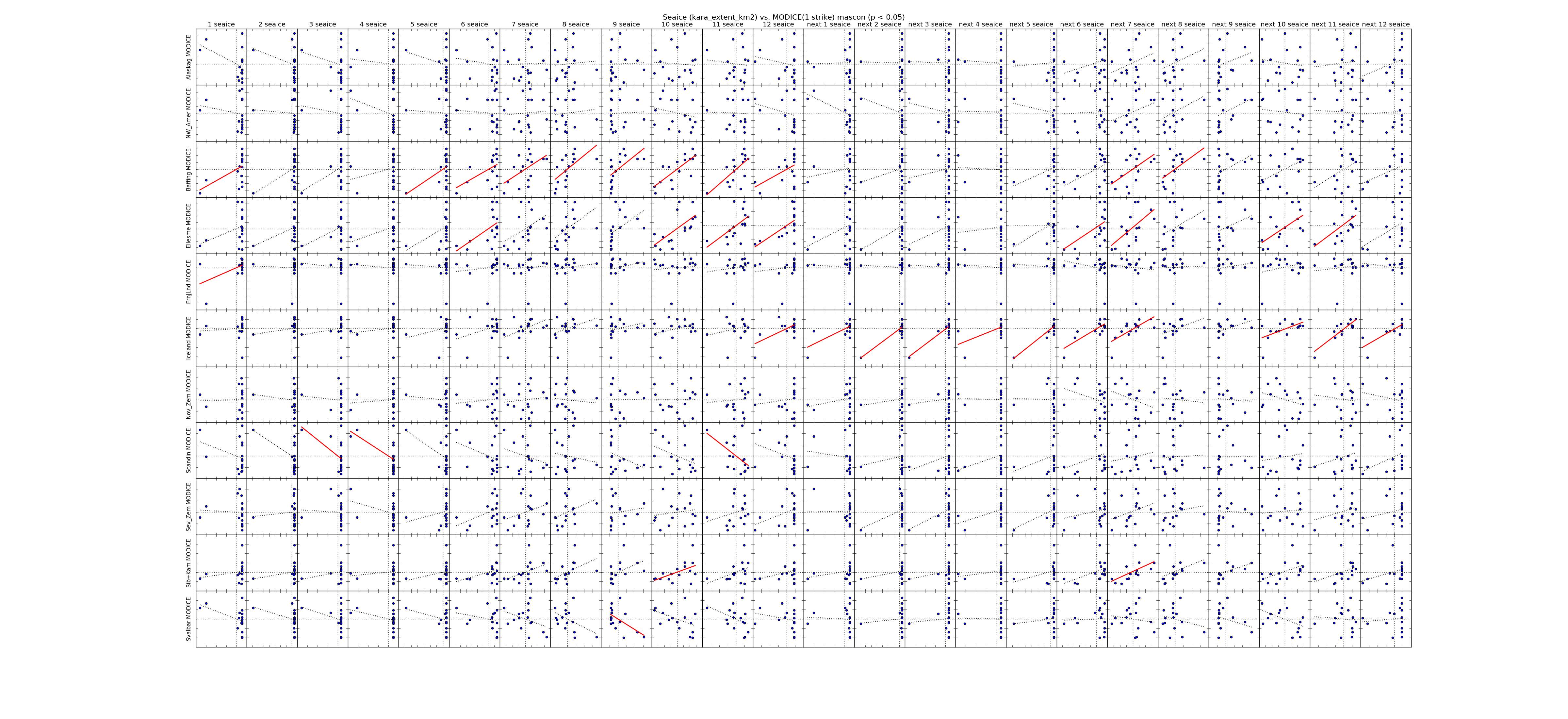 |
| ------------- | |
| Laptev Area | 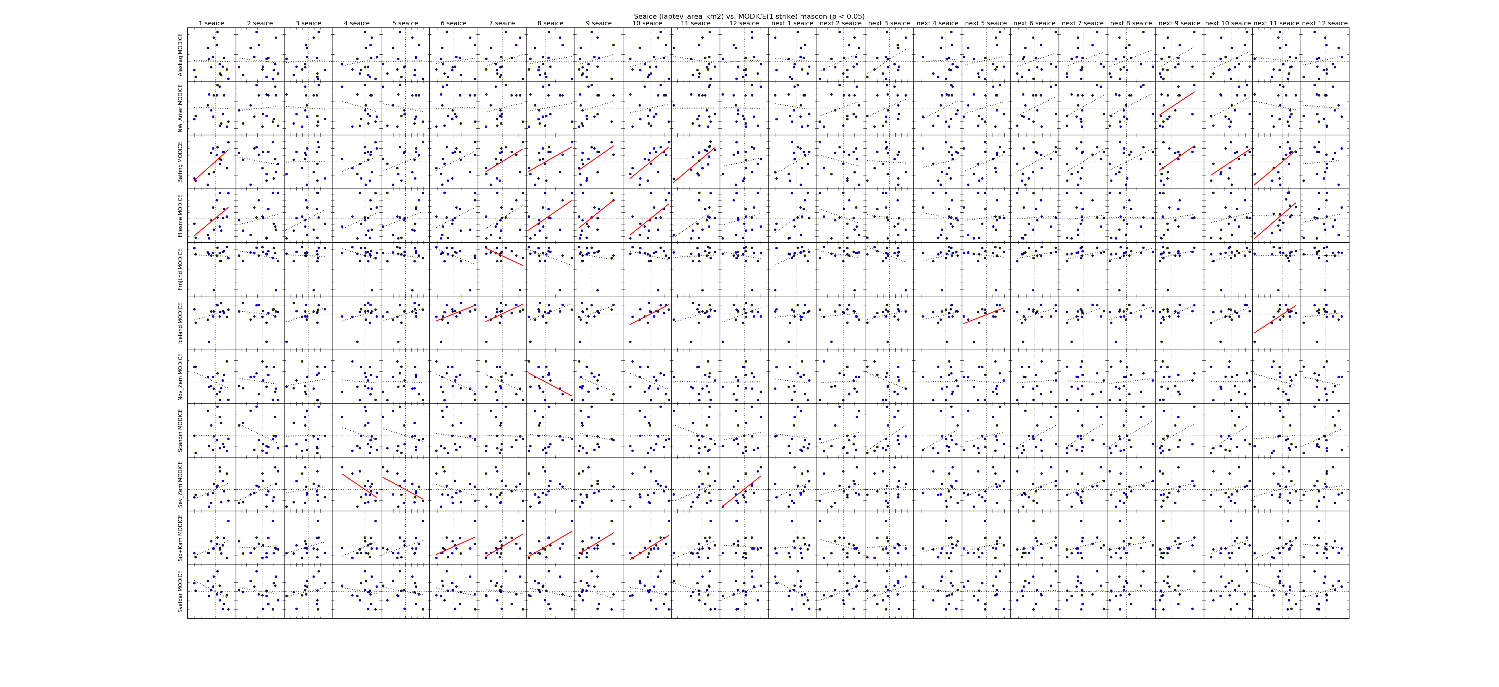 |
| Laptev Extent | 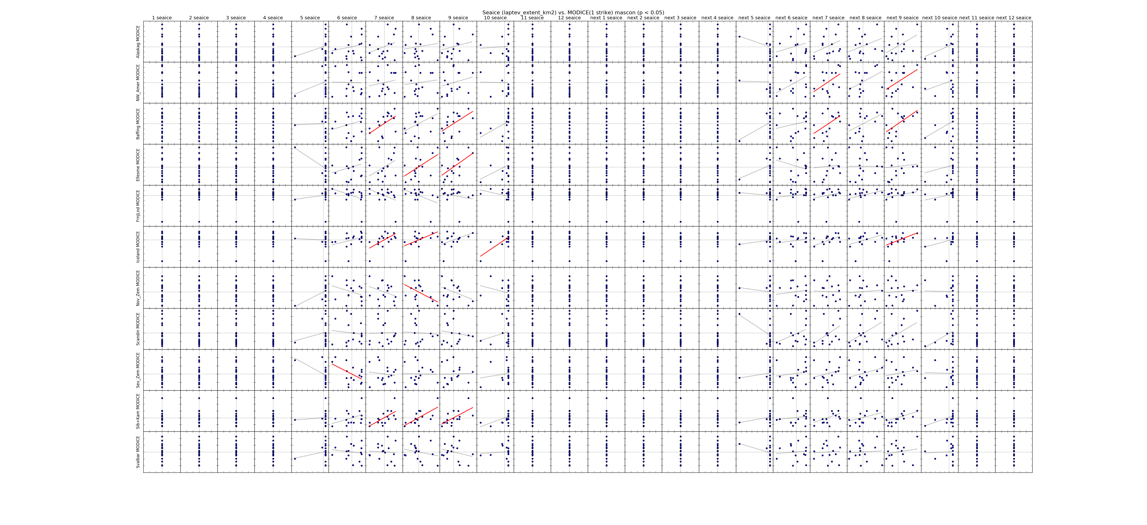 |
| ------------- | |
| Okhotsk Area |  |
| Okhotsk Extent | 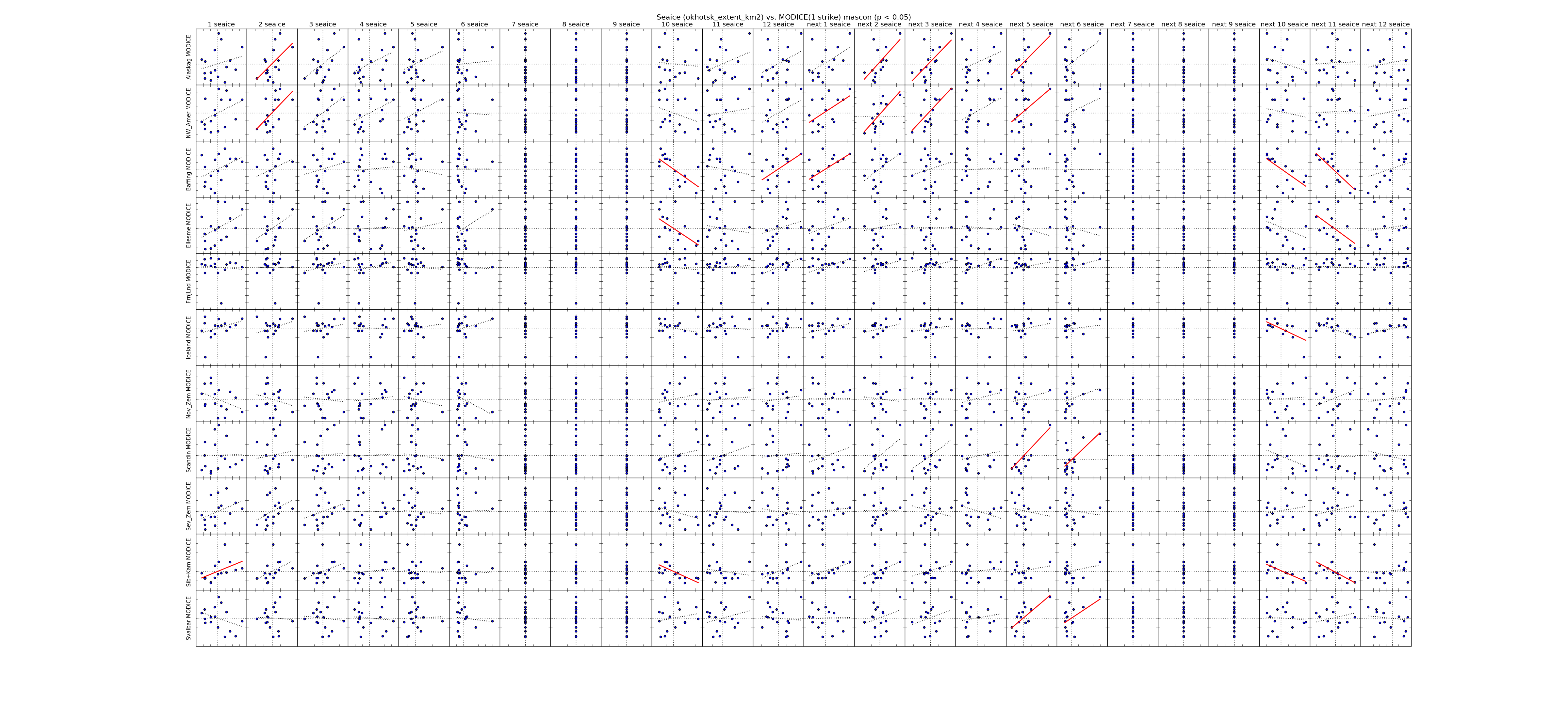 |
| ------------- | |
| St Lawrence Area | 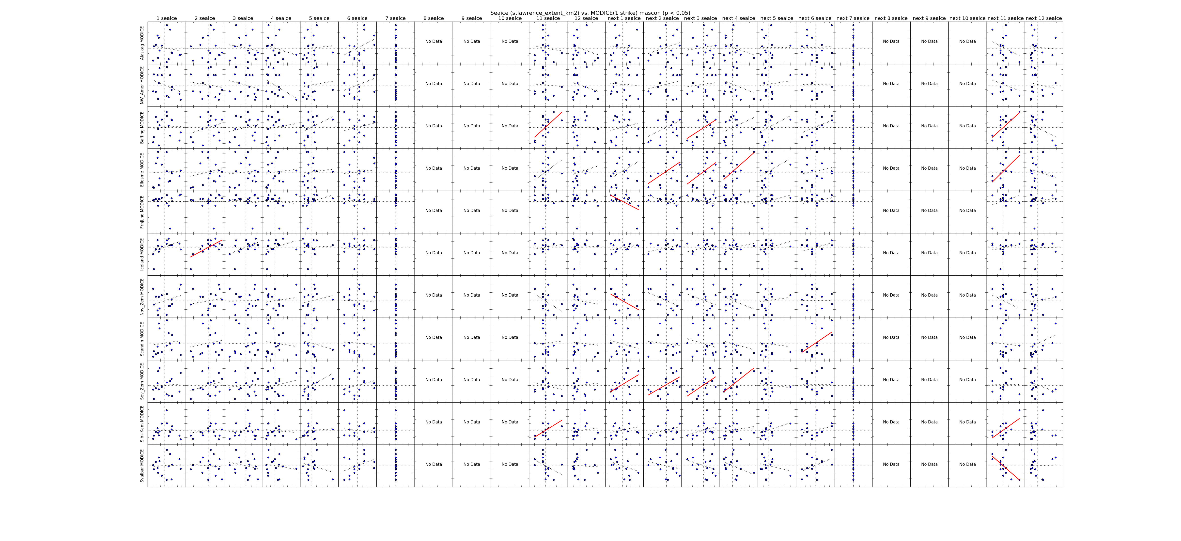 |
| St Lawrence Extent | 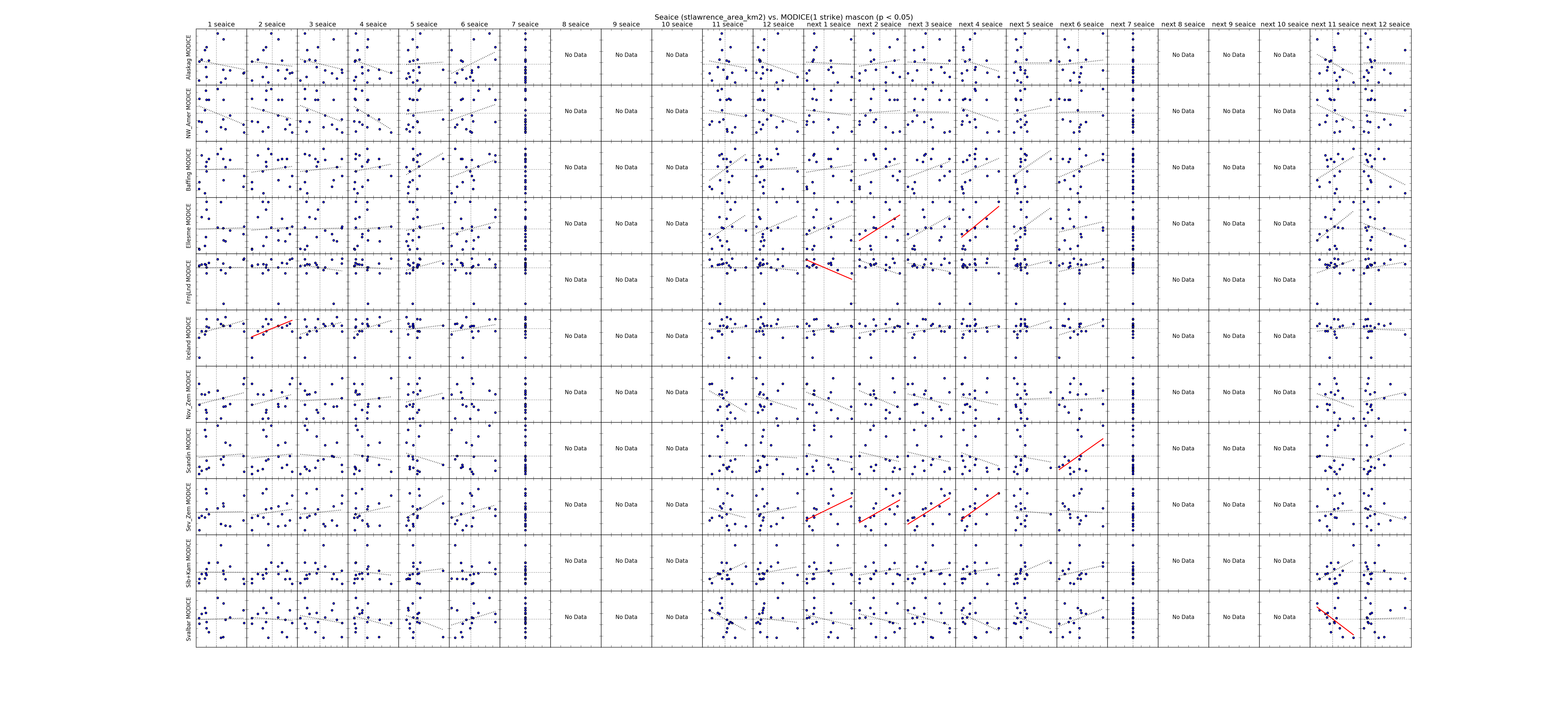 |
| Sea Ice Region | Comparisons by Month |
|---|---|
| Total Sea Ice Area | 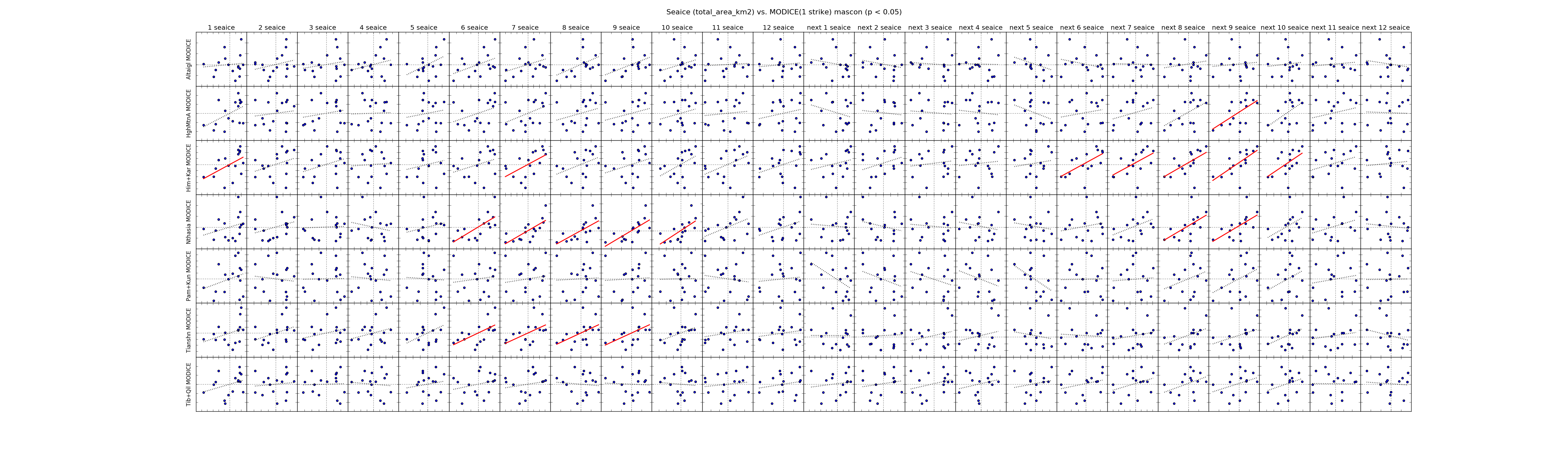 |
| Total Sea Ice Extent | 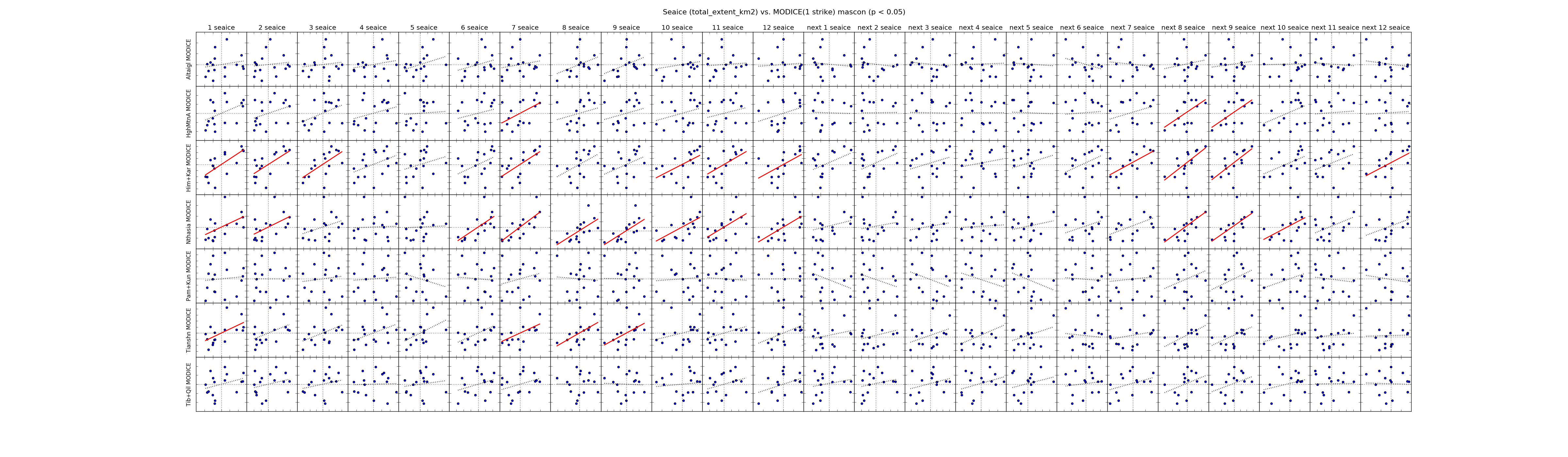 |
| ------------- | |
| Baffin Area | 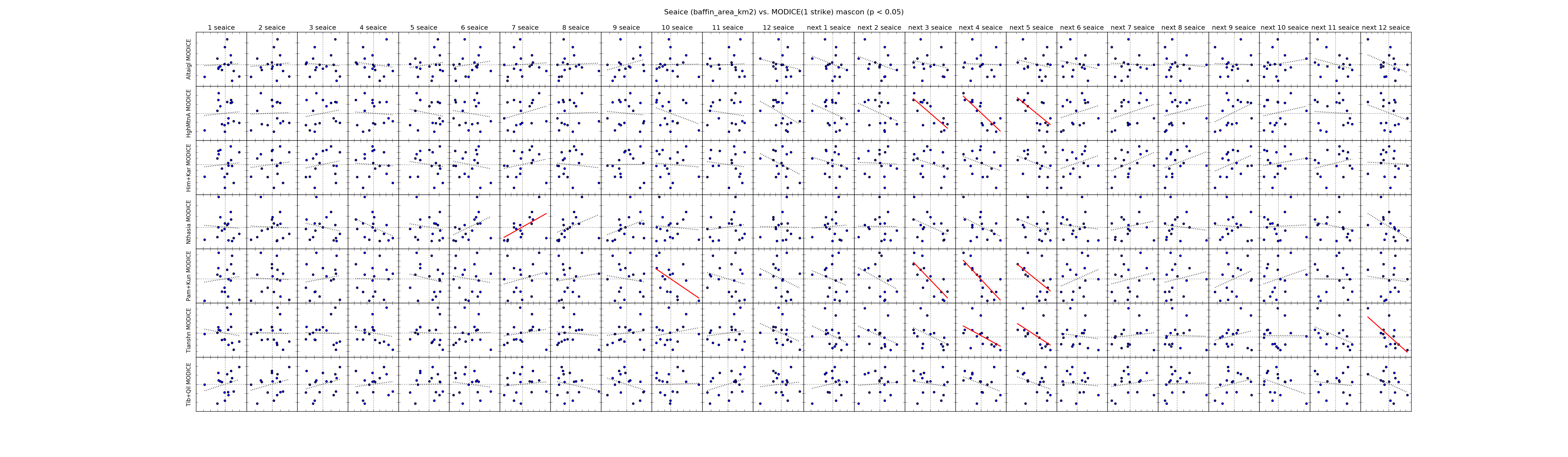 |
| Baffin Extent | 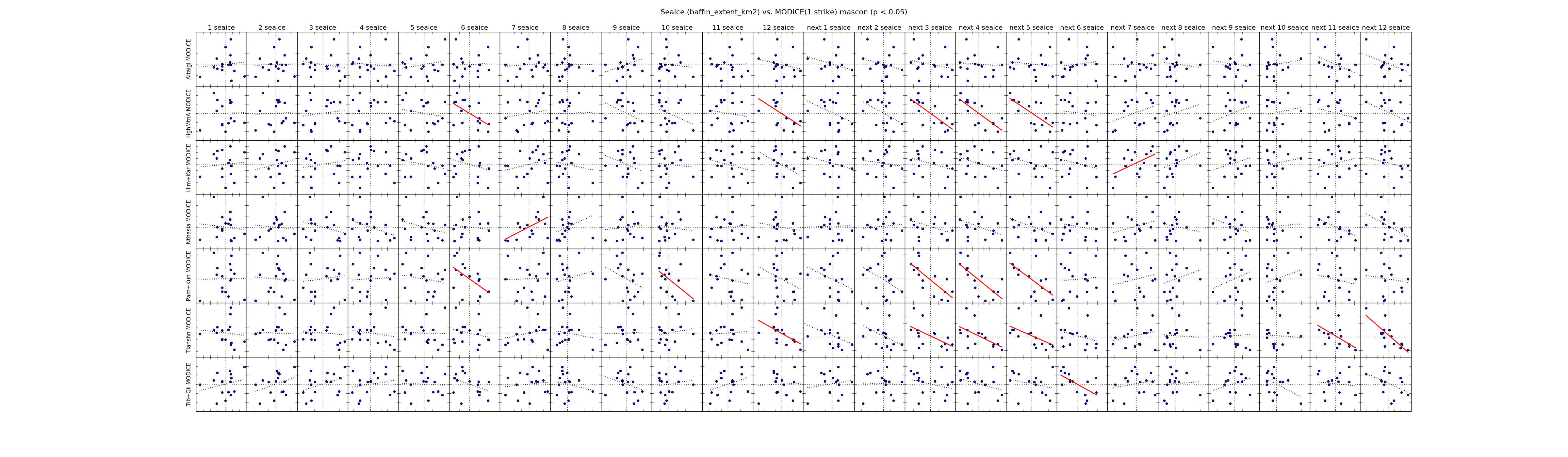 |
| ------------- | |
| Barents Area | 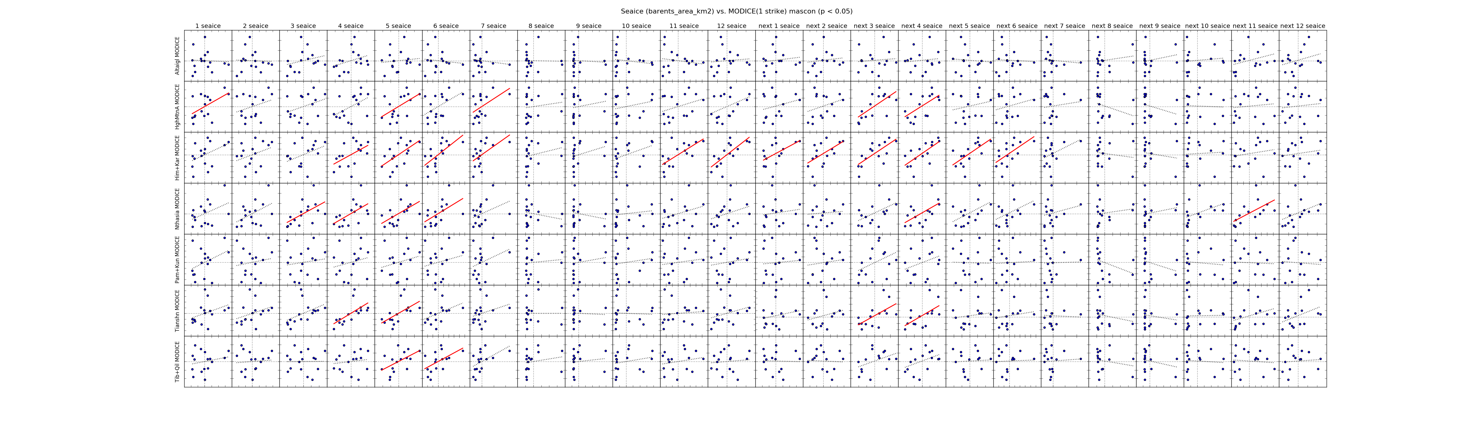 |
| Barents Extent | 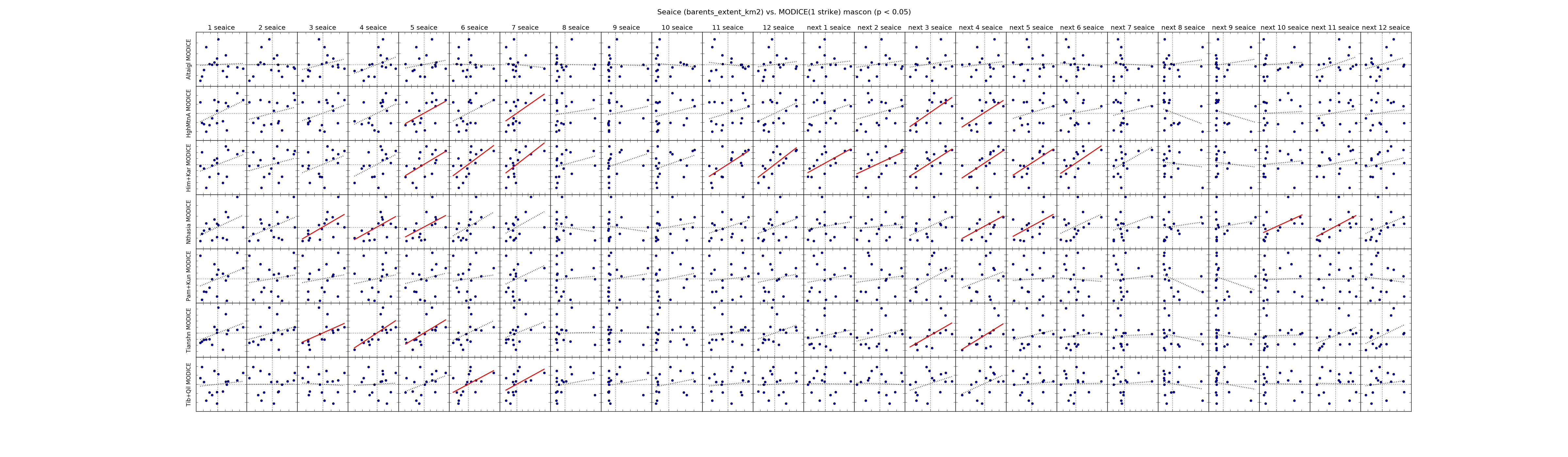 |
| ------------- | |
| Beaufort Area | 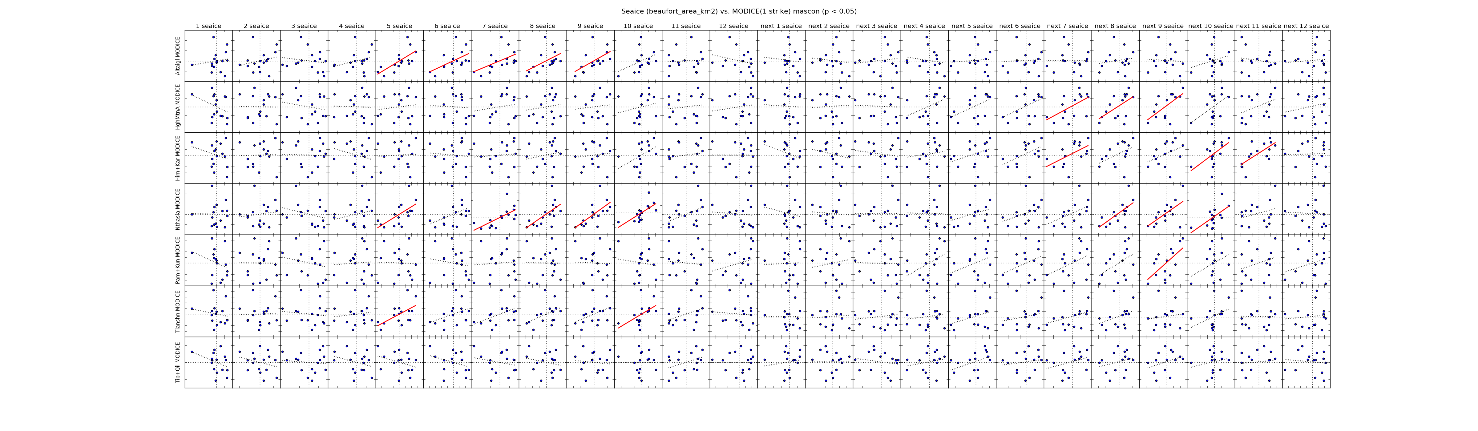 |
| Beaufort Extent | 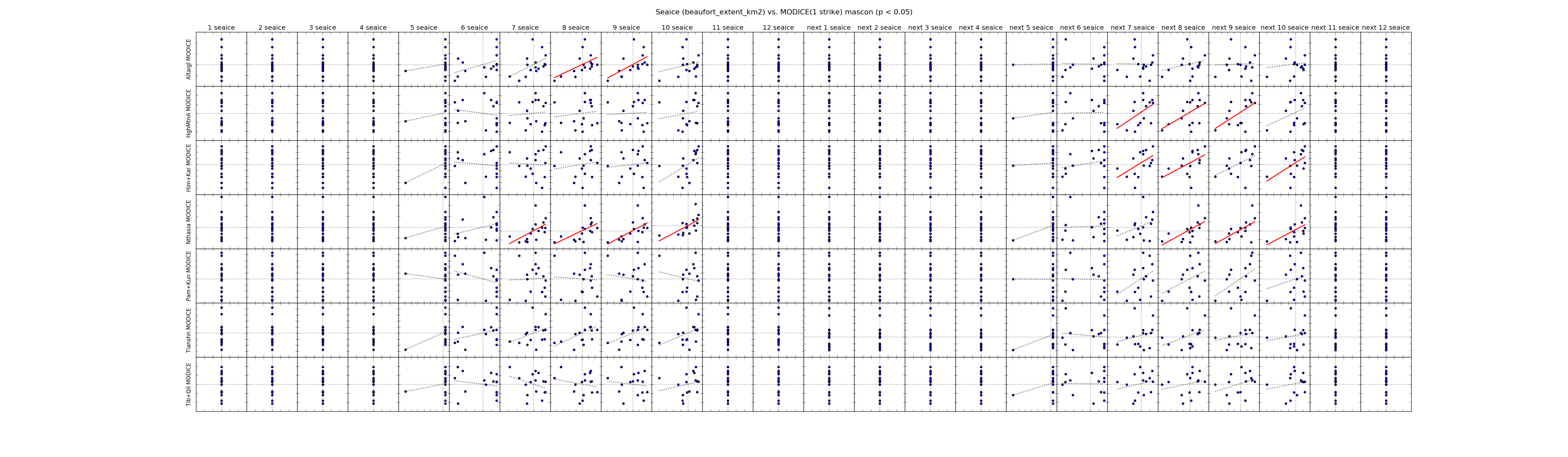 |
| ------------- | |
| Bering Area | 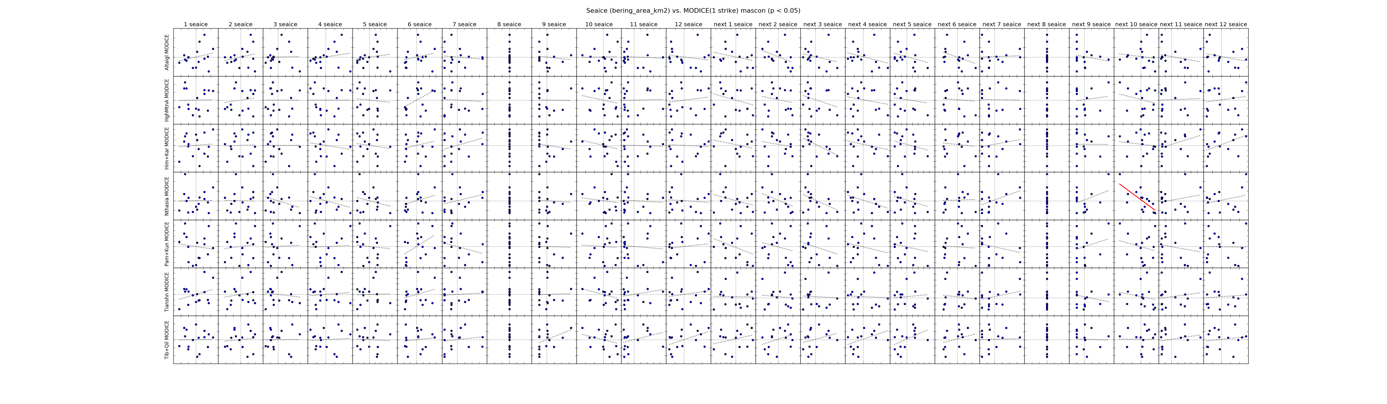 |
| Bering Extent | 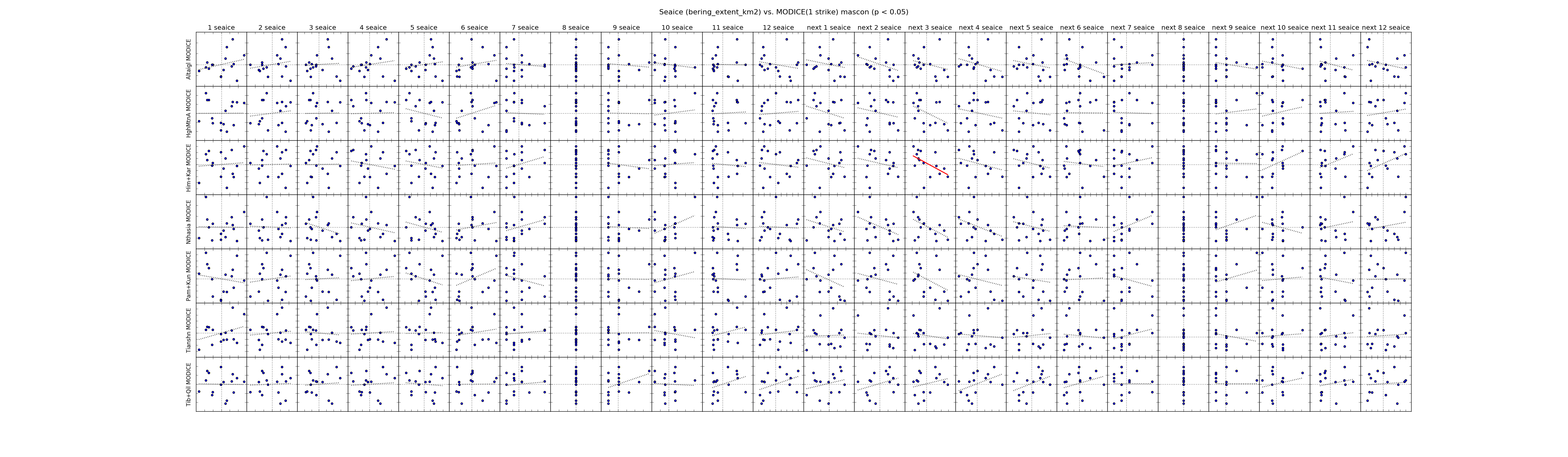 |
| ------------- | |
| Canadian Archipelago Area | 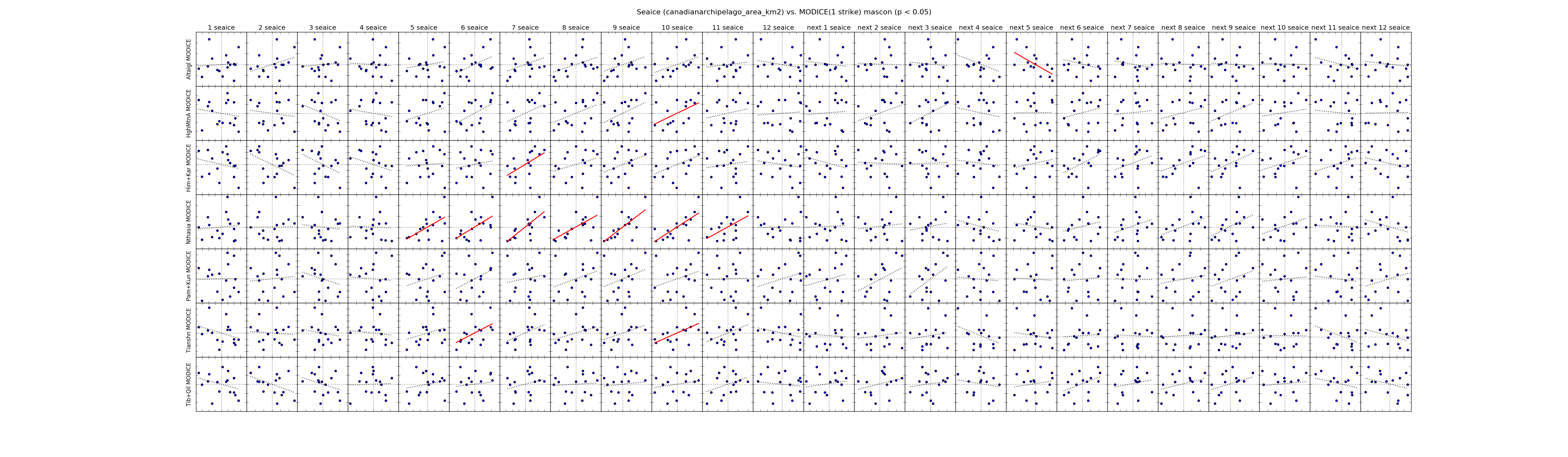 |
| Canadian Archipelago Extent | 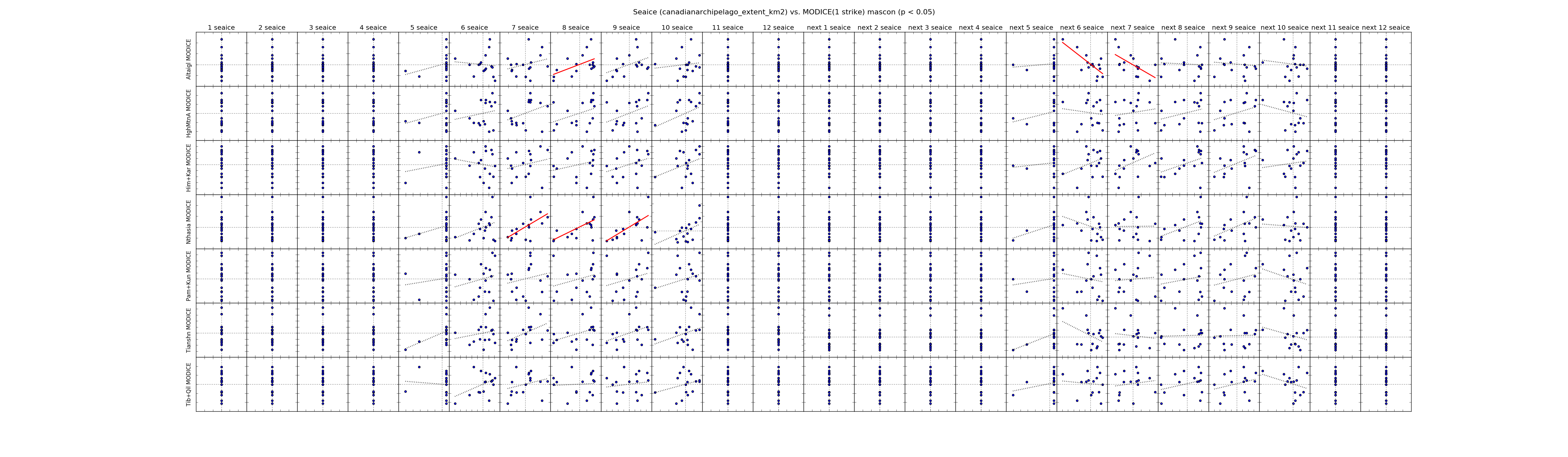 |
| ------------- | |
| Central Arctic Area | 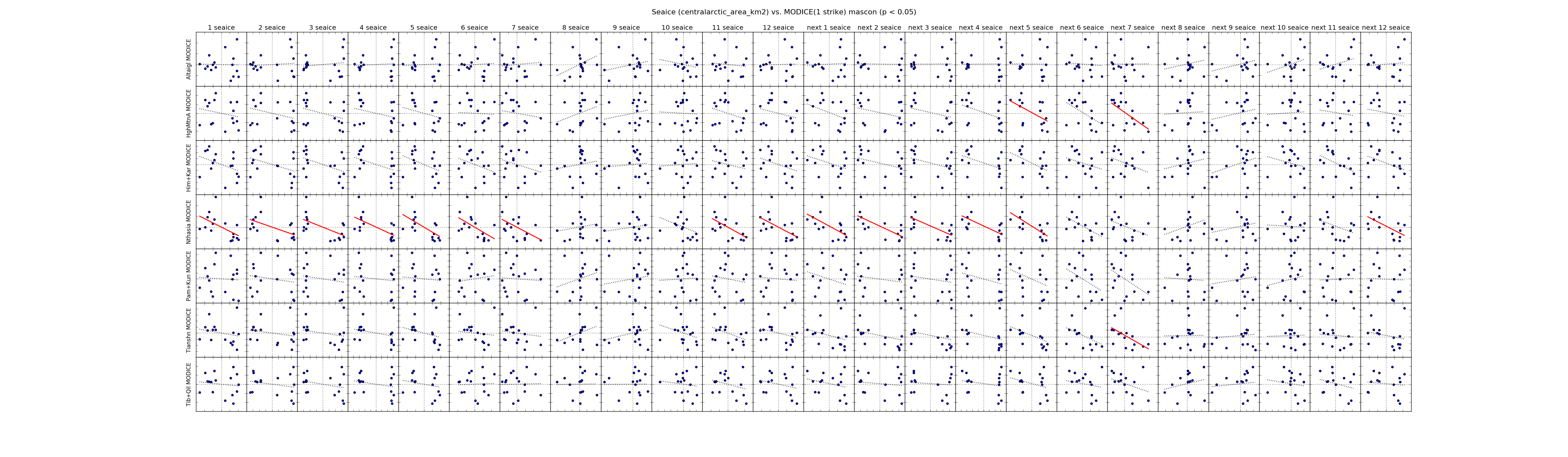 |
| Central Arctic Extent | 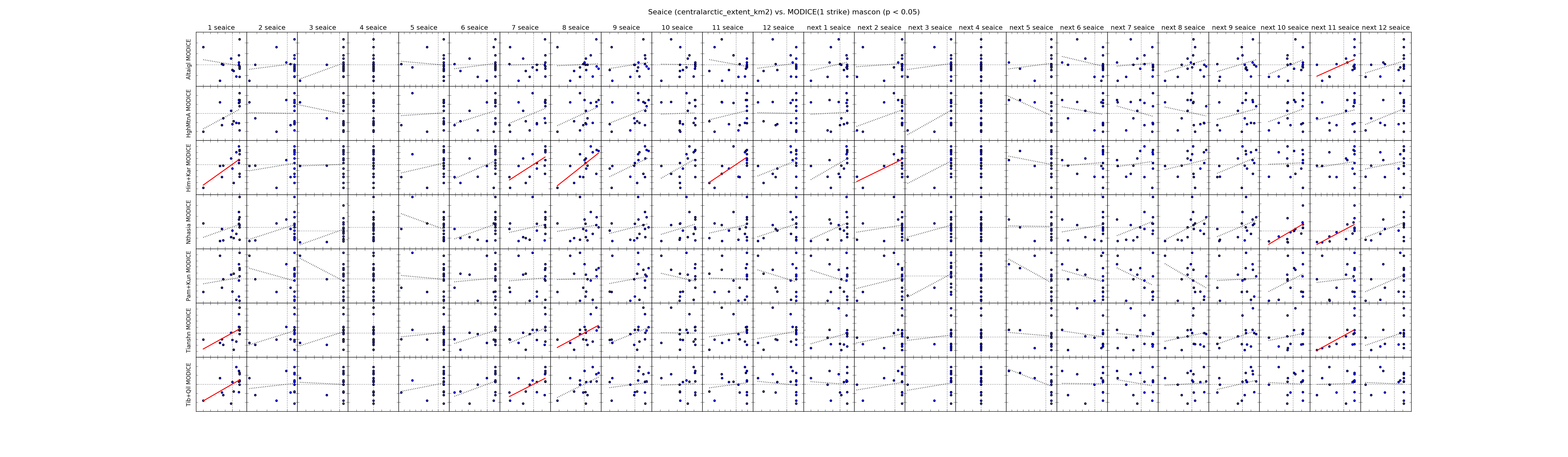 |
| ------------- | |
| Chukchi Area | 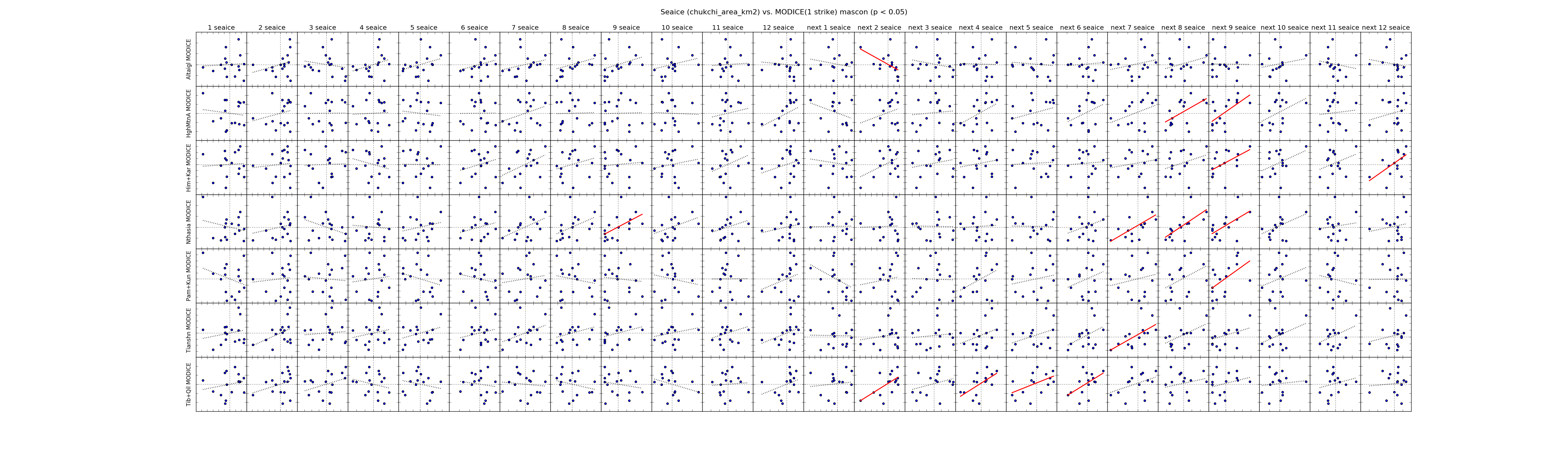 |
| Chukchi Extent |  |
| ------------- | |
| East Siberian Area |  |
| East Siberian Extent |  |
| ------------- | |
| Greenland Area |  |
| Greenland Extent | 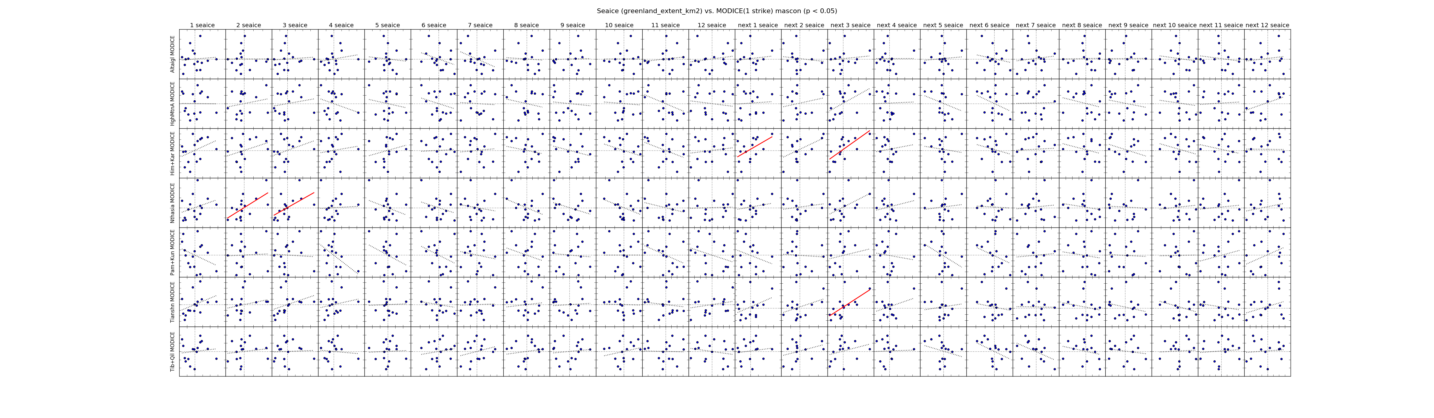 |
| ------------- | |
| Hudson Area | 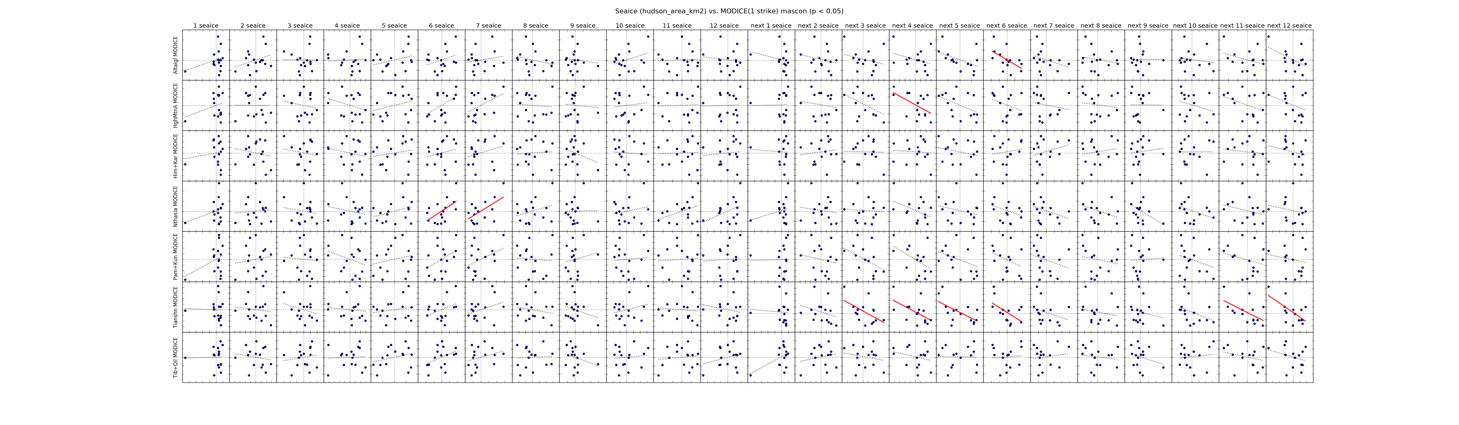 |
| Hudson Extent | 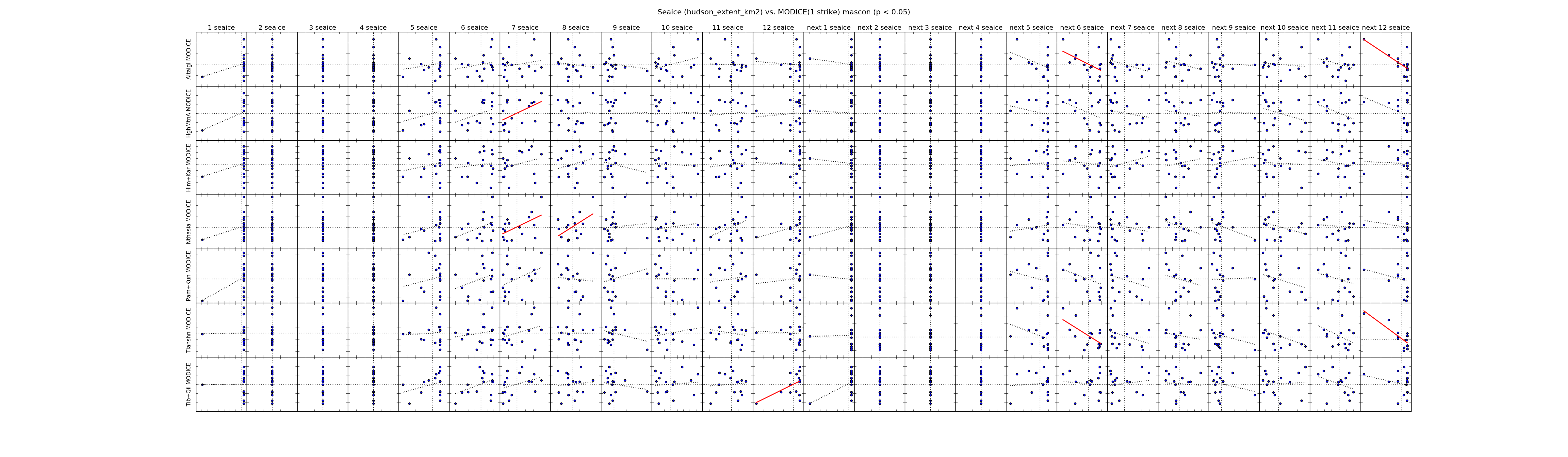 |
| ------------- | |
| Kara Area | 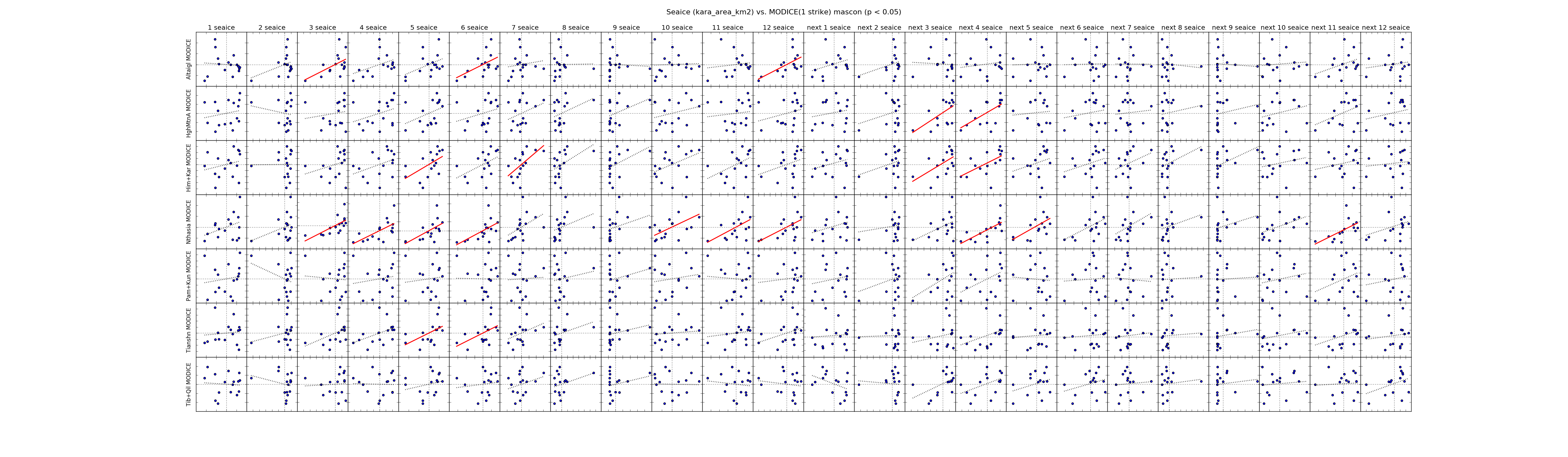 |
| Kara Extent |  |
| ------------- | |
| Laptev Area | 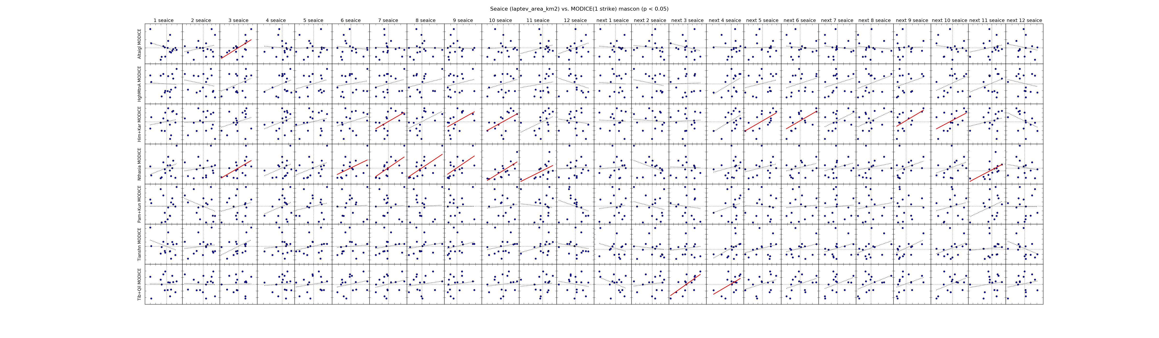 |
| Laptev Extent | 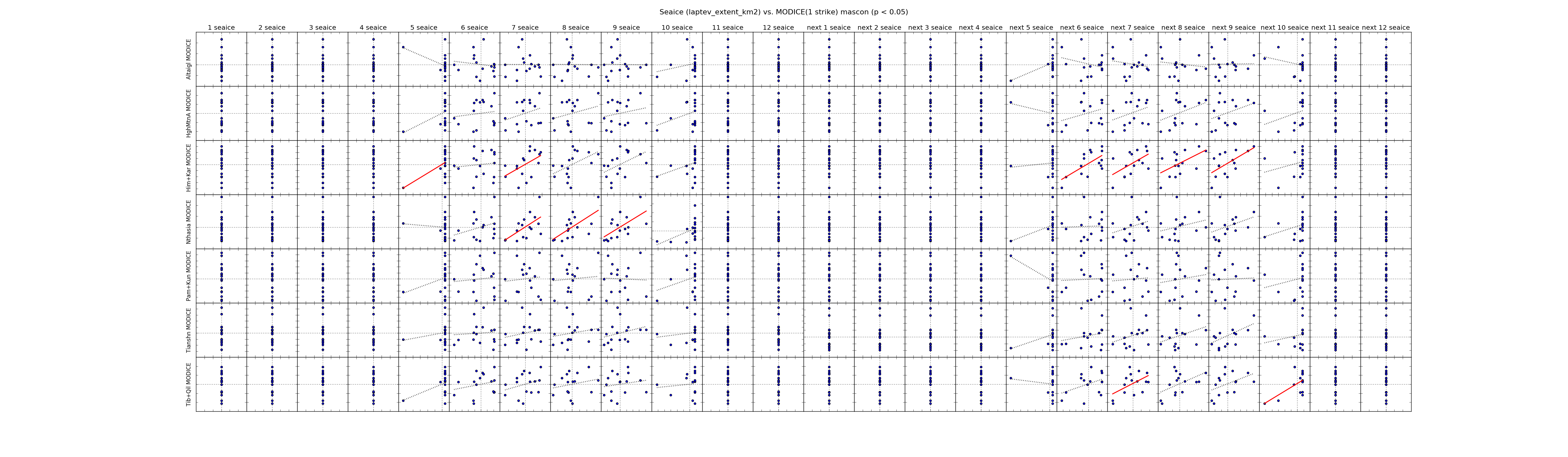 |
| ------------- | |
| Okhotsk Area | 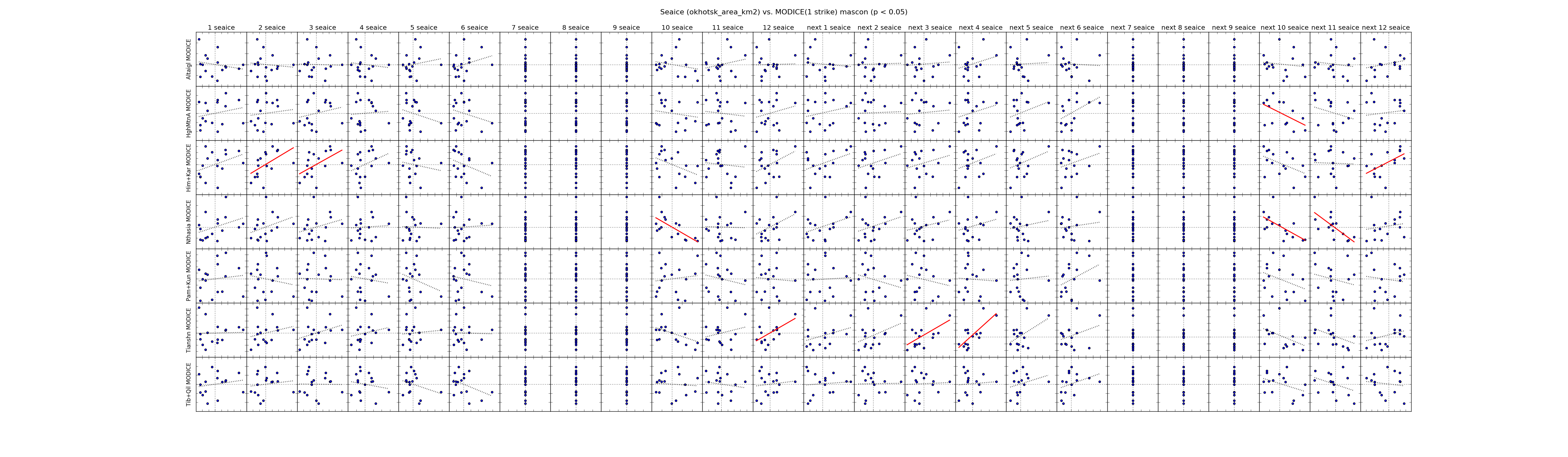 |
| Okhotsk Extent | 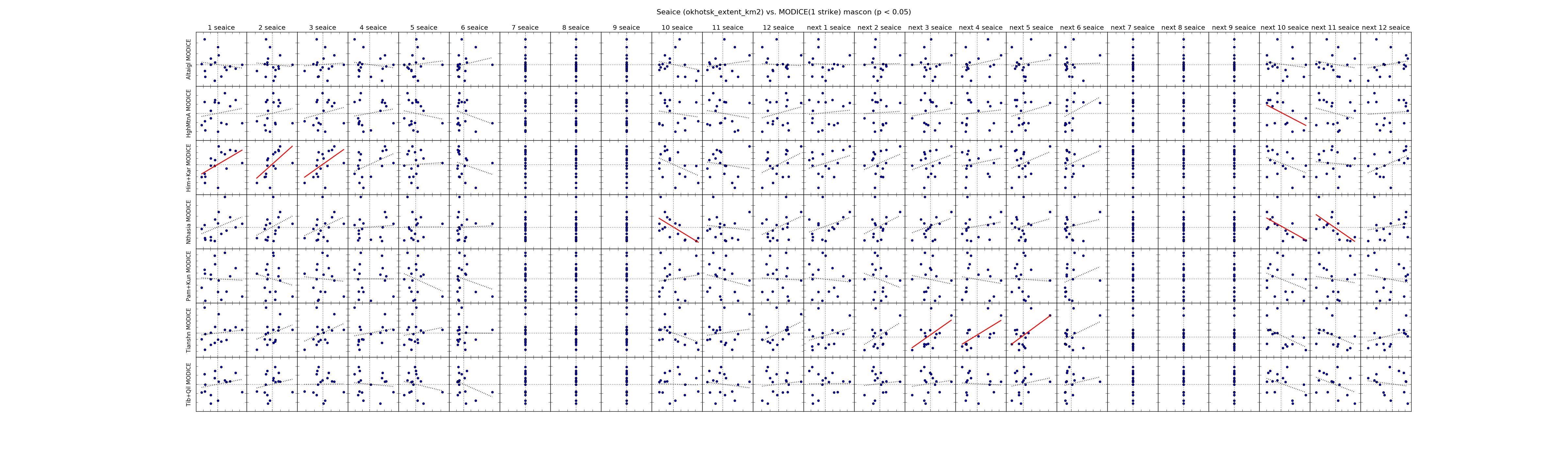 |
| ------------- | |
| St Lawrence Area | 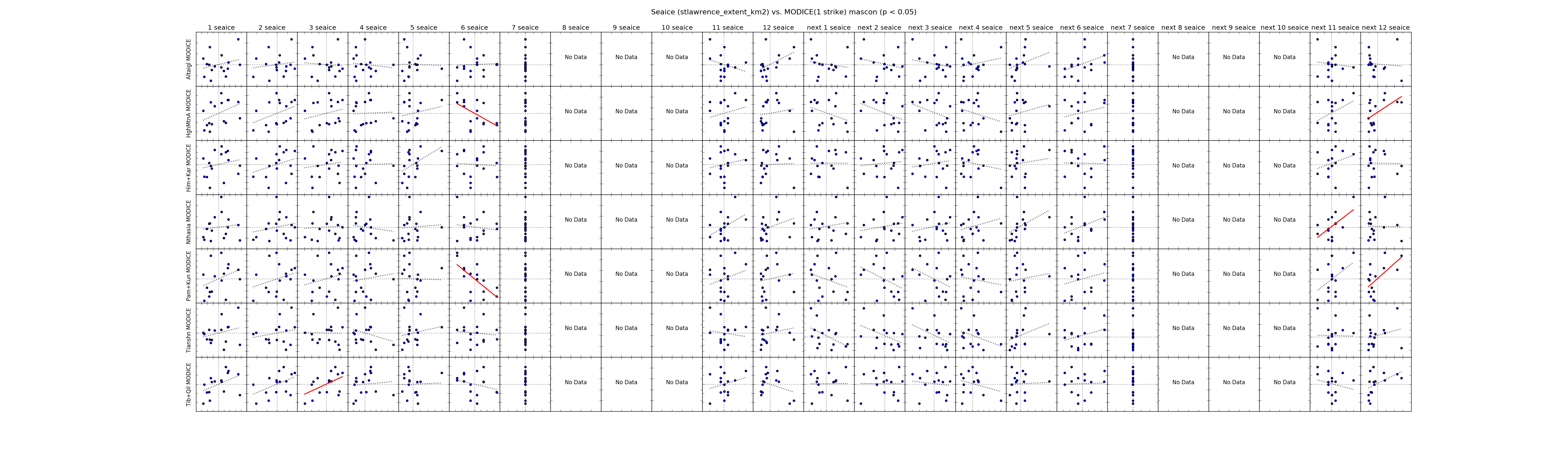 |
| St Lawrence Extent | 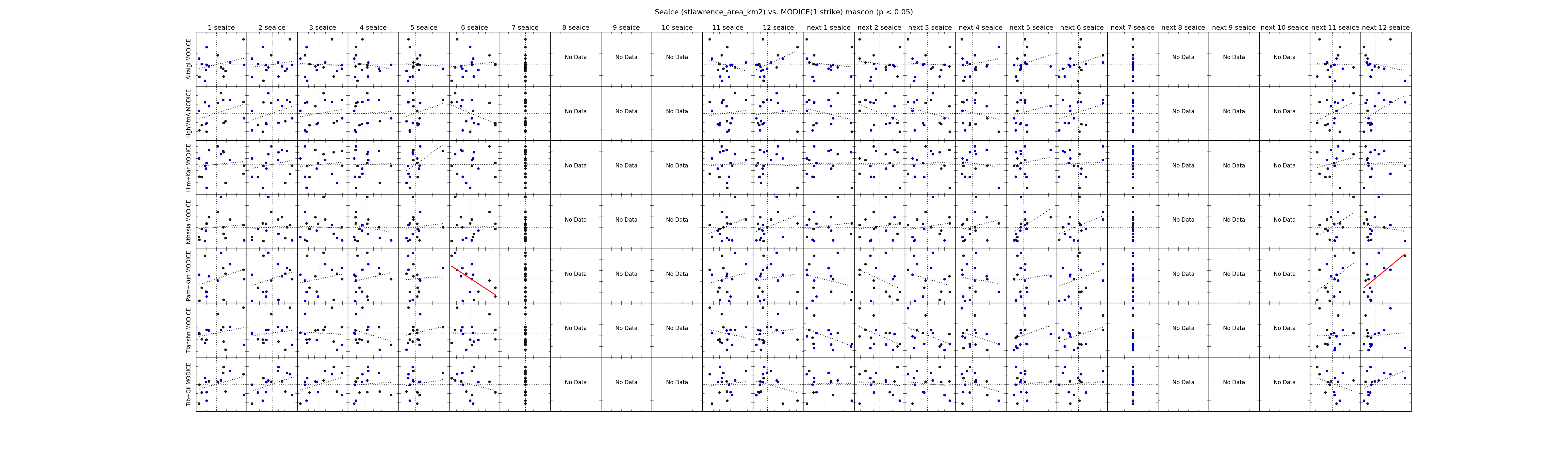 |