You can also locate zooms of seismicity through a
clickable map
Earthquake maps on the Web
This is the single document version of the hypertext listing of recent earthquake
maps available on the WWW. As the core USGS map engines have improved over time, many of the more unusual US maps have dropped away; some are still on the list but very out-of-date. There is still a lot of flux in the international real-time community. Some maps come online for a few months and then are never updated; others are moved repeatedly within a website. My apologies for not keeping up in these instances; please let me know of broken links or stale maps and I will try and fix the links.
The links below are to the most recent earthquake maps available for the
areas indicated. For other seismological information (such as earthquake catalogs) you can start at Steve Malone's Seismosurfing the Internet page. This page usually provides two means of getting the image:
as a GIF or JPEG directly (which will spawn an external viewer in some browsers) and as an
inline-GIF (which will leave you in your local viewer, usually at the source
html page for that map). Some inline maps (usually marked as "with
additional info") can get event data if clicked upon. Some links are to
dynamic map makers that use resources like the Xerox Parc mapping tools, or
the links change with time. Note none of these are locally cached; they are
merely pointers directly to the images.
Several sites have several different time windows for their maps (e.g., all historic events) that are not listed; I've tried to limit things to the more recent maps. If you really like a map but want more time, head to the site listed with it and see if there are other time windows (e.g., year-to-date at
St. Louis U., past week at USGS Menlo Park).
While the sources for seismic information are generally few (e.g., U.S.
Geological Survey's QED locations, Council of National Seismic System's joint
and individual network members catalogs), the diversity of effort in making
maps from these catalogs provides for entertaining viewing. Some strange artifacts (giant earthquakes in places which didn't have them) can be ferreted out by comparing maps and catalogs; these are produced by occasional system glitches. Maps are both
static (generally those marked inline or external) and dynamic (built around
specific events or user-input parameters). Generally I have tried to place
more primary sources near the top of each regions listing.
Any comments, problems or suggestions, please e-mail cjones@cires.colorado.edu
Contents
Details near large EQs/interactive maps
Global
North America
Central America
South America
Europe
Asia
Africa
Australia
Pacific
Atlantic Ocean
Indian Ocean
Last
7 days global seismicity (US
Geological Survey National Earthquake Information Center).
Recent centroid moment tensor solutions for large earthquakes with maps (US Geological Survey National Earthquake Information Center).
Significant
earthquake list (individual event pages have numerous maps)
(US Geological Survey National
Earthquake Information Center)
10 most recent events recorded by the GEOSCOPE network
Centroid moment tensor solutions for large earthquakes (with nice maps; Univ. of Tokyo)
Recent large (M>4.5) earthquakes plotted interactively with past seismicity and lists (Center for Monitoring Research)
Full CMT catalog plotted with Xerox web mapmaker (Harvard Univ. Seismology Group).
Recent earthquakes plotted using Xerox web mapmaker (can be slow) via Univ. Edinburgh.
Recent earthquakes plotted using Xerox web mapmaker via Carleton Univ.'s Civil & Environmental Engineering Dept. (Canada).Interactive maps for different networks
A global interactive set of maps, last 120 global events, (Prototype International Data Center) inline only.
The USGS in Menlo Park has a set of clickable maps and hypocenter lists for several of the networks (primarily in the US); choose the network you are interested in and you will get a list of events from the network's FINGER server and a map (via XEROX PARC) of the recent earthquakes. (Individual network pages are listed below as well).
Global
There are many more global maps out there than can be listed here. I have
tried to include primary maps (those being generated by the group picking and
locating the earthquakes) plus a sampling of some of the other projections and
map styles available from other groups. If you see a map you think should be listed
here, contact me.
Recent global seismicity (depth colored/magnitude sized) (US Geological Survey National Earthquake Information Center) inline or external
Most recent 15 days with small dots of past 5 years; updated every half hour;
links to earthquake and station parameters and waveforms (magnitude sized,
time colored, relief base (IRIS
DMC) clickable inline, small
gif, and big
gif
Past week's events from clickable list (maps through Xerox PARC; in revision) (Synapse Science Center, Russia) inline only.
Most recent large event with previous catalog seismicity (in Spanish) (University of Chile) external only
Recent global seismicity from the GEOSCOPE network, inline (with hypertext listing of 10 most recent large events) or external
Worldwide EQ Bulletin from USGS NEIS via USGS Menlo Park --listing and dynamic map, inline only
Recent NEIC locations (mapped at University of Arizona, Southern Arizona Seismic Observatory, depth colored, magnitude sized) inline or external
Recent global seismicity (on shaded topography) (Bureau of Reclamation, magnitude sized) inline (with additional info) or external
Past 2 weeks, global seismicity (depth coloring/magnitude sizing) St. Louis Univ. Earthquake Center, inline or external
Past 2 weeks, global seismicity, southern hemisphere view (depth coloring/magnitude sizing) St. Louis Univ. Earthquake Center, inline or external
Past week's seismicity (with plate boundaries) (CERI, Memphis State) external only (broken, 9/3/99, but linked from CERI still)
Past week's seismicity, azimuthal projection from Memphis (with plate boundaries) (CERI, Memphis State) external only (broken, 9/3/99)
Recent seismicity (last 15 NEIC reported events?, with listing) via Institute for Geophysics, Victoria University at Wellington (New Zealand), external only
Last 4 weeks seismicity, European events emphasized (magnitude sized, time colored), (Swiss Seismological Service) inline only.
Past 6 month's (roughly) M>5 events (Mercator, latest highlighted), (Seismic Data Analysis Center, BGR Hannover) inline or external.
Past weeks M>5 events (magnitude sized, Pacific centered), (Seismological Observatory, Victoria University at Wellington), inline or external.
Past month's events (NEIC locations; depth colored, magnitude sized, Pacific centered) (Earthquake Research Inst., Univ. of Tokyo), external M>5.5 or external M>4.0.
Past year's large North American events from the GEOSCOPE network, inline (with hypertext listing) or external
Northeast Pacific Rim
Recent earthquakes, M>2, western North America, on shaded relief (mapped
at University of Arizona,
Southern Arizona Seismic Observatory, magnitude sized) inline
or external
Most recent week's events offshore (NE Pacific), Gorda Rise, (VENTS
program, NOAA), inline
or external.
Last several months' events offshore (NE Pacific), Gorda Rise, (VENTS
program, NOAA), inline
or external.
United States
You can also locate zooms of seismicity through a
clickable map
ANSS recent US seismicity (USGS
NEHRP ANSS)
inline or external
Western United States
Recent western US (on shaded topography) (Bureau
of Reclamation) inline
(with additional info) or external
Past month's western U.S. seismicity (CERI,
Memphis State) external
only
California/Nevada
You can also locate zooms of seismicity through a
clickable map
Past week's events, California/Nevada (time coloring/magnitude sizing), Southern California Earthquake data center, inline (with zooming through clicking) and external.
Northern California
Details of specific areas:
Southern California
Southern California, last 500 events (automated, on shaded relief) from Caltech/USGS via UCSB Institute for Crustal Studies, zoomable inline only - Java.
Details of specific areas:
Los Angeles basin-past week (magnitude sized, time colored) (Southern California Earthquake Data Center) inline (with clickable map and lists) or external.
Nevada
None at present.
Utah
Past two week's seismicity, magnitude sized, time colored (Univ.
of Utah Seismograph Stations) clickable
inline or external
Yesterday's (or past week's) earthquakes in Utah (Univ.
of Utah Seismograph Stations, magnitude sized) external
only (1 day) or external
(7 days) (might be on the way out)
Utah and western Wyoming and SE Idaho (roughly past 2 weeks), from Univ.
Utah, via USGS Menlo Park
--listing and dynamic map, inline
only
Wyoming
Past two week's seismicity of Yellowstone, magnitude sized, time colored
(Univ. of Utah Seismograph
Stations) clickable inline
or external
Yesterday's (or past week's) earthquakes in Yellowstone (Univ.
of Utah Seismograph Stations, magnitude sized) external
only (1 day) or external
only (7 days) (might be on the way out)
Events in southwest Wyoming (~past 3 months, M>2) on shaded relief (Bureau
of Reclamation, magnitude sized) inline
(with additional info) or external
Colorado
Events in southwest Colorado (~past year+, M>2) (Bureau of Reclamation) inline (with additional info) or external
Pacific Northwest (Washington, Oregon, Idaho)
Washington/Oregon, past 2 weeks, magnitude sized, time colored (Univ.
Washington/Pacific Northwest Seismic Network), clickable
inline map or external
Last 2 weeks, Pacific Northwest (small size/depth coloring/magnitude sizing)
St.
Louis Univ. Earthquake Center, inline
or external
Recent and
catalog moment tensors in Pacific Northwest (Oregon State Univ.)
Pacific Northwest, from Pacific NW Seismic Network, via USGS
Menlo Park --listing and dynamic map, inline
only
Recent events offshore (NE Pacific), Gorda Rise, (VENTS
program, NOAA), inline
only.
Oregon
Eastern Oregon recent events from Boise State University, inline or external
Idaho
Western Idaho recent events from Boise State University, inline or external
Montana
Montana, from Montana Bureau of Mines network, via USGS Menlo Park --listing and dynamic map, inline only
Central United States
Past month's, clickable (zoomable) map (sized by magnitude, colored by date)
(CERI, Memphis State),
inline or external
Past month's central U.S. seismicity (CERI,
Memphis State) external
only
New Madrid region, SE Missouri and surroundings, from St. Louis Univ., via
USGS Menlo Park --listing
and dynamic map, inline
only
Past 2 weeks, Central U.S. (small size/depth colored/magnitude sized) (St.
Louis Univ.), inline
or external.
Eastern United States
Past month's eastern U.S. seismicity (CERI, Memphis State) external only
Most recent New England event (if available) (New England Seismic net), external or inline with detail.
New England's current quarter's events (frequently months behind) (New England Seismic net), inline only.
Recent events recorded in southern Appalachians (Virginia Tech), through clickable lists only.
Recent (past few years) seismicity in Southern Appalachia (and a little more ;-) ), from Virginia Tech, via USGS Menlo Park --listing and dynamic map, inline only
Recent (about 6 mos.) EQs in New York State and New England, from Lamont Cooperative Seismic Net, via USGS Menlo Park --listing and dynamic map, inline only
Hawaii (Big Island) - last week (reviewed; time colored; clickable info)
(Hawaii Volcano Observatory),
inline
or external.
Last 2 weeks, Hawaii (depth coloring/magnitude sizing) St.
Louis Univ. Earthquake Center, inline
or external
Last months Hawaii seismicity (CERI,
Memphis State) external
only
Last 72 hours of Hawaii seismicity (M>2) from Hawaii Volcano Observatory,
via USGS Menlo Park --listing
and dynamic map, inline
only (broken?)
Alaska
Recent seismicity (magnitude sized, clickable) (Alaska
Earthquake Info Ctr.) inline
or external
Whole state-last week (Univ.
Alaska, Fairbanks Seismology Dept.) inline
or external
Southern central part of the state-last week (Univ.
Alaska, Fairbanks Seismology Dept.) inline
or external
Alaska's past year's large events from the GEOSCOPE
network, inline
(with hypertext listing) or external
You can also locate zooms of seismicity through a
clickable map
All of Canada, past month (Canada
Natl Earthquake Hazards Program, magnitude sized) inline
or external
Western Canada:
Eastern Canada:
- Eastern Canada, past month (Earthquakes Canada, Geological
Survey of Canada) inline
or external
- Detail of Lower St. Lawrence/Upper New Brunswick (Earthquakes Canada, Geological
Survey of Canada) inline
or external
- Detail near Montreal and Ottawa, past month,(Earthquakes Canada, Geological
Survey of Canada) inline
or external
- Detail near and north of Quebec City (Charlevoix), past month (Earthquakes Canada, Geological
Survey of Canada) inline
or external
- Detail of Southern Ontario, Toronto and Vicinity, past month (Earthquakes Canada, Geological
Survey of Canada) inline
or external
- Detail of the New Brunswick area, past month (Earthquakes Canada, Geological
Survey of Canada) inline or external
- Detail of northern Ontario, past month (Earthquakes Canada, Geological
Survey of Canada) inline or external
- Southern Ontario and vicinity (since 1991) (Southern
Ontario Seismic Network), zoomable map, inline
or external
Northern Canada:
You can also locate zooms of seismicity through a
clickable map
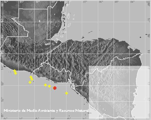
Last 10 days events, Central America (senso stricto) (Instituto
Nicaragüense de Estudios Territoriales - Direccion de Geofisica),inline with list (click on Centro América on left), inline or external
Past year's events from the GEOSCOPE
network, inline
(with hypertext listing) or external
(out of date) Recent significant events in region (Middle
America Seismograph Consortium, Univ. Puerto Rico, San Juan), clickable
list, inline only (also at Middle
America Digital Seismograph Consortium, Univ. Puerto Rico, Mayaguez), map
and list, inline)
(out of date) Most recent events (Middle
America Seismograph Consortium, Univ. Puerto Rico, San Juan), clickable
list, inline only (also at Middle
America Digital Seismograph Consortium, Univ. Puerto Rico, Mayaguez), list
and map, inline) (includes links to maps by contributing network)
Mexico
Most recent event (on shaded relief) ( Servicio
Sismólogico Nacional, Universidad Nacional Autónoma de Meacute)
, inline
(zoomable).
Last month of seismicity in Mexico (shaded relief with listing) (Servicio Sismólogico Nacional, Universidad
Nacional Autónoma de Meacute) inline or external
Last week's seismicity in Mexico (shaded relief with listing) (Servicio Sismólogico Nacional, Universidad
Nacional Autónoma de Meacute) inline or external
Past year's events from the GEOSCOPE network, inline (with hypertext listing) or external
Costa Rica
El Salvador
Jamaica
Maps offline at present (Jamaica Seismograph Network, Univ. of West Indies, Jamaica)
Nicaragua
Panama
Puerto Rico
Last felt event (Puerto Rico
Seismic Network, Univ. of Puerto Rico), inline
only .
Trinidad and Tobago (Eastern Caribbean)
Recent events (erratically organized at present; maps are usually within detailed pages for events), West Indies (Seismic Research Univ, Univ. of West Indies) inline only
You can also locate zooms of seismicity through a
clickable map
Recent seismicity (depth colored/magnitude sized) (US Geological Survey National Earthquake Information Center) inline or external
Last 2 weeks, South America (depth coloring/magnitude sizing) St. Louis Univ. Earthquake Center, inline or external
Past year's large events from the GEOSCOPE network, inline (with hypertext listing) or external
Chile
Chile's 30 most recent events (Departamento
de Geofísica of the Universidad de Chile)
list with links to event maps only
Colombia
Current year's seismicity, western Colombia (Observatorio Sismol�gico del SurOccidente), inline only (clickable list).
Peru
Europe
You can also locate zooms of seismicity through a
clickable map
Recent European seismicity (depth colored/magnitude sized) (US Geological Survey National Earthquake Information Center) inline (with clickable earthquakes) or external
Last 2 weeks seismicity (time colore/magnitude sized), (European-Mediterranean
Seismological Center), inline or external.
Europe's past year's large events from the GEOSCOPE network, inline (with hypertext listing) or external
Last 2 days in Central Europe (GERESS, Institute fur Geophysik, Ruhr Universitat, Germany) inline or external.Belgium
All known events (?), (Royal
Observatory of Belgium) apparently now offline (text of recent events
available with occasional maps) .
Czech Republic
Recent events located by Institute of Physics of the Earth, Masaryk Univ., Brno, inline only .
Most recent event located near Temelín Nuclear Power Plant (Institute
of Physics of the Earth, Masaryk Univ., Brno, seismogram and map), inline and
external(?).
France
Past week (magnitude colored) (Bureau
Central de Sismologie Francais, Ecole et Observatoire des Sciences de
la Terre
de Strasbourg ), inline
(clickable map). or external.
Germany
Last 72 hours of events (automated) in Germany (Seismic
Data Analysis Center, BGR Hannover) inline
or external
Past year's events (reviewed) in Germany (Seismic
Data Analysis Center, BGR Hannover) inline
or external
Great Britain
Past month's events (British
Geological Survey EQ page) inline
listing or external
image.
Greece
Most recent event M>4.5, (National Observatory of Athens) inline with listing or external.
Past week's events, (loads faster than National Observatory) Aristotle University of Thessaloniki, Seismological Station, inline or external.
Central Macedonia (Greece)
Past week's events, Aristotle University of Thessaloniki, Seismological Station, inline or external
Iceland
Past week's earthquakes in Iceland (Geophysics Dept of the Icelandic Meterological Office),
inline, regular external, or large external.
Last 48 hours earthquakes (Geophysics
Dept of the Icelandic Meterological Office, time colored) inline
with zooms or external
Italy
Clickable list of recent events with maps and seismograms (MEDNET),
inline only.
Northwest Italy (Genoa region)
Last 20 events in northwestern Italy (IGG
network, Genoa University, magnitude sized) external
only.
Last week's northwestern Italian seismicity (IGG
network, Genoa University, magnitude sized) external
only
Eastern Italy
Eastern Italy (Marche) clickable list of recent events with maps and seismograms
(in Italian) (Osservatorio
Geofisica Sperimentale Macerata) through
clickable list only.
(English
page more out of date)
Republic of Macedonia
Recent events, (Seismological
Observatory - Skopje), inline (broken 12/05) or external
(broken 12/05) .
Norway (and Scandinavia)
- Past weeks automated locations (NORSAR,
magnitude sized, shaded topo base) inline
with clickable list or external
- Detail of West Norway and the North Sea (NORSAR,
magnitude sized, shaded topo base) inline
with clickable list or external
- Detail of Central Norway (NORSAR,
magnitude sized, shaded topo base) inline
with clickable list or external
- Detail of East Norway (NORSAR,
magnitude sized, shaded topo base) inline
with clickable list or external
- Detail of North Norway (NORSAR,
magnitude sized, shaded topo base) inline
with clickable list or external
- Detail of Svalbard (NORSAR, magnitude
sized, shaded topo base) inline
with clickable list or external
Portugal
Romania
Recent event, (Coll.
Res. Ctr. 461 of DFG, Univ. Karlsruhe), inline or external.
(Irregularly updated)
Recent events (irregularly updated) (Romanian Seismic Network, National
Institute of Earth Physics), inline (with listing) or external
Serbia
Spain
List of recent events with clickable maps (Instituto Geográfico Nacional), inline only.
A recent week's seismicity, Andalusia (southern Spain) (Andalusian Institute of Geophysics), external only.
A recent month's seismicity (usually a couple months ago), Andalusia (southern Spain) (Andalusian Institute of Geophysics), external only.
Switzerland
Recent seismicity (past 4 weeks, magnitude sized and time colored) (Swiss
Seismological Service) inline
only.
Yugoslavia
Last month's seismicity in Montenegro (magnitude sized) (Seismological Observatory of Montenegro), inline (with commentary) or external.
Middle East
Recent seismicity (depth colored/magnitude sized) (US Geological Survey National Earthquake Information Center) inline or external
Iran
Israel
Last 25 located events (Geophysical
Institute of Israel), inline
with hyperlink list or external(?)
Turkey
Kandilli
Observatory, Bogazici University, Turkey, recent
earthquake map (clickable, in Turkish), English
version of recent earthquake map, or external.
Asia
Recent seismicity (depth colored/magnitude sized) (US Geological Survey National Earthquake Information Center) inline or external
Southeast Asia's past year's events from the GEOSCOPE network, inline (with hypertext listing) or external
Eastern Asia's past year's large events from the GEOSCOPE network, inline (with hypertext listing) or external
Central Asia's past year's large events from the GEOSCOPE network, inline (with hypertext listing) or external
Japan
FREESIA project's latest major earthquakes (broadband sensors) (FREESIA
project, NIED), through a clickable
list only (different links are to arrival times, map of event, and CMT
solution).
Hi-net (High Gain Seismographic Network, National
Information Center for Earthquakes and Disasters) location
maps for Japan (text is Japanese):
Southeast Asia
Recent events clickable list (ASEAN Earthquake
Information Center), inline
only.
China
Phillipines
List of recent earthquakes (click on date to get map) (Seismological
Observation and Earthquake Prediction Division, Phillipine
Institute of Volcanology and Seismology),
inline only
Taiwan
Current month, clickable list, (Taiwan
Weather Bureau), inline
only; latest event map and info, inline
only.
Africa
Recent seismicity (depth colored/magnitude sized) (US
Geological Survey National Earthquake Information Center) inline
or external
This year's seismicity, magnitude sized (Seismology
Unit, Council for Geoscience, South Africa), inline
(with list) (or click on "Recent
Earthquakes" here) or external
Northern Africa's past year's large events from the GEOSCOPE
network, inline
(with hypertext listing) or external
Central and southern Africa's past year's large events from the GEOSCOPE
network, inline
(with hypertext listing) or external
Algeria
South Africa
Recent seismicity (depth colored/magnitude sized) (US
Geological Survey National Earthquake Information Center) inline
or external
Interactive map of all Australian earthquakes with clickable list (recent
highlighted on M>6 historical background) (Australian
Geological Survey Org.), inline
interactive only.
Interactive maps of earthquakes to 1998/1999 (with focus on SE Australia
& capitals), (Seismology Recearch
Centre, RMIT Univ. (Melbourne)) inline.
Past year's large events from the GEOSCOPE
network, inline
(with hypertext listing) or external
Recent seismicity, southwest Pacific (depth colored/magnitude sized) (US Geological Survey National Earthquake Information Center) inline or external
Western Pacific's past year's large events from the GEOSCOPE network, inline (with hypertext listing) or external
Southern Pacific's past year's large events from the GEOSCOPE network, inline (with hypertext listing) or external
Central Pacific's (incl Fiji, Tonga) past year's large events from the GEOSCOPE network, inline (with hypertext listing) or external
Northern Pacific's past year's large events from the GEOSCOPE network, inline (with hypertext listing) or external
Eastern Pacific, previous 6 month download, (VENTS program, NOAA), inline only.
Galapagos Islands
Last 6 month download, (VENTS program, NOAA), inline or external (frequently months-years late).
Wilkes microplate
Near 8° S and 108.5° W; last 6 month download, (VENTS program, NOAA), inline or external.
New Zealand
Recent earthquakes in New Zealand (Inst.
of Geological and Nuclear Sciences Ltd.), last event inline
only, or most recent 3 weeks
inline (with clickable list) and external
Most recent New Zealand earthquake (from IGNS via Seismological Observatory, Victoria University at Wellington), inline or external.
Earthquakes 1994 to present (magnitude sized, time colored in last 30 days) (from IGNS via Seismological Observatory, Victoria University at Wellington), inline (with hyperlinks) or external.
Recent seismicity New Zealand (depth colored/magnitude sized) (US Geological Survey National Earthquake Information Center) inline or external
Recent seismicity (Australia/New Zealand) (depth colored/magnitude sized) (US Geological Survey National Earthquake Information Center) inline or external
Northeast Pacific Rim
Recent earthquakes, M>2, western North America, on shaded relief (mapped
at University of Arizona,
Southern Arizona Seismic Observatory, magnitude sized) inline
or external
Most recent week's events offshore (NE Pacific), Gorda Rise, (VENTS
program, NOAA), inline
or external.
Last several months' events offshore (NE Pacific), Gorda Rise, (VENTS
program, NOAA), inline
or external.
Atlantic Ocean
South Atlantic Ocean's past year's large events from the GEOSCOPE
network, inline
(with hypertext listing including North Atlantic) or external
North Atlantic Ocean, past year from hydrophones, (VENTS
program, NOAA), inline
only.
Iceland
Past week's earthquakes in Iceland (Physics
Dept of the Icelandic Meterological Office),
inline (click for
zooms) , or
external.
Indian Ocean
Southern Indian Ocean's past year's large events from the GEOSCOPE network, inline (with hypertext listing) or external
Northernmost Indian Ocean's past year's large events from the GEOSCOPE network, inline (with hypertext listing) or external
Please send mail to cjones@cires.colorado.edu if you encounter any problems or have suggestions.
C. H. Jones | CIRES | Dept. of Geological Sciences | Univ. of Colorado at Boulder
Last modified at
May 12, 2008 12:12 PM