 |
 |
| Steffen Home | People | Projects | Publications | Classes | Contact |
| RESEARCH GROUPS @ CIRES > |
January 2008
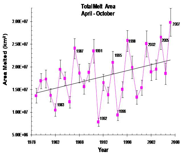
Greenland Melt Extent, 2007
Konrad Steffen
and Russell
Huff
Cooperative Institute for Research in Environmental Sciences (CIRES),
|
Passive
microwave satellite data are used to map snowmelt
extent and duration on the
CIRES is a joint institute of CU [ About CU ] and the National Oceanic and Atmospheric Administration [ About NOAA ] . Steffen,
K., S.V. Nghiem, R. Huff, and G. Neumann, The melt
anomaly of 2002 on the Greenland Ice Sheet from active and passive
microwave
satellite observations, Geophys. Res. Lett., 31(20), L2040210.1029/2004GL020444, 2004. Hanna,H., P.Huybrechts,
|
See Also
|
||||
