Colorado Mineral Belt
Geographic Setting
The Colorado Mineral Belt (CMB, a.k.a. COMB) is located in central Colorado, USA. It trends northeast from the San Juan Mountains in the southwest to its northeastern extent in the Front Range of Colorado near Jamestown. Most of the Colorado mining districts as well as many Colorado "Fourteeners" are incorporated in the CMB.
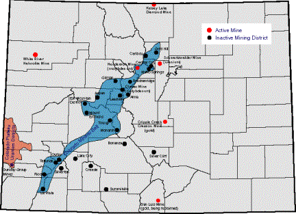
Colorado Mineral Belt shown in blue.
Image from the Colorado Geologic Survey
http://geosurvey.state.co.us/pubs/geohazards/docs/mining.html
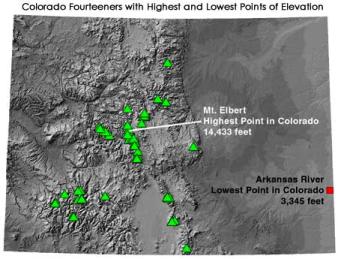
Image from the Colorado
Geologic Survey http://geosurvey.state.co.us/pubs/geol_hist/14ers/14ers.htm
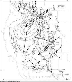
The CMB runs along a Proterozoic basement shear zone that defines the Colorado lineament (Cunningham et al, 1994; Mutschler et al, 1998). This lineament also served to facilitate some of the highest Laramide uplifts (Mutschler et al, 1987) that took place during the Laramide orogeny.
 |
 |
CMB and Colorado Lineament (Mutschler et al, 1998)
<- Introduction | Home | References | Tectonics (geologic setting), timing and ages of CMB ->