|
|
| Tucker Group Home | People | Research | Publications | Courses | Software | Contact Us |
| RESEARCH GROUPS @ CIRES > |
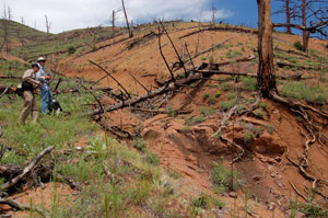
Francis Rengers and John Moody at the Spring Creek fire site
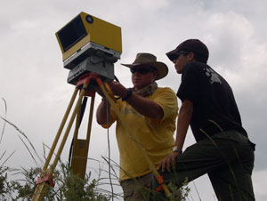
RESESS intern Emmanuelle Feliciano-Bonilla runs the laser scanner
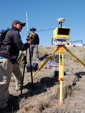
David Phillips (UNAVCO) and RESESS intern Fernando Martinez-Torres
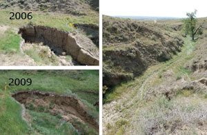
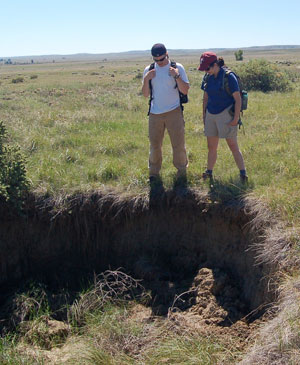
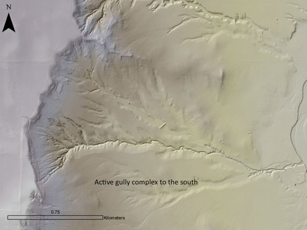
Andy Wickert and Mariela Perignon inspect a gully head at West Bijou |
From Peaks to Prairie: Two Natural Experiments in Decadal Landscape EvolutionSupported by National Science Foundation grant EAR-0952247, 2010-2013
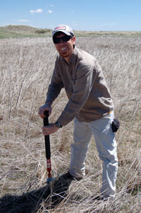
Francis digs for Cesium Investigators and Partners:
Numerical models of landscape evolution play a vital role in geomorphology, but there remains a pressing need to test these models against field data. We are developing two case studies for model-data comparison testing. The two case studies are sites of rapid, decadal landscape change. The decadal scale is particularly important because:
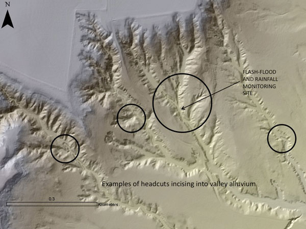
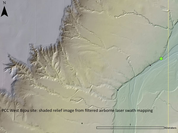
The study pairs two very different environments: a low-relief, semi-arid, soft-rock setting dominated by rapid gully erosion and scarp retreat, and a steep, montane, forested, crystalline-rock setting responding to a 1996 wildfire. The first site, located on the high plains of eastern Colorado, provides a unique opportunity to reconstruct erosion rates and channel growth patterns over a 70-year period. The second site, in the Colorado Front Range, contains an extraordinarily rich 14-year database of post-fire geomorphic response, thanks to intensive monitoring efforts by the U.S. Geological Survey. The project relies on a variety of methods, including aerial photo analysis, reservoir sediment volumes, 137Cs measurements, LiDAR DEM analysis, and oral history interviews. Modern hydrology and geomorphology are documented with a network of rain gauges and flow sensors, combined with biennial tripod-laser scans to measure rates of channel-head retreat (estimated at ~0.5m/yr). The two data sets are used to test a physically based numerical model of landscape evolution using a Monte Carlo calibration method. Related links:Hydrologic and Erosion Responses of Burned Watershed (USGS)
|