 |

|
| Tucker Group Home | People | Research | Publications | Courses | Software | Contact Us |
| RESEARCH GROUPS @ CIRES > |
|
CMG Research - Modeling River Basin DynamicsSupported by National Science Foundation grant EAR-0621199, 2006-2011 Investigators:
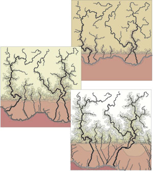
River basins and their networks occupy the vast majority of the earth’s land surface. Most of us live in a river basin and depend on its ability to gather water over a large area and focus it into a narrow channel. However, the same mechanism gathers sediment and contaminants and can produce floods. A fundamental research goal in earth-surface science (geomorphology, hydrology, sedimentology) is to develop mathematical (usually numerical) models that describe the formation of river basins over geologic time and their response to natural and anthropogenic forcing over human time scales. Within the last two decades, the potential for building, testing, and applying such models has advanced significantly thanks to three parallel developments.
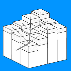
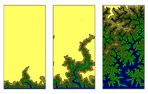
Because of nonlinearities in the governing equations, current models cannot, for example, handle an area larger than a few hectares at the resolution of a typical LiDAR image (1 m2). Significant coarsening is not an option because of the loss of important terrain characteristics. To address this obstacle, we are engaged in a collaborative effort between geoscientists and applied mathematicians, aimed at developing efficient numerical algorithms for solving the equations that govern the evolution of a topographic surface. A major emphasis is on the application of Discrete-Event Simulation methods to geomorphic and hydrologic models. Preliminary work on this shows that there is huge potential in this method for advancing computational geomorphology, sedimentology, hydrology, and related fields.
|

 First, the emergence of cosmogenic nuclide analysis allows us to measure millennial-scale erosion rates and their variability in space. Second, there has been significant progress in the development of rate laws for processes such as soil production and down-slope transport in specific environments. Third, rapid advances in digital mapping technology, such as LiDAR and synthetical aperture radiometry, are producing an unprecedented volume of terrain data that have a resolution comparable to the scale on which key transport processes operate. We now have the opportunity to construct models of landscape change that are grounded in the physics and chemistry of the governing processes, and able to address the dynamics of river basins on scales of tens to thousands of square kilometers. However, computational efficiency is now a key limiting factor.