 |

|
| Tucker Group Home | People | Research | Publications | Courses | Software | Contact Us |
| RESEARCH GROUPS @ CIRES > |

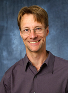
Greg Tucker
Professor of Geology
Department of Geological Sciences
Fellow, CIRES Council of Fellows
University of Colorado at Boulder
Ph.D. Penn State University, 1996
B.A. Brown University, 1988
I study the processes that shape the Earth's surface. As the 18th century founders of geology recognized, our planet's surface is continually sculpted by processes that obey the basic laws of physics and chemistry. Most of these processes can be seen in action on today's Earth. My main interest lies in discovering how the physics of processes like floods and landslides interact to shape the land surface, drive mass and energy across it, and determine how a landscape will respond to forcing from the atmosphere above and the solid earth below.
Much of my work focuses on river basins and their networks. The vast majority of Earth's population lives in river basins, relies on them for water, and must occasionally cope with the floods they generate. The structure and dynamics of river basins pose some fascinating questions. How might erosion and sedimentation patterns in a river basin respond to climate change? How do patterns of tectonic motion influence drainage and erosion patterns, and thereby create the distinctive terrain of places like the Italian Apennines, the Zagros Mountains or the Jamaican Cockpit Country? How does natural variability and heterogeneity -- such as the mixture of grain sizes on a streambed or the quasi-random nature of rainstorms -- influence river basin form and dynamics? My approach to answering these questions involves a range of methods, with an emphasis on mathematical modeling and computation. The task of creating, testing, and refining mathematical models of landscape evolution is among the most exciting challenges in the field. On the other hand, models alone are not enough. Understanding the physics behind landscape evolution requires careful measurement of processes, landforms, and rates of change. To fulfill this need, my research group uses a wide array of techniques, including digital terrain analysis, field surveying, ground- and aircraft-based laser mapping, luminescence dating of sedimentary deposits, aerial photograph analysis, sediment tracers, and process monitoring. Each of these methods yields insight into processes as well as data for formulating and testing mathematical models.
Recent Meeting Abstratcts (PDF)
Striking and slipping (Duvall and Tucker AGU Dec 2012)
Resonating with the climate (Godard et al. AGU Dec 2012)
Modeling on the Fringe (Langston et al. AGU Dec 2012)
Grains that Wear (McCoy et al. AGU Dec 2012)
Flooding the Arroyo (Perignon et al. AGU Dec 2012)
Lasers on the Burn (Rengers et al. AGU Dec 2012)