Vijaydurg (Gheira) Fort
Although the site was known to Ptolemy, the present fortifications date from the 17th century. The present fort has been much restored following 18th century battles. No substantial changes in elevation relative to sea level are evident since 1760 in the fort foundations or in the approaches of "Dockyard some 3 km to its south (described below). Marine archaeological studies, have revealed a 122 m long, 7 m wide undersea wall, below present day sea level. This has been interpreted as an artificial barrier constructed to impede the approach of hostile fleets. An alternative explanation is that it may have been a breakwater or a drowned harbour wall related to former lower sea level. The harbor lies on the hanging wall of the Vijaydurg fault.

Extracted from the Maharashtra Gazetteer: On the neck of rocky land that forms the south side of the bay, Vijaydurg, one of the best of Konkan fortresses, though not very striking from the sea side, rises grandly about 100 feet above the river. The walls, of very great strength and protected by twenty-seven bastions, rise, at their highest point, into a great round tower. On the west breached in several places by the sea, they are over their whole length loosened and ruined by trees and creepers. Their triple line of fortifications encloses about twenty acres, [Govt. List of Civil Forts, 1862.] overrun with bushes, but with some good wells and several large habitable buildings. [Bombay Government Gazette, 3rd July 1879, 699. In 1862, except a part of the first and third outer walls, the fort was in good repair. Water was abundant and supplies easily obtained. There were 278 old unserviceable guns Govt. List of Civil Forts, 1862.] The fort is probably old, enlarged under the Bijapur kings, and about the middle of the seventeenth century, much strengthened by Shivaji [Grant Duff, 85; Nairne's Konkan, 63.] to whom it owes its finest features, the triple line of walls, the numerous towers, and the massive interior buildings. [Nairne's in Ind. Ant. III. 320.] About forty years later (1698), Angre made it the capital of a territory stretching for about 150 miles along the coast and from thirty to sixty miles inland.
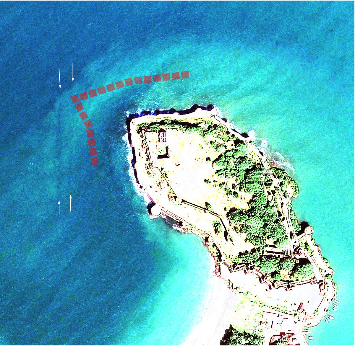
Ripata et al. (1998) show a submarine barrier approximately 100 m offshore. The Google Earth image reveals a north south structure approximately twice as far offshore as in their sketch (see arrows).
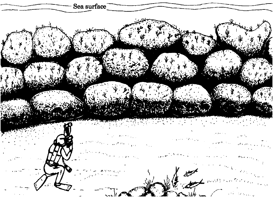
The 122 m long 7 m wide barrier is 3 m high and consists of blocks with dimensions up to 3.5x2.5x2.5 m. Tripati et al (1998) do not indicate its depth below sea level, and although their sketch implies its upper surface lies only 1 m below sea level, their map indicates it crosses an 8 m(?) contour which suggests that its upper surface may be submerged 5 m. The rough construction resembles more a breakwater than a submerged dock. Its present submerged state has led to its interpretation as a naval defense reef.
Angre's Dockyard c.1750
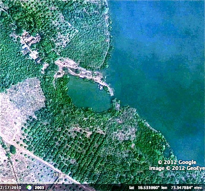
Extracted from the Maharashtra Gazetteer: Two miles from the fort, on the same side of the river, is an old dock, hollowed out of the rock by Angre, 355 feet long and 227 in the broadest part, and said to have been able to hold vessels of 500 tons. [Waddington's Report in Asiatic Journal, IX. 123.] Though nearly chocked with mud the stone face and entrance may still be seen. There was also a small building yard and a mast house. [In 1819, the bottom of the dock, sloping gently upwards from the entrance, was thick with mud and sand. The gateway, 23 feet broad below and 37 above, stood open without gates. Of the walls parts on the south and east were cut in the rock; the rest was of masonry in good repair. From the south-east corner ran a stone-built water channel. Lieut. B. Dominicette, 9th June 1819; Public Diaries 432 of 1819, 1055.]
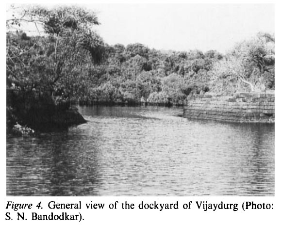
The dock is described in Tripati et al., (1998) who show a view of the entrance.
Sila Tripati, M. K. Saxena Sundaresh, P. Gudigar, S. N. Bandodkar (1998) Marine archaeological exploration and excavation of Vijaydurg—a naval base of the Maratha Period, Maharashtra, on the west coast of India, International Journal of Nautical Archaeology, 27(1), 51–63.