Deformation of the Western US
in response to the San Andreas initiation
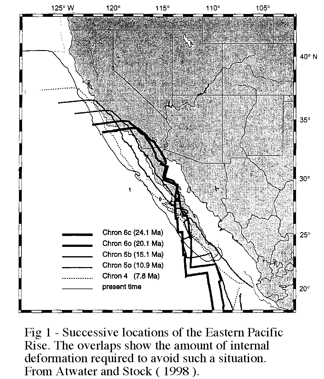
If the Western US is kept fixed and the global circuit reconstruction method is used to determine the position of the East Pacific Rise it can be seen that there is a significant overlap of the two ( fig 1).
If we accept that there cannot be a spreading center beneath a continent then it has to be deduced that the Western US has experienced a large amount of deformation in response to the plate interactions at its boundary.
There is indeed a plethora of literature that is concerned with deformation especially concentrating on the Basin and Range, coastal and offshore California and the San Andreas itself. These mainly deal with specific areas to unravel the geological tale for the past 30 Ma. The trick is to combine all the available data to reconcile the plate boundaries leaving no overlap and honor the majority of data found from smaller studies. This has been attempted by Atwater and Stock (1998) and the rest of this page will present their assumptions for Western US deformation which in themselves have been synthesized from many workers.
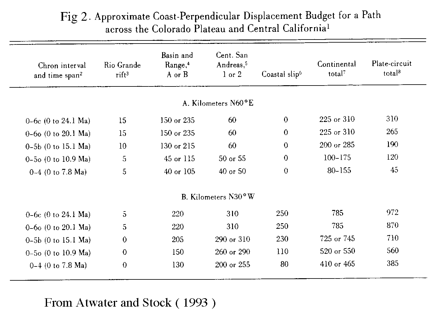
There are some large scale assumptions that can be dealt with first regarding the maximum and minimum deformation allowable. Looking at coast perpendicular ( assumed to be N60E ) deformation within the North American plate, it can be seen that this must equal or exceed the coast perpendicular motion calculated in the plate circuit solution. If it can be assumed that shear is caused only by the plate interactions and if an unknown quantity of that shear is accommodated offshore then the total deformation parallel to the to the coast must be less than that calculated for the Pacific — North American motion. When the two become fully coupled ( ~18Ma ) it should be expected that the coast parallel components should be equal. With these restrictions in place the following local assumptions have been made.
As can be seen, a juggling act is required to fit all the pieces of evidence together to firstly not contradict one another and secondly to fit the bigger picture, namely the plate reconstructions.
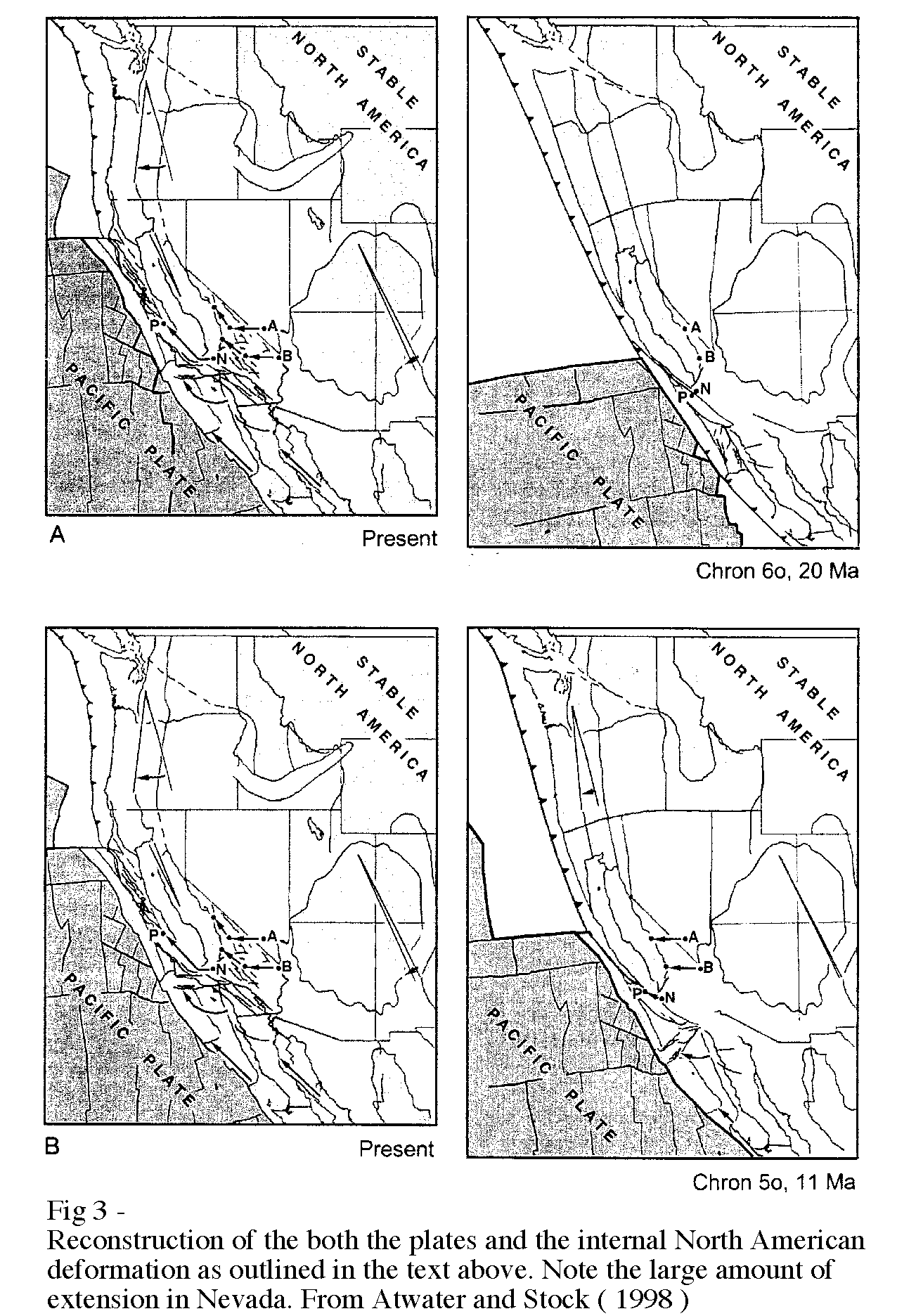
Figure 3 shows the evolution of the Western US as it was impinged upon and altered by the Pacific-North American coupling. However a far better understanding can be found from Tanya Atwater movies available to download from here although a QuickTime viewer is required.
| Intro | Slab Gap | Deformation | References | Disclaimer |