Documentation

CONTENTS
PBO H2O maps are map services created by the GPS Reflections Research Group for viewing GPS stations producing hydrologic products on a map via your web browser. These custom maps display both static and dynamic information. Daily data maps (e.g., Daily Snow Depth) display current and historical hydrologic data as derived from GPS reflections. This user guide describes how anyone with an internet connection and a supported web browser can use this free service on a desktop or laptop computer.
The following diagram describes the features available in PBO H2O maps.

  1. Basic Zoom Control - Use these controls to zoom the map
  2. Date Selector Menu / Additional Options - Use this to select a date on a dynamic daily data map
  3. Station Marker - This marker represents the location of a GPS station producing a hydrologic product
  4. Pan Control - Use these controls to pan and zoom to predefined regions
  5. Map Legend - This legend holds station marker descriptions. Clicking on marker descriptions toggles the display of that class of markers ON/OFF.
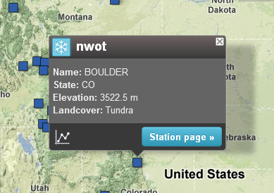
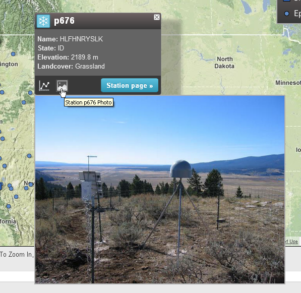
There are numerous ways to navigate around PBO H2O maps:

Drag Extent - By clicking and dragging with your left mouse button, you can drag and recenter the map


Selection Zoom - Hold SHIFT and drag with the left mouse button to zoom to a selection


Basic Zoom - 
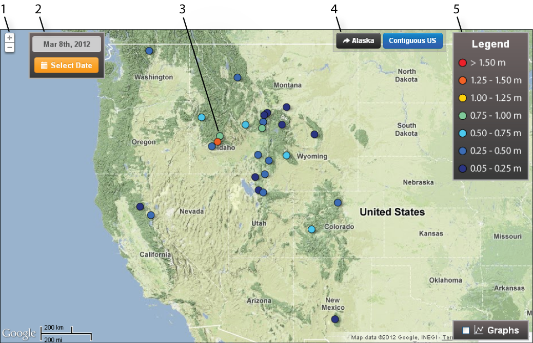
Use the zoom controls in the upper lefthand corner of the map to ZOOM IN/OUT from the center of the map


Other Zoom Options - You can double leftclick on the map background to ZOOM IN on the map. Similarly, double rightclicking (or CNTRL+doubleclick on a MAC) will cause you to ZOOM OUT.
Hover Information - Hovering your mouse over station markers will display the station ID on all maps. On some dynamic maps, additional hydrologic information (e.g., Snow Depth) will appear when hovering over a marker.


Opening Info Windows - Leftclicking on most station markers will open an info window describing that station.


Closing Info Windows - Info windows can be closed by clicking the 'X' in the upper righthand corner. Alternatively, opening another station's info window will close the current one.

Time Series Icon - Hovering your mouse over the time series icon in map info windows will display a data product preview graph for the station


Image Icon - Hovering your mouse over the image icon in map info windows will display a preview station image

Individual station pages are accessible via maps in two ways.

Via Info Windows - Clicking the 'Station Page' button in a station info window will take you to the station's page.


Rightclicking Markers - Rightclicking (CNTRL + Click on a MAC) on station markers will take you directly to the station page, circumventing the info window.

Opening the Date Selector - Dates for dynamic daily maps can be selected by clicking the orange 'Select Date' button


Selecting Dates - In the date selection dialogue, simply clicking on an available date will reload the map with data from that date. Unavailable dates are crossed out and not able to be selected.


Copyright © 2012 - 2024 GPS Reflections Research Group. All Rights Reserved. | Funding.
Supported Browsers: For best performance, use the latest version of one of the following browsers: