
-
Data Products
- Data Products
- Snow
- Vegetation
- Soil Moisture
- Water Loading
- Documentation
- Outreach
-
Contact
- Contact
- Reflections People

 Active
")
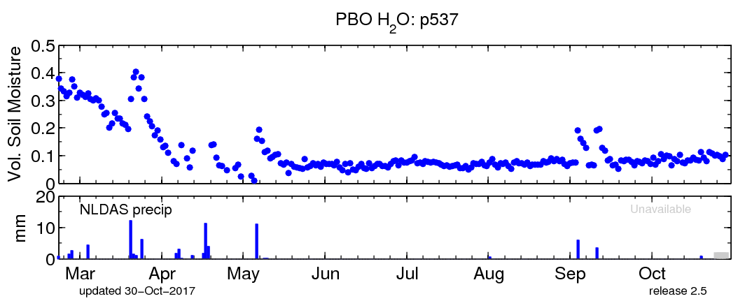
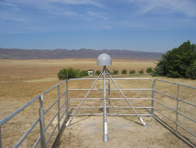
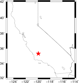
Station p537 |
|
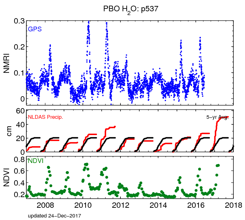
 is a simple optical indicator that can be used to analyze remote sensing measurements and assess whether or not the target being observed contains live green vegetation. provides a model-generated forcing data set. is a measurement of the amount of water contained in snow pack. It can be considered as the depth of water that would theoretically result if the whole snow pack instantaneously melts. Snow Water Equivalent is the product of snow depth and snow density. It is usually presented in units of either kg m-2 or m. in a soil (also called the volume wetness or volume fraction of soil water) represents the fraction of the total volume of soil that is occupied by the water contained in the soil. It is usually presented as a percentage.


 PBO H2O Contacts