Until the Well Runs Dry
Satellites reveal global groundwater depletion
By Kristin Bjornsen
Imagine having a bathroom scale that not only told you how many pounds you've gained or lost, but also told you exactly where on your body that weight change occurred—a few ounces shed from your arms, two pounds added to your midsection, one pound packed into the saddlebags. Now imagine the scale did this with incredible sensitivity—a couple milligrams lost from pared fingernails, an eyelash that fluttered away.
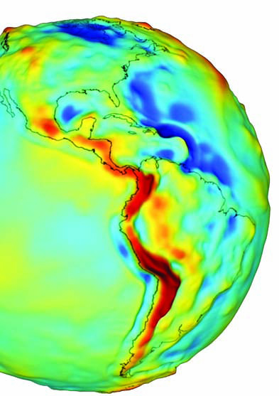
While it's debatable whether anyone would want such precise measurements of their love handles, that's what the GRACE (Gravity Recovery and Climate Experiment) satellites do for Earth—measuring changes in mass at any region on the planet. The data from GRACE have proven invaluable for monitoring such phenomenon as the melting of the polar ice caps, rise in sea level and even changes in groundwater.
Until now, monitoring groundwater has been notoriously tricky. The traditional method—point readings of individual wells—is laborious and unreliable, since a single well may not be representative of the entire aquifer. Using GRACE, however, CIRES Fellow John Wahr and his colleagues are studying groundwater in ways never before possible and are revolutionizing the field of hydrology in the process. For the first time, scientists can reliably measure total changes in a region's groundwater.
The results have been eye-opening. Wahr and colleagues, along with researchers at the University of California, Goddard Space Flight Center and other institutions, have discovered that in places like northern India, North Africa and California's Central Valley, humans are drawing out groundwater faster than it's being replenished. The disparity could have disastrous results for the more than 1.5 billion people who depend on it for drinking water.
Launched in 2002, GRACE consists of two twin satellites, each about the size of a car, that travel in identical orbits. As they circle the planet, they measure
subtle changes in Earth's gravity field (see "How Grace Works"). This allows scientists to map regions of greater and smaller mass—for example, the Himalayas versus the Mariana Trench, respectively. By comparing the data month to month, they can determine how that mass migrates with time.
Since 2002, the biggest mass changes recorded by GRACE have been ice melt in Greenland, Antarctica and Alaska. "But another dramatic long-term mass change we've seen is in northern India, Pakistan and Bangladesh," Wahr says. "It's a huge mass loss, and it's due to farmers pumping water from the ground for their fields." This area is the most heavily irrigated region on Earth, with more than 75 percent of it irrigated. According to Wahr and his colleagues' calculations, from 2002 to 2008 the region lost 44 million acre-feet of water annually—enough to submerge the entire state of Oklahoma in a foot of water each year.
Researchers at the University of California have also observed dramatic drawdown in California's Sacramento-San Joaquin Valley, where from 2003 to 2010, aquifers lost 25 million acre-feet of water. GRACE has detected groundwater depletions in North Africa and northeastern China as well. "It's a serious problem," Wahr said. "In India, the wells are drying up, and some people are having trouble getting enough to drink." Wahr's results have garnered attention from policy makers, with Indian leaders even discussing the findings on the Parliament floor.
Nevertheless, many traditional hydrologists and water managers have been skeptical of the satellite-based findings. "It's a radical idea to think you can measure 1-centimeter changes in groundwater from space—that somehow the satellites up there can see water beneath the soil," Wahr said. "Even though I've been involved with GRACE from the beginning, it's still staggering to think about what you can accomplish. But once you understand how GRACE works, you understand how fantastic the methodology is."


