|
 A red letter day. Our first day of August is our last day with Matt, it is the day of our resupply, and it will prove to be the easiest day (in terms of uphill) of any hiking day (only the day when Megan climbs Whitney while I stay in camp will be easier, and then just for me). Our camp will be the lowest of the whole trip.
As before, we had a pretty good dew on everything last night, so we're trying once more to dry out some before leaving. With the big downhill, we aren't feeling too pressed for time. I go to collect the laundry and, to my great surprise, it is dry. Go figure.
While we are packing up, a somber note enters our camp. A couple of men come up from the lower camps looking to see if we have a sat phone. No, I said, but we do have a device for sending and receiving texts and emails. We also have that, they said; it was a satphone they were hoping for. A hiker camped across the lake from us had passed away in the night and they are trying to help out in contacting the authorities. Although death in the mountains isn't terribly uncommon, usually it is something more violent, like falling off a cliff or dying of hypothermia. Of course, this does happen. Joseph LeConte, the first Professor of Geology at the University of California, died of natural causes on his last visit to Yosemite (there is still a memorial to LeConte, co-founder of the Sierra Club, in Yosemite Valley). Still, it is a bit of a shock to hear of someone who hiked up to a lake about 10,200' up and then died in his sleep.
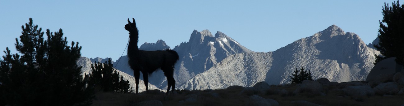
After we had enough attempts to dry things out (the sun was late rising here as we are in the shadow of Mt. Senger), we finally get everything loaded and ready to go about 10:30. Since we are heading down, Matt stays with us this time. Just as we are getting ready to go we hear a commotion near the lake--several people are splashing into the water. As we head past them we realize it is a Boy Scout troop. Several of them are pointing out the llamas, though the strangest call is one claiming they were camels.
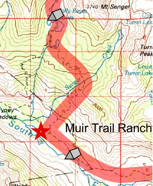
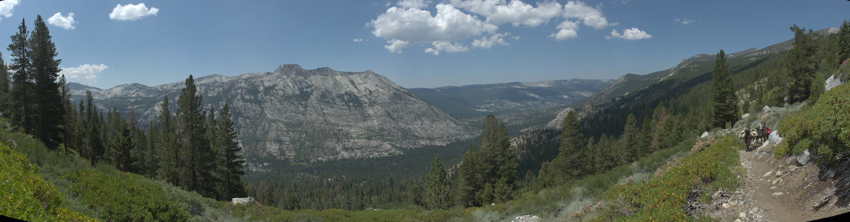
We continue down, passing a meadow we hadn't noticed at the far end of the lower lake (so that would have been an alternate campsite last night). The trail wanders lazily through forest before actually climbing over a moraine to head east to Senger Creek. Once we cross that, we get a view down into the San Joaquin canyon, with Blayney Meadows and the Muir Trail Ranch visible far below. Now the trail heads down steep switchbacks in the direct sun with little shade provided by the manzanita, the flip side of our 2000' climb a couple of days ago and a far more pleasant descent than ascent. While we are on the switchbacks we see a helicopter flying around, which we suspect is to deal with the death at Sallie Keyes Lakes. As the valley bottom nears, we hit a junction with a cutoff to Florence Lake; this is our route to the Muir Trail Ranch.
This trail descends even more steeply with little interest in switchbacks, so it is a bit of a relief to reach a junction with the main Florence Lake trail. Matt initially thinks that we will part company here, but I think there must be a more direct trail from the ranch, so let's keep on going together. The ranch trail continues down and then splinters, a branch heading to hot springs, one to the entrance for backpackers. The third probably goes around the ranch and on to the Florence Lake trail (which in essence becomes a road used by the trail ranch).
We wind down to the gate at the ranch. I had already been warned not to bring the llamas through, and given there is a big corral full of horses just inside, this is wise counsel. We tie up the llamas just outside the gate and I head in to get our buckets. The resupply area is bustling: tables have been set up under canopies and hikers are busily spilling out the contents of their buckets and jamming them into their bear canisters or backpacks. A shed houses most of the buckets; a peek inside reveals probably well over 100 of the buckets. A woman there asks my name and then asks if I had dropped the buckets at Florence Lake. She retreats into the shed and comes out with one bucket; the other two, she says, are elsewhere. I take the one while she goes to get the others. Soon we have all three buckets. We unload the bear boxes and put out our tarp and start to contemplate restocking for another 13 days.
We have other chores here. They have a power strip in a plastic tub. I go to recharge my camera battery, having brought the AC charger as I suspected that the solar charger would not work for this battery (it did not later on when I tried). I also go ahead and charge my phone. We can get rid of trash here, for which I am grateful: I had started by putting all trash in a single large trash bag and it is now both bulky and unpleasant (going forward, "dry" or clean trash will go in a ziploc and gunky trash a separate ziploc, with both being squished down so I can put them in the bear boxes). There is a small store; I am hopeful there are snacks because we ate our first half of M&Ms in under 10 days, so the other half in our resupply isn't really as much as we want. Unfortunately, they do not stock any food. They have medical supplies (though I forget to ask about tincture of benzoin--a huge problem I've had is that most of the bandages I've used on the blisters have pulled off the skin and gotten attached to socks), gloves, batteries, and will sell internet access on a computer. Megan wants better gloves, so we buy a pair, and I get some additional blister repair stuff.
I had arranged one treat for us in the resupply: a can each of Pringles potato chips. I had mentioned this the day before to Megan, who was a bit down on the resupply, and she looked at me with the concern of a child to her doddering parent who probably did the wrong thing: "what kind?" "Sour cream and onions" I said. She gave a hint of a smile; I had remembered her favorite flavor. So we each had this bounty of bad calories to consume. Megan's would barely last another day. I managed to limp along on my tube for a few days more.
The other exciting facet of this place are a series of tubs with things other hikers decided to part with. The tubs are labeled; you can add or subtract from tubs. I rummage in hopes of finding a better sponge, but have no luck. There is no candy in these either; that seems the one food item that nobody has an excess of. Megan does better: she scores a few packets of oatmeal that she likes and, more importantly, gets 2 Snickers bars courtesy of our old acquaintance Nick the marine (apparently he had them in his resupply; he had slipped behind us again because he and his buddy spent two nights at Vermilion Valley Resort, which says something about our speed). Next to the tubs are more tables where more hikers repacked or exulted over the loot they got out of the tubs. For the backpackers, the final chore is often to use the scale on the building holding the tubs to see how heavy their packs now are. We of course have no need, both because the llamas are carrying our stuff and we have 2 scales of our own.
I had brought enough freeze-dried food to make it through if my field burritos had to be abandoned; since they have worked well, I was planning on pitching some into the trading buckets, but Megan is insistent that these are expensive and we shouldn't just toss them away. So all I get rid of is a partial tube of jelly, and I throw out some of the older vegetables (the new ones in the resupply are in pretty good shape). Jamming all this in our boxes is impossible, though I get most of it in. In the end, the panniers are 35 lbs each.
As we are eating lunch and repacking and all that, Matt prepares to leave, taking the few items we had put on the llamas and offering any of his remaining food to us (I take the excess lemonade mix). We say our goodbyes, and Matt heads back up the hill to the junction with the Florence Lake trail as people here said there was no path through the ranch (looking on Google Maps, I think they were wrong--an unmarked trail that Megan nearly took would take you around the trail ranch, avoiding a significant uphill). [Much later I learn that Matt ended up meeting the survivors of the party with the death at Sally Keyes, the adult son and a female friend--apparently they had been backpacking for awhile along the Pacific Crest Trail and were actually nearing the end of their trip when the father passed away. Matt ended up driving them down to Fresno once they all crossed Florence Lake on the ferry.]
 It is well after 3 pm when we finally have recollected the charging items and loaded the panniers on the llamas. The 70 lbs of food goes on Sarek, the biggest of our llamas, and so shifts about everything else. I ask where a good spot with grazing for the llamas might be and am told that 15-20 minutes up the trail there is Shooting Star Meadow; they say it is popular but there are lots of camps. Unfortunately we are much faster than 15 minutes to that spot, and because I expect more meadow to be visible, we walk on by. By the time I figure out that we have indeed blown right past it, we decide to continue. We suspect Nick and his buddy will be at Piute Creek at the entrance to Kings Canyon, and I figure that we can probably manage something there (the Park Service grazing guide says there is some forage there). We struggle along, keeping an eye out for a campsite, when Megan points out some flats to the right with some grass. We detour over and find several campsites, taking one with a firering near 4:30 pm. After we unload, Megan finds another site by a big rock nearby, but I nix carrying all the gear over there; the existing site is fine.
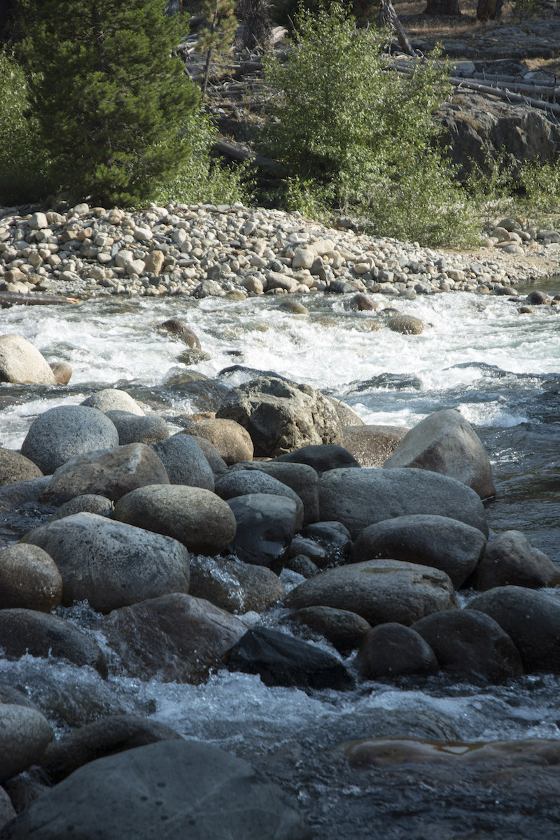
The site is above the South Fork of the San Joaquin; it turns out that reaching the river isn't trivial because there is a bit of a cliff below our site. I go upstream to fill the water bucket, first to water the llamas and then to have water sitting in camp so any sediment could settle out. Megan goes downstream to take a dip in a quieter part of the river and then lays out on a big rock in the sun. The grass is pretty thin where we are; Megan's scouting also found some better grass, so we move the llamas; I will move them a couple more times before the sun sets.
With the trail out of view, this feels like the most remote spot we have camped at; we have no idea where the nearest other campers might be, but I'd guess we're halfway between groups near Shooting Star Meadow and Piute Creek. Although we haven't camped directly near anybody since our first night with Matt near Quail Meadow, we knew folks weren't far away either because we saw them across the lake at Sally Keyes or because we saw them hiking past at Bear Creek. Not so here. The number of sites here is a bit of a surprise (there is another one down to the east near the river); I suspect that hunters might like this area in another couple of months because we are where hunting is legal, just outside the park.
Dinner is a Thai meal with coconut milk for Megan while I make two of my burritos. We can have a fire here, so I start one, but Megan heads into her tent pretty early on; she is tired. So it is getting dark when I finally go to hang the excess food, toiletries and grain. When the line slips off the tree, I decide I'd just go for a classic hang (i.e., tie everything to the rope, pull it up and tie it off somewhere else); as earlier, I suspect that we'll be OK as far as bears, given our position outside the park. I finally can sleep out again, so I enjoy the fire awhile before retiring for the night. This was kind of a strange day, between the death at Sally Keyes, Matt leaving, the resupply and all the hubbub at Muir Trail Ranch, and finally our search for a campsite. The two of us are on our own again.
There is something mildly odd about having met up with a friend after a week on the trail, had him walk with us for several days, and have him leave--and we still have not reached the halfway point in our journey. It underscores just how long this trip really is.
This is our last night in Sierra National Forest. We will spend nearly the entire rest of the trip in national parks. Greg had suggested that outside of the park, the llamas' presence would discourage bears from bothering us because in the fall, stock parties are frequently hunting parties and they tend to have bear tags. In contrast, inside the parks, being part of a stock party might actually be more of an invitation to bears. Many stock parties in the past have had aromatic food and some have been bad about keeping their camp clean. So I expect in the next few nights, until we can get all the food and trash in the bear boxes, that we might risk seeing some nightlife we'd rather not see.
Day 10. 4.8 mi to cutoff to MTR, 0.6 to Florence Lk trail, 0.25 to MTR (out and back), 1.3 to camp; 10,200' Sallie Keyes camp, 9980' low point, 10,120' high, 7660' MTR, 7910' saddle, 7790' low, 7840' camp.
7.2 miles, 2360' net elevation loss, 440' total elevation gain
Total to this point: 80.7 miles traveled, 15,170' total elevation gain.
prep | 0 | 1 | 2 | 3 | 4 | 5 | 6 | 7 | 8 | 9 |10 | 11 | 12 | 13 | 14 | 15 | 16 | 17 | 18 | 19 | 20 | 21 | 22 | coda | CHJ home