|
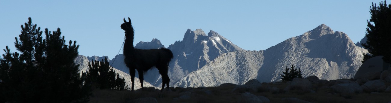
 The peak of the Perseid meteor shower is a disappointment for me. I awake about 2:30 am and spend the next half hour shooting pictures. No obvious meteors that I see in the direction I am shooting (one out of view was pretty good, though), though later examination of the pictures turns up a couple of streaks I first think are meteors. But comparing photos taken back-to-back-to-back reveals the streaks to be satellites. Not overwhelming, unlike a night I remembered from my previous Whitney backpack long ago.
Going back to sleep is easy, but awakening early is not. At 5:50, nearly an hour late, I realize that things are getting pretty light. I struggle up and start rushing about, heating Megan's oatmeal water, collecting my gear, etc. Even though I am quite late, we manage to slip out of camp at 7:20.
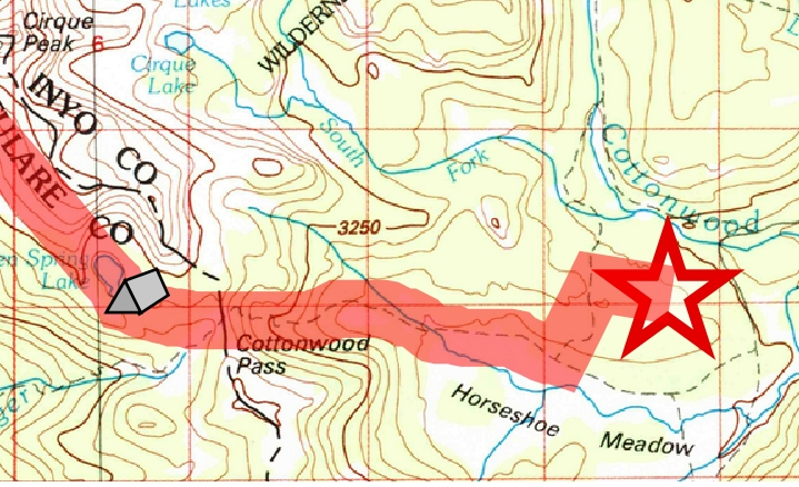
Covering the trail down to the pass goes quickly, and at the pass we scan the horizon for the fire. Flames are not visible, but smoke rising to the left of Horseshoe Meadows reveals the fire's location. (This is when I realize my photos last night missed the actual fire). We start down the hill, but our trail is weak and hard to follow. Soon it becomes clear why: we had missed the trail's northward swing right at the pass. Fortunately we can contour over and pick up the trail without much grief.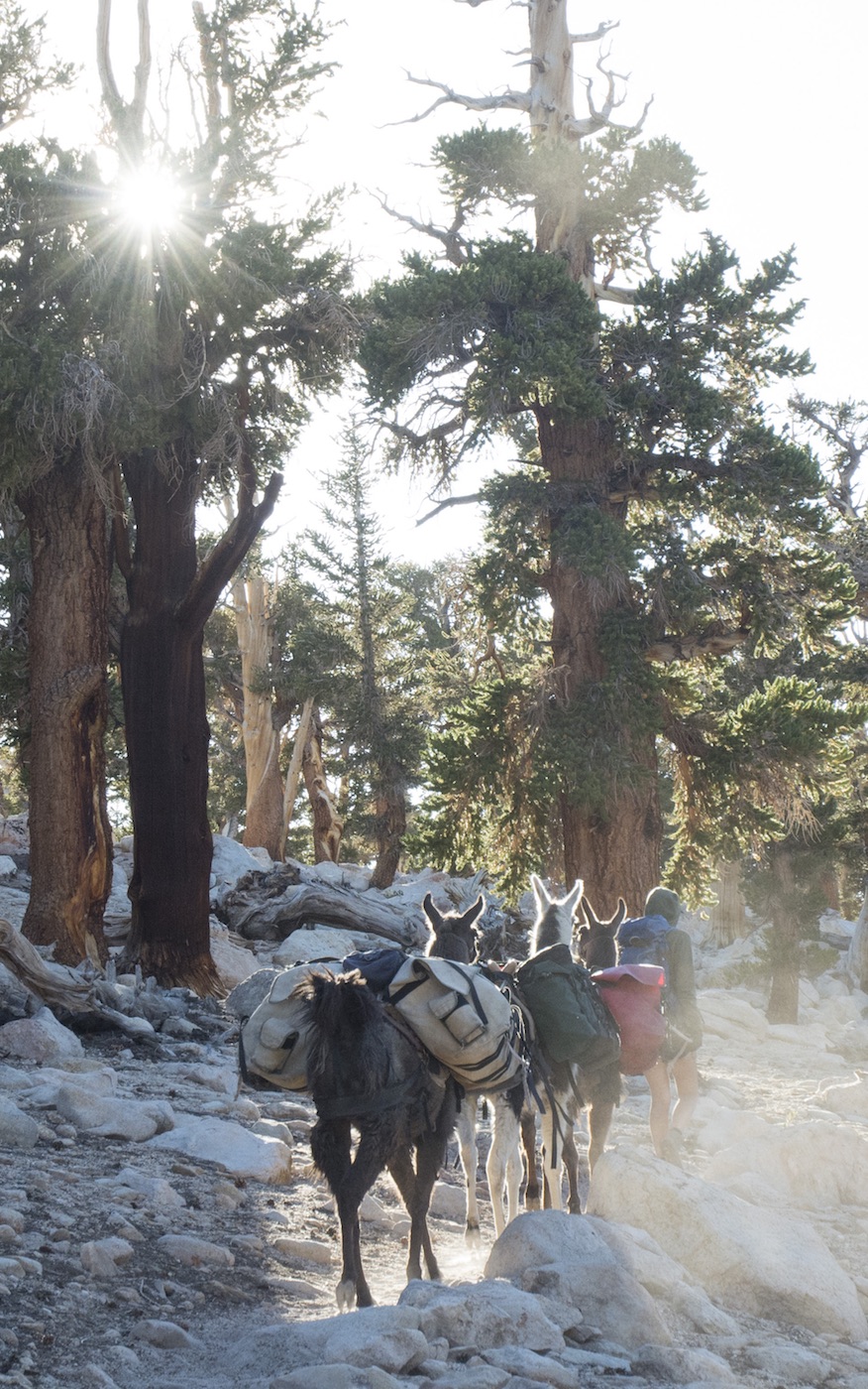
We have fine views of the meadow as the trail switches back and forth. I begin to think we will never reach the level of the meadow, but finally the trail swings off a small hill and parallels the meadow. Our descent is now gentle and it is just a matter of plodding forward. We finally reach a trail junction. The hiker trailhead is ahead of us, the equestrian one to our left. I decide we should be at the equestrian one and send out a message that this will be our pickup spot. The trail rises up a wide moraine; soon we pass the back side of a large stable; some men there gesture that the trailhead is a bit farther. Soon a spur trail heads to the right and we find ourselves in a stock campground. I send a message at 9:24 "Llama, meet road. Road, meet llama." We are out at a time when we usually were just getting started.
I scout while Megan sits at a table. The campground is for stock users and so most sites have a small corral. I am surprised to see so many are in use; I thought everybody had left. Crossing to the entrance, I find a spot nearer the road where we will be very visible, so I go back to get Megan and the llamas. Megan discovers she sat in some tree sap and is kind of disgusted, but there is little to be done about it now. We walk around to the entrance area where there is another small corral. We unload the llamas but leave the saddles on in case we have to move again. I plan on heading down the road to be sure that Greg doesn't miss us, but first want to change clothes. A nearby restroom, disgusting as it is, is my first change of clothes while standing up in a long time. While I am getting ready to head down the road, we see a pickup with a trailer pull into our area. It says Potato Ranch on the side and has Greg at the wheel. We have all made it, us after an early morning, Greg after a really really early morning, rising about 2 am back in Sonora.
Greg is armed with snacks, which we eagerly explore. Meantime the saddles are removed, the panniers and other gear put in the rear of the pickup, and we are off. We just miss one escort down canyon, so we have to wait awhile before we can make our way past all the firetrucks and see where the fire had started.
The rest of our day is anticlimax as we pass the guard at the base of the road and head up US 395. A stop at a Mobil minimart provides Megan and I the chance to get some snacks we really longed for. I take over driving so Greg can get some rest; our next stop is the Mobil restaurant Greg had lauded at Lee Vining. After that, Greg takes over as we pass through Bridgeport and then over and down Sonora Pass. My choice of meal (pizza slices) proves a poor one for mountain driving, and I am a bit green as we make our way down, but somehow hold together until we reach Potato Ranch once more. After posing one last time with the llamas and pitching away our trash and other undesirable leftovers, we throw everything into our car and head out, eager for showers and soft beds.
Day 22. 0.6 mi. to Cottonwood Pass, 4.1 mi to equestrian trailhead, Horseshoe Meadow; 11,250' Chicken Springs Lake, 11,150' Cottonwood Pass, 9970' Cottonwood Lakes Jct, 10,120' trailhead jct, 10,040' trailhead.
4.7 miles, 1210' net elevation loss, 150' total elevation gain
Total for the trip: 201.2 miles traveled (210.8 for Megan), 38,340' total elevation gain (41,260' Megan).
prep | 0 | 1 | 2 | 3 | 4 | 5 | 6 | 7 | 8 | 9 |10 | 11 | 12 | 13 | 14 | 15 | 16 | 17 | 18 | 19 | 20 | 21 | 22 | coda | CHJ home