|
I have had an uneasy night sleeping: it is cold, and although my sleeping bag claims to be good down well below freezing, that claim means it will stave off death so long as you can shiver through the night rather than it guarantees a pleasant slumber in the cold. Oh well, I do find positions (usually flat on my back) where I can fall asleep and be reasonably comfortable. We may be lower than Wanda Lake, but the clear skies have allowed for a lot more cooling.
When I finally rise, before dawn as usual, I find out why things were so grim. There wasn't dew, there was frost. And it isn't just on the top of the tarp I slept under, but on its bottom and the top of my sleeping bag, which is somewhat damp. Well, this is why I brought the heavier fiberfill bag instead of a lightweight down bag, so it could have been worse.
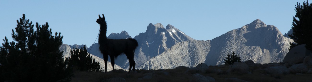
If I needed any confirmation of the nighttime conditions, the llamas' water bowls provide it: they have a film of ice on top. The llamas, though, are unperturbed, as usual.
Sunrise is earlier than yesterday but still can't come soon enough. I have spread out my wet sleeping bag and tarp (having scraped off as much frost as possible) and look forward to shedding some clothes. Megan's tent's fly joins my stuff once she emerges from her tent.
Even with the extra time spent trying to get things dry before packing them, we are able to get off about 9:30 again. While I am getting on my sunscreen and boots, Megan and the llamas start to diagonal up the hillside in the general direction of the trail. As I catch up, I wave them to angle up higher. I can't exactly find the path I thought would be best, but manage to get us going pretty well towards the trail's low point. Crossing the creek near the campsites turns into a bit of a circus as the llamas stall out and kind of encircle Megan. I go around them and help to get everybody pointing up the trail.
For quite awhile the trail is a steady climb, passing through meadows once we clear the pine forest above the upper end of the lake. Right below Mather Pass we first encounter real switchbacks. Although the climb is modest--only about 1200' or so from where we got on the trail--it is enough for me. So I am not eager to go beyond the low point for today, which is where we cross the South Fork of the Kings River. In contrast, Megan is hoping we go to Lake Marjorie, in part because it is, well, a lake, which she likes, but it is also partway up towards Pinchot Pass. It turns out that she, unlike most folks, prefers to climb late in the day. She says in the morning that she isn't really warmed up and stretched out for hard climbs. Since the grazing guide sounds potentially pessimistic about grazing near the South Fork of the Kings, but is equally iffy for Marjorie Lake, I am inclined to aim for lakes below Marjorie that sounds like they have lots of good grazing.
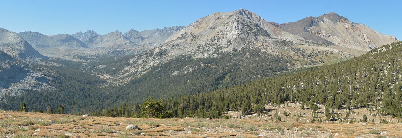
Actually looking south from the pass tends to confirm this bias. We can see all the way to where both the Bench Lake Ranger Station and the area around the lakes just above the station should be, and the large open grassy looking areas we can see look very promising (they are above the thickly forested area at left-center in the photo below). We can nearly see Pinchot Pass itself from here, and the peaks beyond are probably on the Sierran crest near Baxter Pass, not far from our camp night after tonight.
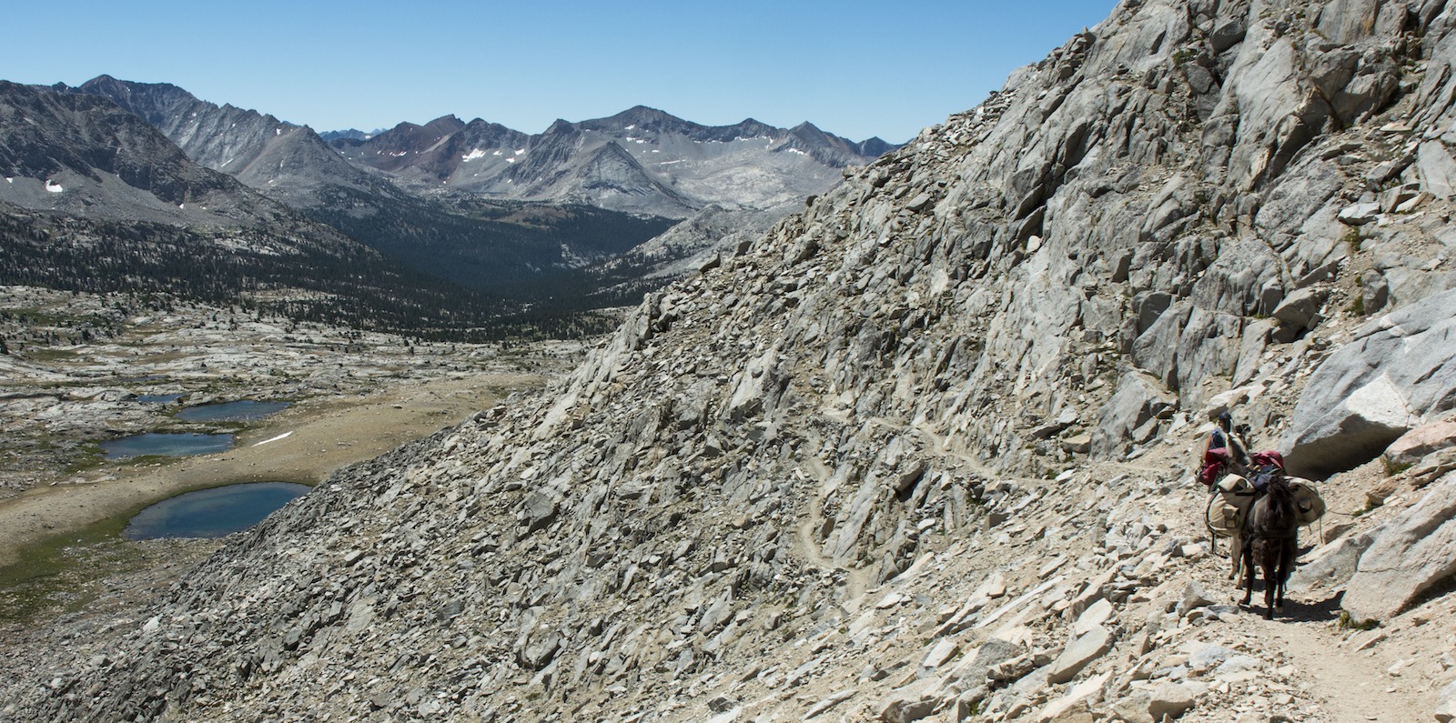
Mather Pass is a bit narrower than Muir Pass, and you can find a spot to sit and look both ways. It is still wide enough that there is a nice flatish area off the trail where we can park the llamas while we eat a snack--it is only 11 am. The Palisades are now to the north, in our rear view mirror, and we can now see Mt. Sill, a peak I climbed long ago. The Upper Basin of the South Fork of the Kings lies in front of us, promising a long fairly flat stretch of trail once we descend the switchbacks snaking up the steep southern side of the pass. About a half dozen people are sharing the pass with us. I think here is where we first encounter people who have actually seen other llamas on the trail; to this point, we are a total novelty. Now we are sometimes asked if we are the same group as that group people saw much farther south (it seems a strange question; after all, we are heading south, so we didn't come from the south).
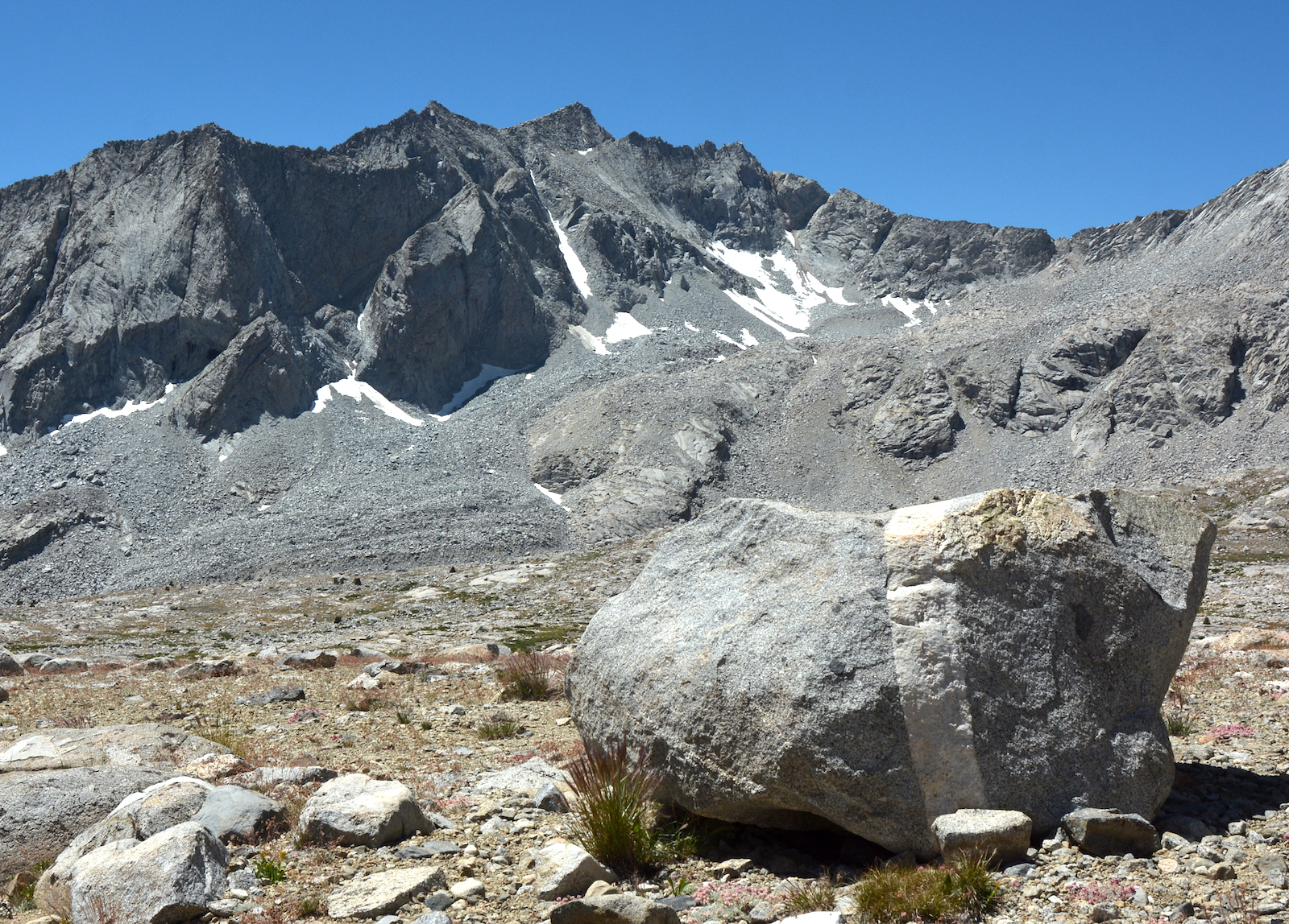
After a few quick switchbacks, the trail makes a big swing out to the east to drop us onto a low medial moraine that we will follow through Upper Basin. To the right of our path, the serrated summit of Vennacher Needle rises up, a wonderful backdrop for many photos. To our left, the deeply eroded molar of Split Mountain caps the Sierran crest. To its north (our left) is a gentle and inviting col that curiously lacks a trail, the reason being that the far side is a cliff. An even broader col to the south will host the next trail across the Sierra (and the first we have encountered since the Bishop Pass trail near the LeConte Ranger Station).
We wander down to a spot just before the trail crosses the South Fork--here a small stream--and sit for lunch. Some other folks are pausing on the other side of the creek. After perhaps a half hour we rise to continue our journey, Megan leading the reluctant llamas across the river. We chat from time to time with some of the other hikers. This is probably the section of trail least likely to have people hiking for only a few days: we are two passes from the nearest easy trailhead in, that being the route over Bishop Pass; Taboose Pass (the col ahead of us) is a 6000' slog up from Owens Valley that most hikers will choose to avoid, and although the South Fork will descend to the roadend at Cedar Grove in the one developed part of the park, the trail from Cedar Grove has to cross Pinchot Pass, ahead of us. Our fellow travelers here are more likely than not doing the Muir Trail or a big hunk of it. It is a noticeable change from the people we saw back near Muir Trail Ranch.
One pair we talk to are a couple of older fellows taking a midday break under some trees near the edge of the forest. They are planning on camping at Marjorie Lake, so they will probably pass us later in the day. That is kind of the yin and yang of our travels: we are faster on the trail, generally, but we are off the trail more than most backpackers. Later on, just past the last crossing of the South Fork, we meet an unusual group as one woman is carrying her chihuahua in her pack. You kind of think that some bear may thank her for the hors d'oeuvre.
Now in the forest, we descend a bit more steeply. The trail doesn't dip nearly as low as yesterday, thankfully, bottoming out near 10,000', so no wood fires are a possibility here, as a sign on the trail reminds those who might be coming up the abandoned trail that heads down the South Fork to Cartridge Pass. We instead climb up, switchbacking at times in the forest. As we get close to the lip of the valley we realize that the rake we use for spreading out llama droppings is missing; it is usually lashed on the outside of one of the panniers. My job in the rear is to recognize when things have fallen off, and Megan reminds me that I must have been derelict in my duty. Joy. Well, so I start to head back down the trail. After descending several switchbacks I figure that I'm not likely to find this thing, so I turn back. Megan, in reflecting on our journey, suspects that the rake was scraped off the pack when we had to divert around a downed tree. Regardless, I am now responsible for spreading out llama droppings with whatever tool I choose to use.
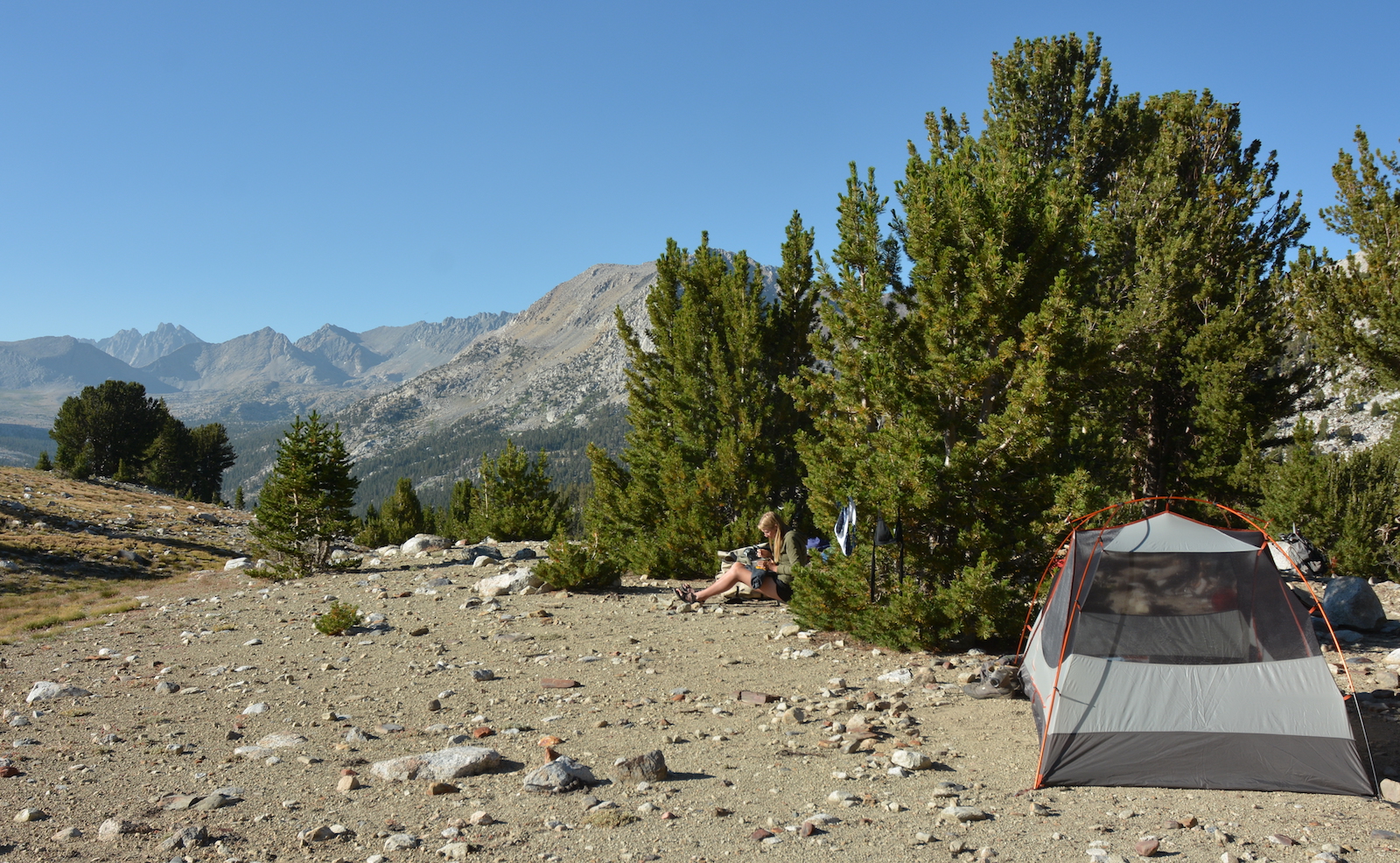
We find the trail to Bench Lake a short distance farther up and a sign and note with directions to the Bench Lake Ranger Station, which is, rather curiously, the opposite direction from Bench Lake. We meet some folks coming down who say that the lakes above have great water and some good campsites; this is reassuring as we have just passed through a couple of very marginal sites in some trees above the first lake beyond the ranger station. As we approach a stream draining the second lake, a faint trail on the right of the stream suggests some decent campsites might be above us. A short walk brings us in view of the lake. All around is the kind of grass we prefer for the llamas. Pines are grouped in clumps on our side of the lake. We tie up the llamas and split up, I look south and Megan looks north. When we compare notes, we find we both have found a nice campsite and it is hard to say which is better, so we now visit each other's find. Megan's site sits on a hill to the north of the lake and has a commanding view of the upper South Fork basin. Fallen logs provide nice seats and there are ample spots for tents. We decide that is the better site; had there been a howling wind, the site I had found would have been better. Soon the llamas are grazing in, arguably, their most scenic meadow of the trip (the photo on the top of all these pages came from here). While Megan prepares to set things up, I decide to visit the ranger if for no other reason than to alert him to our missing rake.
On the way down I meet the two older fellows we saw earlier. We had told a couple of folks heading north about the rake, and they apparently passed on the word. They had heard of this on the far side of the South Fork and not seen the rake, so it was just as well that I cut off my search when I did. I thank them and continue toward the ranger's cabin. The directions at the trail junction said that the cabin was at the edge of the meadow by the first lake, but this isn't necessary coming from the south because you can see the structure from the trail. So I angle out across the meadow, aiming to hit the stream below the wet part of the meadow, and I find that I am coming up on the back side of the station. So I walk around and find the ranger apparently in the early stages of preparing his meal. It seems the structure I came around is his work area, with a small stove inside and a table and chair, while a nearby tent is, I guess, his sleeping quarters.
It turns out that this is an off day for Ranger Bob, but he is happy to chat a little. I tell him about the rake, and he says it will probably get up to him eventually; it doesn't seem to bother him that we lost it. He asks about the ranger at McClure, whom he has known a long time, and I said that he seemed to be doing fine. I ask if there is any news on the weather forecast and it sounds the same: dry and cool. He says tonight will be another really cold night, and he for one is delighted to finally be rid of the mosquitoes that have plagued him for weeks. I mention the new cabin at LeConte and he laughs a little, noting that that ranger not only has the nice new cabin but his girlfriend is there too. He tells me I should really check out the cabin at Rae Lakes, which was built on the same plan. He notes that we'll pass by that ranger, the Charlotte Lake ranger, the Tyndall Creek ranger and the Crabtree ranger before Whitney and Rock Creek after that. Hearing the radio, I note that it seems the radios have gotten a lot better than when I was doing field work in 1988 and borrowed a radio; he agrees that the digital radios are better, but he then taps a satellite device and says that the satellite thing is really his best security as there are still plenty of places that the radio repeaters fail to reach. I ask if the rangers still only get the one big food drop at the start of the season, and he confirms it and notes that all his tasty stuff is gone, except he has been fishing and shows me a large trout he is preparing for dinner. So its not all bad for him. I thank him for the information and apologize for bothering him on his day off and head back to camp.
Camp is free of Megan when I return, and I am a bit puzzled. It turns out that she has found a nice spot to sun herself, and so it is awhile before she wanders on back. We both have our tents up--I am not repeating my mistake of the last night, and a tent will also help me stay warmer. But I have set up my tent where I have a view north towards Mather Pass (below). I also set up my tripod; I will see about taking some star pictures tonight. Sometime in the coming nights we will see the Perseid meteor shower, so I want to keep an eye on the skies when possible.
Dinner is unremarkable for the food; it is really just sitting and looking out in all directions that occupies us. In addition to the fine views north (the ranger station is visible in the photo in the lower right), the colorful peaks above Lake Marjorie are around us to the south and east, and we get a hint of the majesty of the Muro Blanco area downstream along the South Fork. As it was last night, we are alone at this lake. Apparently the backpackers gravitate to Lake Marjorie (we know there is no shortage of hikers nearby, having seen them on the trail not far away).
As the light lowers, we move the llamas back in close to camp, wash dishes and put all the food in the bear boxes and cannister. Just some grain, some of the trash and the first aid kit are outside; I put them on branches of the tree by the food boxes. Apparently the bears are no more attracted to us inside the parks than outside. In fact, something I notice more and more as we go is the absence of any mention of bear encounters. Thirty years ago, that was practically the standard opening for conversation, and seeing crestfallen hikers heading out because their food had been consumed by the wrong species was hardly unusual. Apparently the requirement in much of the park that food be stored in bear-proof cannisters has had a positive effect.
We are in the sun almost until it sets a bit past 7:30. I had put my iPhone up with the time lapse option on, but I didn't know how to use it and find that it only recorded a few seconds of me setting it up. So my hope for a time lapse of the light of the setting sun isn't to be. I take a few photos off the tripod. For the first time since near the beginning of the trip, the Moon makes an appearance, now a small waxing crescent. The really good star photos will require it to set. So as I lay in my tent, I wait for the glow of the moon to fade out; around 10 pm I maneuver over to the camera and take a few shots. After last night's misery, I put my coat over part of the sleeping bag as extra insurance and go to sleep.
Tomorrow is when we will short-circuit my original plan. Instead of a short day ending at Twin Lakes, we plan to go all the way to the very edge of where we are allowed to graze the llamas, at the Baxter Creek drift fence. That promises to be a really long day, and it ends with another 1000' climb. Well, today's 1000' climb at the end wasn't all that bad, so maybe it will be a similar day...
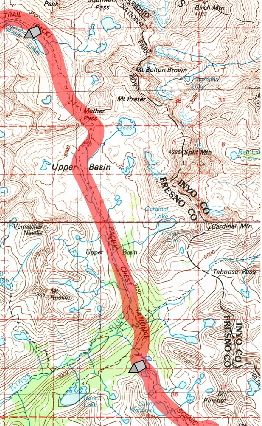
Day 15. 2.9 mi to Mather Pass, 5.6 mi to South Fork crossing, 1.7 to camp; 10,670 Upper Palisade Lake, 12,070 Mather Pass, 10,040 South Fork crossing, 10,990 camp.
10.2 miles, 320' net elevation gain, 2350' total elevation gain
Total to this point: 130.6 miles traveled, 24,890' total elevation gain.
prep | 0 | 1 | 2 | 3 | 4 | 5 | 6 | 7 | 8 | 9 |10 | 11 | 12 | 13 | 14 | 15 | 16 | 17 | 18 | 19 | 20 | 21 | 22 | coda | CHJ home