|
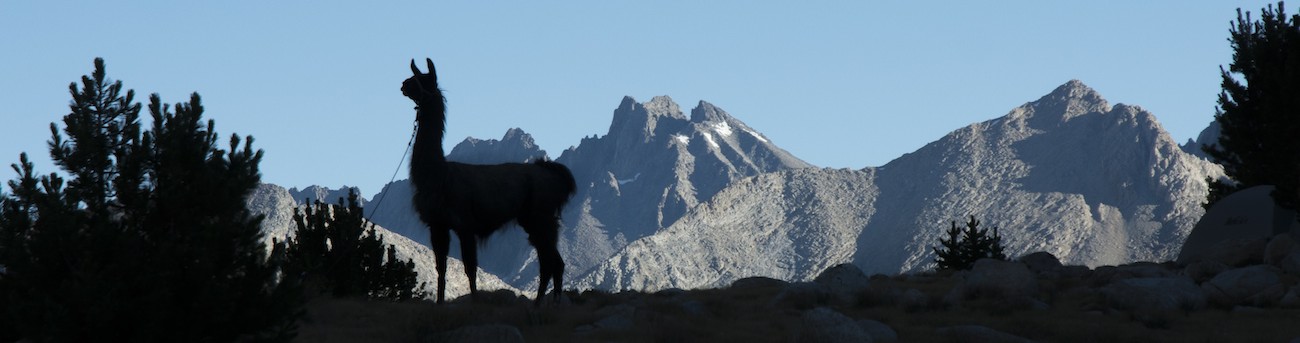
When I get up, I find my hopes that the tent might dry out overnight were misplaced; we have had another pretty decent dew and so things are, again, wet. I am able to watch the sunrise slowly track down the west valley wall, highlighting the Citadel and, eventually, revealing the falls of Ladder Creek. So we eat our breakfast in the cool morning shadows--Honey-Nut Cheerios for me, two packets of oatmeal for Megan--before pulling all the gear together as usual. As Megan saddles the llamas and I stuff gear into panniers, a couple of hikers pause on the trail above to watch us. Now I have a notion what it is like to work in a living history exhibit. With the sun now on us and showing that we will be treated to a warm, sunny day, we are off. It is about 9:30 in the morning.
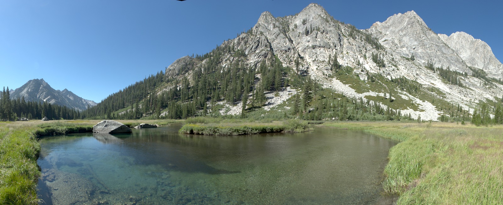
On the way to Grouse Meadow we keep an eye out for where the "good" campsite was (there might have been a site down near the creek in the woods a bit beyond where I gave up the night before). When the meadow appears through some trees, Megan and the llamas keep on going, but I hustle out into the meadow to absorb some of the views. A long time ago, I camped here and bathed in the river (I remember it being cold). Today there are several fish hanging out in the deep pool on the outside of a hairpin bend of the river.
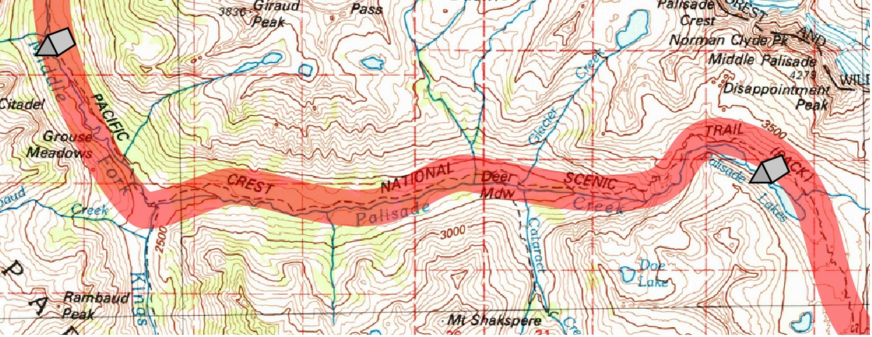
The trail dodges around some rocks at the lower end of the meadow and then begins descending again, the river making a nice fall at one point. The left wall of the canyon is pulling back from us, revealing the opening holding Palisade Creek and our route back up. After a final drop to meet the trail heading down the Middle Fork, we turn left and into the sun and begin our 3000' climb back up. Almost immediately there appears a stone wall to our right, sort of resembling an old pueblo ruin. This is the remains of the old bridge over Palisade Creek. Like many other Sierran trail bridges, it had been wiped out in some high snow year (most of the bridges are done in by avalanches; our guidebook claims a flood did this in, though looking at the still intact abutments, I'd guess an avalanche the more likely player here).
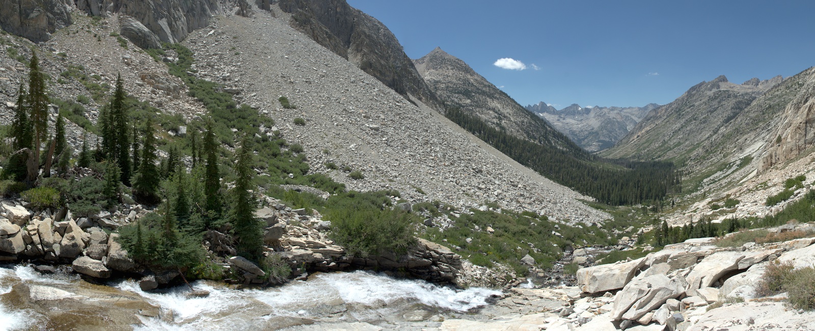
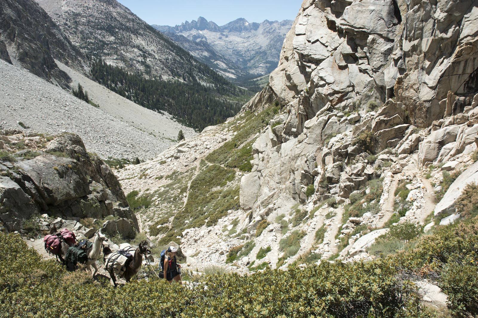
Compared to LeConte Canyon, the canyon of Palisade Creek has fairly banal walls. I look ahead to discern where creeks would come in from both sides of the canyon, as that marks the beginning of our real climb towards Palisades Lakes. We get some open views courtesy of an old (2002) fire that burned through the forest. We finally reach some of the flats near Deer Meadow and cross the creek above it. It seems a buggy spot, so we delay our lunch a bit longer. Soon I mention the time to Megan, and she asks if we should stop under some nearby trees. No, I say, there will be better spots a little ways up. Unfortunately, as true as that would eventually prove to be, the trail here emerges from under the forest cover and begins switchbacking and rising without any shade. Megan scowls at me; we should have stopped. We pause briefly for a trail crew to finish moving a rock (no explosives today), and we pass on. No inviting shade; indeed, few places where we could get the llamas off the trail. Megan grouses that we will have to go above a waterfall well above us. That is indeed where we pull off, taking advantage of the trail swinging around a large open piece of granite near the waterfall. After tying the llamas to a tree, we find a comfy spot for lunch, on a rock with a view down the canyon for me, right near the rushing water for Megan. Far down the canyon was the south end of the Black Divide, with the Devils Crags just coming in to view on the left and Wheel Mountain a bit more to the right. The edge of the forest where I had dismissed stopping for lunch an hour earlier is far below.
Although technically we have been on the Golden Staircase awhile, the attention-getting part remains in front of us. The trail swings away from the creek now and heads for a series of small, south-facing side gullies. The cloudless sky gives the sun full rein to blast us directly and, reflecting off the bright granite, indirectly. The trail enters a gully and we go east a few steps, then west, then east again and so on with the length of the straight stretches growing smaller until it is time to cut over to another gully. You cannot see quite where you are going or how much more uphill you have; if you just judge the gully you can see, you are disappointed again and again as the trail shifts over. Just as you think this will go on forever, you come across a wooded flat and some relief from the sun, but there are still more switchbacks before the trail makes a big traverse to the right across the face of a major granite step. You get a last grand view down Palisade Creek's canyon before rounding the end of the step and turning up a rocky valley angling towards the Palisades.
A lot of times when you gain that inflection point from steep uphill to a gentle climb you find yourself at a lake, but not here. Palisade Creek has notched into what maybe was a flatter valley floor, so the trail winds around small knobs and gullies before turning back to the right to reveal Lower Palisade Lake. Here is the main camping area, and indeed one fellow on the trail just in front of us turns left to find a spot. Although there is a little grass here, it seems clear to us that this is not a good stopping point for us; too many other campers and too little llama space. Besides, the grazing guide and the ranger indicated that the best forage is farther up.
The trail only stays near the lake a short distance, so soon we are once again moving uphill. The trail rises high up the valley wall, seeking to get above a steep piece of unbroken granite. Although we are still next to the lower lake, we can see over the upper lake to the upper basin and Mather Pass. And the trail rises still more. As we pass the upper end of the lower lake, we look down and see what seems a decent campsite and some grassy flats, but there is no easy way down. We continue on until there is a plausible path down to near the outlet of the upper lake. Megan thinks there might be camping down there, so we agree on hand signals for "come down" or "nothing good" and she presses down through the bushes. I see her go by some meadowy areas, then vanish behind a rise, and finally reemerge, giving the high sign: come on down. It is almost a 200' descent to the lake; I don't want to double back.
It is a bit harder leading the llamas through the bushes than on the trail but hardest when I need to get them across a small creek. Even so, soon I am down with Megan. She has found a spot close by the lake that has been used as a campsite; it occupies a bare piece of granite with some small whitebark pines. A couple of sandy spots offer a place for tents. The lake has a narrow neck here and is fairly shallow; a somewhat lower level than earlier in the season has left some muddy flats along the shore in places. Bush-lined stretches of meadow are around us, so there is decent feed for the llamas, which is good after our solid day of hiking.
Although the sun is still beating on us, a steady wind from down canyon keeps things cool. In fact, temperatures seem colder than when we were at a similar elevation at Wanda Lake; maybe that weather forecast is finally coming through. I decide to scout our route back up to the trail, which doesn't seem to be visible from camp. Angling upwards, I climb the valley wall. Up and up, finally I find the trail. It had traveled around the back side of a knob and only came back out in view of the lake as it approached the stream draining the north side of Mt. Bolton Brown. I get to the creek and find that this is the next major campsite after the outlet of the lower lake; the larger site is already occupied and surrounded by drying camp gear, and some hikers are eying another site nearby. I intended to find the supposed stock camp somewhere upstream but decide I have done enough. As I head back, looking for a better approach to the trail, I pass a hiker looking to also camp at that spot. It looks like the vicinity of that creek is a camping magnet.
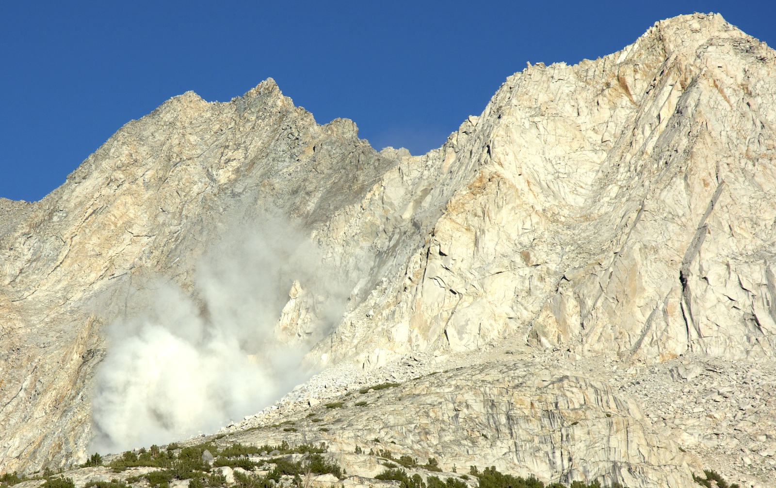
In contrast, we are quite alone at the lake. Megan has taken her dip in the lake while I was gone. I decide to do a quick towel wash. Between the cold water and the stiff breeze, it is a pretty chilly operation done as quickly as possible. Getting drinking water is a bit of a challenge owing to the shallowness of the lake here, and then hanging the water filter bag is another challenge in the dense but low pines. I am hungry; we really don't have enough chocolate in my view. My dinner is two burritos, Spanish rice, and some corn. Megan eats more of the corn and one of her meals. As we are eating there is a loud boom and we turn to see a rapidly growing cloud of dust. A piece of the end of Mt. Bolton Brown has just fallen, revealing a wet fracture surface that had caused the failure. Very cool, but as we cross below many steep pieces of mountain, it is a caution that there can be hazards even on blue sky days.
 |
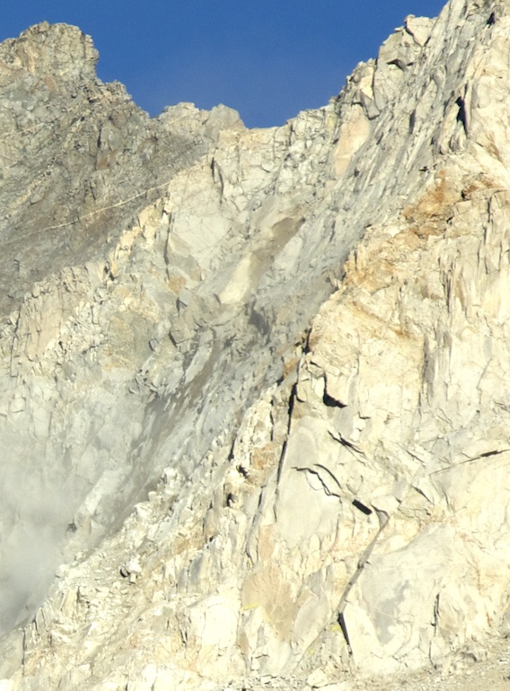 |
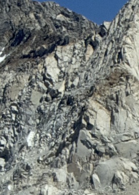
| Before the rockfall from farther down the valley | Immediately after the rockfall. The upper rock that fell came from the darker spot in the upper center of the photo and this seems to have carried a larger chunk below. |
We will be reminded of this a few more times as other rocks fall down the mountain. We had heard a few rockfalls earlier in the trip but could never quite locate them. This one was pretty easy.
We are graced with sunlight until a little before 7, then the shadows fall across camp and temperatures drop. Megan hustles over to a nearby rock to enjoy the last few minutes of warmth. As the sun descends, we are treated to a fine sunset on Bolton Brown. A few fish strike in the lake as the orange colors of sunset wash over the peak and its reflection. After nearly two weeks of being tortured off and on by bugs, we have now reached areas where bugs are barely present. The cold takes its toll on the mosquitoes. The extra bottle of bug repellent I bought at Muir Trail Ranch will stay unopened this trip.
Megan retires to her tent. I wash the dishes out beyond the llamas and put food and toiletries in the bear boxes and bear cannister. Only trash and a few odds and ends (like the first aid kit) are propped up on a rock outside of camp. I decide that I can finally sleep out again. To protect against the heavy dews we've had, I take the tarp and use it as a kind of blanket.
We've started pondering how the trip will end. One concern is making sure we have a day for Megan to climb Mt. Whitney. At the start of the trip she didn't quite appreciate that Whitney is the highest point in the lower 48. Having already conquered the second highest in Mt. Elbert in Colorado, this now stands as a real objective for the trip. My original sketch itinerary had no layover day near Whitney, so we need to shoehorn one in. It turns out that by accident we have closely matched a suggested schedule in the National Geographic map Megan carries. Following that schedule going forward clearly buys us our day. In a couple of days, if we bypass a couple of short days I had in the schedule, we should easily have an additional day. This seems reasonable but means we will have a pass a day for the next four days. It is rather daunting but in fact today (which will prove to have the greatest net elevation gain of the trip) was in many ways harder than most of the days ahead. So tomorrow starts four passes in four days.
Day 14. 2.0 mi to Middle Fk Jct, 7.9 mi to Upper Palisade Lake camp; 8340 Ladder Camp, 8030 Middle Fk Jct, 11,090 trail above camp, 10,670 camp.
9.9 miles, 2330' net elevation gain, 3140' total elevation gain
Total to this point: 120.4 miles traveled, 22,540' total elevation gain.
prep | 0 | 1 | 2 | 3 | 4 | 5 | 6 | 7 | 8 | 9 |10 | 11 | 12 | 13 | 14 | 15 | 16 | 17 | 18 | 19 | 20 | 21 | 22 | coda | CHJ home