|
Hump day. Yes, a Wednesday, but for us, it is the middle day of the trip. Eleven days have passed, eleven to come (we thought eleven more after this day, but it will turn out to be eleven including this day). It also begins a changed cadence for our travels. We have crossed three named passes so far: Island, Silver, and Selden. In front of us are twice as many: Muir, Mather, Pinchot, Glen, Forester, and Cottonwood. We will go from an erratic up and down to a more rhythmic up and up, then down and down, until we clear Forester Pass. Our camps have only twice been above 10,000 feet to this point; we will only camp below that level three more times. The really high Sierra awaits.
As always, I am up early. Being in the valley, the sun will delay awhile before warming us. The landscape is better oriented for sunset, so watching sunrise isn't nearly the must-see as watching sunset, but it is still nice to see the sun hit Evolution Creek and light up the relief on The Hermit. By sunup I have fished out some foil that had ended up in the fire: Megan's tube of Pringles was a very awkward thing to put in our ziplock trash bags, so we elected to burn it last night. There was a foil component to the wrapping, so I have to be sure to collect it. Along the way I get a few other scraps of foil out of the firepit.
Our trash and toiletries are down, food is laid out for the morning, eggs are cooked--Megan is soon ready and itching to hit the trail, but I need to repair the blister bandages that were soaked yesterday, so we aren't ready to hit the trail until a bit after 10.
A short ways up the trail we meet a fellow in park service gear walking down. I am a bit puzzled, as he is not the ranger. Turns out, he is part of a trail crew working on this stretch of trail. He warns us that they are going to stop hikers in a bit up ahead to blast out a rock that made for a high step in the trail; he thinks we'll get through before they stop traffic so long as we keep moving. Soon enough we find the fellow who is stopping traffic. He gets on the radio and asks if we should be allowed through. The answer is yes, let the llama party through, but they will be the last ones. So we head on up, evidently the last to ever tread across this troublesome rock. Two women are completing their preparations to blast; I kind of think they let us through just to witness the novelty of the llama train. For a ways past them we see wire paralleling the trail. They will evidently be some distance from the rock when they fired the shot. When we pass the guardian of the other end of the trail closure, we see a couple of hikers sitting and waiting for approval to continue; no doubt they rue their timing. We had been told it the delay would be maybe 15 minutes while they did the blast. I figure that the blast necessary to take out the rock will be fairly small, but when we are well past the blast area and high on the switchbacks to Evolution Lake, the blast takes place and is plenty loud, reverberating through the valley. Megan and I both guess it took far more than 15 minutes, and one might think that the trail wouldn't open until the blasting crew checks out the results of their shot. We are lucky to have snuck past in time.
A bit before we hear the blast, we get a bit of a lesson in llama psychology. A pair of women are hiking down towards us, curious as most are, and one trips and falls forward. The llamas leap backwards even though she is a good 20-30' away. With a cliff behind them, this makes me very nervous. Fortunately the llamas do not go over the cliff and the woman is OK.
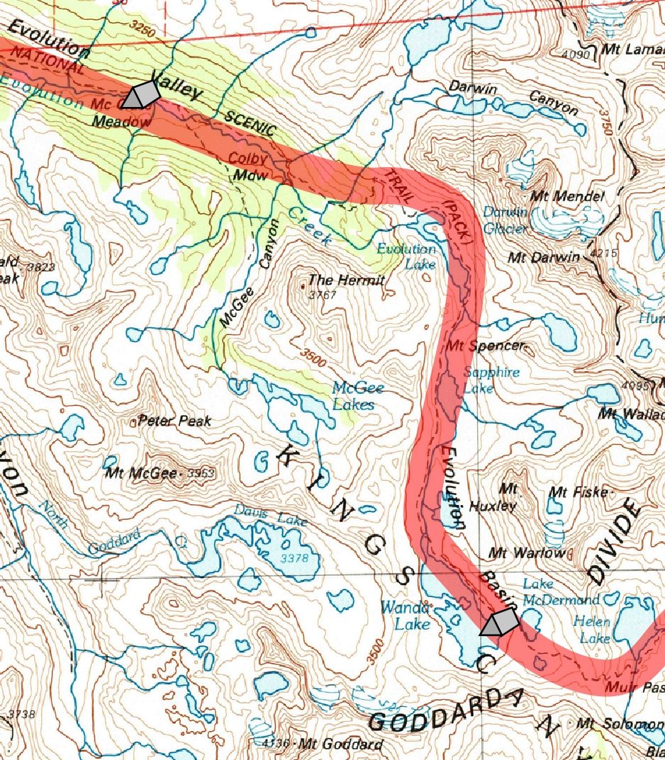
The switchbacks are soon over and the trail then turns right, angling around some knobs, and now we have a view of Evolution Lake and Evolution Basin. As we approach the lake, the trail heads to the left, but I call out to Megan to go right. I know of a place I don't want to just pass by.
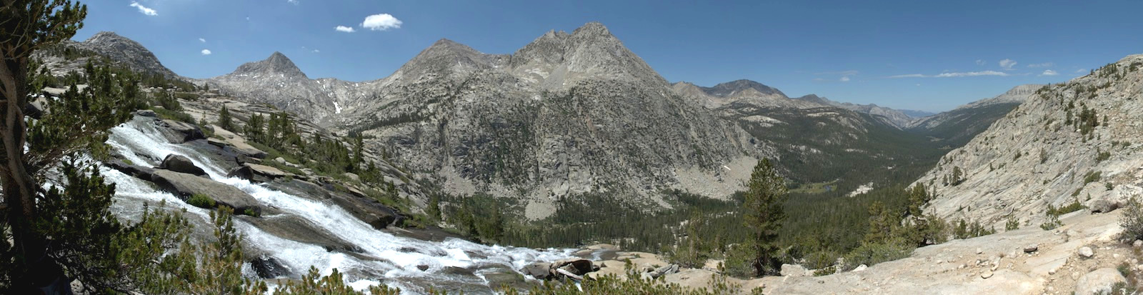
The trail bends farther right and the lake gradually becomes a wide, slow moving stream, and a bit farther down it moves more quickly. A little farther we stop and tie up the llamas; the stream now is a cascade plunging to the valley below. We look back to almost all of Evolution Valley; The Hermit stands now as a large asymmetric molar to the valley's left. Below it is Darwin Meadow, which had been hidden from us by a screen of trees when we walked by, then Colby Meadow and beyond that, with its wide, slow stream, is McClure Meadow. The far end of the valley curves away to the left, just concealing Evolution Meadow. Distant summits that had been far above us near the Muir Trail Ranch are now insignificant points on the horizon.
The best spot in the shade is taken by a group eating lunch; another spot has a fellow who seems to be breaking a small campsite. We move a bit below the group and get enough shade to be comfortable and pull out our lunch. The water cascading down adds some sound and motion to our vista. It is a wonderful spot for lunch.
When we leave and return to the Muir Trail, it seems Evolution Lake is a busy place. Other hikers watch us as we make our way back to the Muir Trail. The view up Evolution Basin over the lake is great. In getting on a rock to take a photo, I watch as a fish swims rapidly to the surface to jump and catch a bug.
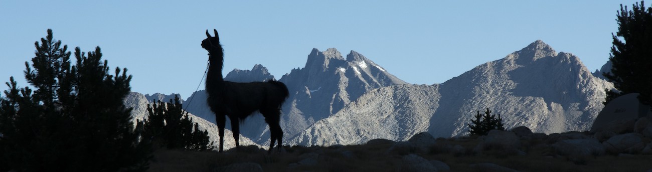
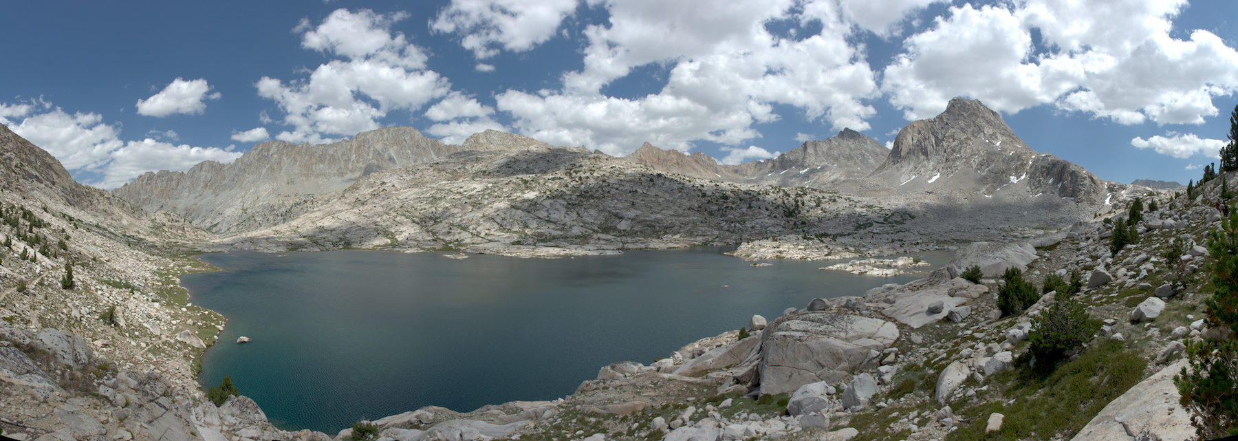
I trail Megan and the llamas a ways, in part to get photos of them as a small part of the landscape, in part to just revel in the mountain sculpture we are walking through. I have sort of felt uneasy the whole trip; the kind of emotion the mountains usually evoke seemed absent. But Evolution Basin brought back some of the awe of these mountains I had been seeking. From the immense cliff face of Mt. Darwin to the arrangement of the glacially polished knobs and peaks beyond Evolution Lake, it is all a bit of a wonderland.
The trail now rises up, well above the lake. I look down and see the old trail, quite possibly one I had traveled some 30 years ago, still visible as it cuts through the lakeside sedges and then clambers up a saddle. In many places a careful look will reveal the many generations of trail that are aligned along the Muir Trail; here, presumably, the trail migrated up the slope to remove pressure on the lakeside vegetation.
We crest a low saddle to be able to view the upper part of the lake, then the trail wraps around that upper part and crosses the broad but shallow waters to the west side of the stream. A further climb reveals Sapphire Lake (somehow the name was not used in the Minarets area, where Garnet, Ruby, and Emerald Lakes graced our travels on day 3). Sapphire actually seems to be several lakes with only tiny drops in elevation between them (or maybe these are unnamed pools below Sapphire proper). The flat granite slabs and grassy areas make for an inviting tableau. But our goal is higher.
The last climb of the day carries us well above Sapphire; we rush to get some llama pictures before we can be overtaken by a couple of other hikers who have been near us, off and on, since Evolution Lake. We lose sight of Sapphire and then pass through a narrower part of the basin before things widen out and Wanda Lake comes into view. Campsites are mainly here, at the outlet, and indeed there is already a resident in these parts, but as the ranger told us, the grass is mainly on the benches farther up the lake. So we press on. We pass a young woman wearing a mosquito-net hat and are a bit puzzled; the bugs have not been a bother for us. She says that when you stop near the lake, these midges rise up and are pretty obnoxious. As we proceed, I look uphill and see what might be a possible campsite, so I head up the hill while Megan continues along the trail. There is a spot where we can make camp--fairly bare but not too bad, and there is a swath of good grass nearby. Megan, though, thinks we can do better and doesn't like this spot. She decides to be the one doing recon, so I take over the llamas for a bit. After awhile we meet back up and she says there isn't anything worth camping at here.
Farther up the trail we diverge away from the lake. Megan points out a small sandy circle down to our right and suggests we can camp there. There is a big rock for our water filter. It seems pretty stark and unappealing to me, but we've hiked enough that I am game to give it a try. Megan decides though that there might be better, so she sets off to look. Meanwhile the two hikers following us, it seems a mother and son, but I am not sure, come up and ask if they can share the site. I look at it and say, you know, if we stay, we have two tents and I actually don't think there is room for a third. They are disappointed but look around a little themselves and find another small sandy flat not far away. After awhile Megan returns and says she has found a decent site. We go and look; it has the benefit of a view of the lake and there is grass nearby, so we decide to make that our camp, freeing up the little sandy circle we had originally staked claim to.
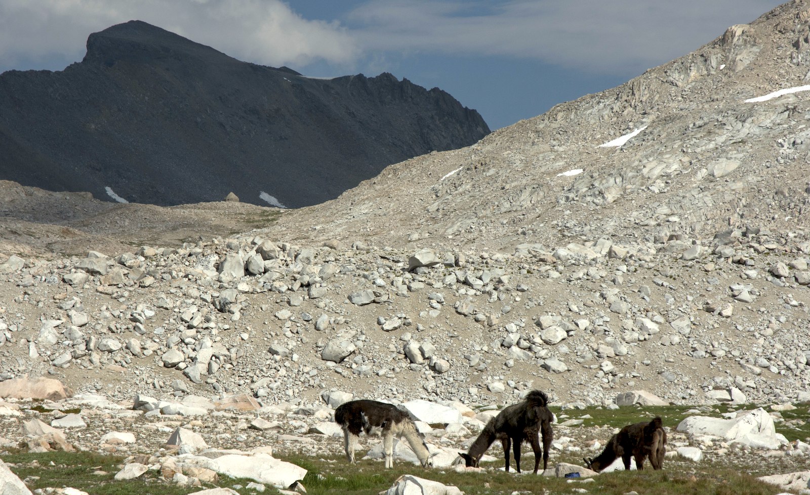
Wanda is a stark lake. A few very tiny trees--no bigger than a small shrub--are near our site. The view is mainly rock and rubble and water and some grass. We can look to the south and see the Muir Hut at Muir Pass. Parts of the trail are visible, too, but we are out of view of the closer parts of the trail and so have some privacy. The meadows are full of different sorts of plants, so I take some care to try and find places that most resemble the grassy plots we've used to this point. The llamas seem happy with what we offer them.
Going down to the lake to get water reveals a lot of scum floating on the lake: we are at the downwind end. I walk along the shore a ways to a small point; there the water is in the lee of the point and much cleaner. So I fill our water filter bag and lug it back to camp. My first plan is to sort of lean the bag on the large rock near camp, but water leaks out the top. So I get my tripod and set it up, making sure that when I put the water bag on, that the center of mass will be well back of two of the legs. But in doing this I don't get the bag high enough and bang the outlet on the rock, damaging the outlet hose and quite possibly the fitting on the bag. I raise the tripod so that the bag is now totally above the rock, but I have to repair the outlet hose. Thankfully it is nothing more than a simple long length of flexible hose, so I cut off the top half inch and reattach it to the outlet. Everything seems to work fine, though I will worry for days that I might have damaged the filter.
We have some time before dinner, so I wander about a bit while Megan visits the lake. A more substantial campsite is by a knob at the very southeast corner of the lake. Somebody has built a rather substantial bench and windbreak here; somebody also left their gaiters, so this probably was last used weeks earlier when travel through snow was more of an issue. It is a much windier site and so not really a temptation for us, though I am surprised Megan overlooked it on her search for a campsite.
Although I have found some of the gnats near the lake, where we are camped there are no bugs to speak of. We have to get a spot out of the wind for the stove (we lack a windscreen), but soon have our meals ready. All day we've just had a few fair weather clouds, but now more sinister looking clouds rise from the east. These start to drift over us; as the sun sets and alpenglow is all around us, the clouds begin to light up. We get the nicest sunset since our dousing back at Squaw Lake.
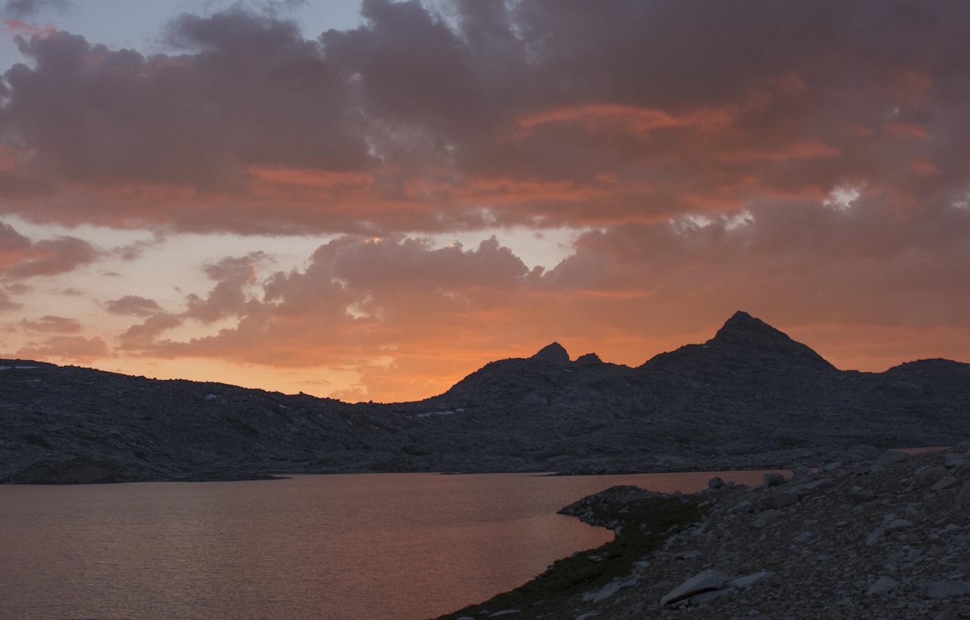
The clouds, though, are a clear warning. Clouds coming from the east suggests we're in for some moisture; the basic fabric of the weather forecasts we had been hearing made it seem as though a cold front is going to come through. Getting some rain as the moister air is marshaled out by the front seems likely. Megan now thinks the clouds are not worth any worry, but I decide that I do not want to wake up in the middle of the night having to leap out and protect everything. So the rain tarps go over all the panniers, the fly goes on my tent (right side up), the rain cover is on my pack, and I have all my stuff in the tent that I want. I had been incautious once; I am not eager to repeat the mistake. So while I am deprived of a night up high under the stars, at least I can sleep soundly. As the light fades from the sky, we hear a group near the lake's outlet do some wolf howls, which are good enough to momentarily get the attention of the llamas. There is apparently a high-spirited group below us.
We are at what should be the highest camp of the trip, a fitting end to hump day (in fact, we will camp a bit higher at Guitar Lake, an unexpected bivouac). Muir Pass is a stone's throw away. Tomorrow starts the rite of the passes.
Day 12. 8.4 miles to Wanda Lake camp; 9640' McClure Mdw, 11,440' Wanda Lake camp.
9.6 miles, 1800' net elevation gain, 1800' total elevation gain
Total to this point: 99.9 miles traveled, 18,850' total elevation gain.
prep | 0 | 1 | 2 | 3 | 4 | 5 | 6 | 7 | 8 | 9 |10 | 11 | 12 | 13 | 14 | 15 | 16 | 17 | 18 | 19 | 20 | 21 | 22 | coda | CHJ home