|
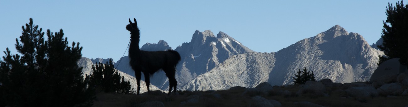
As usual, I am up around 5:30 and I come out to see how sunrise is going to play out. Days are getting noticeably shorter, with sunset before 8 pm now and sunrise about 6 am. At Thousand Island Lake sunset on Banner Peak was after 8 pm and sunrise was 5:50. Looking in the sky about 15 minutes before sunrise, I see what resemble crespicular rays streaking across the sky. So there is something high to the east blocking sunlight in some directions and not others; most likely these would be tall clouds. So while we have been relieved to have clear skies, somebody to the east is probably seeing thunderstorms.
 The big gap at Taboose Pass is just about perfectly placed to let the morning sun light up the arms of Mt. Ruskin across the South Fork valley from us. Peaks along the Cirque Crest to the west are also lighting up, though Mt. Ruskin itself stays dark, as does most of the rest of the Upper Basin area. Far over Mather Pass, though, light has come to the Palisades. While I heat water for Megan's oatmeal, the peaks above our lake light up and are reflected by the calm waters of the lake. It is past 7:30 when the sun finally reaches our camp. Camp chores eat more time than yesterday, so it is 9:40 when we finally lead the llamas back past the lake and onto the trail.
My disabilities have been shifting the last few days. The blisters that were a problem early in the trip are simply fading out in importance. After the day of blossoming blisters with the thinner pair of socks, I only use the heavy socks hiking and save the light socks for use with my sandals in camp. About now I lose the coverings on the blisters on my right heel and will finally peel off the band-aids from the left heel before much longer. This is being replaced by increasing problems with my thumbs. The skin on the thumbs has basically gotten calloused, which in and of itself isn't too much of an issue (other than it seems to interfere with using the TouchID on the iPhone). This though has led to painful cracks at the edge of the thumbnails. I try band-aids, but they fall off too easily, so instead I move on to medical tape. This is more to prevent me from jamming my thumb in a way to further open the crack than to really heal anything. It can make it awkward to unclasp the clasps on the llamas' ropes and other such tasks.
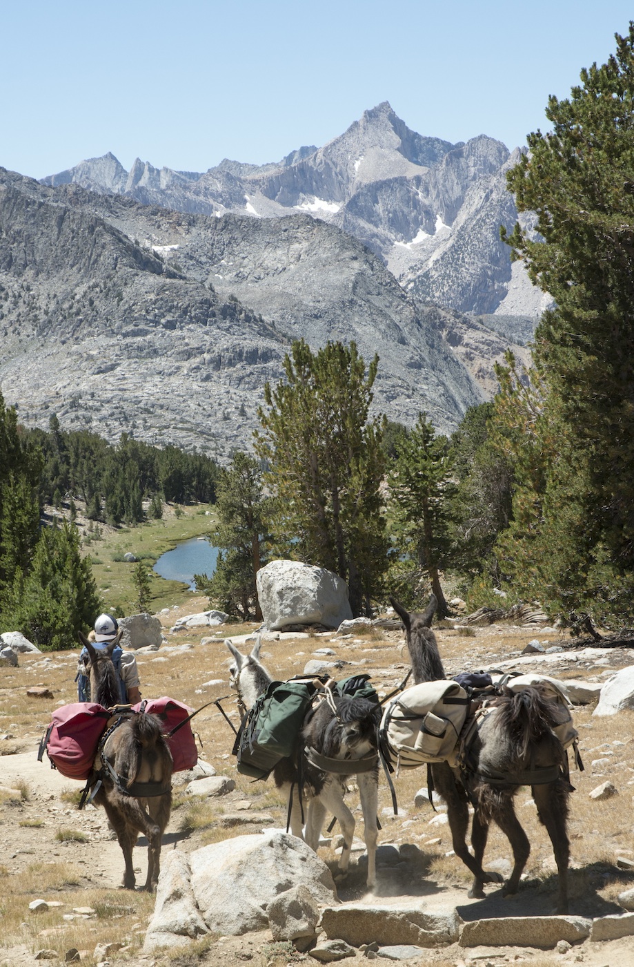
Our trail wanders up past another small lake before we rise enough to see Lake Marjorie . Although a number of hikers camped here last night, there is only one side of Marjorie where you can camp. There is little grass, so our choice of lakes was better. As we've advanced, the view behind has narrowed down. By the time we reach the pass the views down the South Fork canyon and over to Taboose Pass are gone, but we can now see over the Cirque Crest to see dark Mt. Goddard anchoring part of the Goddard Divide back close to Wanda Lake. To the south, new vistas open up. The headwaters of Woods Creek are below us, with heavily furrowed Mt. Cedrick Wright prominent in our view. Far beyond are some of the peaks of the Kings-Kern Divide; we can nearly see Forester Pass, the highest pass on the Pacific Crest Trail and our goal for day after tomorrow. So in a sense, from here we see back three days and forward two.
Another four or so hikers share the summit with us, a summit kind of similar in dimensions to Mather Pass. It is still only 11 am, so we just have a snack and shoot some pictures and then head down. We still have a long ways to go.
 As we descend, the views more to the west start to open up, and I recognize some peaks from long ago. The classic arete of Mt. Clarence King appears; to its left we can see the upper part of the cliff face of the north side of Mt. Cotter. Mt. Cotter was the first Sierran peak I ever tried to climb; it was coming unexpectedly upon the top of that cliff that prevented me from trying to go the whole way up.
Uncharacteristically, we meet few hikers on this long descent. Instead we do encounter a young buck and doe ahead of us in the trail. They regard us with curiosity until we get too close.
As we near Mt. Cedrick Wright, we can see one of the Twin Lakes at its base. This had been my planned campsite back in the basic schedule I had made. The trail doesn't go directly to the lake, so we just stop off the trail nearby to eat our lunch. When we resume, the trail passes a lateral to Woods Lake and then plunges into a narrow canyon, shutting out most of the views.
I look forward to see where the South Fork of Woods Creek is coming in to try and estimate how much farther we have to go. It isn't easy. The views are now more monotonous, although we pass high above a waterfall before a quick descent to just below the fall. Below the fall we hike through what seems a large pile of rubble. Looking up to our right I can see what looks to be the headwall of a large landslide. Given the nature of the rubble across the stream from us, I would guess that much of the debris had been glacial deposits. A large buttress at the north end of the King Spur grows more prominent, its near end marking where we might turn uphill to follow the South Fork of Woods Creek. As the canyon wall on our left finally falls away, we find ourselves well above the confluence of the two forks of the stream. We angle down to the west, finally meeting the junction with the trail down to Paradise Valley and Roads End. We turn left to head farther on the Muir Trail.
One of the landmarks on the Muir Trail is the suspension bridge across Woods Creek. This is not something the llamas can walk over, though, so we are looking for signs of a stock crossing as we approach the bridge. I see nothing, and the creek crossing by the bridge doesn't look fun. A fellow coming across says there is a sign to the stock crossing on the other side, so I go across and verify that there is such a sign. I indicate to Megan that I will head down and look for the crossing and that she should head down as well.
This does not go well.
While I hustle down the trail past a number of campsites to the stock crossing, Megan is trying to lead the llamas along the stream bed, crashing through brush and otherwise having an unpleasant journey. By the time she reaches the crossing, she is angry and frustrated. At this point there is nothing to do but just cross the creek, so she crosses with the llamas and then hands me the lead rope in disgust. While she resets her footgear for the trip uphill, I move the llamas away a little. We then head back to the junction with the footpath over the bridge. A fellow comes up to Megan and exclaims that she must be the legendary woman with llamas doing the Rae Lakes Loop. Megan demurs, suggesting that this must be the other group we had heard was somewhere ahead of us. [It probably wasn't; the more we hear, it seems likely that the other llama group ahead of us entered over Kearsarge Pass and then headed south. Though it is possible they entered from Roads End]. Megan goes to check out the bridge while I go down to the stream to purify a bottle of water.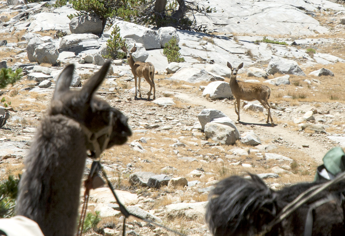
This was the high water mark of my very first backpacking trip, an epic misadventure in many ways. On that trip, after one of our party was suffering from bad boots, I was suffering from dehydration, and a third had some GI problems, when we reached this spot at lunch, we decided that going all the way around Rae Lakes was a bad decision, and we spent the afternoon here. Today this area is totally different. The most obvious change, the suspension bridge, was built in 1988. But it is the magnitude of camping presence in the area that feels wrong. There are people camped in several areas along the creek, and most likely a bunch more will show up before sunset. It seems much more heavily used than back in 1977; back then, I remember feeling like we were in remote and relatively untrammeled wilderness. Part of that was naiveté, but part was a piece of landscape that didn't quite bear the scars I am seeing today. It is a little disappointing.
Well, not to worry as we aren't here long. We have another 1000' climb to suffer through.
Now that we are across the creek, our hand is forced. For some distance up the trail grazing is forbidden. After we leave that zone is a stretch of trail with few if any campsites and probably little grass. Our goal is the meadow near the drift fence opposite Baxter Creek. Although it is only a bit over two miles, the trail feels longer than that, and we are both eagerly examining possible campsites as we rise up the South Fork of Woods Creek. At one point I go on a major expedition towards the creek to see if a campsite lurks behind a screen of trees. It does not. Had I studied the map a bit more, I would have known what to look for, but when we see a grassy meadow below the trail, we know we have arrived.
While Megan stays with the llamas, I go to figure out where the camps are. The trail drops to cross a particularly wet part of the meadow on a boardwalk; just past that I see a trampled trail to my left. Following that I find lots of evidence that this site was heavily used by horses, but I don't see camp. Continuing along, though, there is a trail to my right, now heading toward the creek, that goes in the forest. Towards the edge of the forest on the creek side are two campsites, both fairly flat. The wind won't be great here, and maybe the bugs will return to be something of a pain, but it should work. I go back and lead Megan and the llamas to this site. Megan is not satisfied and suggests that a better site is probably closer to the stream beyond a grassy area. Sure enough, she finds a site that is far nicer, being open and out of the woods for the most part, with a large firering and plenty of space for our tents and gear. Although I had planned on taking the llamas back to the main meadow, there is ample grass right near camp, although several downed trees and rocks make tethering the llamas more of a pain than usual.
Camp is sunny to start with, but we are in a north-south canyon, so we know things will be in the shade soon. But we are also now lower, so things are a bit warmer, and we have the opportunity again to have a fire. We are hungry because this was the longest distance we've covered in nearly 2 weeks. I have two burritos and corn accompanied, as usual, by lemonade while Megan scarfs down have a Mexican-themed freeze-dried meal, corn, and ramen. Food and toiletries finally fit in the bear containers, which is just as well as we are now in the most active part of the park for bears. We start our fire. I have been carrying the empty tube of my Pringles for a few days and, just as with Megan's before, it is a bit of a pain, so I decide to burn it and fish out the foil in the morning. Megan has some tea by the fire before she retires for the night. I spend some time writing in my journal before laying out my sleeping bag; I'll risk sleeping out tonight.
For our third straight night, we are by ourselves, nobody near enough for us to be aware of their presence. Probably there is nobody within a mile of our camp. This is all the more amazing because we are not only on the Muir Trail, we are on the Rae Lakes Loop, the most popular backcountry trip in Kings Canyon National Park. It just goes to show how people tend to cluster in the same places. Of course, if it wasn't for the grazing ban immediately ahead of us, I would probably have pushed on to Dollar Lake, the lowest of the lakes in the basin. Having llamas sometimes means getting to camp by yourself.
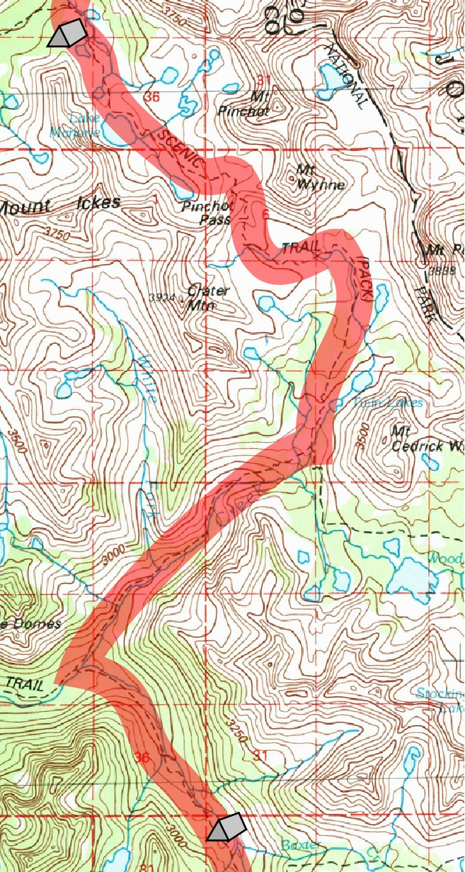
Day 16. 2.7 mi camp to Pinchot Pass, 7.4 mi to Woods Creek crossing, 2.4 to Baxter Creek Drift Fence Meadow; 10,990' camp, 12,140' Pinchot Pass, 8490' Woods Creek crossing, 9470' Baxter Creek Drift Fence Meadow.
12.5 miles, 1520' net elevation loss, 1630' total elevation gain
Total to this point: 143.1 miles traveled, 26,520' total elevation gain.
prep | 0 | 1 | 2 | 3 | 4 | 5 | 6 | 7 | 8 | 9 |10 | 11 | 12 | 13 | 14 | 15 | 16 | 17 | 18 | 19 | 20 | 21 | 22 | coda | CHJ home