|
I awake looking up at the sky. What I see isn't comforting: there are shards of cumulus clouds pushing across the sky. Often when you see things like that, there is plenty of moisture in the air and a likely setup for thunderstorms. Today we will rise back up and get much closer to the crest, so the chances of getting wet seem higher than they have been.
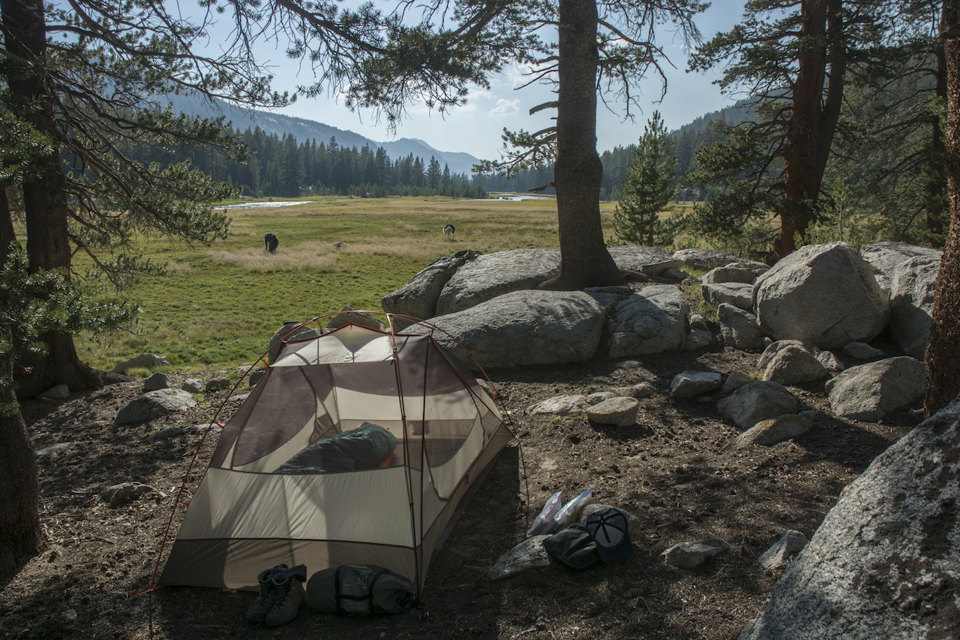
I move the llamas back out to some of our feeble pasture and retrieve the food. At night, I take the bear boxes out of the panniers and put them away from camp; I don't want a bear playing with the boxes to destroy the panniers. The food and other items I hung are fine, and soon all is lined up in camp, the daytime snacks pulled out, my PB&J sandwich made and stashed in my pack. Megan gets her oatmeal and is soon pulling her tent down. We are pretty efficient this morning and are off about 9:30 am.
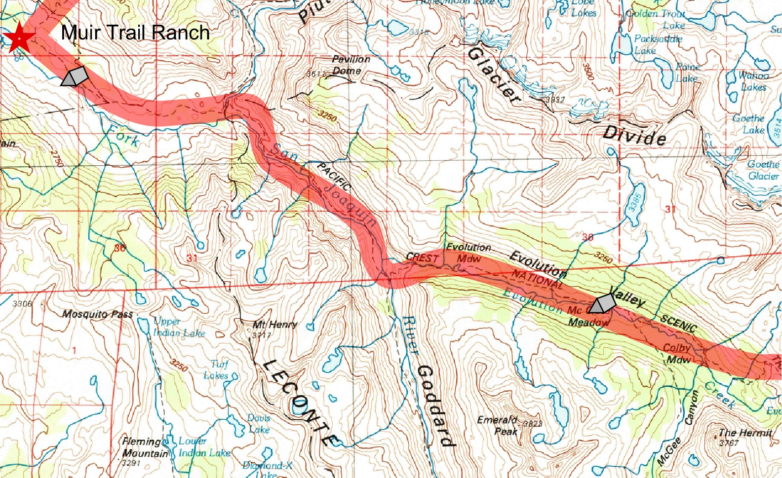
Shortly after we return to the trail we meet the John Muir Trail again (it diagonals down from where we left it yesterday, saving those not visiting the Muir Trail Ranch some elevation loss). The trail today seems far more crowded than we have seen for awhile, with a lot of the hikers seeming to be short-distance walkers. This makes sense as some no doubt have stayed at the trail ranch and are just out for the day; others might be finishing a short trip into Evolution country. Anyways, this gives us many opportunities to talk about the llamas. Fortunately Megan is the one fielding most of the questions; I just get involved if they really want to know something detailed, like how much the llamas cost. When we started, Megan wasn't too sure of the name of our trailhead, but at this point the question has been answered enough that she knows it well: Rush Creek, just south of Yosemite. As far as we can tell, we're the only ones to use it as an entry point for the rest of the Muir Trail.
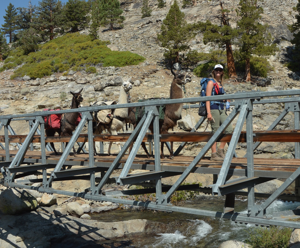
It isn't long before we pass over and around a few low knobs and the trail swing to our left, seemingly aiming up a deep canyon to our left. This is the canyon of Piute Creek, and it marks the boundary of Kings Canyon National Park. Of course there is another llama quiz administered before getting on the bridge, so I have a chance to run in front and capture Megan and the llamas entering the park.
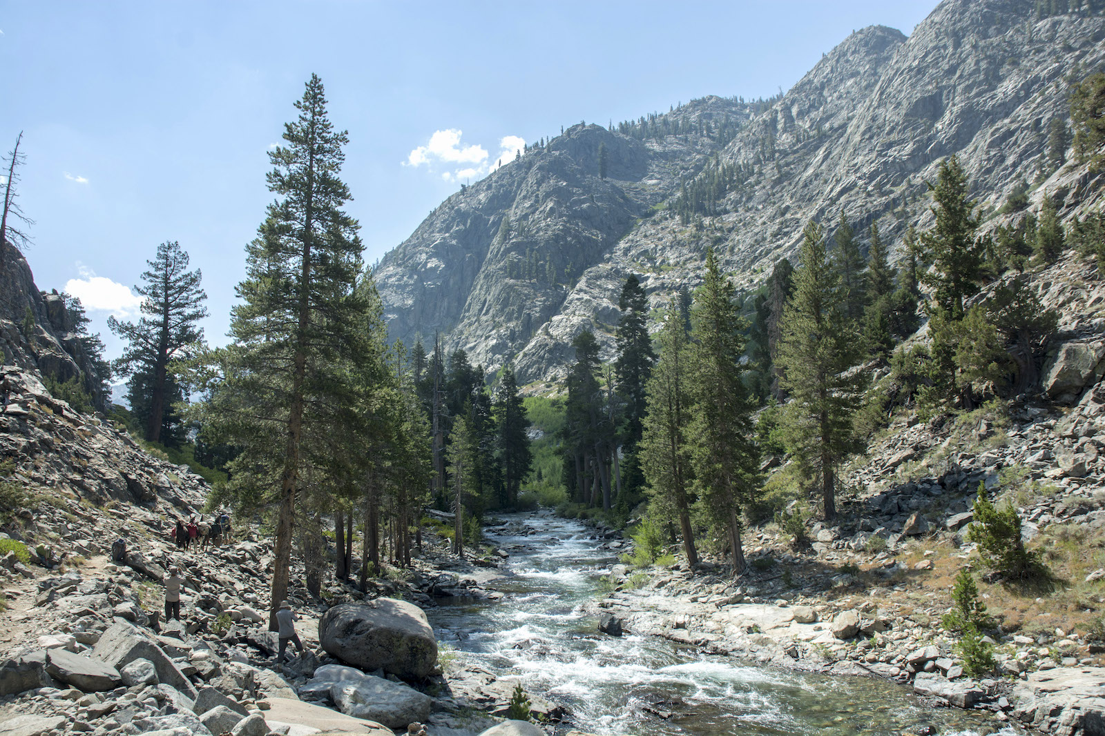
As we continue, the broad valley we have been in narrows noticeably, almost becoming a fluvial V-shaped gorge. The trail has some extra ups and downs to deal with the occasional cliff with a river at the base. We pass a large rock being examined by some hikers. I stop and look: this is the John Muir Trail rock, marked "John Muir Trail 1917". The inscription is barely legible with the lichen and moss on the rock, but it is a testament to the durability of this trail.
Our stretch of the river is now cutting across metavolcanic rocks of the Goddard pendant, nicely visible below a bridge over the river. This is probably part of the reason for the narrow valley bottom. Ahead we spy a break in the canyon's wall: Evolution Valley. The trail turns a bit to the right, as though to bypass the valley altogether, before passing the trail up Goddard Canyon and crossing the river once again. A nice flat and the river suggests a good lunch stop, so we tie up the llamas and sit down near the river to eat.
The bulk of our day's climb is now before us. I can't find my bandanna, which is frustrating. I lost one of two on the first day of the trip and now, it seems, I have lost the second. A series of switchbacks and traverses will carry us back to the north to Evolution Creek, where a potentially hazardous crossing awaits. It is so commonly a problem that the Park Service has a sign pointing out a trail to a safer crossing in Evolution Meadow if the usual crossing is too high. When we reach the crossing, having watched Evolution Creek roar down the cliffsides below us, we find a perfectly simple crossing. Sandals come out, boots off, and we are soon across the creek with half a dozen other souls. At this point I am almost beyond repairing my blister patches. Soon we are off again, now enjoying the gentle grades of Evolution Valley.
This is one of the places I had wanted to return to, so I look around with great interest. Evolution Meadow is a bit too far down the valley to capture the views that the meadows farther up have, but the grass at Evolution looks like excellent llama grass. Because McClure is supposed to be closed to grazing unless Evolution and Colby are being heavily grazed, I am eying this to figure out where we might camp: it is possible we will return here.
Back into the forest we go; we occasionally get views when we are near the river, but mostly we see trees and the slopes immediately above us. Then I spy part of a familiar landscape through the trees, and I tell Megan to pull off into the campsite to the right.
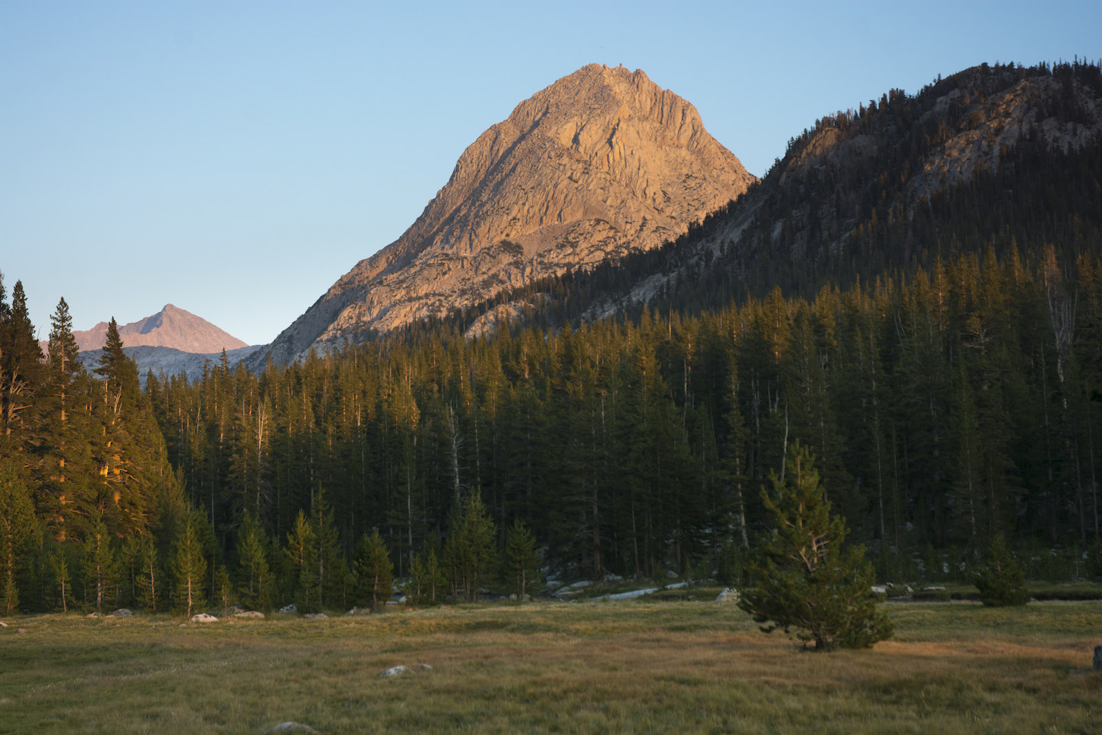
I had camped here, I am pretty sure, many, many years ago late one season. We tie up the llamas and walk to the river. It now is deep and placid,curling between banks of grasses and sedges. We are at the lower end of McClure Meadow, one of the gems of the Sierra. Up the canyon we can see massive Mt. Darwin anchoring the Sierran crest; to the right, bell-shaped The Hermit is closer and balances the ragged peaks to the left. Between them are more minor peaks of the Evolution Basin. We can make out Evolution Creek tumbling down the canyon wall from that high lake basin. Megan even works her way out on a downed tree to take some pictures.
We agree this would be a nice place to camp, and I am surprised this camp is still empty, but it isn't a great llama camp, and besides, I don't know if we are even allowed to graze here. So it is off to see if the ranger is in. We accidentally pass the easy path up to the ranger cabin and instead bull our way straight up the hillside outside the cabin.
The ranger is indeed in, a cheerful older member of the ranger clan. The cabin is an older one as well (we learn later it was recently updated as a historical building, which included felling some nearby trees to restore the foundation). The ranger has been listening to his radio and comes out to chat. I ask about fires (they are still allowed) and then ask if he wants to see our permit (no, just name will do). I say that I know the meadow is closed to grazing and he stops me. No, he says, it is always open to private groups. We can camp here. Well, I say, that is good news. Is there a particularly good place to go? I describe the drier grasses we are told to favor for the llamas. He thinks and offers a couple of suggestions, one at the edge of the meadow nearby, the other at the upper end of the meadow. He says it is near where he takes his nightly dips. He just asks that we graze the animals some distance from the campsite so things look nice for the next group through. He also asks us to fill out a postcard listing where we end up grazing through our journey. I take the card and thank him.
We take a look at what I think he was pointing to nearby, and it seems a poor camp for us; perhaps I misunderstood. So we continue up to near the upper end of the meadow and then veer off the trail. We cross two fainter, older versions of the trail and find a few campsites. We settle on a nice sized camp with a number of good sized rocks and a nice firepit about 3 pm. Scouting the grass things look pretty good; there are areas where it does seem like there might be some unpleasant plants, but mostly things look good. Soon the llamas are feasting on the best grasses they have seen. We have our stuff settled out. Megan is soon seeking out a swimming hole while I decide to rig up our solar shower.
My plan is to use the tarp I had brought as a shower curtain, but at 7' x 9', it will be a pretty snug shower. (The tarp's main use was as a place for us to pull out all our food each evening and morning.) I find some trees close enough together to figure I can probably work something out. Soon I have the tarp tied to trees and the bottom anchored by big rocks against the steady west wind; it is only closed on 3 sides, but I figure the 4rth side faces away from where anybody is likely to be. Rigging up the shower bottle itself is trickier; I finally grab one of the black straps that connects the llamas on the trail. One end has a C clasp, then the panic clip can be adjusted. I get the strap over a tree branch and then clip the water bag to both clasps. Only after I have finished my shower do I realize that I could have raised the bag by tightening the black strap.
Although the shower is colder than I had hoped (the bag didn't sit long enough in the sun), getting clean all over and even washing my hair is a good feeling. I leave the setup for Megan, who uses it to wash her hair.
This is one of the more relaxed camps we have had. Llamas are in view and don't need to be moved as much as usual. Although we cannot see The Hermit and Mt. Darwin from our site, it is only a short walk into the meadow to look back at that view. The breeze coming through camp keeps any bugs down. Megan notices a deer with fawns in the meadow. They seem to vanish at some point. When I go out in the meadow to consider taking some pictures, I notice the deer's head peeking out above some tall grasses downstream.
As the day grows late, we pull out food for dinner. Megan has collected firewood; although the area near us is pretty well picked clean, there is wood near the trail. Although there are several fine campsites near us, we have no neighbors at our end of the meadow, though we do see some hikers camped at the far end. We move the llamas close to camp; this probably ended up being a bad move as they left piles of droppings not far from camp, exactly what the ranger wanted us to avoid. I should have moved them on the side of camp away from the meadow. As the sun is dropping toward the horizon, we both hurry out into the meadow, eager to watch the alpenglow move across the meadow and up into the peaks. As the light dims, we return to camp and our fire. All in all, today was one of the nicest days of our trip.
The weather that had concerned me never materialized; the few fair-weather cumulus that did appear were never a threat. The ranger said that the forecast was for things to cool down and stay dry, a welcome forecast. Anne has relayed the weather forecast; the computer-generated point forecast suggests a 20% chance of afternoon thunderstorms; the zone forecast says things should be dry. This all sounds encouraging; I don't want to camp up at Wanda Lake tomorrow in a thunderstorm--it is very exposed at that lake.
Our llamas have been carrying the heaviest loads of the trip with no ill-effects. Joe has 55 lbs, Theo 60 and Sarek is at 66 lbs. Our food tonight all fits in the bear boxes plus the bear canister, so it is only the toiletries and grain I have to hang from a tree on a small knob behind our camp. Being where bears might be an issue, I am more careful tonight and, with Megan's help, I do counter balance the bags, though it isn't one of the better jobs I've ever done.
I had set up my tent on a sandy flat that is really bare rock with a thin veneer of sand, so it isn't too well staked, but with the wind dying after the sun sets, I don't really have any problems. Tomorrow is our hump day: the middle day of the trip. It is a bit cruel to look forward to it, as the goal of the trip is experiencing the trail and not merely racing to finish it, but somehow things feel more in hand now that we've survived this long. I let the fire burn itself out and go to bed.
Day 11.1.8 Mi to Piute Crk-KCNP, 3.5 to Goddard Canyon, 4.3 to McClure Mdw camp; 7840' starting camp, 9640' McClure Mdw.
9.6 miles, 1800' net elevation gain, 1880' total elevation gain
Total to this point: 90.3 miles traveled, 17,050' total elevation gain.
prep | 0 | 1 | 2 | 3 | 4 | 5 | 6 | 7 | 8 | 9 |10 | 11 | 12 | 13 | 14 | 15 | 16 | 17 | 18 | 19 | 20 | 21 | 22 | coda | CHJ home