|
I'm not sure which wakes me first: the growing light or the growing wind. But I am forced to pay attention when the wind whips my tent's fly hard enough to pull out the stake holding the part of the fly covering the vestibule of the tent. When some plops of rain announce that things will get wet, I struggle up to jam the tent stake back in the ground. With the fly resettled, I shift back to rest in the tent and enjoy the rain falling on our well-prepared camp. This will slow us down this morning, but at least it isn't the panic I had back at Squaw Lake. The only downside is I realize I didn't bring in my raincoat. So I will have to wait to do my morning constitutional.
The rain does abate after awhile and I get up and get my coat. I decide to move the llamas back to some of the grass while I head off to find a pleasant spot for my morning toilet. I come back and am about to start up the stove to prepare Megan's breakfast when the rain returns. So I hustle back into the tent to wait out the rain.
One distant thunderclap provides the announcement that the rain is over. When I emerge I hear a wolf howl again, this time from up near the Muir Hut. I look up and can make out a figure standing by the hut, presumably the source of the celebratory vocalization. They must have managed to get going before the rain and passed us by. I never hear the wolf howl again; I suspect that they, like many others, are faster than us on the trail.
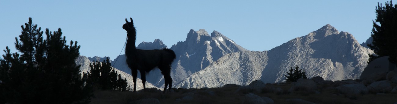
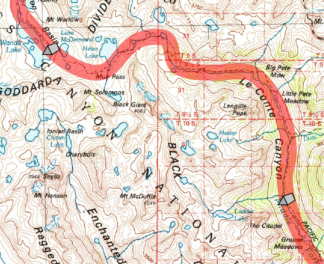
With the rain, everything is kind of late and kind of slow, but most of our hiking today will be downhill, so at least it won't be too taxing. Megan is unhappy with my speed, but she notices that the lake has become mirror-flat in the wake of the squall, so a few quick pictures are in order. By 10:15 the llamas are all packed and we trek a bit farther up along the lake as I had found that the trail could be reached where it crossed the outlet from Lake McDermand, the next lake upstream. With the Muir Hut in front of us, it seems as though it should only take a few minutes to reach the pass, but it is farther than it looks. Still, at a quarter of 11 (a way of telling time that Megan claims is misleading) we reach the stone shelter. Behind us to the north we can see the dark mass of Mt. McGee (made of an older quartz syenite that also makes up Mt. Goddard, which we could see from Wanda Lake) and far beyond it, Emerald Peak, made up of even older metavolcanic rock. Before us are some more dark rocks of the Black Divide, these too metavolcanic rocks but of a younger generation.
Muir Pass is a funny place; I think it is the only spot on the Muir Trail from which you cannot see a single tree. That seems a bit ironic as Muir really gloried in the forests of the Sierra, so naming a pass for him with no such evidence of that forest seems a bit inappropriate. On the other hand, Muir did first make his name in tracing the courses of ancient glaciers in these mountains, and there is no shortage of signs of glacial activity here. Indeed, it appears that the massive ice sheet that once sat over Wanda Lake must have spilled through to the south, over this pass, making it broader and gentler than the pre-glacial divide that presumably existed somewhere nearby and far above.
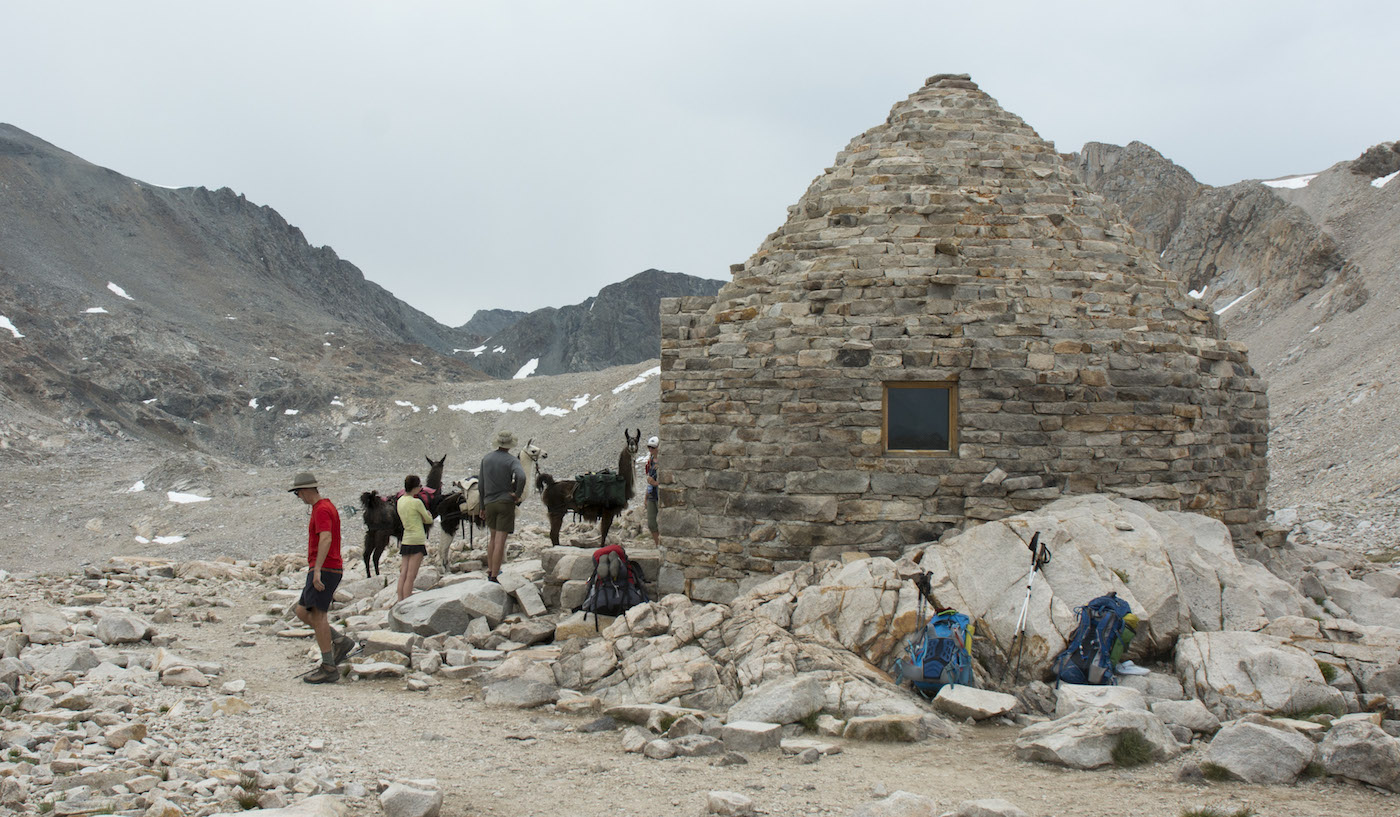
As is evident in the picture, we attract attention as usual, and Megan takes the brunt of the questioning about the llamas. We both take a look inside the renovated shelter before finally setting off from the San Joaquin drainage and into the headwaters of the Middle Fork of the Kings River.
One small reward today. My missing bandanna was in the pocket of my pants. I had looked for it there night before last and didn't find it, but clearly I didn't look very hard. Since I am wearing my jeans today, it quickly became obvious that I had the bandanna in a pocket. Of course, today I don't need the bandanna...
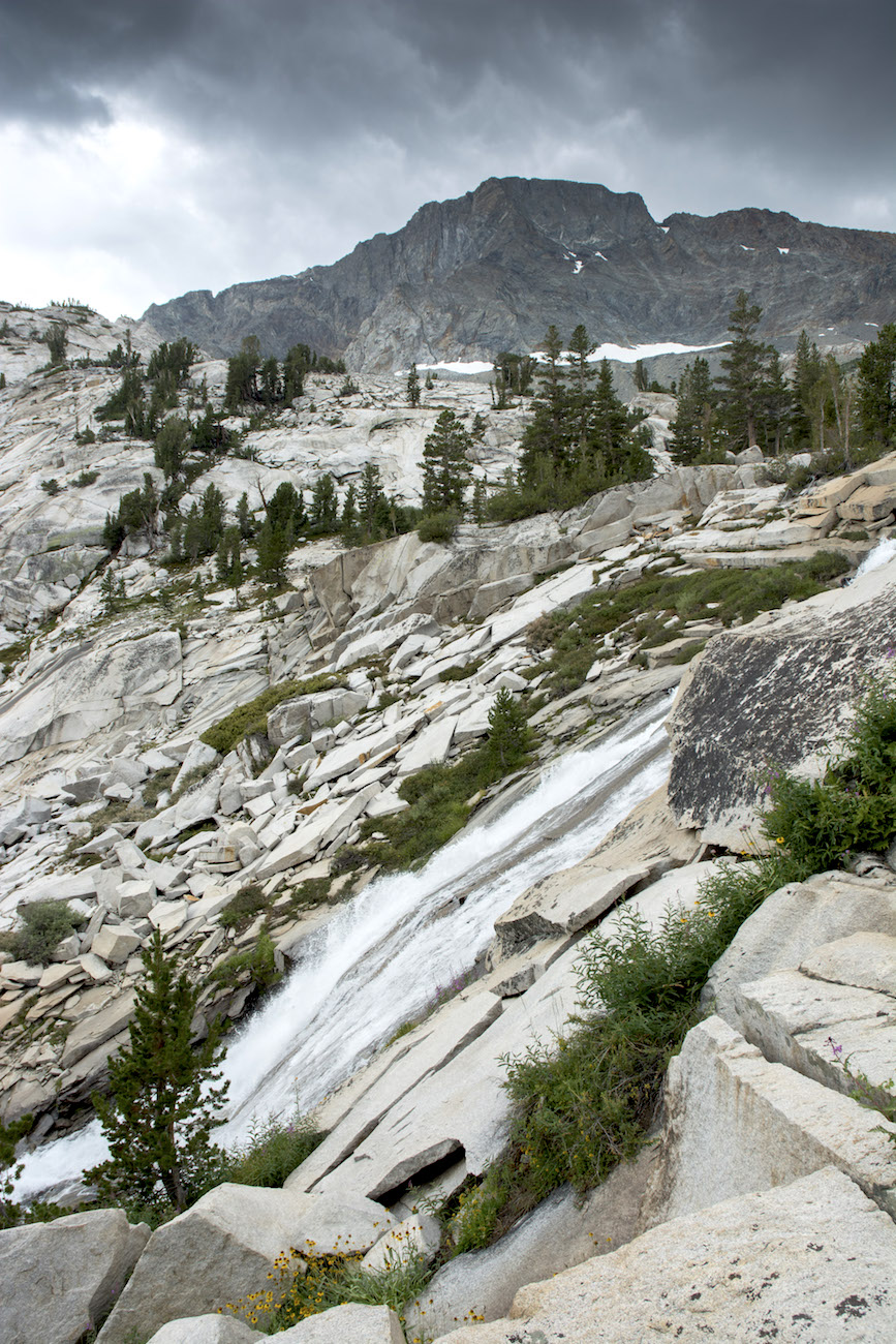
The ascent to Muir Pass from Evolution Lake was wide open, with long views to distant peaks. In contrast, the descent to the south feels almost claustrophobic as the trail winds around knobs and through gulches, bobbing and weaving first east, then north, then finally plunging east again to breach the barrier of the metamorphic rocks of the Black Divide, then south for a bit before finally turning back east and opening up at the head of LeConte Canyon. Along the way we first pass along the edge of Helen Lake (with Wanda, honoring Muir's daughters) with Mt. Fiske rising beyond as we get closer to the Sierran crest. As we pass the lake, the sun peeks out and lightens the scene a little. When the trail turns to follow the stream emptying the lake it takes us a moment to recognize that the trail crosses the creek and is rising up before contouring around a major buttress; the creek itself is lost in piles of rubble in its narrow notch.
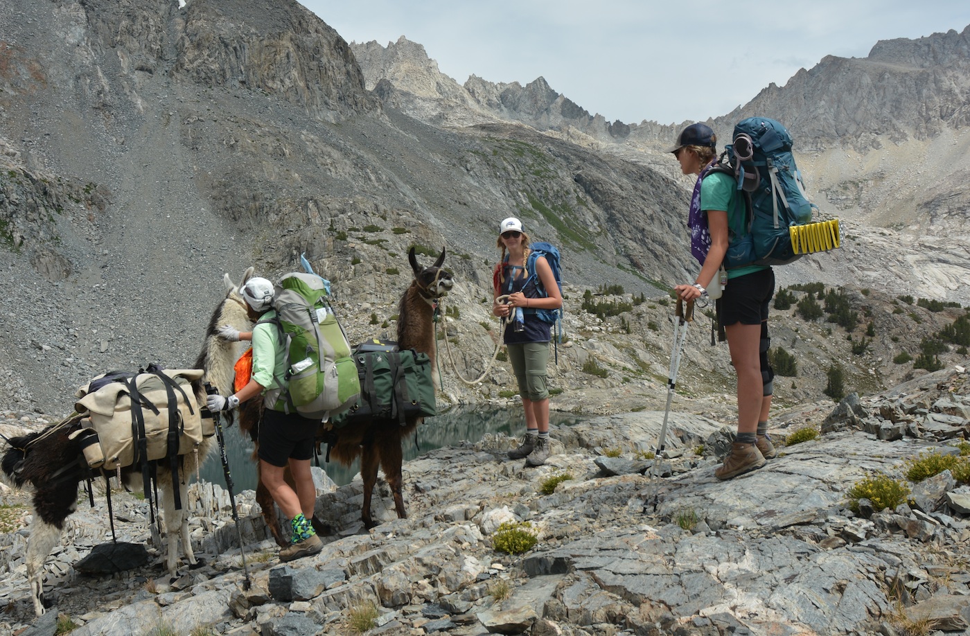
As we contour around to head more to the northeast, we turn a bend and find a small coulier with some snow and a party of hikers coming our way across this narrow snowfield. So we pull off the trail on a scenic ledge to wait. When the group finally completes their crossing they come up and have a seemingly endless array of questions for us. Can they pet the llamas? Well, you can stroke the neck of the white llama, he is OK with it. Where did you get them? Do they graze or do they carry their own food? Are they easy to care for? and so on. Megan and the llamas are scenically placed below the Sierran crest to the northeast, so they take turns being photographed with the llamas.
While much of this goes on I speak with one member of the group. He says several of them are teachers and so the timing of their trip was dictated by the school schedule, much as our timing had been determined by my academic schedule. Turns out they entered the wilderness the same day as us and will exit the same as us as well (in the end, we probably ended up out a day before them, but they will hit Tuolumne Meadows if not the Muir Trail Ranch, Vermilion Valley Resort and Reds Meadow while we will not see any supply spots). So both groups are pretty near the center of their trip some 13 days in. The biggest difference is that they hope to exit at Happy Isles in Yosemite, well beyond our starting point. They entered at Horseshoe Meadows, where we will exit. Having carried their packs up from the bottom of Le Conte Canyon, they are jealous of our llamas. Of course, they have done far more of the vertical climbing of the trail than we have.
 When they leave, we try to get the photo of Megan with the llamas in line that would have been easy before they came up, but the llamas now want to start walking; Joe in particular seems to be trying to push Theo out of the way. So Megan gets the llamas turned around, and we resume our descent, deciding to pass just below the small snowpatch, which will turn out to be the only snow on the trail on our journey.
The trail winds past one rockbound lake and seems to end on bare granite at its lower end; we ask where it goes from one resting hiker; evidently a foreigner, he does get the idea and points in the direction of the trail. Picking up the path again, we descend to the next lake where we find an incredible mass of writhing tadpoles darkening the lake bottom. Near the outlet a nice lunch spot presents itself. As we eat, we watch as a couple of men wander around the lake, seemingly looking for a campsite. Then they are checking a GPS--are we at 10-6? No? 10-8? Did we miss it?--then they get on a radio. Where are you? Are you to this lake? We learn that they are hiking with some women who are ready to camp and are farther back down the trail. They had gone ahead to make camp but missed the lake they were aiming for; when they finally decide they aren't going to talk the women into coming this high, they head back down to find their lower lake.
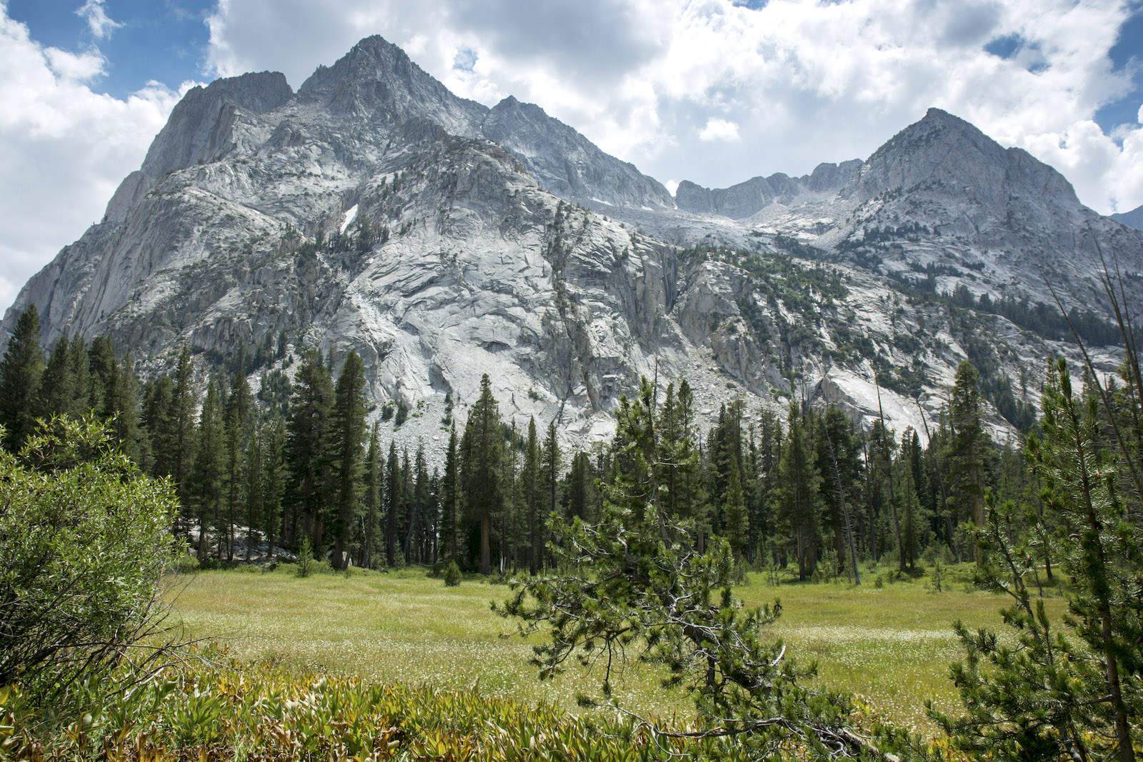
As we eat, it seems some darker clouds are starting to form. Once we resume hiking, we put the raingear on the packs once again for what will turn out to be the very last time. We are now paralleling the Black Divide, with the Black Giant, which had been a minor part of our views from Wanda Lake, now a presence towering far above us. We pass some meadows and see one of the lakes across the stream and behind some trees--if it is the goal of the two men, it is an awkward lake to get to. Our southward trek finally ends with a bend left at a lower lake. With the Kings River now frothing down a cascade, the Black Giant rising behind the head of the fall, we get our first wide open view of LeConte Canyon. Even though we can only see the uppermost part--the rest hides behind yet another bend in the canyon--it is a tremendous canyon.
The trail now begins a serious descent full of switchbacks, but before long the trail starts to slow its descent as the valley widens. Here we find one of the more curious landmarks of the Muir Trail, a split rock that somebody decorated with rock teeth and eyes to make the visage of a monster or whale ready to consume hapless hikers. We cannot pass up the chance for a fun picture with Megan in the whale's mouth. Along the trail we catch glimpses of parts of the Palisades Group, a collection of fourteeners we'll sort of circle around in the next few days. Farther down, we pass a large campsite with a group of hikers; behind them is Big Pete Meadow. Here the trail swings back to the southeast, so the mass of Langille Peak, in the crook of the bend, rises like a massive fortress almost 3000' from the valley floor. This is but the first of several tremendous rock masses to grace the west wall of this canyon.
Soon we see Little Pete Meadow, and this is a tempting place to stop because the grazing rules are pretty open here. But we decide that we'd like to get a bit farther today because tomorrow we have to face the Golden Staircase and a big uphill, so on we go. Not far beyond we meet the trail from Bishop Pass, a trail I had used many years ago to reach this canyon. This is seemingly a major rest area for the many hikers huddled nearby, but to the right is the trail to the ranger station. I suggest to Megan that she wait here while I go chat with the ranger, but she wants to come along. It turns out she isn't interested in meeting the ranger, she just wants to avoid the inevitable deluge of questions that the llamas would inspire of the crowd back at the trail junction. So she stops just short of the station.
I walk up to a nice new building; the ranger is sitting on the porch, reading a book. It strikes me that we are down in the forest again and yet the ranger is unconcerned about flies and mosquitoes. I don't know it yet, but we are finally coming clear of the fierce battle with bugs we've had for most of the trip. I ask him about the weather forecast, which had obviously let us down this morning, and he says that it is still what we had heard from the McClure ranger--should be dry and cooler. Huh. I ask about grazing going downstream--the grazing guide lists Ladder Camp near a drift fence. He says that is a fine place, but that once we pass through the fence we should pass the obvious camps below us and then go to a large rock--we can't miss it--and the better campsite is down below that. After confirming that Grouse Meadow is closed to grazing this year, he opines there is a meadow near the junction with Palisade Creek, but he doesn't think there are campsites that are any good. All in all, Ladder Camp sounds like our best bet. I ask about grazing at Palisade Lakes, our goal tomorrow night, and he is less certain: the campsites are near the outlet of the lower lake but the grazing is up higher.
Armed with this information, I thank the ranger and return to Megan. We soon pass the masses at the trail junction once more; one fellow there asks if we can take his trash out for him--he will pay $10 or $20. I say no, sorry, but you brought it in, you can take it out. I don't want to become the trash collector of the wilderness. (Megan later tells me that he had approached a number of hikers with the same offer; I kind of wonder just what was so unattractive about his trash). As we turn back south, we pass a collection of pounded down campsites in the woods just by the trail; a couple are in use, but I marvel at both the number of sites and their condition. Maybe this is a major stopover for PCT hikers. I figure there are plenty of campsites down the canyon; I'm not sure why so many people would cluster here.
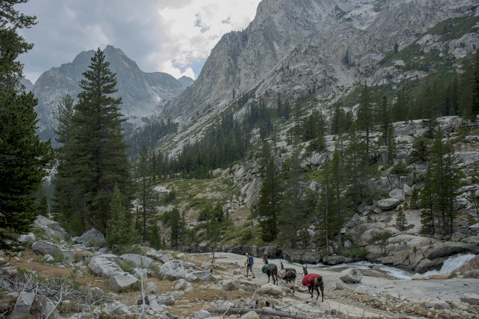
We are now looking for our drift fence, but we also are eyeballing another stone monument on the west wall of the valley named the Citadel. Just on our side of this rock is a waterfall, which turns out to be Ladder Creek. Ladder Camp is nearly opposite the creek. We pass through the drift fence and see the camps below us. Megan and the llamas wait while I look for the better camp. A short distance farther there is another camp below that looks little better, and I don't see the large boulder. I go farther, but the small meadow ends and I am looking at forest again. There is a boulder, but I see no trail, so I go back and scout the second camp, and it looks like it might have been used as a stock camp. It is a short stroll over to the first camp where Megan and the llamas wait. She decides to check out that second camp and returns with her verdict: she likes this first camp. I disagree--the other camp has more room and a better firering--but Megan is sure this is the better camp. I relent and we unload our gear. We first string the llamas in the grass right by camp, but a little later I move them into the higher part of the meadow above the trail. Megan has a nice spot for her tent. It takes me quite awhile before I decide on a spot where I feel I can put up my tent.
A couple of fellows come up asking about a campsite; we direct them to the nearby site Megan had spurned. Sunset is early down in this canyon, and sunrise will probably be late on the other side of things. There aren't a lot of places to sit at this site, so the bear cannister comes in handy here as a stool. I'm still eating my burritos while Megan chooses another flavor of freeze-dried food. Tonight I can get some toiletries in the bear box, but not all. In the rain I learned that water will get into the bear boxes if they sit upright, so I now lay them down flat so the lids are not able to catch any water from dew or rain. I use a tree branch near the llamas to hang the trash and remaining toiletries; I don't bother with a counter balance tonight, figuring the llamas will give the alarm if we have a problem. After rain and some heavy dews on previous nights, I have the fly up on my tent tonight. The clouds that have dogged us through the day are breaking up as we go to bed; we won't know it until the end, but this was the last day we will be threatened with rain.
Tomorrow we will face one of the most brutal uphills of the trip, a total uphill of over 3,000' as we climb the Golden Staircase. Knowing this, we hope to leave earlier than the last few days.
Day 13. 1.4 mi camp to Muir Pass, 6.0 mi Big Pete Meadow, 1.8 LeConte RS, 1.4 Ladder Camp; 11,440 Wanda Lake camp. 11,990' Muir Pass, 8340' Ladder Camp.
10.6 miles, 3100' net elevation loss, 550' total elevation gain
Total to this point: 110.5 miles traveled, 19,400' total elevation gain.
prep | 0 | 1 | 2 | 3 | 4 | 5 | 6 | 7 | 8 | 9 |10 | 11 | 12 | 13 | 14 | 15 | 16 | 17 | 18 | 19 | 20 | 21 | 22 | coda | CHJ home