|
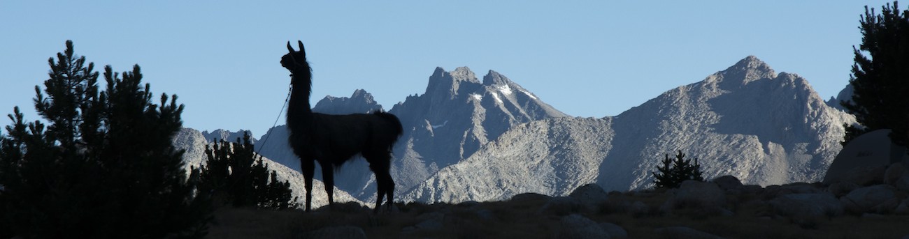
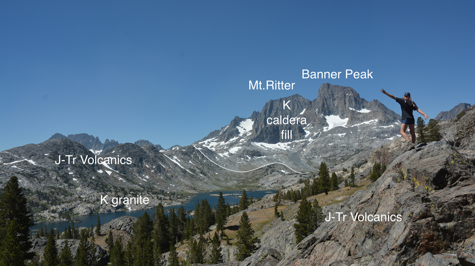
 Most of the John Muir Trail lies on the west side of the Sierran crest. Sunsets are usually the main attraction; sunrise, not so much as usually the peaks getting the sun are to the east. You just get a view of shadows. But here, in the upper reaches of the Middle Fork of the San Joaquin, two things combine to make sunrise worth getting up for. One is that about three-quarters of a million years ago the old Sierran crest was blown sky high in a volcanic eruption, leaving the scar of Long Valley. Enough volcanic material piled up on the edge of the caldera to make the modern Sierran crest, but the crest here isn't terribly high, hanging out about 10,600' or a bit more. The other element is, ironically enough, the guts of an equally violent volcanic eruption about 100 million years ago. The material that fell into that giant hole solidified rather nicely into one of the more confusing rock units in the Sierra, a rock unit that makes up the bulk of the Ritter Range. Mt. Ritter itself just exceeds 4000m (so just over 13,100'). We are camped between that low crest to the east and the high peaks of the Ritter Range to the west. Sunrise comes early to the Ritter Range.
As usual I was awake before dawn and hustle about so I can get my sunrise photos. Our camp being situated near the lake means I only have to sit on the big rock by our camp to have a perfectly good view. Lacking clouds, it isn't the most spectacular of sunrises, but the rose-tinted mountain is still worth rising for.
Today will be our first real day of hiking. Although we will end the day at a lower elevation, the numerous ups and downs along the way will stretch our legs pretty well. Breakfast was fairly early with the sun coming up quickly--eggs and (for Megan) oatmeal. Things got packed quickly...until we thought we had lost both a black strap used to connect llamas and a short lead rope that is always supposed to be on the llamas. The strap was hiding in a saddle already on a llama, but the rope was gone--looking at pictures from yesterday reveals that the rope had been off then. This delays us quite a bit; we leave at 10 am, the air already growing warm even here at 10,000'.
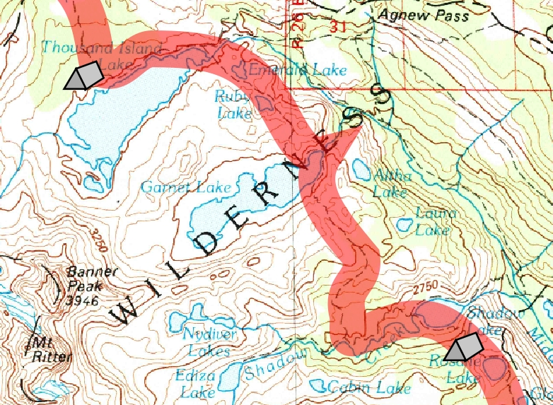
We travel the trail along the lake, finally seeing some other campers when we are fairly close to the outlet (in fact, probably a bit too close for legal camping). At the lake's end we find the Muir Trail and the PCT. Here the PCT splits off to wander the sides of the volcanic slope on the east side of the San Joaquin's canyon, while the Muir Trail rocks up and down as it visits every nook and cranny on the west side of the canyon. A group is at the junction and they have a dog, but the dog is well off the trail and leashed, for which we thank the owners (we will actually come across the dog holder far to the south in the national park). We turn south on the Muir Trail.
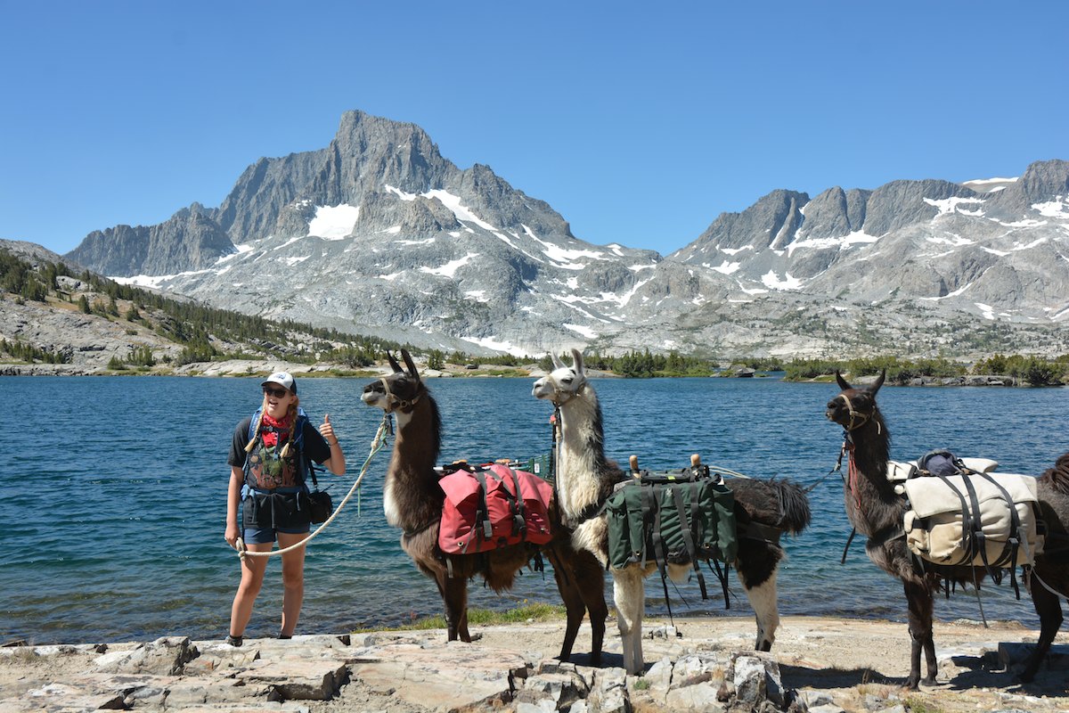
Our roller coaster ride starts quickly as we rise up to pass Ruby and Sapphire Lakes only to plunge back down on the other side to Garnet Lake. The view from near the divide separating these lakes is great, with Banner in front and Ritter more clearly evident behind, the sides of Garnet's valley aimed right back up to those peaks. At the outlet from Garnet we have to ask a couple of people to move for a moment so Megan can lead the llamas to the other side, the log bridge being too narrow for stock.
The trail now lurches back up the south side of the valley. As we near the top we see a horse party. We holler up and ask what they'd like us to do. They suggest coming up to the side, but we actually are at a pretty good spot to pull off the switchback we are on. Soon the horses and mules are rumbling past, the large wooden boxes on the mules' sides no doubt carrying ample provisions for some group. [I think it was also near here we met a woman with two horses who apparently did the Muir Trail south to north on horseback; her horse bridled some in passing us]. The saddle beyond the top of the switchbacks is a decent spot for lunch, having a breeze that will keep down any bugs. We can peer southward toward the Silver Divide where our second pass will be in a couple of days. We also can look down the next leg of the roller coaster at the switchbacks that will help carry us down 1400' to Shadow Lake.
Soon we are trundling down the trail, the wide views of the saddle replaced with rock walls and then evergreen forests. The wind dies down and the bugs become more evident Soon we pass the trail that goes up to Ediza Lake (a place I would like to visit, as apparently the old landscape from 100 million years ago is exposed there, under the large pile of debris that toppled on it in that large eruption). Turning east, we take the right fork just above the lake, the left one heading out to the Middle Fork and to the trailhead, while our fork will skirt Shadow Lake on the right before hammering up the hillside. We are low on water, so before we undertake that climb I pull out my UV purification wand and purify a couple of liters of lake water. When a breeze reaches us, the scene is pleasant, but the moment it dies the bugs rise up to torture us. Rewatered, we collect the llamas and pass a couple of women heading up the trail.
There are all kinds of switchbacks; these are the kind that let you know this is serious work. As you rise up and look down it feels as though you are hovering directly above the switchbacks below you. Having a climb like this towards the end of the day is tough; having a hot day doesn't help either. Although the grade is steep, it is pretty uniform. Finally the slope starts to lessen and we lose sight of the trail below us. A few more switchbacks to a rock wall carry us up and over the top, some 700' above Shadow Lake. The gentle summit then leads to a more measured descent towards the outlet of Rosalie Lake. We spy green grass waiving in the breeze below us as we catch sight of the lake, and below that the flats of a still-empty campsite . It is a bit after 3 pm, and although the amount of grass seems scanty, it looks like good llama grass. We decide to put in for the night here.
We have to descend steeply to the camp, but soon the llamas are unloaded. Megan busies herself with her hammock and tent while I figure out where I can place the llamas so they don't get tangled in small trees or rocks. As last night, I use the two meadow screws and the bag o' rocks to individually place the three llamas. Soon they are chowing down on the grass. I decide to take a look down the trail; Megan considers swimming in the lake.
From the looks of things our camp might be the best llama camp. There is a campsite hidden behind another on the north side of the outlet with some grass, but it isn't any better than our site. It might be less buggy, though, as a little beyond the canyon wall of the San Joaquin falls away. I wander out onto the bare rock at its lip and can look at Olaine Lake below, with the River Trail rising just beyond it. The PCT is barely visible on the far side of the canyon near my own elevation. PCT'ers, though, didn't have our roller coaster ride; the PCT declines steadily from Thousand Island Lake toward its meeting with the Devils Postpile Road at Agnew Meadows.
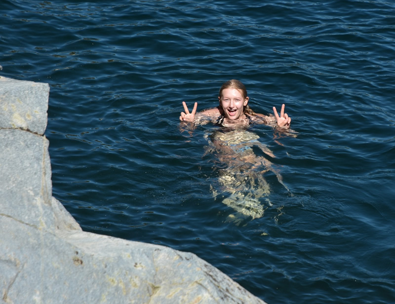 Back in camp, Megan decides the cliff nearby is good for jumping from. I go and watch as she leaps into what I would think would be pretty cold water. She sits up on the rock for awhile before dinner, the spot being a bit higher and less buggy than our camp. The llamas are moved a couple of times and then it is time to make dinner. Megan polishes off the other half of her mac and cheese meal. I try making half a package of Mexican rice, which is a bit of a disaster--I can't get half of the spices out, so the rice mixture is between bland and yuk. I just put it into my field burrito, which helps the rice but knocks down the appeal of the burrito.
As the sun goes down, the wind slows more and more and the bugs rise up. The llamas get a treat of some of the pellets we carry before I bring them closer in to camp. Cleaning dishes is a pain as the bugs assault me. I set up my tent as well to keep the bugs away.
My first big worry about finding a camp suitable for llamas is relieved. In fact, our camp is nicely isolated even as a couple of guys camp on a ledge above us (which sort of distresses Megan a little). The more popular camps are at the outlet, but even there the sites behind the ones by the trail are left empty. Even with the search for missing gear in the morning, we had managed in about five and a half hours to cover all the ground necessary. Tomorrow, though, will be another challenge: we hit a long stretch where camping looks to be impossible and will, once again, have a steep uphill at the end of our day. The climb tomorrow will be hotter and higher and the distance covered greater. In fact, it will turn out to be the second longest distance we cover in one day on the whole trip.
As I lay in my sleeping bag I ask myself, why am I doing this? We are three days in, twenty more to go, we have yet to face the high passes. Between flies and making sure llamas are being taken care of and washing dishes and cooking food, things feel more like a chore than a vacation. Since we left Garnet Lake the scenery has become (and will largely remain for awhile) pretty pedestrian. It's a question I have in mind many days on the trail that will never get a simple, solid answer, but the next day will help salve my mind that this wasn't just a very stupid idea from a has-been backpacker.
Day 3. ~1.5 miles to JMT, 7.4 to Rosalie Lake campsite; 9,840' 100 Island Lake, 10,140' at Ruby/Garnet divide, 9680 at Garnet Lake, 10,140 at Garnet/Shadow divide, 8740 at Shadow Lake, 9450 at Shadow/Rosalie divide, 9350' at Rosalie Lake
8.9 miles, 490' net elevation loss, 1,470' total elevation gain
Total to this point: 20.2 miles traveled, 4570' total elevation gain.
prep | 0 | 1 | 2 | 3 | 4 | 5 | 6 | 7 | 8 | 9 |10 | 11 | 12 | 13 | 14 | 15 | 16 | 17 | 18 | 19 | 20 | 21 | 22 | coda | CHJ home