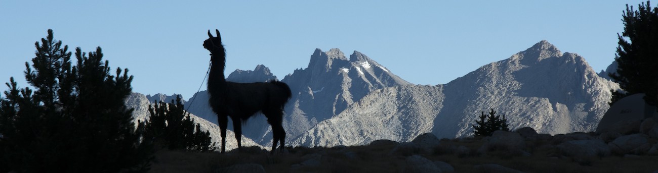
|
 (2023 note: Our camp was at the time named Squaw Lake; as of September 2022 it has been officially renamed Nüümü Hu Hupi, which means (I am told) Paiute women lake, which is preferable both as being specific to the place and not carrying unwelcome baggage. So I've updated the name here, though it wasn't the name we used at the time.)
Morning came as usual and I was up and out of my tent at an early hour. Although the bugs were nowhere near as obnoxious as the previous morning, I had decided a tent was better protection. The tent near up up a bit higher seemed to never have been occupied--either the resident was very quiet and shy or totally absent. Although this was another site where the sun wasn't up that early, we make better progress on hitting the trail. Finally using a list of objects in each pannier was beginning to pay off; we manage to head out about 9:45.
The bad news is in the sky. Looking east to the Sierran crest we see clouds artfully aligned above us. Although the clouds right now are not threatening, they are there, and in the Sierra, unless they are cirrus clouds (these are stratocumulus), they warn of rain ahead. Of course the storms tend to be scattered, so maybe we get wet, maybe not. But it will rain somewhere.
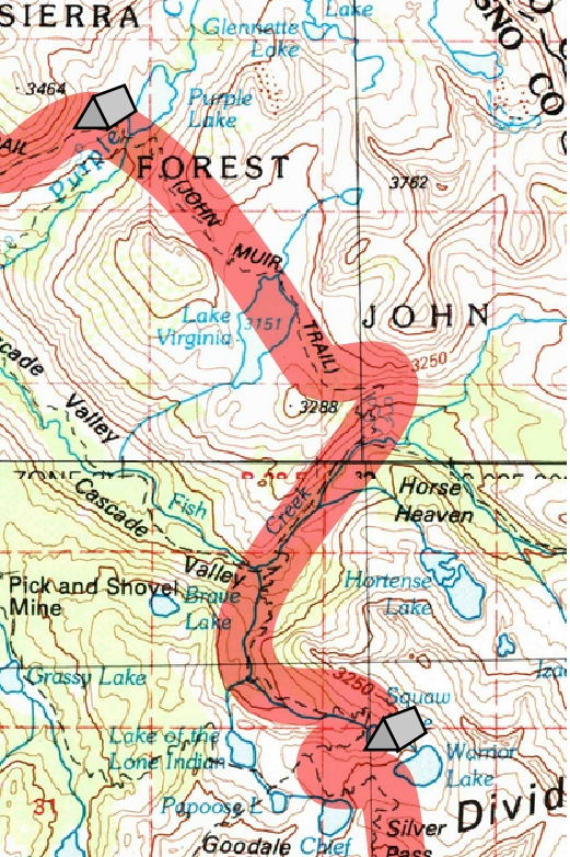
We return to the trail junction and then follow the Muir Trail on to the outlet of the lake, passing a side trail that goes down to Cascade Valley. Although we will pass through the upper end of the valley later, our path now carries us up instead, into a curious notch through the ridge separating us from the next lake drainage over, that of Lake Virginia. At the top of the switchbacks we find a huge pile of rubble next to the trail, courtesy of a rock glacier hiding under the debris off to the side. The trail skirts this unstable mass and we soon are over the top and heading down toward Lake Virginia.
As we go we chat up some folks going the other way. "How were the bugs?", is our main question. We hear horror stories about the area near Tully's Hole, which is our goal for the day. This is not encouraging. One party of a couple of guys waits a little bit while we pass before turning on their portable music player and heading north on the trail, acknowledging that some of us would rather not have to share other's noises on the trail.
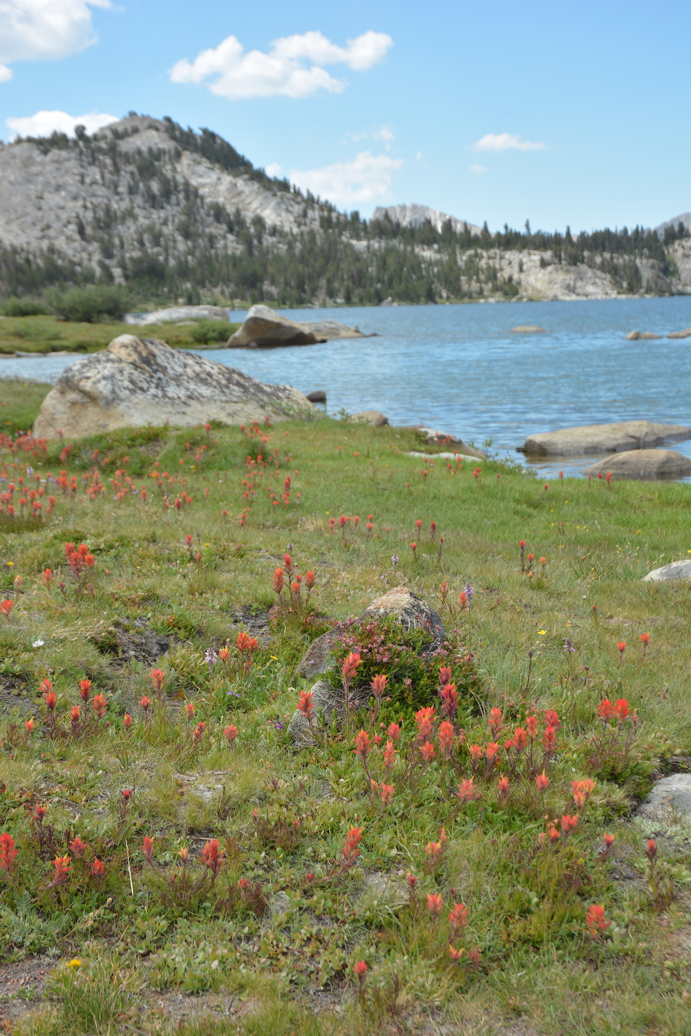
Meanwhile, we have a more pleasant task, skirting around Lake Virginia. Laid out in a broad open basin with great views of peaks in most directions, this seems a very pleasant place. Wildflowers--a variety of paintbrush--color the meadow, something we rarely have seen. And indeed, despite midday approaching, we see people camped nearby, presumably spending a day or two or more enjoying the lake and its surroundings. Had we known and had the energy, I would have picked this as a premier stop on the trail.
After we traverse the soggy meadow at the inlet, the trail rises to a low saddle to the south. Soon after we stand at the top of an array of switchbacks; far below is the lush green circle of Tully's Hole, which certainly feels like a hole in the mountains from where we stand. The topography is a bit confusing here; it seems as though we should cross the hole and head upstream, up Fish Creek, and cross somewhere near the Sierran crest. Such a route is probably feasible but was not the choice of Muir Trail scouts. We will drop into Tully's Hole, then go downstream to the head of Cascade Valley and turn up a different creek that heads up the Silver Divide farther to the west.
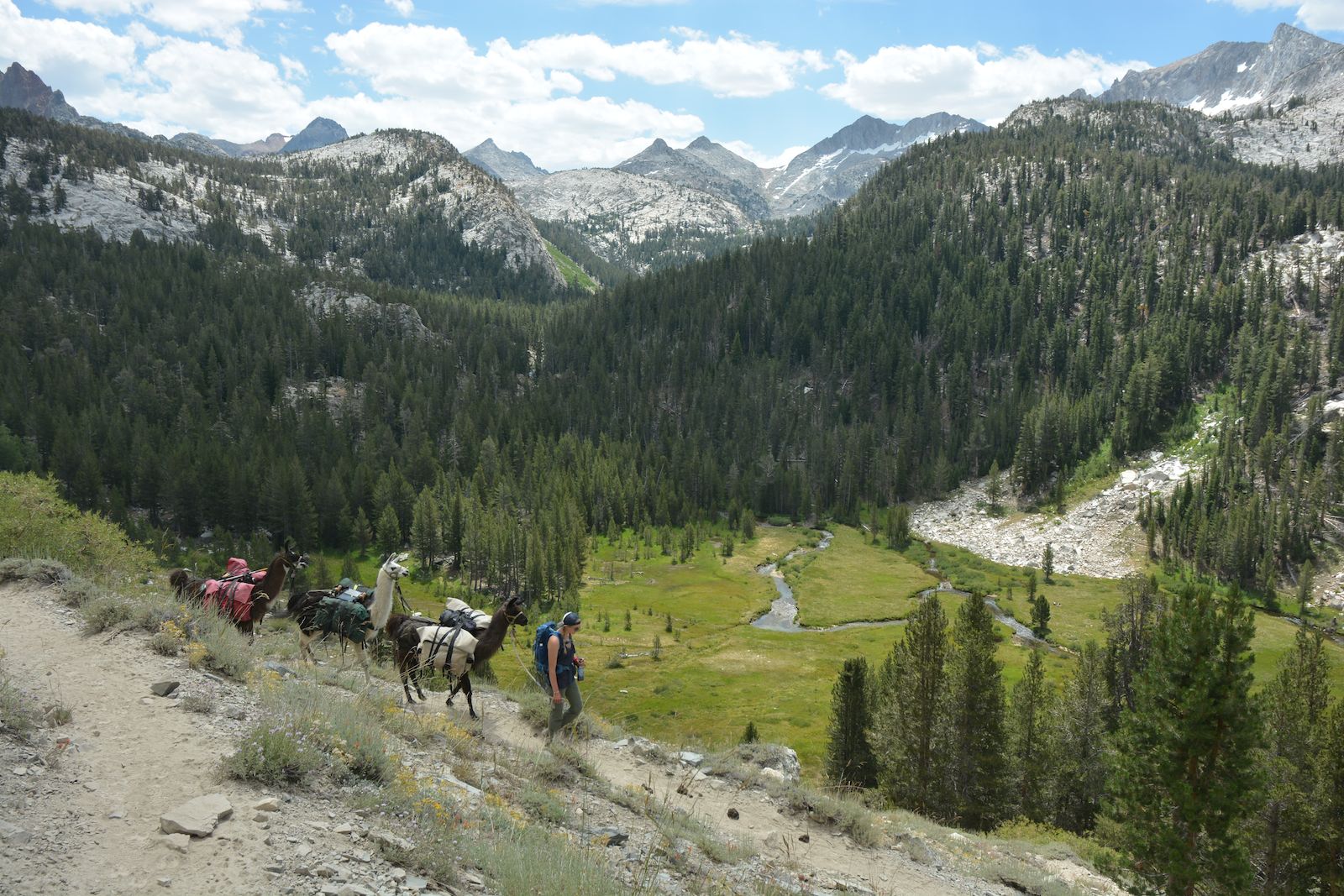
This is one of those stretches of switchback where the decision to go north-to-south looks pretty good; we are descending the sun-drenched south-facing slope instead of climbing. In fact over the next few days we'll be reminded a few times that this is a good direction to go if you don't like climbing in the sun. We can peer down all the switchbacks below as we go back and forth, losing all that hard-earned elevation. Finally we bottom out and turn downstream, staying to the right of Fish Creek.
This stretch is where I had planned to camp, and looking across the creek reveals a number of very attractive potential campsites. The creek, though, is a pretty high running stream. If we were to really camp here, we would have been wise to have turned left and crossed the creek and bushwhacked down the other side. But the complaints from other hikers about flying pests still echoes in our ears, and when we find a quasi-decent site on our side of the creek, Megan is unimpressed. It is still early in the day; we should go on. So on we go.
Although it is helpful to hear of the bugs in possible campsites ahead of us, it can also be misleading. Certainly people who camp in a spot have a fair idea, but the difference between a site with some breeze and one in the trees can be enormous. People who merely hike by places and provide a scouting report are even less reliable. In the early morning, the still air brings all the bugs out in full force; one woman who had said the bugs drove her crazy in Tully's Hole had in fact camped elsewhere and passed though in the morning hours. Conversely, the stiffest breezes are in the afternoon and a place that will become an invertebrate hell at dusk might be quite pleasant in midafternoon. So I wonder if the camps along Fish Creek might be better than advertised. We will never know.
Although the trail initially descended slowly, it now starts to steepen, and Fish Creek gets even more agitated. Before we can fully descend to the bottom of Cascade Valley, the trail veers across a substantial bridge well above the creek. We pause on the other side to eat our lunch and decide on our goal. Campsites in our guide are in a few places above us, but the descriptions of nearer spots sound like major bug traps, so we plan on going to Nüümü Hu Hupi, which, being near timberline, will presumably get some good breezes. A short distance beyond the bridge the Muir Trail meets the trail that descends the length of Cascade Valley and we turn left, ready to fight our way back up a hill.
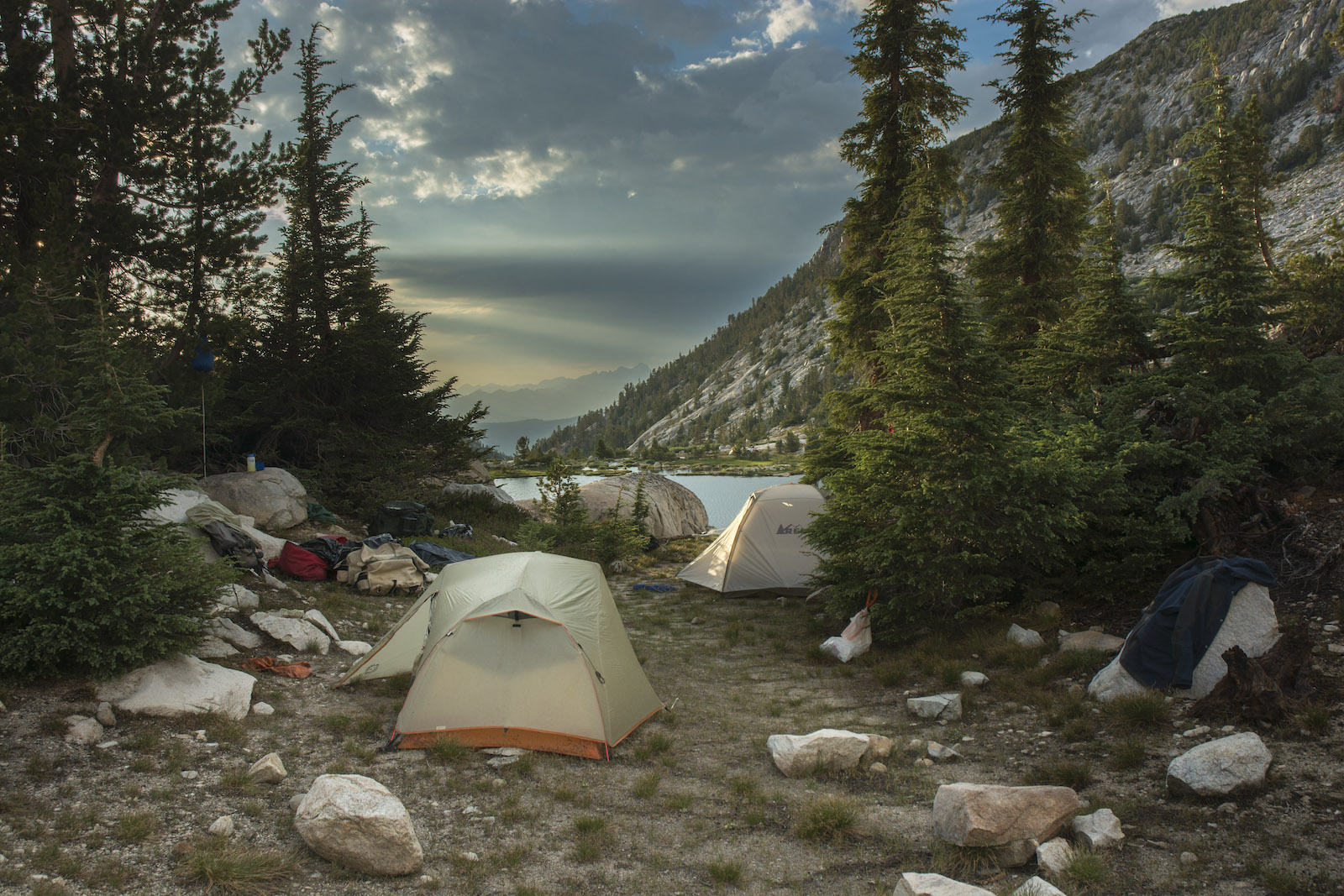
The clouds now are dense enough that we aren't in danger of sunstroke or even sunburn. The cooler temperatures help to offset the rather close air in the forest as the trail steadily rises. We emerge at the edge of a meadow, cross the creek and plunge through some dense vegetation before turning back a bit higher and recrossing the creek. Now the trail swings away from the creek, the forest thins back to more typical densities, and we continue upward with a few switchbacks but mainly on a steep grade to a prominent rock bench crossing the valley. Before we get there we can see several hikers hanging out here where the waters of Nüümü Hu Hupi exit and tumble down the valley. We move off to the side a bit and consider our options.
Our book tells of campsites here on the northwest side of the lake, and indeed there are a few patches of gravel where one can pitch tents without destroying vegetation. The best is by a big boulder not terribly far from the lake; I'm not sure it is the requisite 100 feet away. The clouds are looking more serious, and this site seems exposed. My recon in the area doesn't turn up anything better and I prepare to use the exposed site, but Megan suggests that the rocks at the east side of the lake might hold a better site. I sit and relax while she hikes over; she returns with news that there is an area that has been used and there is grass for the llamas, so she thinks it will be a better spot. So with Megan leading the llamas we retrace her footsteps--well, we try, but the llamas are leery of some muddy areas and Megan has to cajole them and wander around a bit to find places where they will continue to walk. Meantime I head up to the camp area.
The camp clearly isn't as heavily used as the spots down below, and had a few rocks not been stacked oddly, it wouldn't be clear this had been a campsite anytime before. But we are more than 100 feet from water, there is a tall cliff behind us that would attract lightning well before it would strike the trees framing our camp, and we have a commanding view of the lake and the San Joaquin drainage beyond. The grass Megan found seems a lot less inviting than the grass we left behind near the outlet, but there is enough without evil looking ground cover to feed the llamas, so we soon have our gear laid out and the llamas strung out on a picket line. I plop myself down on a rock with some snacks. I had wanted a rest day each of the last two, and as we first arrived at the lake at 2, I feel I have time to just sit and relax. Megan, though, thinks we should get food cooking as the sky is looking dark overhead. I am watching the clouds, and they look to be moving steadily west to east. Farther west the skies are pretty clear. This cloud will blow over soon, I think.
My complacency is broken as a few big fat raindrops demand a response, so I get up and the two of us quickly button up the various panniers, putting the covers over them and closing the trash bags over the items still in the packs. The raindrops soon fade out, and I pronounce the threat over.
Unfortunately for me (and to Megan's delight), I had misread the sky. What is happening is that the clouds are being sucked into a big upwelling right above us, a cloud that is growing rapidly more potent. And while the little low clouds move into it, the big cloud is virtually stationary. And now it is ready to unleash the rain I had seen coming in the clouds this morning.
Megan, as usual, has her tent already up and all her gear in it and has the fly on as well, so all she has to do is leap in her tent and relax. I, however, had hoped that the more bug-free environment here might let me sleep out, and so my tent is not up. So I rush, throwing out the groundsheet, then the tent and the poles. Shock-corded, most of the pole segments fly together on their own, and in my rush I don't check all the joins. Silly me; as I bend the poles to attach to the grommets at the tent's corners I hear a snap. One segment hadn't been fully seated and had now cracked the end of its mate. I fish out the tent pole sleeve I carry for such an event and slide it over the join and then continue to assemble the tent as the rain increases. Getting the poles up, I attach only a few of the tent clips before throwing the fly over the tent.
Well, "throwing" isn't quite right. The fly is nicely stuck to itself, so I am unrolling and unpeeling it, so as soon as I have two of the same color clips unraveled I clip them into their mates at one end of the tent. I keep unrolling until I am ready to clip the other two. I stand back and realize the writing on the tent is backward. The fly is inside-out.
With many tents this would simply be an inconvenience. Here it is a disaster: the one-man tent has only one door, and that door is now safely protected under the side of the fly with no zipper. With rain now pounding down, removing the fly would produce a soaked tent: the inner part of the tent is just mosquito netting at the top. I stand in my raincoat and just stare at this. Well, I will just have to stand and watch the storm. I watch it rain. Then I watch it hail. Back to more rain, a bit more hail. And rain. I walk to the view across the lake, where other hikers are busily seeking refuge in their tents, some in the site we didn't use, others on spots we didn't consider. But nobody is near our side of the lake. I walk back by the tents and wait. I can't even sit as I hadn't put on rainpants and am wearing jeans.
Eventually the rain stops and I rush to pull of the fly, shake it vigorously, and flip it over. As the rain restarts, I leap into the empty tent, leaving my sandals just outside the door under the fly. Here I discover another effect of having the fly inside out: the vent at the top of the tent has been a funnel, channeling water into the tent. There is a nice puddle across one end of my tent.
Having nothing else to do, I ponder this. Finally I open the small vestibule door on the covered side of the tent and push and pull at the tent floor to get the water to exit on that side. I don't get it all, but at least I am not going to drown in the tent. The remainder I attack with my wool socks, the tops of which prove to be excellent sponges. Soon I have a dry, if somewhat damp, tent floor. But that is all the comfort I am going to get. Rain and hail pound the tent. Thunder now booms through the basin, and soon the time between lightning and thunder is uncomfortably short. At the worst we have a stroke and boom separated by a fraction of a second--the lightning probably struck no more than 100 meters away. Thankfully that is the worst of it and gradually the rain and hail start to fade out. A little after six we can venture out of the tents again, light rain dimpling the lake, across which we can see people walking about. A fair number sought refuge at the lake during the storm; it looks like a few are now heading farther up the trail, but most are recovering from a hurried encampment.
With the storm gone we finally make dinner. I discover though that in all the chaos, part of my ancient coffee pot is missing. Two metal loops on the back are used for pouring; one of them has fallen off, making it very hard to hold the pot without it tipping or sloshing in some strange way. This pot and I go way back, though it has never been used for coffee, only boiling water, so I am looking for the missing piece. Because of the way I wrap the pot (it is blackened on the outside from use over a fire), I am confident that the metal loop was present when we got here. So I walk back and forth, looking for the dull gray loop in the wet and gray sand around camp, all with no luck. Megan helps look some too. For the rest of the trip we'll be carefully balancing the pot in pouring out water.
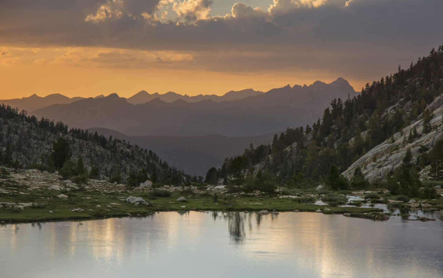
From our rock we can watch the sun descend though the tips of a storm cloud. Smoke from a distant fire (presumably Big Sur) colors the horizon. It is past time for dinner. Our stove has developed a hiccup: it has a nice starter button that lights the stove with a push or two, but not it isn't working. I had noticed the small electrode seemed to sit in the flame and suspect that limited the lifespan of that feature. After fussing with this a little, we dig out a lighter. Even though the lighter doesn't light, it does spark and we get the stove going. With time short, we decide to share some FD veggie lasagna. Megan thinks it fine, I am not a big fan. The llamas sat (kushed) stoically through the storm, and with the rain abating they rise to eat some more. We have a fine time watching the sun set before finally crawling back in our tents. Mine now is more comfortably furnished with pad and sleeping bag and such not. The irony is that now there isn't a cloud in the sky; I could take down the tent and sleep out, if I am so inclined. I am not.
Another one of those things that happens on hikes that you maybe would rather not know. I had been congested for days, probably in part because I was trailing Megan and the llamas; I am getting a sore throat from mouth breathing. Finally I sacrifice some of our rather copious quantities of TP for blowing my nose, and while it takes a major sneeze to dislodge the gunk, I am finally able to breathe properly again. Yeah, you didn't want to know...but that was a big improvement in my life.
I get word through the YB device that Matt has hit a snag: we thought it would be easy to get a permit to meet us and so didn't panic over it, but we are wrong. Apparently the permits for the trail needed were all gone when Matt went to pick one up; he got a permit for another trail. I am not too sure what to make of it (I don't have a key to the trail entrance numbers he provides in the message); maybe he will meet us this side of the pass where a more direct trail comes in from Vermilion Valley? Or he'll go up and come back? I figure it is a lot easier for him to find us than us to find him, so I don't really fret over it.
Tomorrow we finally reach our second named pass, Silver Pass, now only a short distance above us, and then the long descent to near Lake Edison. I had sent a wish list of a few items to Matt; we'll see what he brings. Not precisely a resupply but a nice chance to get a few goodies.
Day 6. 2.4 miles to Lake Virginia inlet, 2.1 to Tully Hole, 3.1 to Nüümü Hu Hupi camp; 9970' at Purple Lake camp, 10520' Purple-Virginia divide, 10300 Lake Virginia, 10430 Virginia-Cascade divide, 9300 Cascade Valley Jct, 10290 Nüümü Hu Hupi
7.6 miles, 320' net elevation gain, 1670' total elevation gain
Total to this point: 50.3 miles traveled, 10,090' total elevation gain.
prep | 0 | 1 | 2 | 3 | 4 | 5 | 6 | 7 | 8 | 9 |10 | 11 | 12 | 13 | 14 | 15 | 16 | 17 | 18 | 19 | 20 | 21 | 22 | coda | CHJ home