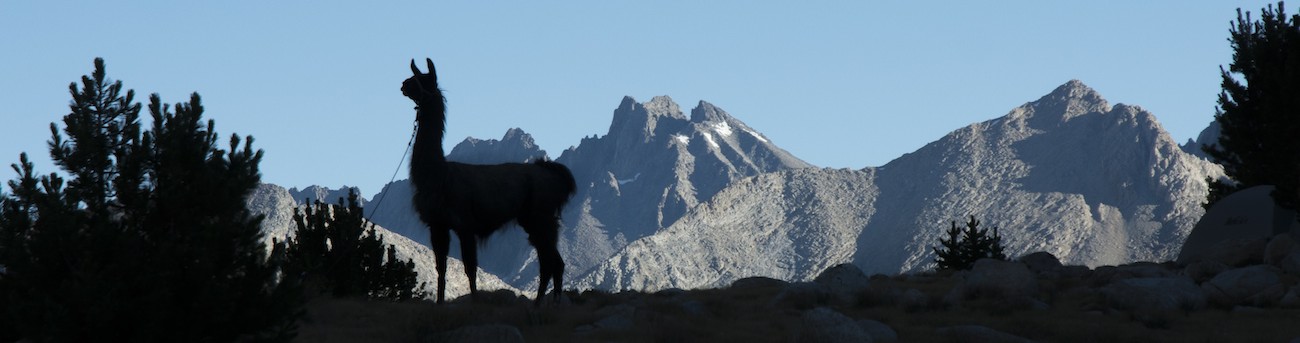
|
It is never easy to sleep the night before a backpacking trip. What am I forgetting? What do I need to grab in the morning? It is a last chance to rectify any oversights, so my mind usually is going back and forth over things. I did sleep some, but not a lot.
Getting up about 5:30 gave me a chance to shower one last time. We unplugged all our toys, pulled the stuff I wanted to keep cold out of the small fridge, and dragged ourselves downstairs about 6 am. We had to park on the side of the hotel. Because I am leaving things with the car, including my usual shoes, I shift to socks and sandals for the drive to the trailhead. We make a U-turn and head back towards Potato Ranch, arriving near 6:30.
Greg is there, the llamas are in their trailer. We are moving the panniers into the back of the pickup truck and then picking through the things in the car that are our sort of last-minute additions. Some stuff goes in my backpack, a handier place for loose items. Soon, but perhaps not as early as we should have, we are on the road towards Sonora Pass. Megan curls up in the back seat while I talk with Greg on the ride. As we go, I ask about different patches of grass that we pass. Would that be good? How about that? I ask him to show me a bad place. We stop a little before the pass to get out and look at some grass. Greg shows how there aren't many species here, but as he walks he says that here is a plant he doesn't like...and I stop him. Without a list, I note, I cannot possibly guess what plants he doesn't like. Show me at the level of our discussion yesterday. So we walk a bit and he points out where he would put the llamas and where they could go. There still isn't an area that is really bad except right on the creek. We drive on.
In Bridgeport we stop at the bakery, a favorite of Greg's that somehow I never visited in all my times through town. Megan hoped for a croissant and a latte; we could do the latter. I got some cookies. We pushed on again and soon enough topped over the summit north of Mono Lake and were descending toward Lee Vining. Just before town we turned left to go to the Visitor Center and get my permit.
The counter was a bit busy, so I had to wait a little before I could approach the fellow issuing permits. Do I have a reservation? I hand him the reservation confirmation letter. If you are going by Mt. Whitney, there is an additional charge. I point out that we already had checked that option and paid the fee. No fires, he says, writing it large across the permit. I start to mention that in Sierra National Forest, they were allowing fires, but he interrupted--"No fires. We don't want any more fires!"
When I came out, Greg was talking with a woman who was very excited about the llamas. I think he was relieved to see us so we could move and he wouldn't have to continue that conversation. We pass through Lee Vining, Greg pointing out the Mobil station with a restaurant just up highway 120 from the junction. Not too much farther south we turn towards June Lake. A few more miles and I can see a trail traversing the steep valley wall to the west; at the base is our trailhead. We pull into the trailhead parking near the pack station; there isn't really a place for a truck with a trailer, but Greg pulls to the side of the parking lot near the exit and we pile out.
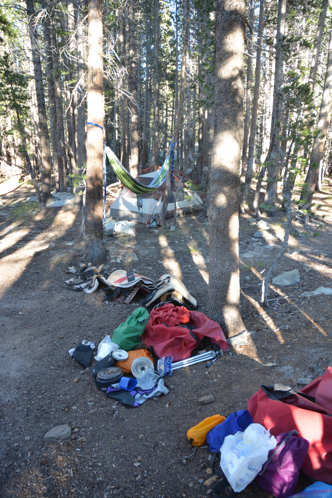
All the gear comes out. Megan helps saddle the llamas as I fight with the gear that we hadn't yet packed. Weighing things reveals that we are actually pretty heavy. The extra grain we hoped to take, and Megan's rocking chair have to be put aside. Things are jammed in, the bags are finally lashed on to the llamas, a last couple extras--hiking poles Anne insisted we take, the gear bag for the llamas, the first aid kit, a water bottle--are jammed in outer pockets or lashed on top. I put some stuff in my backpack, and when it seems we are about ready, I go to put the pack on, only to find that the hipbelt is on backwards, as are the shoulder straps. The pack had broken in my trip on the Routeburn and I had sent the old thing to Jansport for them to repair. I'm not sure if this was a bit of a joke, but I wish I had noticed this earlier as we struggle to get the belt on properly. The shoulder straps will just have to stay as they are.
About noon we look around and decide that we are ready. Greg takes our picture saying we'll have to get another at the other end. I ask Megan if she wants to lead, she defers and so I take the rope and start walking toward the outhouse, which is next to the trail. Joe, Theo and Sarek follow behind and then Megan.
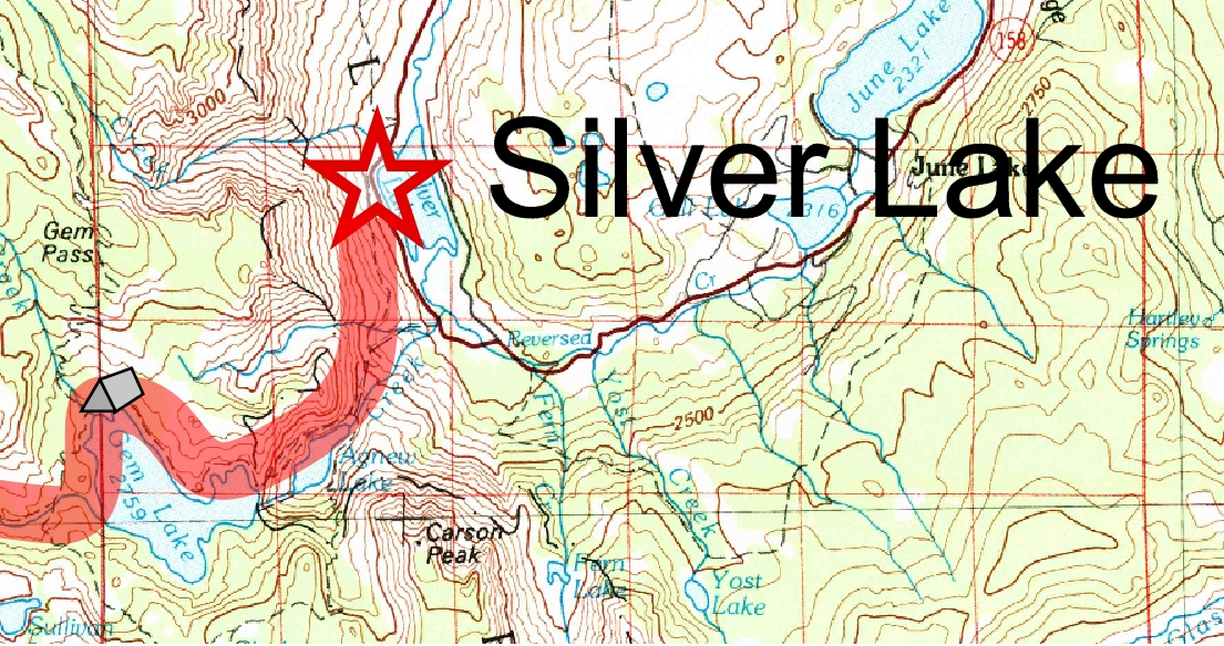
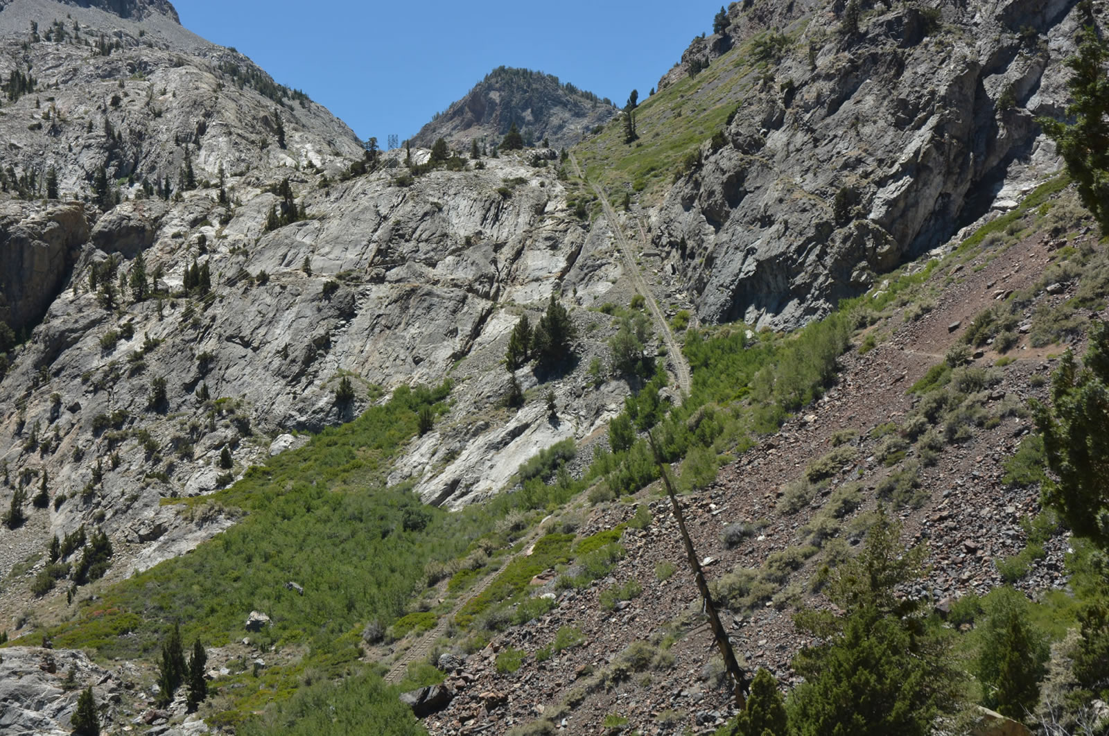
This is not the ideal start to a trip. It is midday, we are on a trail out in the sun on an east-facing slope that has been baking for hours and there is nearly no shade. Greg warned us that llamas can overheat, and Joe is the one likely to fade out first. So we keep an ear out for sounds of laboring that might hint at a forced stop. As the trail steadily rises above Silver Lake we watch to the front for fear a train of horses will be coming down; there is little room to move off the trail and retreating back only to stumble up the trail once more holds no appeal. We crest over a small bump on the slope and can see now Rush Creek coming down the slope before us, the trail now looking to switchback up the steeper slope below Agnew Lake. We cross a cable railway used by the utility that has dammed most of the lakes in this drainage; there feels something false about a Wilderness harboring such a visible manipulation of nature. We cross the cableway again and keep schlepping up the slope. Finally we cross a crest and can see Agnew Lake, its level far down from maximum. Farther upstream we can see the dam holding Gem Lake back sitting above yet another cableway.
The trail traverses up the north side of the canyon, in full sunlight. No llama has overheated despite that. Megan now decides that she would be a better leader of llamas; for nearly the entire rest of the trip she will be in front, and I in the rear. Joe keeps stopping, only occasionally to defecate, so we switch Sarek, who we were told is faster, and put Joe at the rear. But we keep on rising, losing sight of the Gem Lake dam behind the hills on its north abutment. The trail rises up a bit more and then flattens out, and we have our first mountain view. Gem Lake is now well below us and the peaks of the Sierran crest beyond it. Our goal is to camp somewhere around Gem Lake, now the trick is to find a spot.
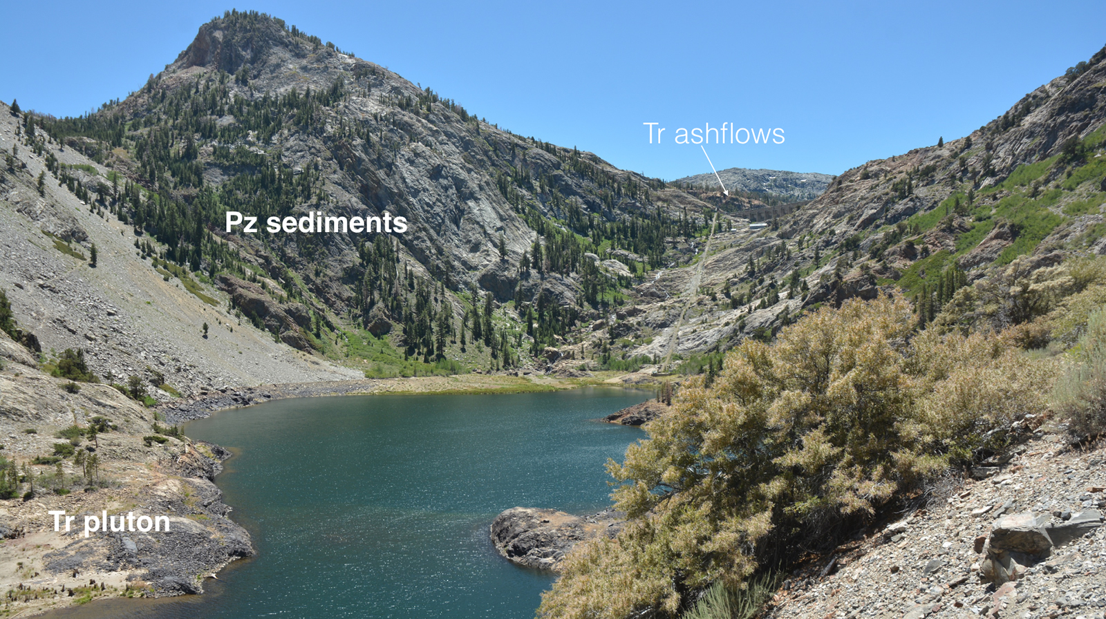 |
| View up Agnew Lake. Gem Lake shear zone is hidden between Triassic ashflows in the distance and Late Paleozoic metasediments. |
The most obvious place seems to be near an inlet from a stream from the north, and there is a campsite right there at the trail junction, but there isn't much in the way of grass. What there is in abundance are flies. A search around this campsite doesn't impress me much and so we decide to push on. The trail rises up on bare rock before finding its way back down to Rush Creek. A little past another side trail is a nice meadow, but the large campsite near that meadow was already taken by a horse party. Knowing we would not be welcome nearby, we struggle on a bit to a decent campsite between the trail and Rush Creek at a place where the creek bows away from the trail. Gratefully we pull off the trail and unload.
The major challenge though is grass for the llamas. There are some decent spots back on the trail a bit, so I take a llama back and tie him up (all our llamas are male) and then come back for the other llamas. I decide to tether them all separately, one on each of the two meadow screws we have and a third on a bag o' rocks, a nylon mesh bag you fill with big rocks that has a tether rope attached. I also bring over water. The grass here is thin, though, and I have to return a couple of times to move the llamas. On one of my journeys to move llamas I meet a group hiking down from above; turns out they are students doing geologic mapping for a professor at San Jose State. Their camp is back at Gem Lake and when I ask, they agree it is full of bugs.
Meanwhile, Megan has her hammock up and her tent and she has found a neat swimming hole in Rush Creek. I take pictures of the gear sitting by the panniers in the hopes that this will speed things up in the morning. With the flies swarming about, sitting around is not pleasant. Megan bemoans the news that Anne nearly bought her mosquito netting for the hammock (which, to be fair, we couldn't find in the bins of hammock stuff). Greg gave us a couple of bug-net hats, saying he heard the bugs were really bad, and finally I break down and use one. Of course you cannot eat with one on, so when dinner time comes around, the hats are of little use. Megan tries a curry dish while I make a burrito with cheese, summer sausage, green pepper, onion and salsa, taking care to have the cheese at the bottom and to heat it so the cheese melts. My choice of cheese is already looking poor. I needed a hard cheese that could take some heat, but the cheese I have is already looking pretty limp.
As the sun goes down the mosquitoes rise up, challenging the flies for supremacy. Megan retires to her tent as I pack the food back in the boxes and bring the llamas to their nighttime spot close to us. It is dark as I carry dishes a bit to the west to wash them. Some toiletries don't fit in the box, so I hang them and the grain we carry from a nearby tree--not correctly double bagged and counter-balanced, but my guess is that between the absence of real food and the presence of llamas that we will be left alone. We now have passed the first big test. We made a meal and made a camp and we didn't get a llama sick.
Day 1. 5.5 miles traveled, 7,200' trailhead, 9,200' Rush Creek camp, 2000' net elevation gain, probably 2100' total elevation gain.
prep | 0 | 1 | 2 | 3 | 4 | 5 | 6 | 7 | 8 | 9 |10 | 11 | 12 | 13 | 14 | 15 | 16 | 17 | 18 | 19 | 20 | 21 | 22 | coda | CHJ home